

mannynyc
-
Posts
411 -
Joined
-
Last visited
Content Type
Profiles
Blogs
Forums
American Weather
Media Demo
Store
Gallery
Everything posted by mannynyc
-
The last hurrah? Putting all the eggs in the Tuesday 3/14 basket
mannynyc replied to Ginx snewx's topic in New England
No matter what happens TV mets are going to get some crazy calls Wednesday and Thursday -
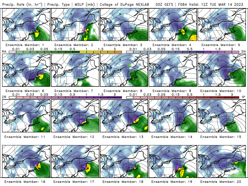
GEFS looks pretty good
-
The CMC follows the RGEM and moves the low West
-
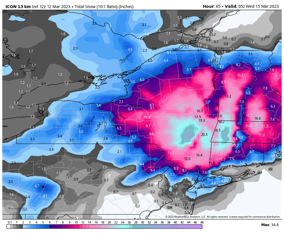
12z Icon snowmap
-
The RGEM is an outlier with the low coming to shore much farther West than pretty much every other model. That’s the big difference and why we get more rain.
-
Euro still looks good
-
UKMET bomb
-
Good be worse
-
Another double barrel low on the GFS
-
GFS still having feedback issues. Too many debby downers on this forum.
-
Big differences between the P-type map and 500MB vorticity on the Euro. Models are struggling with this storm.
-
Double barrel low on the Euro
-
GEFS ensembles look great though
-
Trends are good but things still need to go perfectly for the City to really get in. This is by far our best chance of the year.
-
Long range NAM is a joke.
-
-
240 hour Canadian bomb? At this point, why not.
-
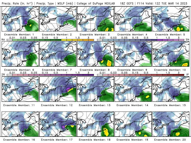
Not ideal but not terrible on the 0z GEFS
-
The low over NYC screams rain for the Metro
-
18z 3k NAM is signficantly colder in the City compared to 12z. Someone could be in for a surprise, but I wouldn’t hold my breath.
-
Beautiful. Someone should frame it.
-
GFS is the only outlier and it always seems to be overamped. Oh well. On to the next storm
-
Way better looks from the GEFS compared to 12Z
-
Dynamic cooling. It never got below 33 the storm a few weeks ago and we still got two inches.
-
NYC's best shot looks to be early Saturday morning when the coastal low starts to take over. Depending on the model, rain should become snow in the city between 3 and 6AM, continuing until 10AM. This shift should happen a couple hours earlier in New Jersey, Upstate NY and Connecticut.


