SnowenOutThere
-
Posts
5,666 -
Joined
-
Last visited
Content Type
Profiles
Blogs
Forums
American Weather
Media Demo
Store
Gallery
Everything posted by SnowenOutThere
-
One of the freakier experiences I’ve had so far with thunderstorms. Went for a brief walk once the gust front passed and could feel the new cells building ontop of me. Super gusty winds with low level scud clouds moving every which way.
-
I need that cell out near the plains to hold together and not drift north. Still hasn't shown a microburst signature of collapse yet, but the gust front is far out ahead of it so I doubt it can keep going forever.
-
Southern severe cell is aimed directly at my backyard. Time to see if it falls apart or microbursts overhead.
-
Areas along the Fredrick cells might need a flash flood warning with the training motion if they don’t collapse on themselves.
-
Two more severe warnings just went up out near the VA/WV border
-

2026 Mid-Atlantic Severe Storm General Discussion
SnowenOutThere replied to Kmlwx's topic in Mid Atlantic
It just doesn’t even initiate with them. Can’t kill what you’re not modeling. -
Anywho, low level lapse rates are past 9 degrees C/km so we’re approaching unconditionally unstable with 2000+ Cape and 1300 DCape. I’d imagine things pop off quickly near DC once outflow boundaries reach us
-
They have 40 day forecasts in the future you know!
-
We did get a 2inch precip storm in January. Just nothing before or after. Which seems to be our pattern now
-
2026 Mid-Atlantic Severe Storm General Discussion
SnowenOutThere replied to Kmlwx's topic in Mid Atlantic
Even yesterday could feel the ability for the DCape to work its magic from the gust front winds alongside gusty winds with a downpour. Just need some taller cells to full take advantage of it.- 1,710 replies
-
- 1
-

-
- severe
- thunderstorms
- (and 7 more)
-
Betting we get storms that pop up in the inner burbs once the gust front hits the bay/river breeze boundary. The gust front came through a bit ago and dropped temps nearly 15 degrees so it’s legit. Now about to get some rain hopefully.
-
Any met want to weigh in on if Spruce Knob WV should be clear enough to stargaze tonight? Seems like it’s my last day to do so for a while.
-
2026 Mid-Atlantic Severe Storm General Discussion
SnowenOutThere replied to Kmlwx's topic in Mid Atlantic
Thoughts on today? I listed out some of my thoughts in the Discobs thread but do we have any hope of a boundary causing forcing? -
We’re already over 2000 CAPE, -6 lifting index, 7.5 ML lapse rates, and lost 150 CIN in the past three hours. It sucks we have no shear or forcing because our thermodynamic parameters are really good! We even got 1200 DCAPE for severe winds. Maybe a bay breeze boundary can get parcels to the LFC?
-
I like how at the end of its run we get days of summer storms. Hot and humid of course, but with daily storms is nice.
-
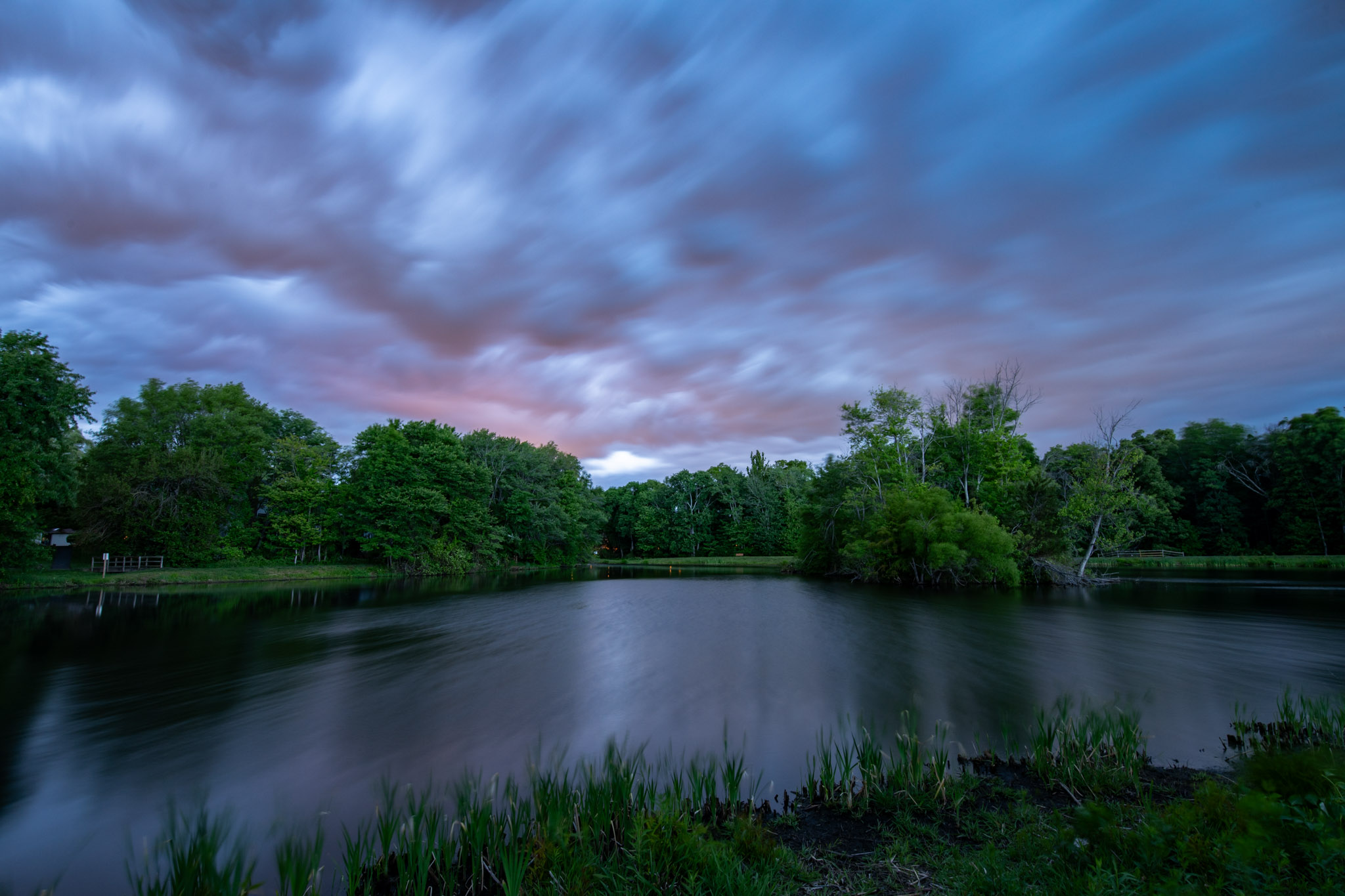
Gorgeous sunset alert
-
Surprised to see storms coming into VA from WV that seem to be holding together. Interested to see what happens to them.
-
Just a shame that it can’t be used again in winter forecasting. Though that makes sense as the NAM is pretty bad with spring-fall systems and convective events. Can’t have your cake and eat it to I suppose.
-
Any met or anyone know the reasoning for the NAM decommission? It still seems more accurate than its successor and a far better tool for winter wx. I mean, it was only the NAM on Jan 25th this year which got close to accurate mixing line accounts. Just seems like a weird decision.
-
Went for a walk this morning through the forested areas of my neighborhood along creeks. Despite yesterday they were almost just as dry, but at least the pools had some flow between them!
-
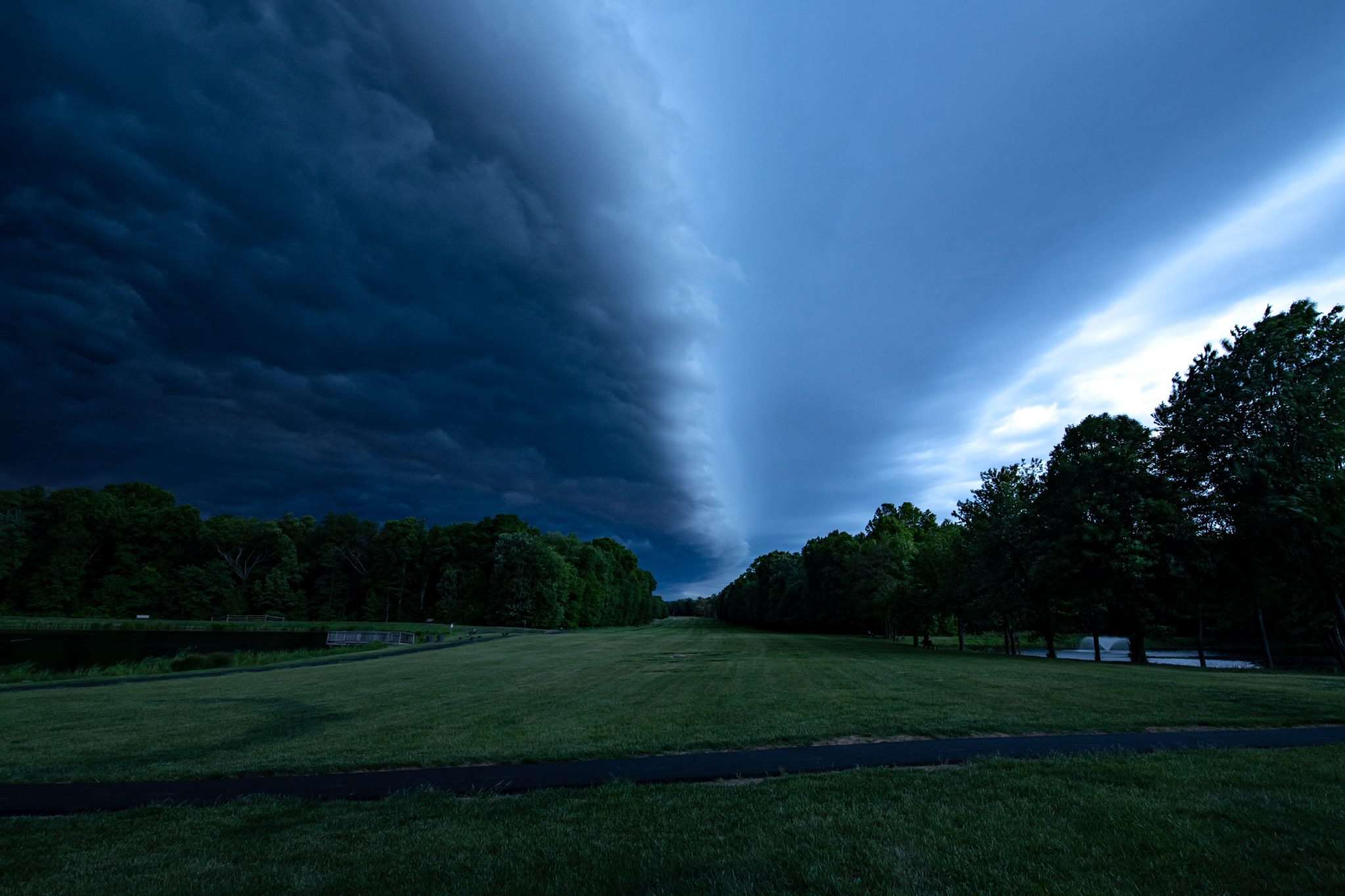
Had a nice shelf cloud come through as I drove home. Made a pit stop by a lake to get some shots, but wish I managed to get to the Herndon metro parking lot roof to see the oranges/purples of the rain behind them. Surrounding area got 0.4-0.5 inches of rain which is the most we've gotten in a long time. Felt good to finally hear heavy rain again.


- 890 replies
-
- 19
-
-

-
I don’t know if it can. Our Cape values are 250ish compared to WV 500-1000.
-
The radar right now reminds me of the January 3rd storm from 2022 with a front shutting off moisture flow to the north.
-
Man that's a weird temperature distribution. Seems like you have a pretty scattered low level inversion considering the valleys are colder than the mountains?
-
.08; missed the good stuff by a couple miles to the north.