

SnowenOutThere
-
Posts
3,943 -
Joined
-
Last visited
Content Type
Profiles
Blogs
Forums
American Weather
Media Demo
Store
Gallery
Everything posted by SnowenOutThere
-

Jan 31st - 33rd Storm Obs and Disco like it's 1979
SnowenOutThere replied to Bob Chill's topic in Mid Atlantic
Overnight we got another coating on the sidewalks and untreated roads with light snow still happening. -
Jan 31st - 33rd Storm Obs and Disco like it's 1979
SnowenOutThere replied to Bob Chill's topic in Mid Atlantic
Its been 72 hours. -
Feb Long Range Discussion (Day 3 and beyond) - MERGED
SnowenOutThere replied to WinterWxLuvr's topic in Mid Atlantic
Oh thanks for clearing up the confusion. -
Feb Long Range Discussion (Day 3 and beyond) - MERGED
SnowenOutThere replied to WinterWxLuvr's topic in Mid Atlantic
Could anyone post the 18z Euro model? It would be appreciated. -
Feb Long Range Discussion (Day 3 and beyond) - MERGED
SnowenOutThere replied to WinterWxLuvr's topic in Mid Atlantic
Yeah I agree with you put the seems legit because this is one of accuweather's forecast that makes sense. -
Feb Long Range Discussion (Day 3 and beyond) - MERGED
SnowenOutThere replied to WinterWxLuvr's topic in Mid Atlantic
That wishful thinking but I agree -
Feb Long Range Discussion (Day 3 and beyond) - MERGED
SnowenOutThere replied to WinterWxLuvr's topic in Mid Atlantic
Seems legit -
Feb Long Range Discussion (Day 3 and beyond) - MERGED
SnowenOutThere replied to WinterWxLuvr's topic in Mid Atlantic
Hey guys don't look at the snow or precipitation maps until at least Thursday because it is just not worth it. Just look at the low and precip maps and the trends. -
Jan 31st - 33rd Storm Obs and Disco like it's 1979
SnowenOutThere replied to Bob Chill's topic in Mid Atlantic
I would describe this storm as it busted then it just kept snowing. -
Feb Long Range Discussion (Day 3 and beyond) - MERGED
SnowenOutThere replied to WinterWxLuvr's topic in Mid Atlantic
Alright so from looking at the models and scrolling through here we should have a mix to rain storm on Thursday leading to an artic outbreak over us. After this there is potential for a storm on Sunday but only the Euro is on board. Then after that another shot of artic air consumes us. The pattern then after the iffy storm looks really good and the models have multiple storm chances with cold air. Then the general pattern for the next 1/2 month or more is very good for snowstorms. I this right or am I off? -
Jan 31st - 33rd Storm Obs and Disco like it's 1979
SnowenOutThere replied to Bob Chill's topic in Mid Atlantic
I feel like a lot of the new snow might start melting now that the sun is out which is a little sad. -
Jan 31st - 33rd Storm Obs and Disco like it's 1979
SnowenOutThere replied to Bob Chill's topic in Mid Atlantic
Winter Wonderland out there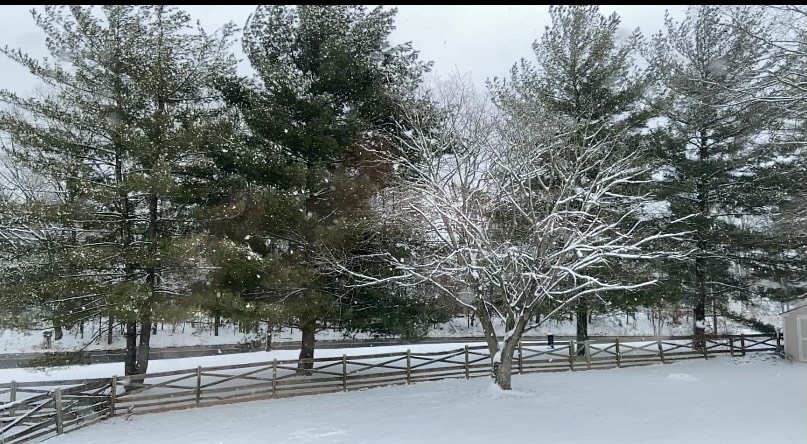
-
Jan 31st - 33rd Storm Obs and Disco like it's 1979
SnowenOutThere replied to Bob Chill's topic in Mid Atlantic
Wow! It is dumping heavy snow with big flakes and wind this is a winter storm. Probably around 5'' of snow here (eyeballing it) but cleared off a bit of the deck so I can see the additional accumulation the right way. -
Jan 31st - 33rd Storm Obs and Disco like it's 1979
SnowenOutThere replied to Bob Chill's topic in Mid Atlantic
You did good thank you for trying to calm us down during panic mode on Sunday. -
Jan 31st - 33rd Storm Obs and Disco like it's 1979
SnowenOutThere replied to Bob Chill's topic in Mid Atlantic
Band looks to be nice for me for the next hour but the temperatures are climbing. Currently they are at 34 with peeks of sun but heavier snow moving in with darker clouds should blot it out. -
Jan 31st - 33rd Storm Obs and Disco like it's 1979
SnowenOutThere replied to Bob Chill's topic in Mid Atlantic
Maybe even 2+ hours looking at it now -
Jan 31st - 33rd Storm Obs and Disco like it's 1979
SnowenOutThere replied to Bob Chill's topic in Mid Atlantic
Snow has really picked up in the last 15 or so minutes with the wind picking up as well, the snowflakes are big not huge but definitly bigger than normal. Also that band looks to put me in a nice spot for the next hour or so. -
Jan 31st - 33rd Storm Obs and Disco like it's 1979
SnowenOutThere replied to Bob Chill's topic in Mid Atlantic
Starting to come down at a pretty good pace. -
Jan 31st - 33rd Storm Obs and Disco like it's 1979
SnowenOutThere replied to Bob Chill's topic in Mid Atlantic
Your welcome -
Jan 31st - 33rd Storm Obs and Disco like it's 1979
SnowenOutThere replied to Bob Chill's topic in Mid Atlantic
Yeah I know but I don't care as much about how much if uncompact more so what is actually there which is why I don't really report my snow totals to any official thing. -
Jan 31st - 33rd Storm Obs and Disco like it's 1979
SnowenOutThere replied to Bob Chill's topic in Mid Atlantic
Also we are over four inches of snow just measuring from the deck with compression and all so probably more around 5''. Either way its warning level advisory. -
Jan 31st - 33rd Storm Obs and Disco like it's 1979
SnowenOutThere replied to Bob Chill's topic in Mid Atlantic
Radar looks like it might try to pivot some of the band towards me. This band will probably last for a while maybe even 3+ hours of it. -
Jan 31st - 33rd Storm Obs and Disco like it's 1979
SnowenOutThere replied to Bob Chill's topic in Mid Atlantic
Now in moderate snow near Reston with good flakes. -
Jan 31st - 33rd Storm Obs and Disco like it's 1979
SnowenOutThere replied to Bob Chill's topic in Mid Atlantic
Works for me as well. -
Jan 31st - 33rd Storm Obs and Disco like it's 1979
SnowenOutThere replied to Bob Chill's topic in Mid Atlantic
Snow is back in Reston with light snow falling with nice flakes looks like we might get the western edge of the band.

