WXNewton
-
Posts
573 -
Joined
-
Last visited
Content Type
Profiles
Blogs
Forums
American Weather
Media Demo
Store
Gallery
Everything posted by WXNewton
-
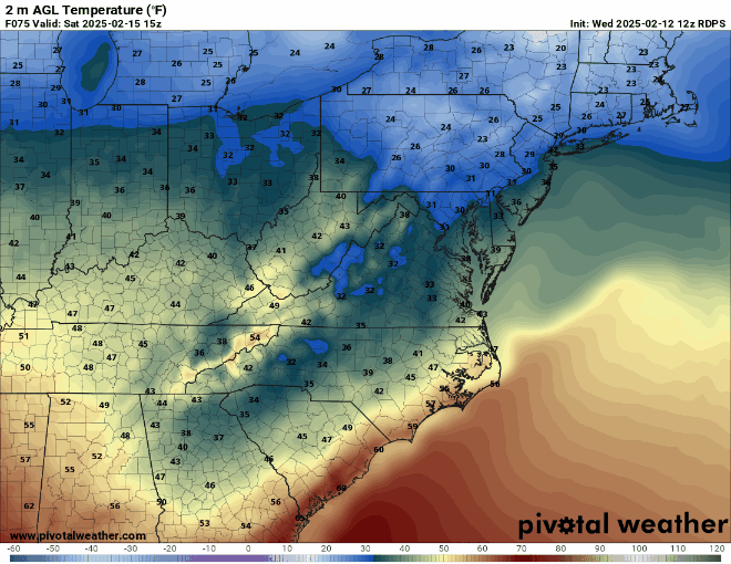
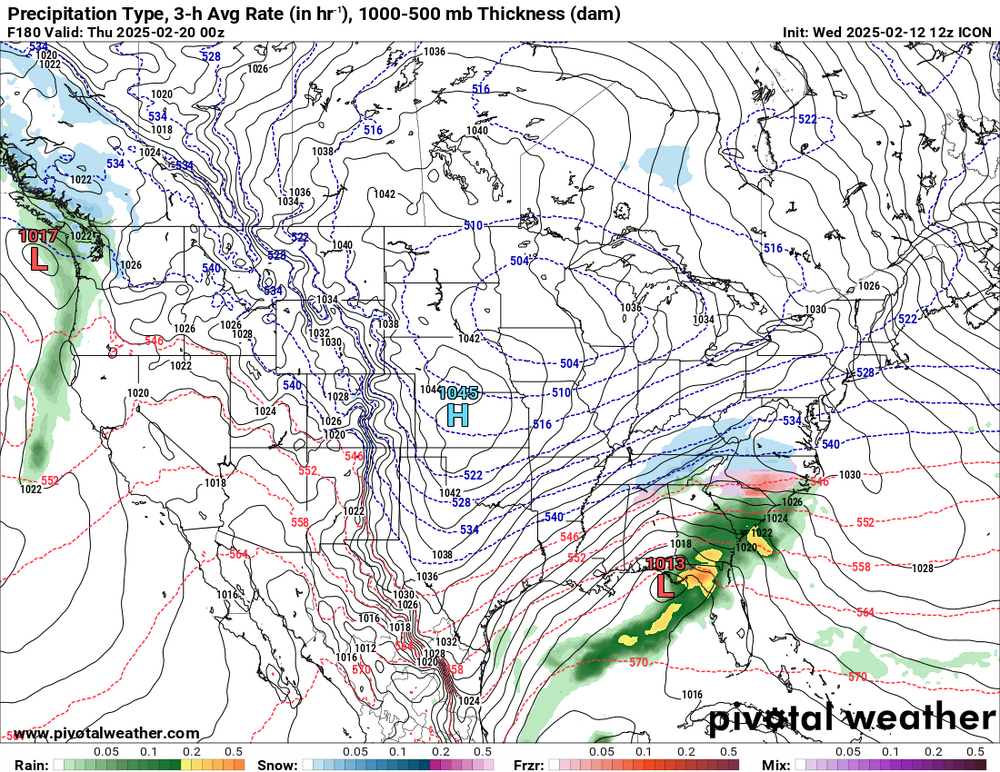
Something to watch for Saturday morning is the trend on some of the short-range models are developing several hours of freezing rain all the way down into the Catawba Valley area, back into the MTNs. Here is the latest RGEM.
-
Seems legit to me, goes right up I85!
-
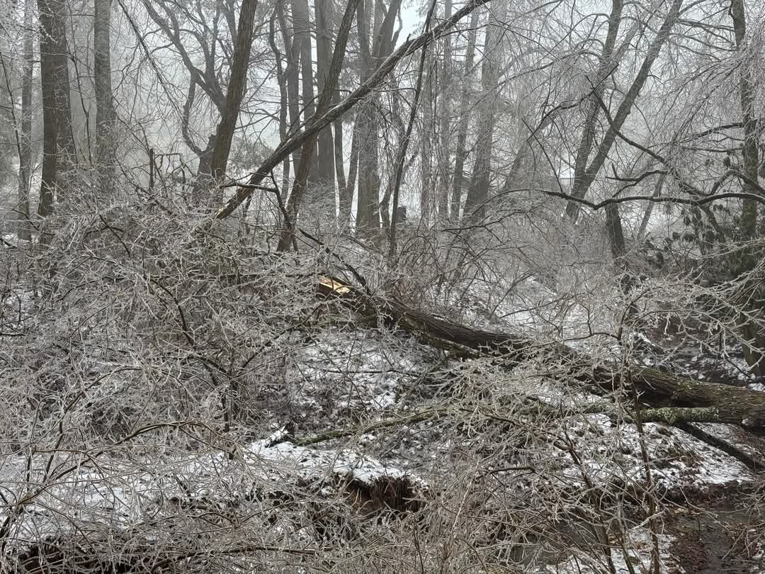
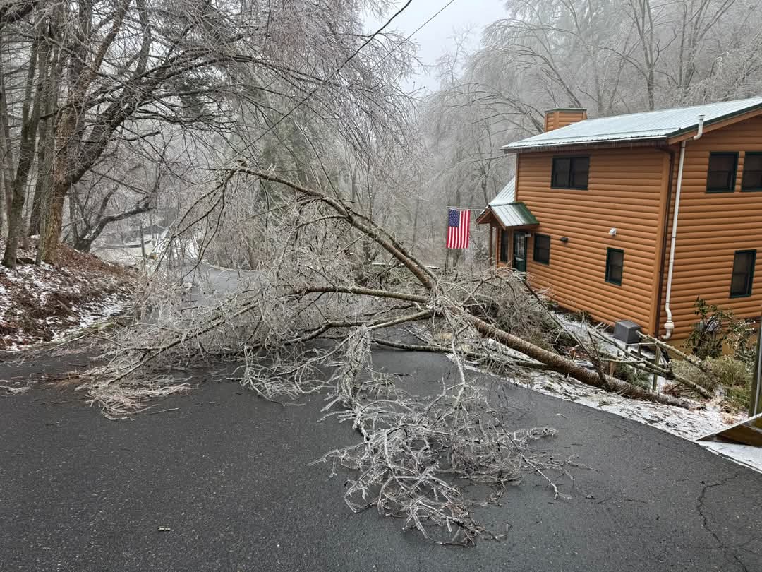
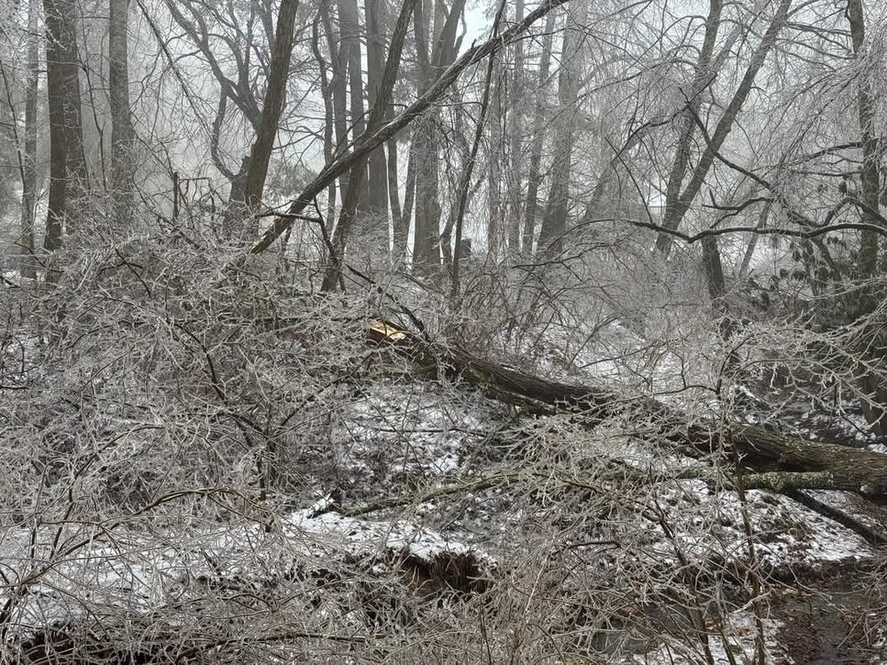
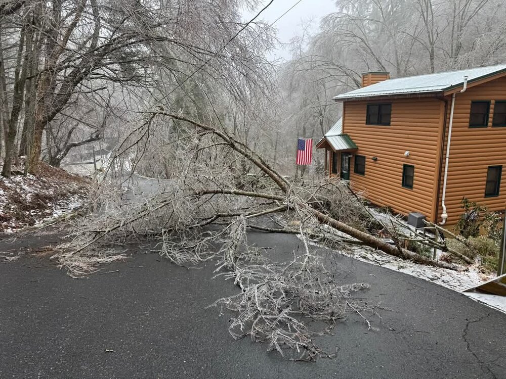
Here's some pictures of the damage up in Ashe County, in Fleetwood. Some of my neighbors took these about an hour ago. Looks like at least 1/2" on the trees.
-
ICON has storm too. I think at this point the models are all in theory with each other on some type of winter storm. I guess at this range that's all we can hope for. I want complain about a little extra model watching for a few days!
-
Looks like overall the EPS increased totals in NC for the 20th-22nd timeframe when compared to previous runs.
-
Just dropped to 32.8, we are close!
-
GFS and EURO Ensembles both showing a good signal around the 20th.
-
MTN Cabin in Fleetwood is down to 29 already with a dp of 23 about 5 miles to the west of the BRP..
-
I am over in Newton and just said the exact same thing. Out here in the country there are some temps already around 34.9-36.2. Most models have us around 40 right now.
-
Temps even down in Catawba County right now are running anywhere from 34.9-37.2 on local weather stations. Most models have my area between 41-43 degrees right now. Not sure if that will convert to colder temps or not when the moisture arrives, but certainly colder than what it's supposed to be.
-
Can anyone speak on the WRF models and their accuracy? They have a major ICE storm much further south than any other model, do they tend to overdue cold air at the surface and precip?
-
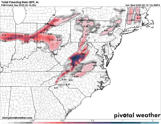
Just did a trend on the Canadian from last night and it clearly shows signs of a deeper wedge with more icing each run.
-
Comparing all of this mornings runs, it doesn't look great for the areas along the Parkway and border counties.
-
I thought about heading up to the cabin to wait it out and see, but the whole family has the flu. Really hoping we don't get that much, that would be a lot of cleaning up to do! Folks along the river in my area have pretty much lost their home and most possessions during the hurricane. I guess we will find out which trees and limbs are still barely hanging on.
-
It will be interesting to see how the short range models trend over the next 18-24 hrs. This ice could keep showing further and further south right up until the storm starts. Here's the latest WRF-ARW2
-
Nice didn't even glance at other models that far out. I will say we have had some active weather here historically during that timeframe over the years.
-
Euro AI on the 22nd and 23rd would make us all happy, too bad it's two weeks away.
-
I have a feeling that once that storm gets into the short range, the NAM and RGEM might expand that I've even further south. I've said it before, the wedge always seems to even pool a little deeper once it sinks down into the Catawba Valley area. It will definitely be worth watching.
-
12z GFS still has a pretty nasty Ice Storm along the border counties. Last three runs.
-
GFS trending further south once again things shaping up to be ice in some of the typical CAD areas.
-
12z Euro has trended much further south and now has some icing back into the MTNs, Ashe, Watauga counties. Looks like this could come further south as we get closer.
-
I agree, I just did a trend on the surface temps on the Euro AI run and the northern progression of temps at or below 32 seem to hold steady (roughly) in the same counties as the previous run. It's has def. trended warmer, but at least that trend has slowed down a lot on the last run when compared to the previous runs. I have observed the CAD in the heart of Catawba County for many years, and if a high pressure gets somewhat locked in, I know for a fact it is almost always colder than what the models show. It never fails, the short range models will tend to lock in the cold air deeper and longer usually in the last 12-18 hours before an event. I think this wedge could be modeled a little stronger over the NW Piedmont and Southern Foothills as time goes on.
-
Starting to come in alignment with ensembles, I think this storm is presenting itself early where the bulk of the frozen will be.
-
12 GFS ENS. look to be headed in the right direction, snowfall starting to align more with your I85 line and def. further south than 06z and 00Z.
-
Ensembles actually had accumulating snow a little further south than 00z though. Have to look more at ensembles at this range than single model runs. 00z Canadian Ensembles also has accumulating snow for much of the state.