WXNewton
-
Posts
573 -
Joined
-
Last visited
Content Type
Profiles
Blogs
Forums
American Weather
Media Demo
Store
Gallery
Everything posted by WXNewton
-
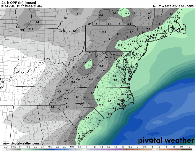
06z EPS looks better than 00z EPS when compared at hr 144, more snow further south and east as well as colder temps. So all and all even though it doesn't go out as far, the EPS looks colder than 00z and more snow with the initial front end. There was still more obviously to come in after hr 144. Also because it was setting up as a colder run freezing rain was further south and east.
-
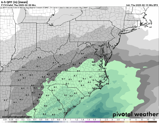
The 6z Euro at hr 144 is sleet and heavy freezing rain for many outside of the mtns. If the run were to extend longer WNC was about to transition to a legit deform band that could really do some damage. This seems like the first storm all year that doesn't just rocket out of the area. I think given the look of everything we could be dealing with a major winter storm in parts on NC and SC that has a wide variety of precipitation with temps well below freezing.
-
Canadian ENS are about the best they have looked, nice uptick for areas around I85/I40 and North this cycle.
-
EPS had a nice jump in the overall precip shield while keeping temps about the same as 12z. Seems to be a nice look for many areas. The OP is a little juicier than the EPS mean, but they seem to align well with the overall placement of the precip shield and temps seem to be a little colder on the EPS mean than the OP.
-
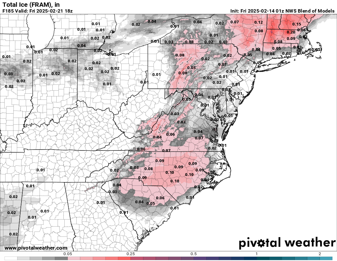
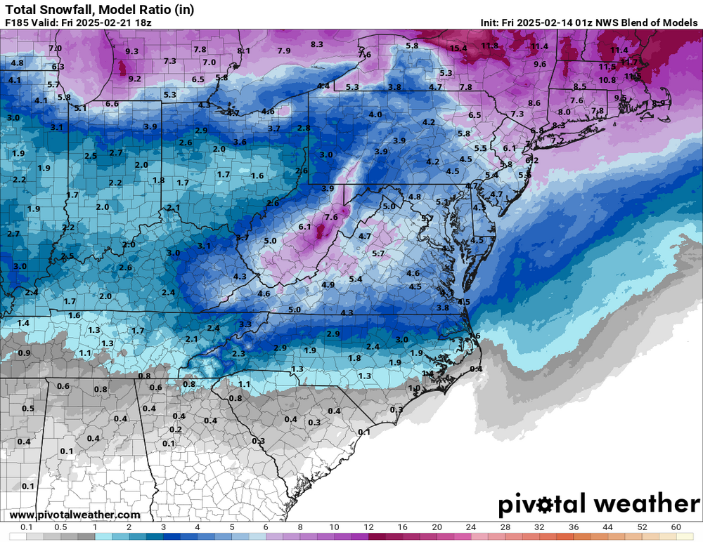
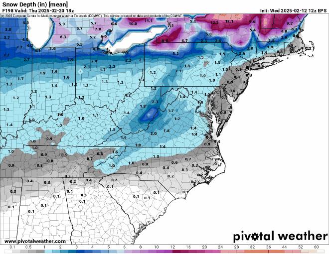
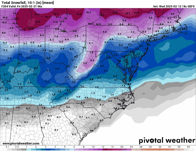
Here is the NWS blend of all models snow and ice.

-
Yes, very nice trends, it really blossoms the precip out of the Gulf on this run and fills in the NW side of the precip shield.

-
-
Yes sir it did. Lived in Maiden at the time, and had 3-4" of snow and sleet with a little freezing rain then the next morning about 7 a.m. the upper low built in from the west and by lunchtime we had 9.5-10.5". Then listened to reports coming out of Sherrills Ford to Statesville of foot plus totals.
-
Yeah I see that now, I didn't let the run finish when I first looked. Seemed like accumulations started a tad earlier this run.
-
More of a backside to the precip on the EPS this run, maybe picking up on a stronger upper level low tracking through ETN.
-
Looks like EPS should tick up even more or at least me close to last night, storm almost takes on a comma head look back in Western NC and E. TN. Looks like more phasing and good NW side to the overall pecip shield.
-
Looks like GEFS is going to be juicer than 06z and maybe colder.
-
The ICON and Canadian are really not that far off from each other, the ICON just seems to phase earlier for a bigger storm. Also, looks like the ICON keys more on the trailing energy than the Canadian. Seeing the Canadian further south and east at this stage in the game is probably a good thing, we know how that will go as it gets closer.
-
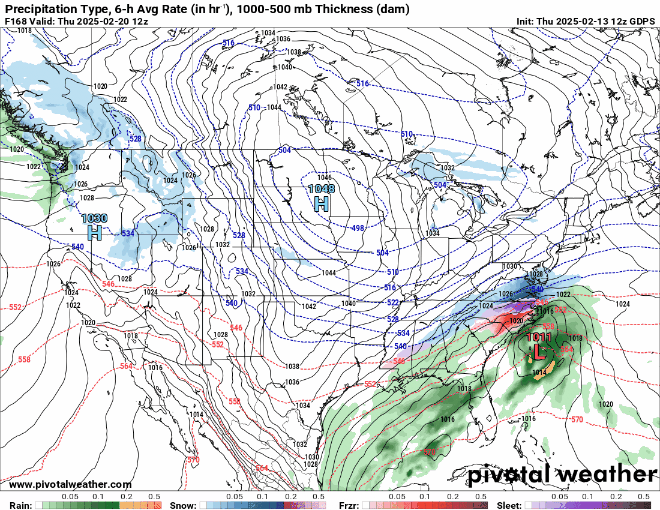
12z CMC is a weird evolution, initial wave gets going further east with zr and sleet in CNC and ENC then second piece of energy over the gulf seems to fill in the NW side and becomes more of like an overrunning of moisture into the Western NC.
-
Also, worth noting is how the 12z Canadian is trying to show some icy potential early Saturday morning Piedmont area and Foothills.
-
I totally agree, mother nature knows when things are getting ready to change drastically. The animals have to prepare for survival purposes, it makes perfect sense that they can tell. During the January 11th storm I noticed a few days prior to the storm the squirrels and rabbits and birds everything was on the move. I might even watch the grocery stores, people do the same thing we rush and buy all the bread. Maybe that's the best indicator.
-
Let's see if the old wives tale holds up for next week. Had several rounds of thunder and lightning last night about midnight, several people I've talked to this morning in person said it's going to snow within a week. I think it's funny how some folks predict their weather, we shall see.
-
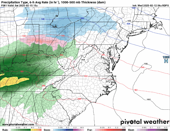
https://collaboration.cmc.ec.gc.ca/cmc/cmdn/pcpn_type/pcpn_type_gem_reg.html
-
Looks like a good bump up.
-
Looks like a good bump up.

-
Had thunder and lightning here in Newton a few mins ago...34.5 degrees. Really shocked me, wasn't expecting that!
-
GEFS is going to bump totals up nicely when compared to the previous run. Really wants to bring in a second storm, looks like a decent signal at this point.
-
For what it is worth, the 18z Euro AI has the storm too. Looks cold enough for most of the state and has higher precip amounts further east than west. Also, does a transfer of moisture from the west to the east and leaves parts of the Piedmont area with a precip minimum.
-
The trend on the RGEM shows it could be a little icy to start Saturday morning.
-
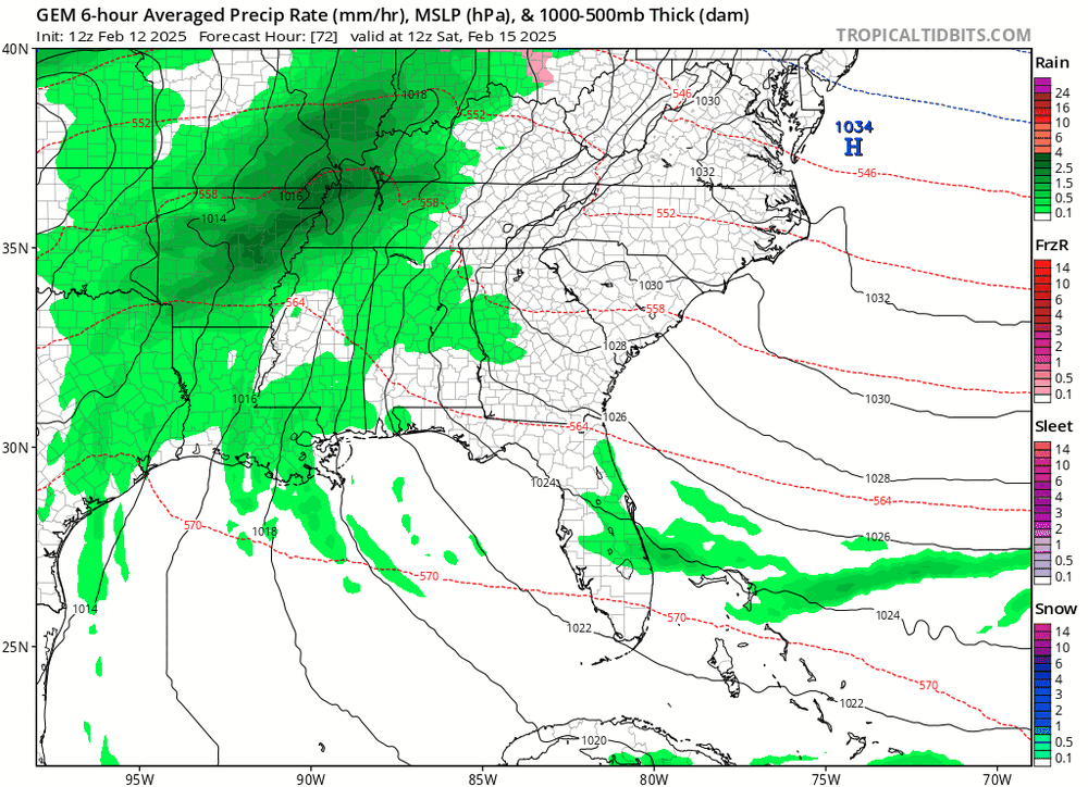
CMC is a pretty significant winter storm. Lots of sleet and zr for most of NC and cold.