WXNewton
-
Posts
573 -
Joined
-
Last visited
Content Type
Profiles
Blogs
Forums
American Weather
Media Demo
Store
Gallery
Everything posted by WXNewton
-
https://www.resortcams.com/webcams/blowing-rock/ Web cam out of Blowing Rock really shows how strong these winds are.
-
Starting to whiten up here at the top of the mtn, was 61 degrees here at 2:30 this afternoon. I feel like the radar is starting to really blossom in TN and KY, pivoting this way.
-
A few flakes starting to mix in here, temp down 37. Wind is starting to to howl out of the NW.
-
Getting ready to head up to the cabin, hopefully I get to see some snow overnight, might be my last chance to make it up this season.
-
I figured border counties would be under an advisory by now. I plan on heading up to the cabin tomorrow night with hopes of seeing snow overnight. I expect some accumulations up around 3600 feet by morning Thursday.
-
FWIW, Canadian ENS. showing some light accumulations too. Went from zero to a little hope! So now all models show some potential.
-
NWF looks pretty stout for the typical areas on Thursday.
-
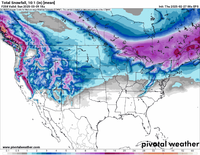
12z EPS still entertaining some probability around the 8th-9th timeframe.
-
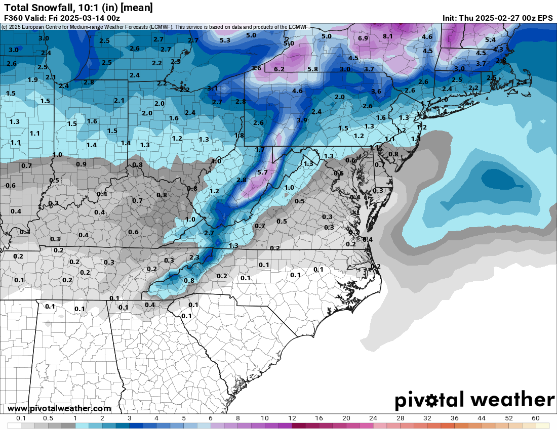
EPS is looking pretty good for some NWF events 3/6-3/12.
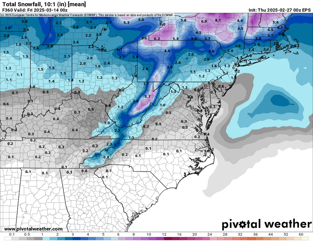
-
Looking at the mid to long-range, it seems like both the EPS and GEFS are showing some interest around 3/3-3/6 period. Also potential for some NW Flow Snow towards the last of Feb.
-
I am out for a few days, going to catch up on sleep at night. I'll check the models once a day for a while until some new potential shows back up. Bring on a good one in March! Actually checking the models once a day was a lie!
-
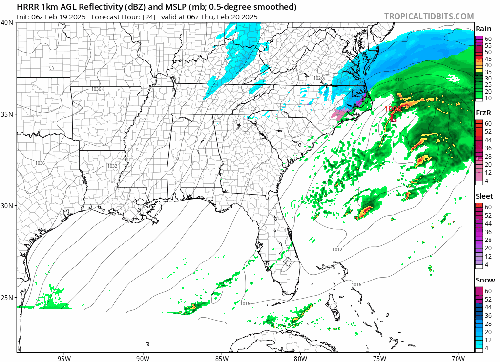
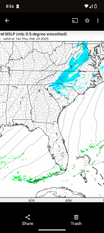
HRRR did really well identifying this band last night. Compared to the radar.
-
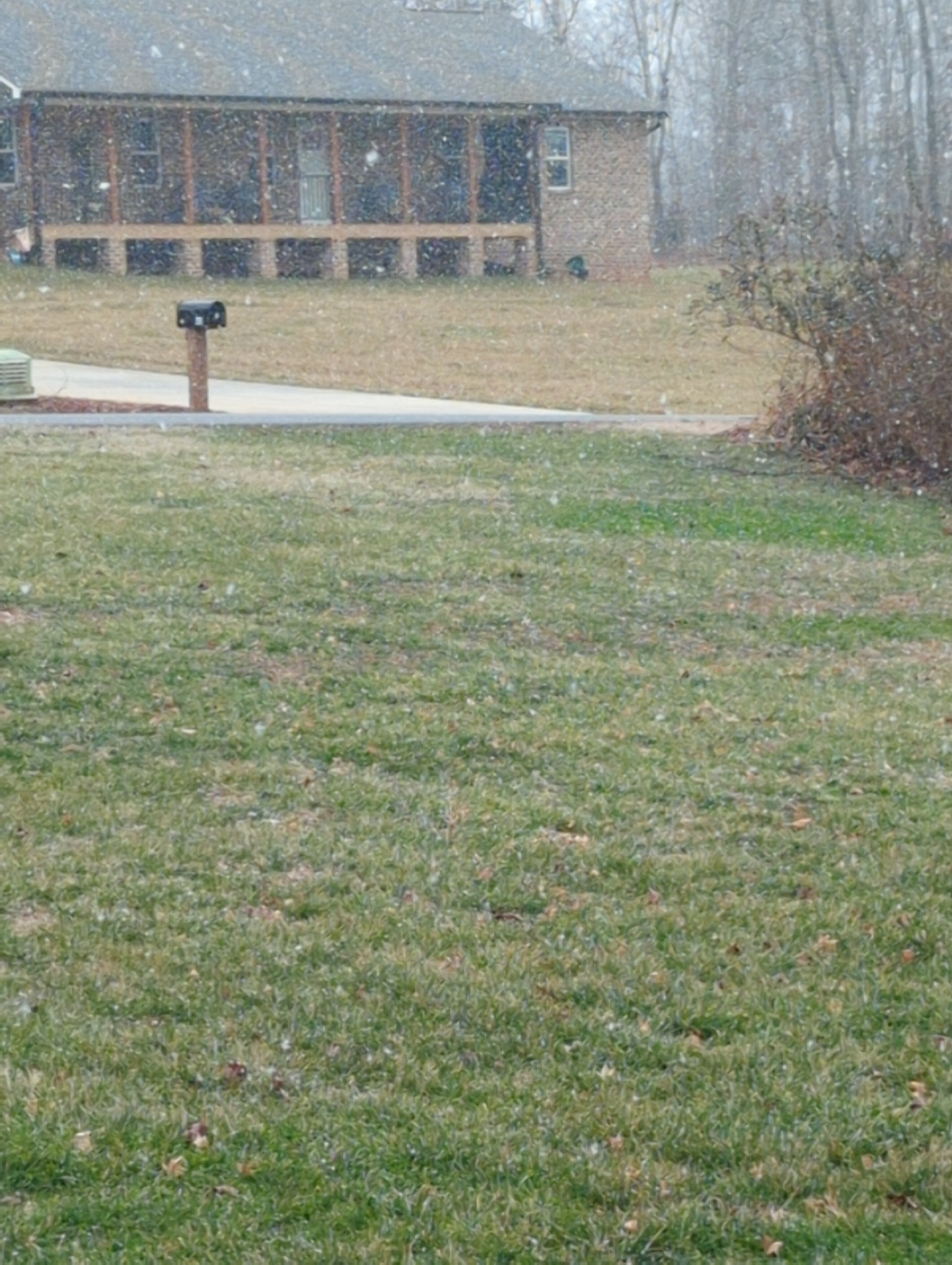
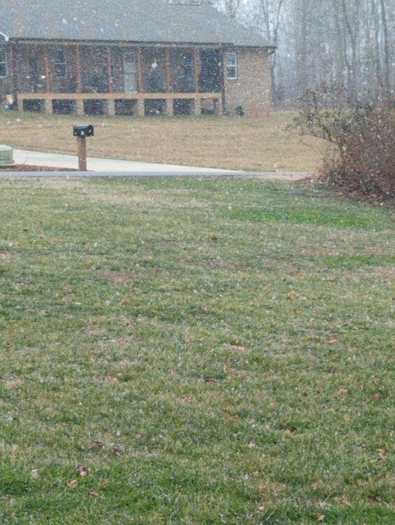
I love it guys, how something so simple like a snowflake can make a person happier. Grass is getting white.
-
Starting to see mostly floaters here.
-
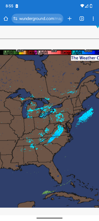
Awesome, looks like radar is showing more moisture starting to break containment. CCS just went remote learning for today.
-
What are seeing your way? Starting to have some small floaters mix in, with the snizzle. I know the wife's car is frozen over.
-
It's a snow/mist falling right now, not sure what to call it...26.6 schools are on a 2 hr delay I expect that to change soon.
-
Grass is getting white south of Newton.
-
Best rates of the day in Newton, moisture just seems to be coming right over the area from Shelby to Rutherfordton.
-
Snowing a little heavier now. Top of grass has a little white in it.
-
Light snow again in Newton, radar looks...um...about how I expected it to look. It's funny how your expectations shift throughout a winter storm potential and now I am happy just to see it snow. Chasing these tiny little bands on radar has become the highlight of my day so far.
-
We could have gotten hammered from this storm, it just goes to show you how close it was to being a big storm. Everything almost has to be perfect nowadays, and forget the models until about 36-48 hrs it seems. I am happy right now just watching it snow finally.
-
Finally Snow in Newton
-
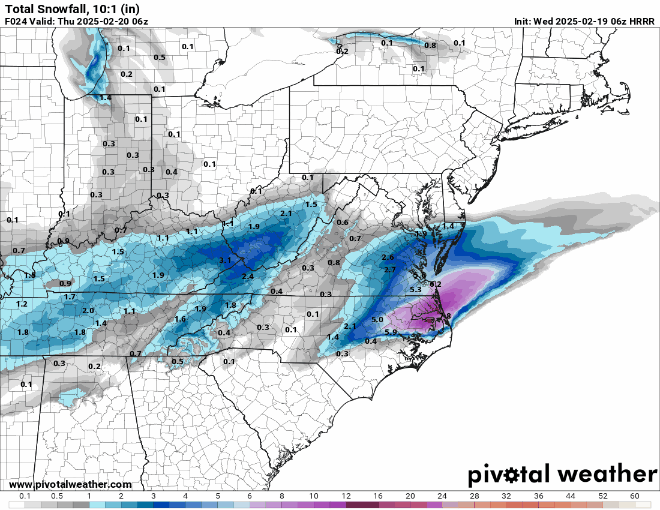
Here's the forecast accum during that time on HRRR.
-
The 6z HRRR has getting our best chance at any accumulations tomorrow morning out of the upper level energy. Maybe that's the best we can hope for at this point.