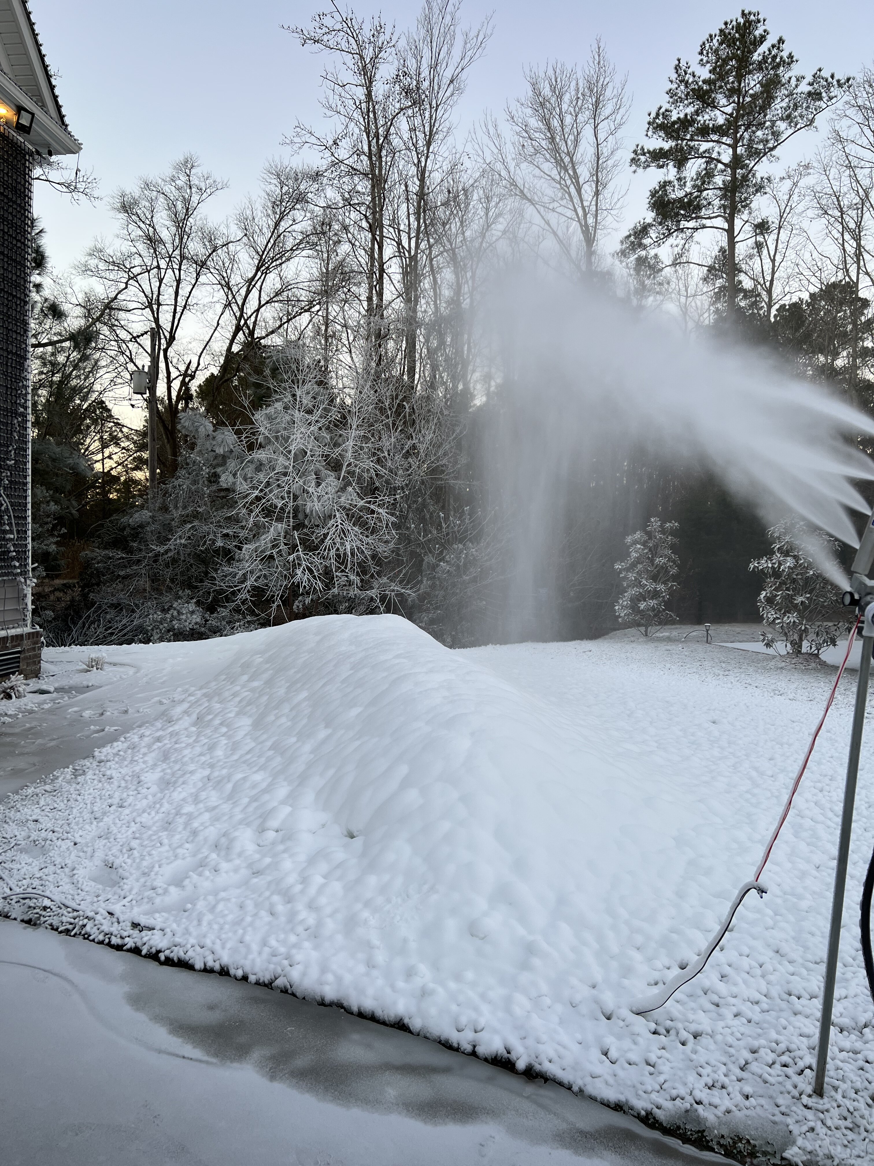

Beach Snow
-
Posts
219 -
Joined
-
Last visited
Content Type
Profiles
Blogs
Forums
American Weather
Media Demo
Store
Gallery
Posts posted by Beach Snow
-
-
1 minute ago, jlh said:
Not with the ridge directly north near the Canadian/NY border, it will follow the path of least resistance around this (NNE)
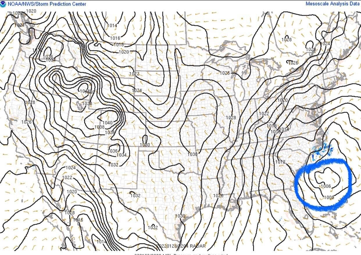
Correct, i think what they were observing is would it track further north and closer to the coast near NC and VA as opposed to ENE
-
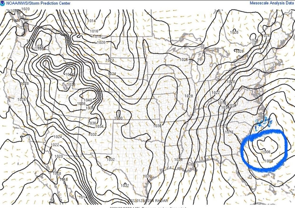
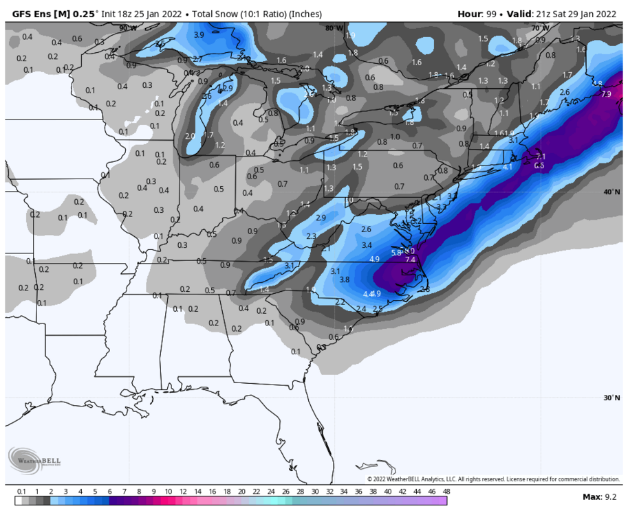
Seeing this float around on social media and LP placement. Few people saying low is further west than NAM shown and should travel N following the depiction of the isobars. Any truth to this?
-
Well me in SE Va now

-
 1
1
-
-
7 minutes ago, Brick Tamland said:
Extreme NE NC and SE VA do well.

The 3K is drastically different unfortunately for us up here in SE VA
-
6 minutes ago, WinstonSalemArlington said:
Where are the maps tonight?

-
 1
1
-
-
2 minutes ago, VBsurf said:
They did real decent last storm. This is such a dynamic system its going to be awesome watching it evolve here on the coast.
I agree. Where you and i are 20 mile shift will
make the difference of 4” or 12”
-
1
-
-
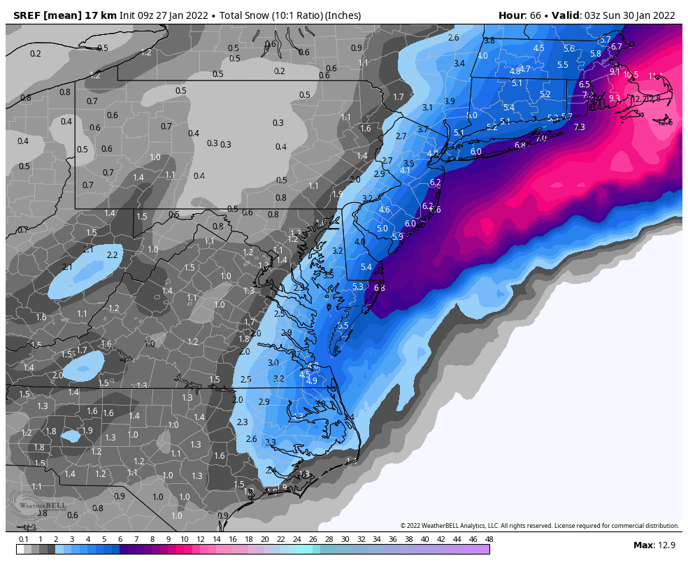
Anyone know how well the SREF plume models are?
-
6 minutes ago, VBsurf said:
Man are the SREF still bullish at this late hour for SE VA or what?
https://www.spc.noaa.gov/exper/sref/srefplumes/
(cant figure out how to link in KORF)
Wow massive change!


-
1
-
-
1 hour ago, burgertime said:
GFS also further east with the northern energy. That'll make a difference for everyone downstream if it keeps that pace of being slower than the models see.
Do you think there is even time left looking at current observations and where energy and NS are for an earlier phase/ more negative tilt to get the low cranking off Hatteras as opposed to the Delmarva?
-
1
-
-
7 minutes ago, VARTV said:
Virginia Beach:
Weather Service - 3"
Channel 13 - 3-6"
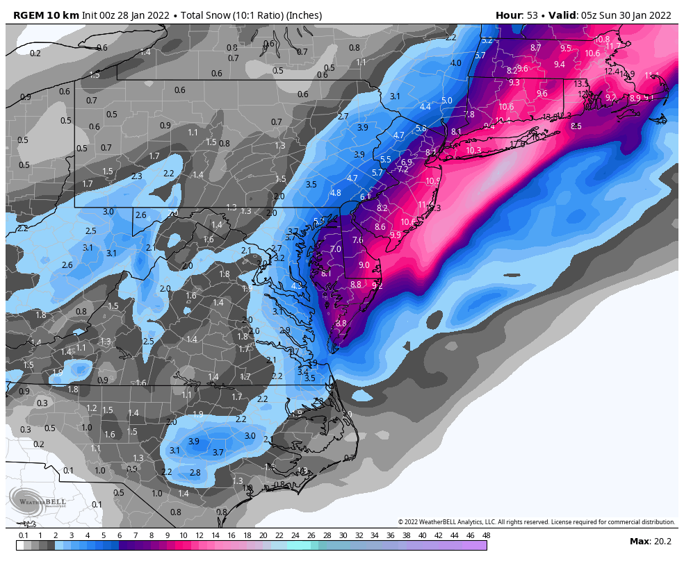
Channel 10 - 6"+It’ll change. RGEM just caved
-
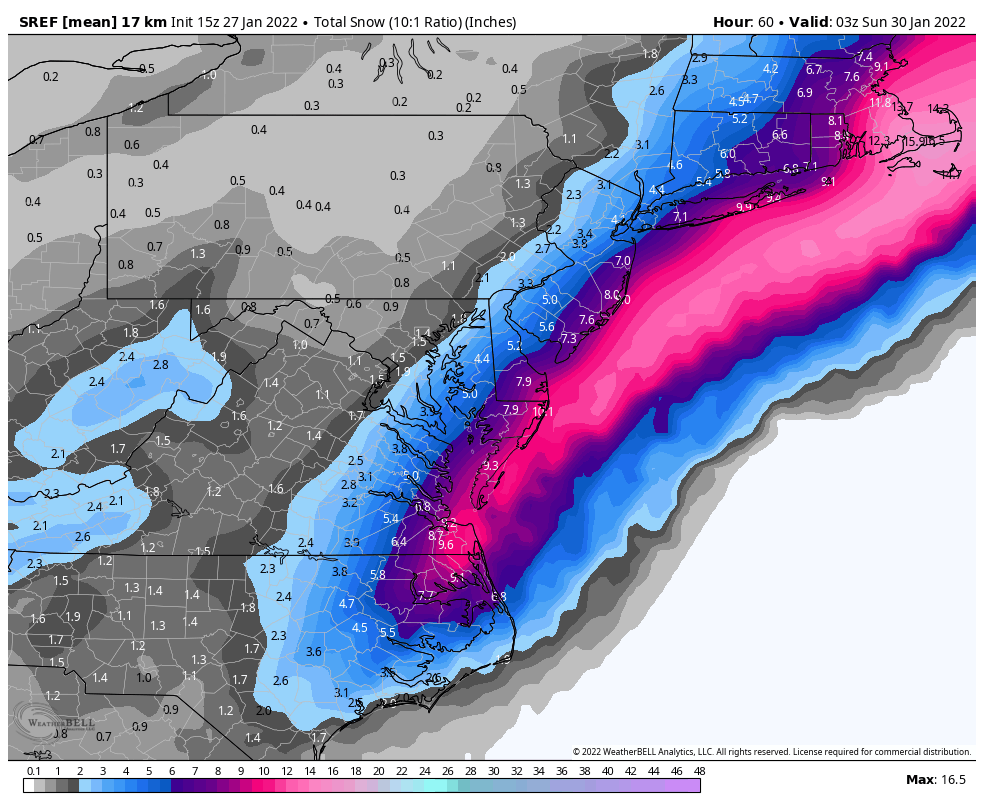
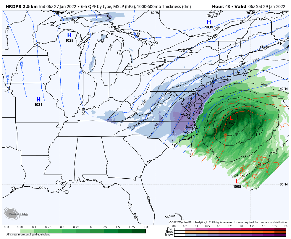
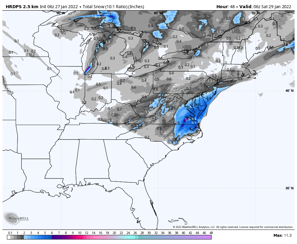
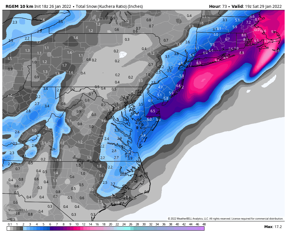
HRDPS is really not a bad look. Also higher resolution then the nam 3km. This is at the end of its run. Still snowing…


-
1
-
-
3km NAM basically caved to the GFS…
-
1
-
-
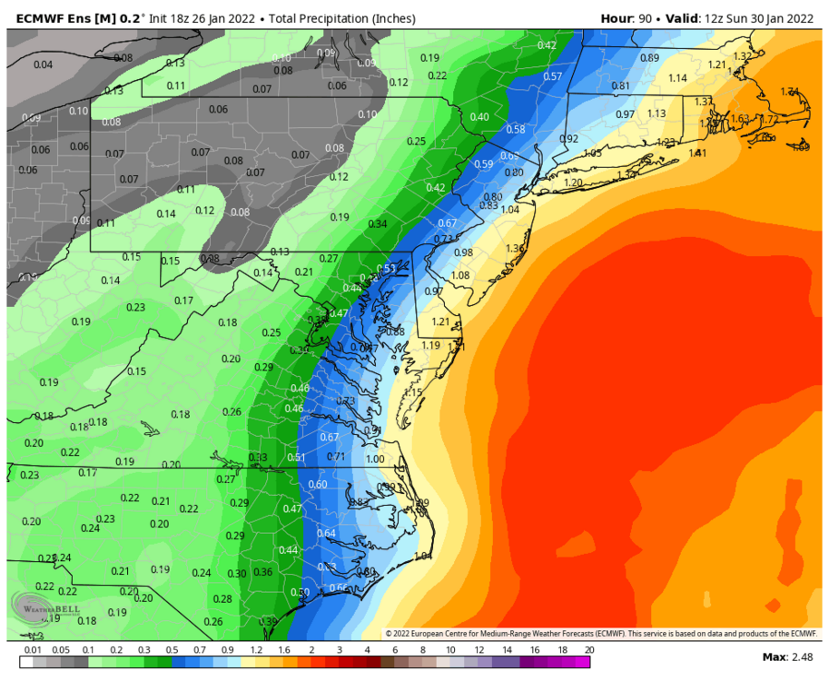
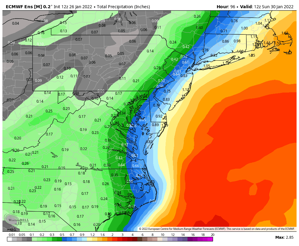
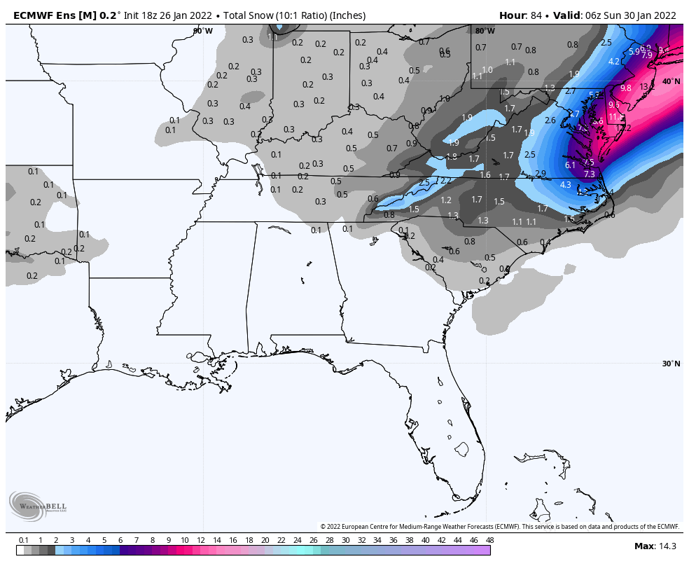
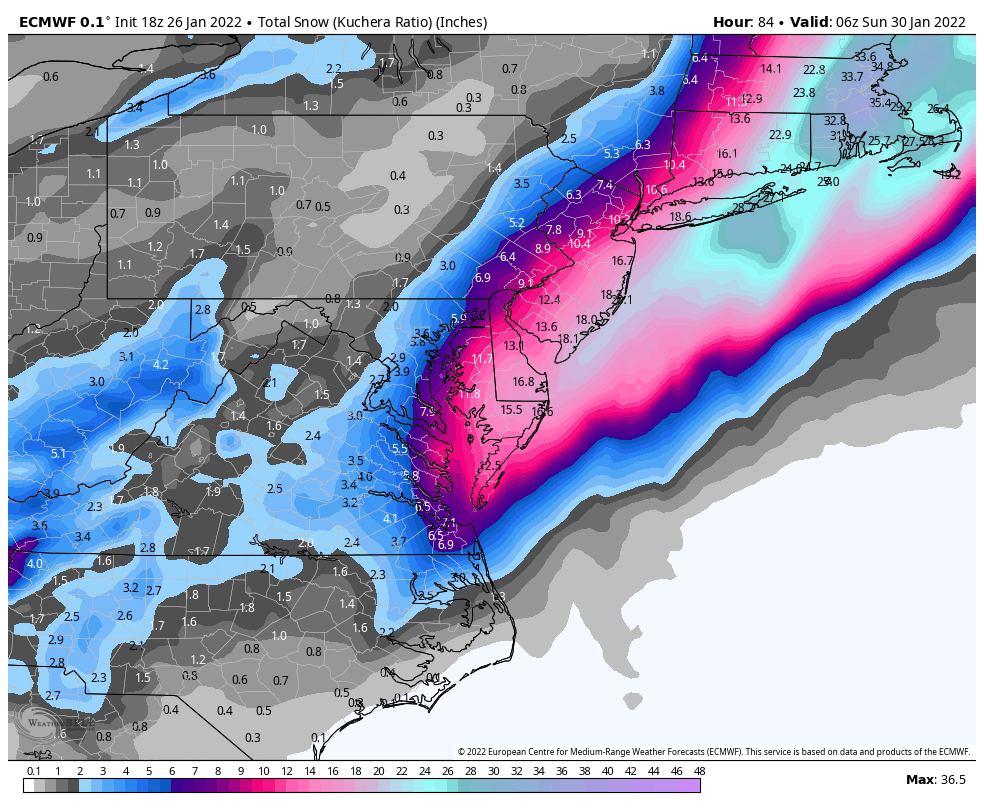
Very nice qpf increase from 12z

-
3
-
-
-
Just now, BornAgain13 said:
Anyone have the 18z eps snowmap?

-
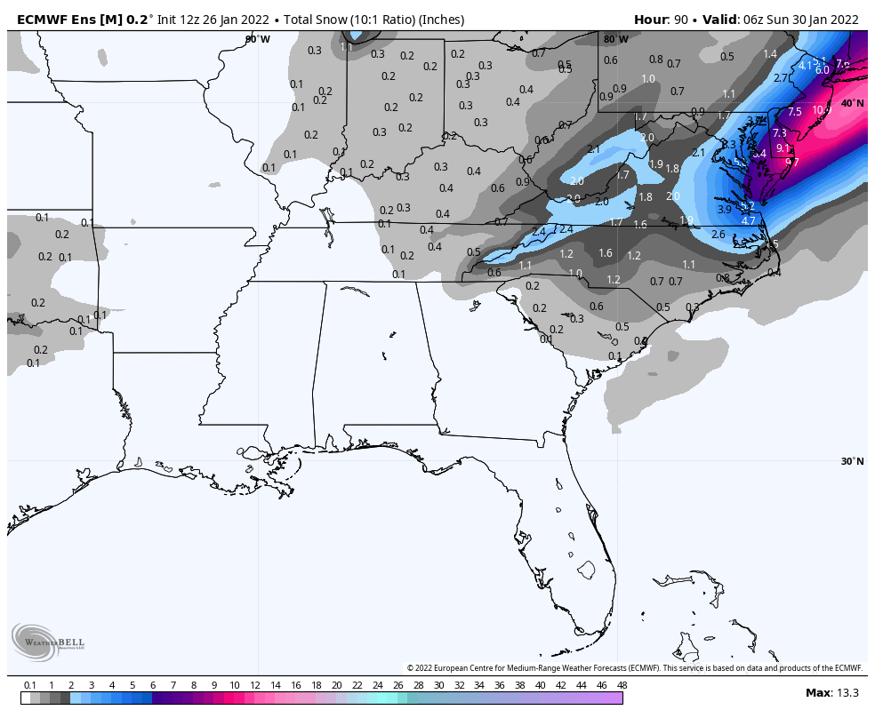
18z euro ticked up for SeVa

-
1
-
-
Just now, wncsnow said:
It's been finished
.thumb.png.244a25c2aac0bbef4fd16a296ad72d22.png)
For some reason my WB maps were not loading..my bad
-
Somewhat of an improvement to the west..baby steps

-
The RGEM is not looking too bad at all. Looks better compared to 12z will post map after finished
-
1
-
-
3 minutes ago, TARHEELPROGRAMMER88 said:
EPS map? GEFS trended in our favor at 06z.
Eps for 6z is not out yet
-
 1
1
-
-
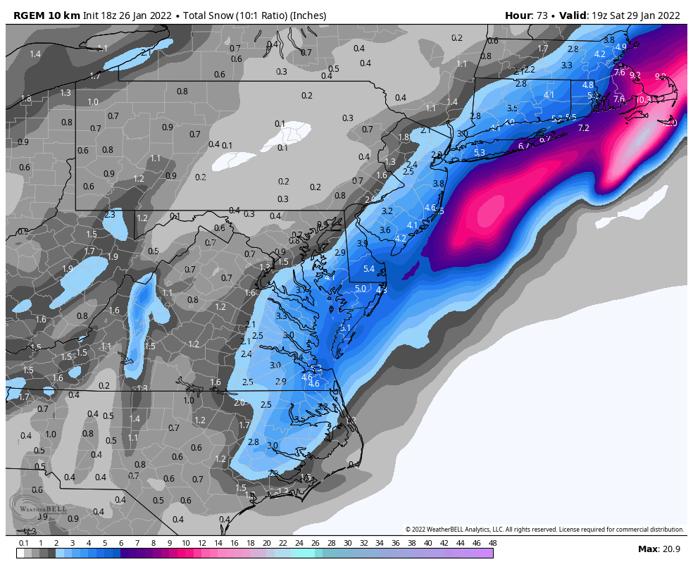
Yikes! RGEM did phenomenal with last 2 systems…not a good look at all
-
11 minutes ago, CntrTim85 said:
I would bathe in their tears. Especially the MA guys.
Don’t jinx it for us down here in SE Va

-
 1
1
-
-
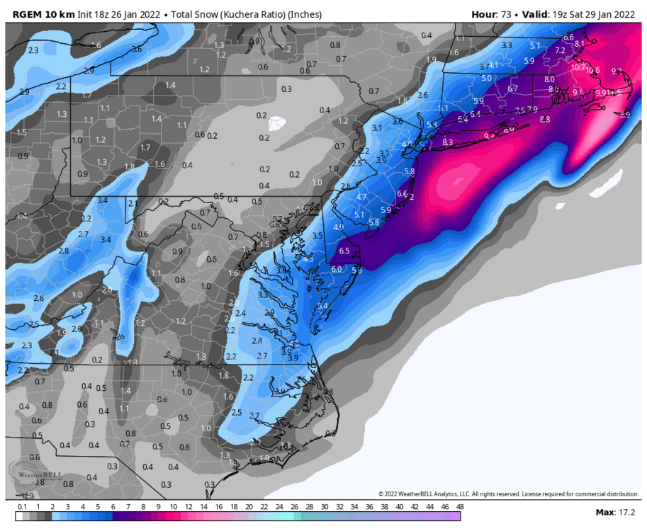
Snow has now exited the coast…pretty substantial increase from 12z
-
1
-
1
-
-
1 minute ago, jlh said:
Question for the long term forecasters... Something that is interesting to me is looking at the 18Z GFS at 84. For us coastal NC/NE NC folks, a low center that relatively close to Hatteras usually features a pretty noticeable warm nose that typically keeps us cold rain with the moisture gone before the column sufficiently cools , However, despite somewhat onshore winds at the same time the warm nose in the forecast sounding for the same plot shows only a tiny bump of a warm nose (and still below 0C). My training in weather is more operational than theory and I know the resolution on the GFS is a bit tough along the coast with the influence of the water, however it is unusual that it would depict snow all the way to the bay with where it is depicting this. In the past this onshore influence would normally be depicted and make sense. What would explain the difference this time? I wouldn't think that ocean temperatures would be significantly colder than average, would it? or is the GFS possibly way out to lunch with the lack ocean influence before winds shift more to the NW from NE?
Not 100% sure but i think because the strength of the low creates its own cold air to help overcome…but i may be wrong


.png.013a8552125ddfb3b9b0b60a4cf5179e.png)

Potential 1/28-1/30 2022 winter storm
in Southeastern States
Posted
Figured as much