Cartier God
-
Posts
53 -
Joined
-
Last visited
Content Type
Profiles
Blogs
Forums
American Weather
Media Demo
Store
Gallery
Everything posted by Cartier God
-
Oh okay. I was just explaining why it was wrong. I’ve seen a couple weenies online push this conspiracy and its complete bs. The ratings for this outbreak were egregious but acting like its some scheme for WFOs to deny people who lost their homes financial aid is ridiculous.
-
What does WAG mean
-
I think you have a misunderstanding of how insurance companies provide compensation for natural disasters. It’s based off the cost of insured losses, not EF rating.
-
The SPC did an excellent job forecasting this event, especially given short-term model guidance that day. It wasn't until around 16z Friday when the CAM runs began to catch on to the overperforming surface temps/dews and started to realize the nightmarish potential of that day. The SPC also did an amazing job with their timely and descriptive MDs as the event unfolded. It's easy to say that they could've gone with a high risk after everything is said and done, but given the model guidance and general expectations for Friday its fair to say that they did a fantastic job.
-
Warm air damming? lol
-
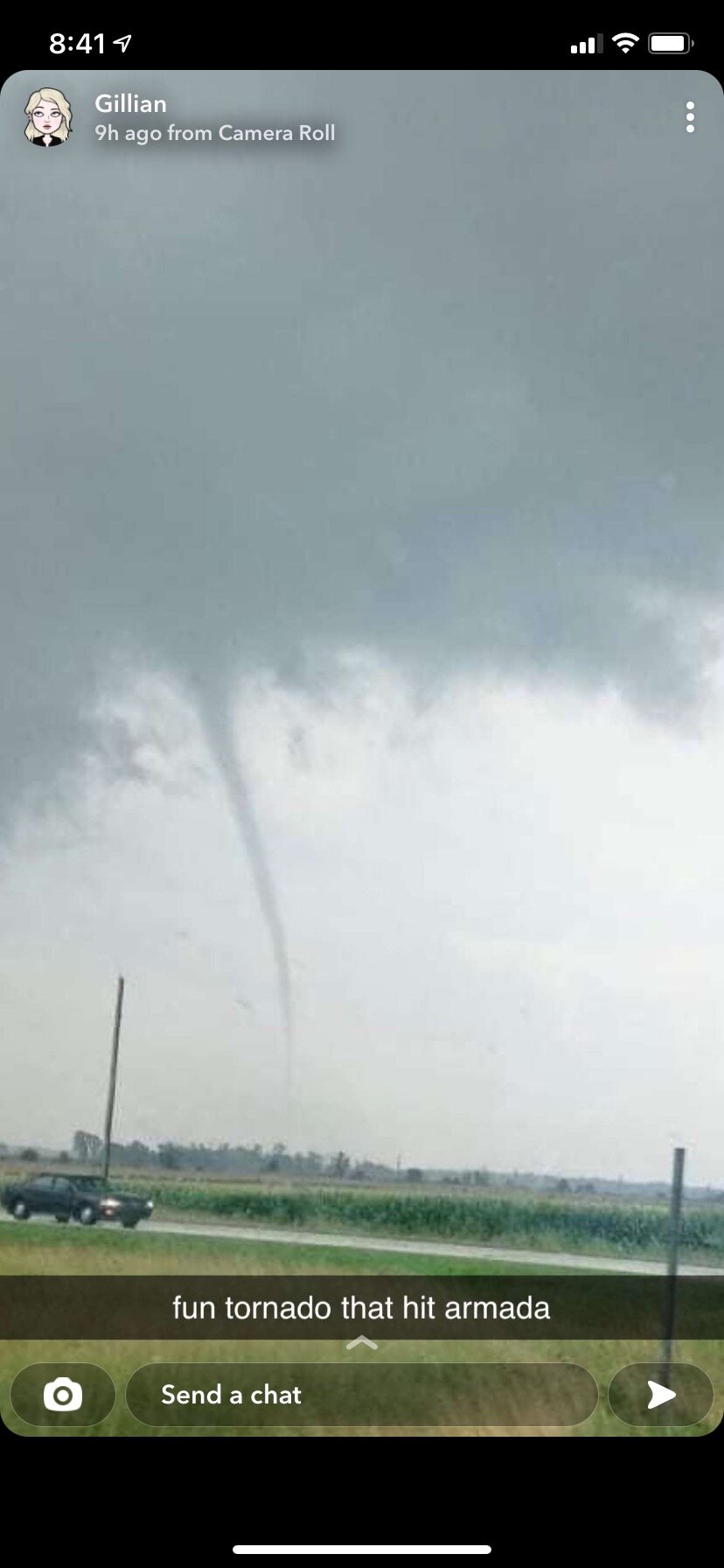
I got off work at 4 yesterday tired as hell and knowing I couldn’t make it to the thumb in time, so I took a nap and then I raced to meet the embedded supercell that dropped a tornado near White Lake. I stopped near Sylvan Lake just after the updraft occluded, but I still saw a grungy looking shelf with some cool striations. It was a decent chase but not as nice as the one I had on 6/26. This picture is of the tornado that hit Armada, from a friend of my girlfriend. Her house was ok but other houses on her street sustained damage.
-
looks like a moderate tornado just passed to the north of mason city, illinois starting about 15 minutes ago. noticeable cc drop
-
CC drop directly southwest of Moundville, AL
-
selma population: 20,756
-
00z nam nest has much less vbv in the hodos tomorrow than the latest rap runs, i wonder if its underdoing it. definitely looking like a potential failure mode in addition to convection clogging the warm sector.
-
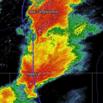
this past saturday in the texas panhandle, march 13th
-
storm near claude texas is starting to strengthen
-
-
the second cell south of happy looks primed, inflow is much less obstructed than the main supercell.
-
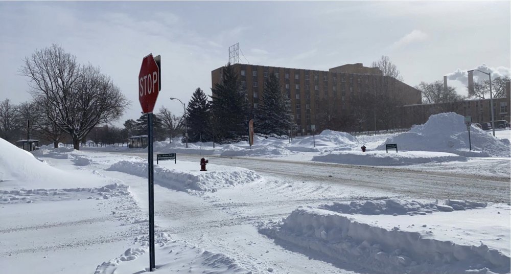
really solid event in east lansing, easily the biggest snowstorm ive seen since ghd 2. about 14.5 inches of snow on the ground, id say around 9 of that is from last night. went on a walk and saw snow drifts up to at least 2.5 feet.
-
small flake size here as the main band pushes north. good rates tho, already accumulating on the roads
-
kind of crazy for grr to have no WSWs out by now, especially with the model consensus going into this event. curious to see if they adjust
-
in like a day this shifted from looking like a 3-5" event here to potential for the strongest snowstorm of the winter. the nw trend really works wonders on my weenie. as much as i wanna lock in the weenie maps, 7 inches sounds good for my final call. if ur reading this i hope u get some snow dawg
-
ready 2 be heliosphered
-

Feb 3rd - 5th Potential strong stm threat
Cartier God replied to Brian D's topic in Lakes/Ohio Valley
main band pushing into ingham county now, light snow starting in east lansing -
Feb 3rd - 5th Potential strong stm threat
Cartier God replied to Brian D's topic in Lakes/Ohio Valley
gonna have to take off my angrysummons brand noise cancelling headphones so i can listen for thundersnow tonight -
if this verifies im hitting up my ex
- 300 replies
-
- 10
-

-

-
Feb 3rd - 5th Potential strong stm threat
Cartier God replied to Brian D's topic in Lakes/Ohio Valley
angrysummons you dont know me but im your biggest fan. for anyone wondering what my take is on any setup pls refer to this mans posts. u guys are laughing now but this man is a future first ballot americanwx hall of famer just you wait -
Feb 3rd - 5th Potential strong stm threat
Cartier God replied to Brian D's topic in Lakes/Ohio Valley
i thought i seen it all. mans fuked up in the crib makin models final call for east lansing: 4 inches of love -
6 inch call looking atrocious now. i gotta keep my head up tho im on the front lines of the weenie brigade