Spanks45
-
Posts
4,368 -
Joined
-
Last visited
Content Type
Profiles
Blogs
Forums
American Weather
Media Demo
Store
Gallery
Everything posted by Spanks45
-

Clipper Fires In Wednesday Feb 25 Disco/ Obs
Spanks45 replied to Damage In Tolland's topic in New England
This winter in particular....it seems like we get into these 1 week periods where it just wants to snow, then we go another week or 2 that it doesn't want to. Upcoming period definitely fits that pattern again -
With the huge snow pack and cold ocean, this spring is going to suck with backdoors....even the long range OPs can see it....60s and 70s down in PA, 40s up here
-
17" NW part of Southbury....
-
"Don’t do it" 2026 Blizzard obs, updates and pictures.
Spanks45 replied to Ginx snewx's topic in New England
Maybe the coastals are back....just needed a 150 miles north and we would have had Long Island numbers..... -
"Don’t do it" 2026 Blizzard obs, updates and pictures.
Spanks45 replied to Ginx snewx's topic in New England
I had close to 6" just past midnight...cleared it, nearly 8.5 inches around 7....then a few inches past that. Tried to measure areas in the yard that had the least amount of wind, but far enough from trees...found a couple near 18 inches and others around 16....will call it 17" here We only had 5-6 inches on the ground prior to this storm Congrats out to those in the east....jealous -
"Don’t do it" 2026 Blizzard obs, updates and pictures.
Spanks45 replied to Ginx snewx's topic in New England
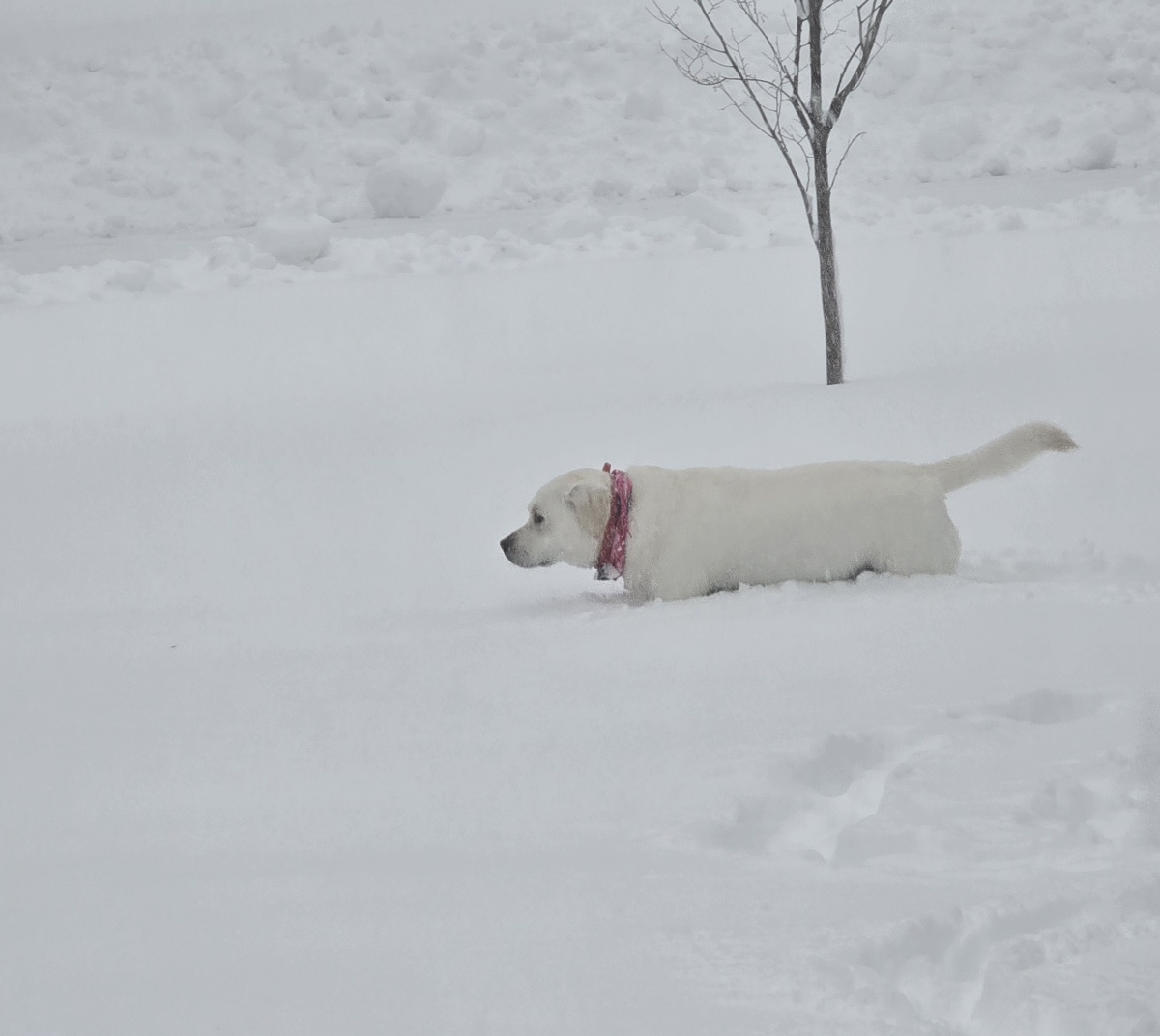
Using my dog as a measuring device, we are between 15 and 16 inches....still heavy snow falling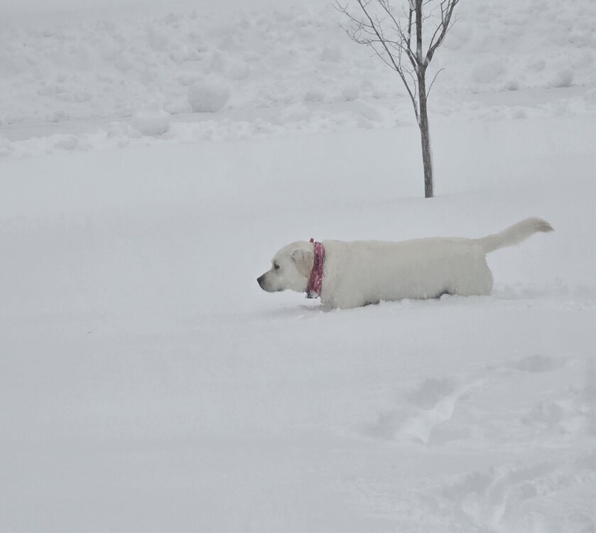
-
"Don’t do it" 2026 Blizzard obs, updates and pictures.
Spanks45 replied to Ginx snewx's topic in New England
Alright, breathing easier now....just on the doorstep now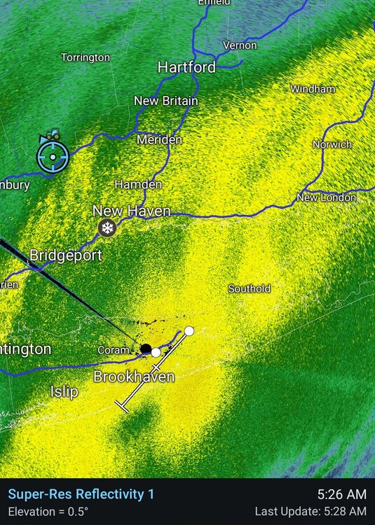
-
"Don’t do it" 2026 Blizzard obs, updates and pictures.
Spanks45 replied to Ginx snewx's topic in New England
My visibilty has dropped dramatically in the past 10 minutes, so hopefully that band is pushing in and setting up shop... -
"Don’t do it" 2026 Blizzard obs, updates and pictures.
Spanks45 replied to Ginx snewx's topic in New England
Thats where I am now....even if we grab another 3-4 here, still a decent storm, but cant we just sit under the yellow bands for a few hours? 10" here -
"Don’t do it" 2026 Blizzard obs, updates and pictures.
Spanks45 replied to Ginx snewx's topic in New England
We stacked close to 6" by midnight...worried my NW tip of New Haven county is going to be sucker holed...need a good 20 mile push westward -
"Don’t do it" 2026 Blizzard obs, updates and pictures.
Spanks45 replied to Ginx snewx's topic in New England
Right over us please... -
"Don’t do it" 2026 Blizzard obs, updates and pictures.
Spanks45 replied to Ginx snewx's topic in New England
Looks like an additional 4 to 5 inches since midnight, so close to 10 so far.... We dont do winds very well here, but the house has been creaking recently... -
"Don’t do it" 2026 Blizzard obs, updates and pictures.
Spanks45 replied to Ginx snewx's topic in New England
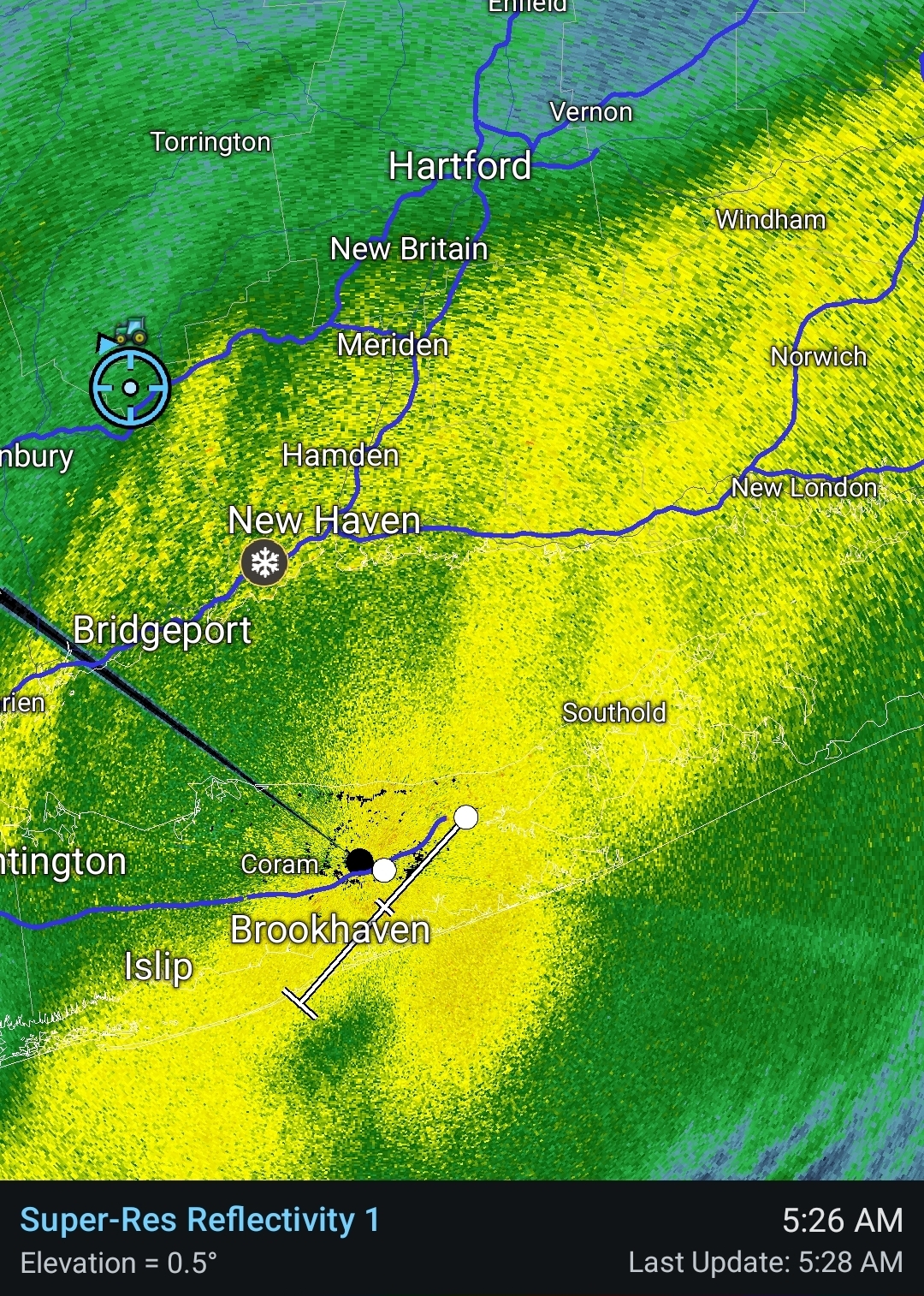
Just made my 6 hr clearing...5.3" so far, radar is definitely starting to look like swiss cheese, assuming the hrrr and other mesos are correct, it should fill back in later. Snow is still pretty wet, sticking to everything, temp down to 29.7⁰ -
"Don’t do it" 2026 Blizzard obs, updates and pictures.
Spanks45 replied to Ginx snewx's topic in New England
4" and still coming down at around an inch per hr...wind is beginning to pickup -
"Don’t do it" 2026 Blizzard obs, updates and pictures.
Spanks45 replied to Ginx snewx's topic in New England
not a Met, but based on radar to our SE, it just seems to be building, not falling apart and it is almost 10 pm, so it is going to have to start soon. Almost at 3 inches, but have the heaviest rates of the night so far, probably 1+ inches per hr -
yikes...just as I was praising the mesos earlier, now I'm definitely feeling a bit uneasy out here in the SW
-
"Don’t do it" 2026 Blizzard obs, updates and pictures.
Spanks45 replied to Ginx snewx's topic in New England
Mesos look good...keep that moisture train coming -
"Don’t do it" 2026 Blizzard obs, updates and pictures.
Spanks45 replied to Ginx snewx's topic in New England
Yeah lets slam that band right through CT... -
I was impressed how much snow you had down there, close to an inch...while we had just a few wet snowflakes
-
"Don’t do it" 2026 Blizzard obs, updates and pictures.
Spanks45 replied to Ginx snewx's topic in New England
'Real' snowfall has begun, nice flake size too....32.5⁰ -
It led the way, then tripped right before the finish line...sheesh, hope its wrong and the mesos finish first
-
My kid has baseball at Zone nation from 130-3....debating whether or not to make that trip down, thoughts?
-
Don't get me wrong, I hope I'm wrong...There is definitely going to be a fun band like the RGEM is showing where someone gets 15-20 inches, hopefully it parks over us, I just feel like we see it set up towards Danbury/New Milford area in coastals and we end up with a NAM/GFS/RGEM scenario
-
12z at this point, outside the 3k and RAP has us underperforming by quite a bit WOR...concerns are valid, especially with a deepening system, well south of the area. Typically you would see maxes in Northern Jersey, even by the NY/CT border and then again EOR, towards RI, I suspect Long Island ends up overperforming. Here I wouldn't be surprised to see 8-12, which is a great storm for the past few years, plus the wind will be fun, but definitely has underperformer vibes with regards to what the NWS is advertising
-
I know its the RGEM, but man that thing has been stubborn....I know I can worry a bit, but there are definitely some red flags for the big numbers out this way, been there, done that situation for sure