Danny8
-
Posts
44 -
Joined
-
Last visited
Content Type
Profiles
Blogs
Forums
American Weather
Media Demo
Store
Gallery
Everything posted by Danny8
-
I've been curious about exactly this. The University of Michigan Ann Arbor records go back to 1881 on the NWS site. And University of Illinois at Champaign back to 1888. Would love to know more that haven't moved at all since the 1800s
-
Winter 2022/23 Short/Medium Range Discussion
Danny8 replied to Chicago Storm's topic in Lakes/Ohio Valley
Yeah this is how they score the AWSSI for that map: https://mrcc.purdue.edu/research/awssi/AWSSI_InfoSheet_2pg.pdf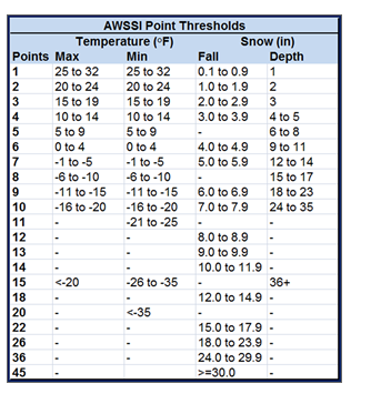
-
Creating snow via alchemy lol
-
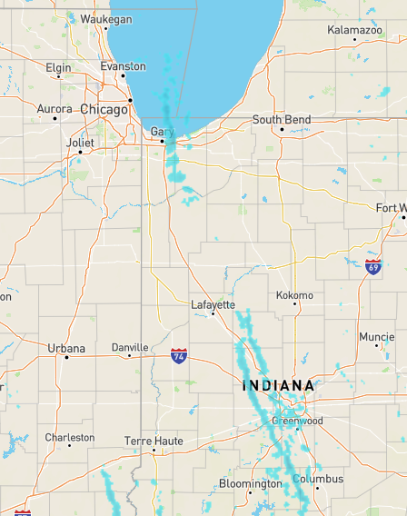
So is that a lake-enhanced streamer really hitting Indianapolis area now?
-
Winter 2022/23 Short/Medium Range Discussion
Danny8 replied to Chicago Storm's topic in Lakes/Ohio Valley
1991-2020 is out now. Although the map definitely has some issues, for example Gaylord & Kalkaska normals should have them in the red -
Looks like two derechos in 1995 hit Ontario. I was in northern Michigan for the one on July 13, 1995 https://www.spc.noaa.gov/misc/AbtDerechos/casepages/jul1995derechopage.htm
-
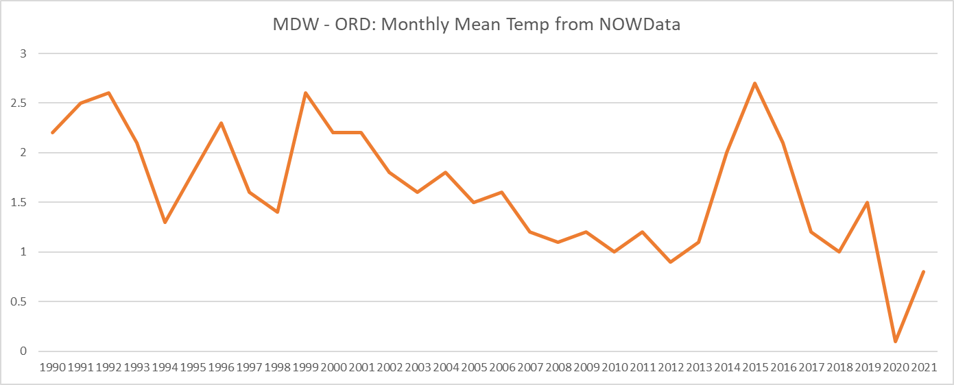
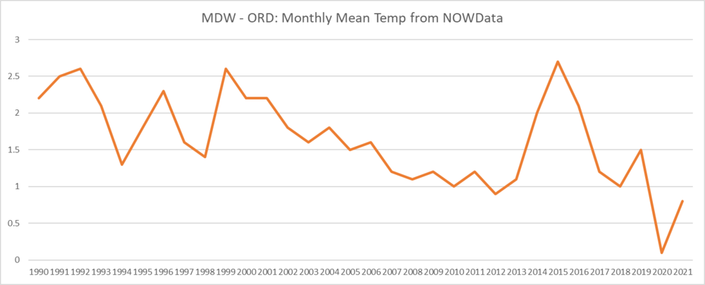
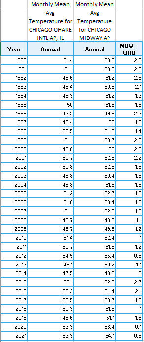
Yeah if you look at MDW vs ORD 2020 was definitely an anomaly where ORD had a warm bias. Compared to MDW at least. I am using the NWS Monthly Summarized NOWData, average temps at MDW vs ORD
-
POLL: 2021-2022 Season Snowfall Total @ ORD
Danny8 replied to cyclone77's topic in Lakes/Ohio Valley
The January 28th lake effect snow event put a lot more snow in parts of the city than ORD -
Ha I agree that it should be moved a month. I want snow all winter but your average citizen only wants it in December for the holidays, so this year was a disaster from that regard.
-
Measured 3.5" at my house in Irving Park. Lake effect snow coming down fairly heavy at my office in the West Loop right now
-
Has been coming down decently in the north side of Chicago, but slowed for the moment in Irving Park. It looks on the radar like Metro Detroit is getting some lake bands? Fun to see the NE winds putting lake effect there and up near Green Bay
-
Are those all ORD? I thought the early years were right by the lake until MDW became the official site in 1940 maybe. I only bring it up because temps stay warmer by the lake in the early winter
-
I'm hoping the maps update to the 1991-2020 normals soon. Haven't seen it yet for the midwest or nationally
-
Can the pros give some more insight on eclipse viewing conditions? I would also like to head to the Chicago lakefront but it seems like we may be cloudy
-
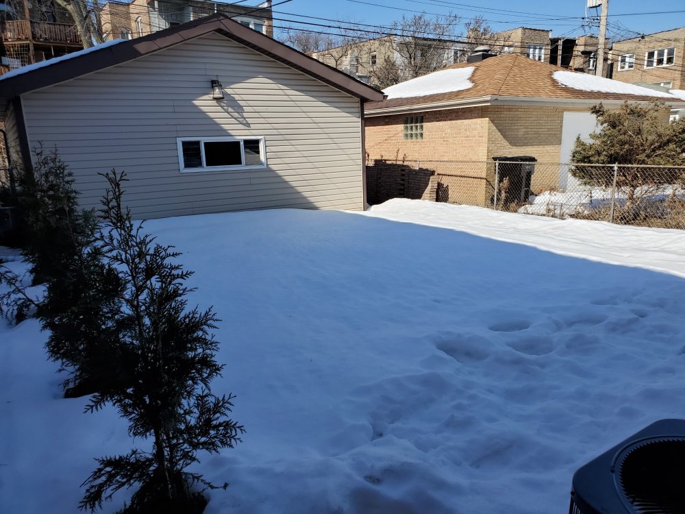
Still over 9" snow depth (glacier depth) in my backyard in Chicago's Irving Park neighborhood. Just amazing snowpack in the city this month. My yard is pretty shaded but the neighbors depth seems pretty similar.
-
@michsnowfreak Curious to look at the snowcover data for some other locations, where would I find that? Best source I've seen is the NCDC climate normals reports but it only has monthly data
-
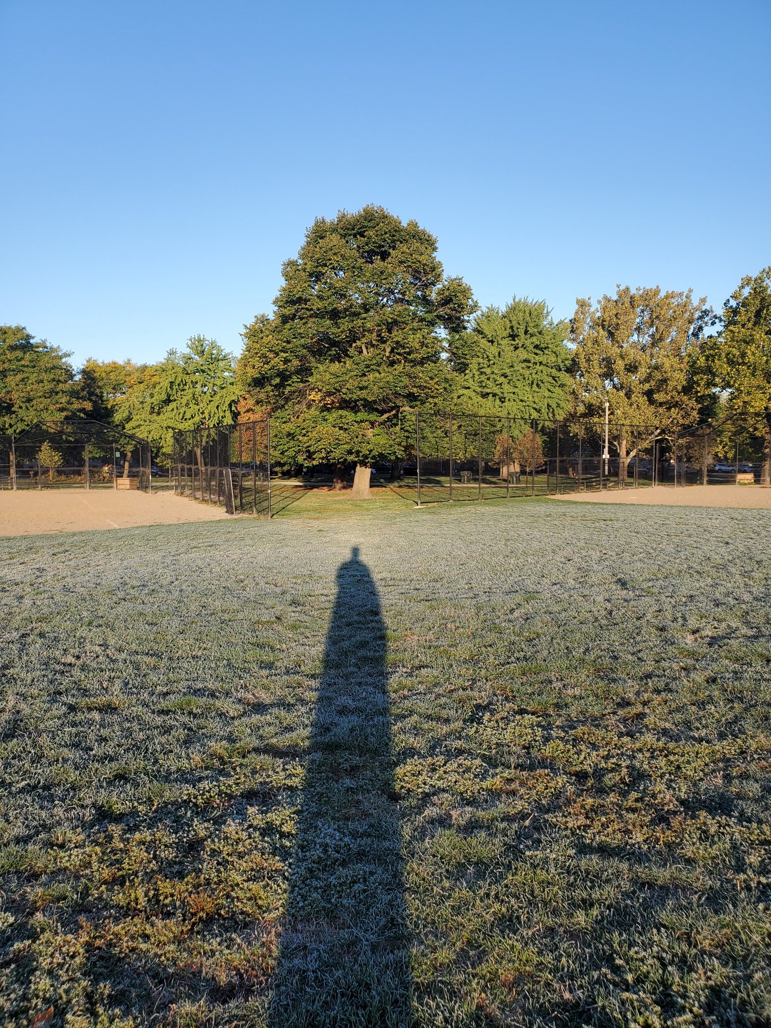
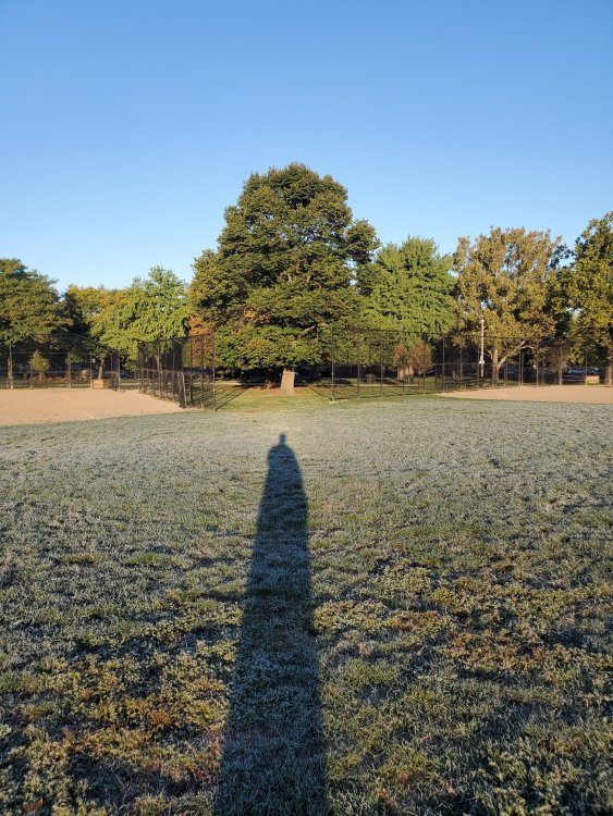
Low of 35 in my backyard, but frost in the center of Horner Park on Chicago's northwest side. Thought it was a pretty good example of a park being somewhat of an oasis in the urban heat island. The grass on the edges of the park was only dewy but frost in the center. Sorry for the dementor shadow
-
I'm in St Helen and was in Grayling yesterday, colors have only just started up here. Maybe ~10% of trees
-
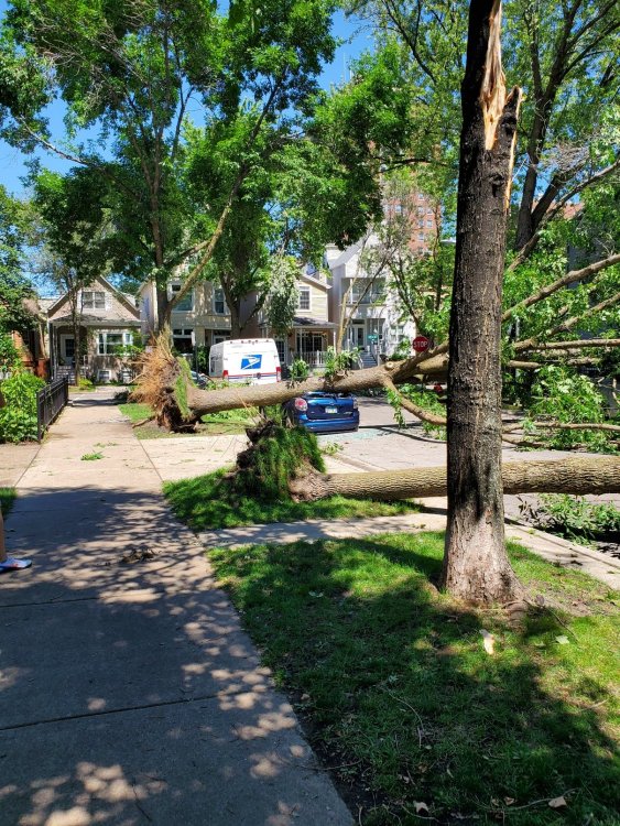
First time poster, but have been following the forum for a couple years. I grew up in Metro Detroit but have lived in Chicago about 10 years. I'm mainly interested in the winter storms and chasing some good snow, so its counterintuitive that my first post would be in August. Thought this shot from Lakeview (Wayne & Byron) was worth posting with the smashed car and multiple trees down. In terms of damage this storm actually reminded me a lot of one I experienced in northern Michigan in July 1995. I looked it up and it hit the far north of the forum, if this is the right storm. https://www.spc.noaa.gov/misc/AbtDerechos/casepages/jul1995derechopage.htm