Intensewind002
-
Posts
803 -
Joined
-
Last visited
Content Type
Profiles
Blogs
Forums
American Weather
Media Demo
Store
Gallery
Everything posted by Intensewind002
-
Clear skies (almost) for the first time in years here, 1.94” is my final total
-
1.87” total now with this never ending rain event
-
Up to 1.68” here in Lindenhurst
-
Up to 1.59” since yesterday morning here after that last round of showers. Judging by radar I’m assuming the island isn’t going to get all that much more unless precip gets enhanced overnight
-
Up to about 1.37”this morning
-
Actually felt a little bit like a tropical storm for a minute there with that shower that moved through, winds gusting maybe 30-35 mph or so. Up to 0.74” on the day for me
-
Up to just under half an inch here
-
Picked up about 0.18” so far this morning, winds gusting maybe 25-30 mph
-
Okx actually just put up an updated overview of the hurricane https://storymaps.arcgis.com/stories/4028d00ea6b44fd8890ba6592c15a544
-
Finished with 0.81” of rain for today
-
I was over at field 5
-
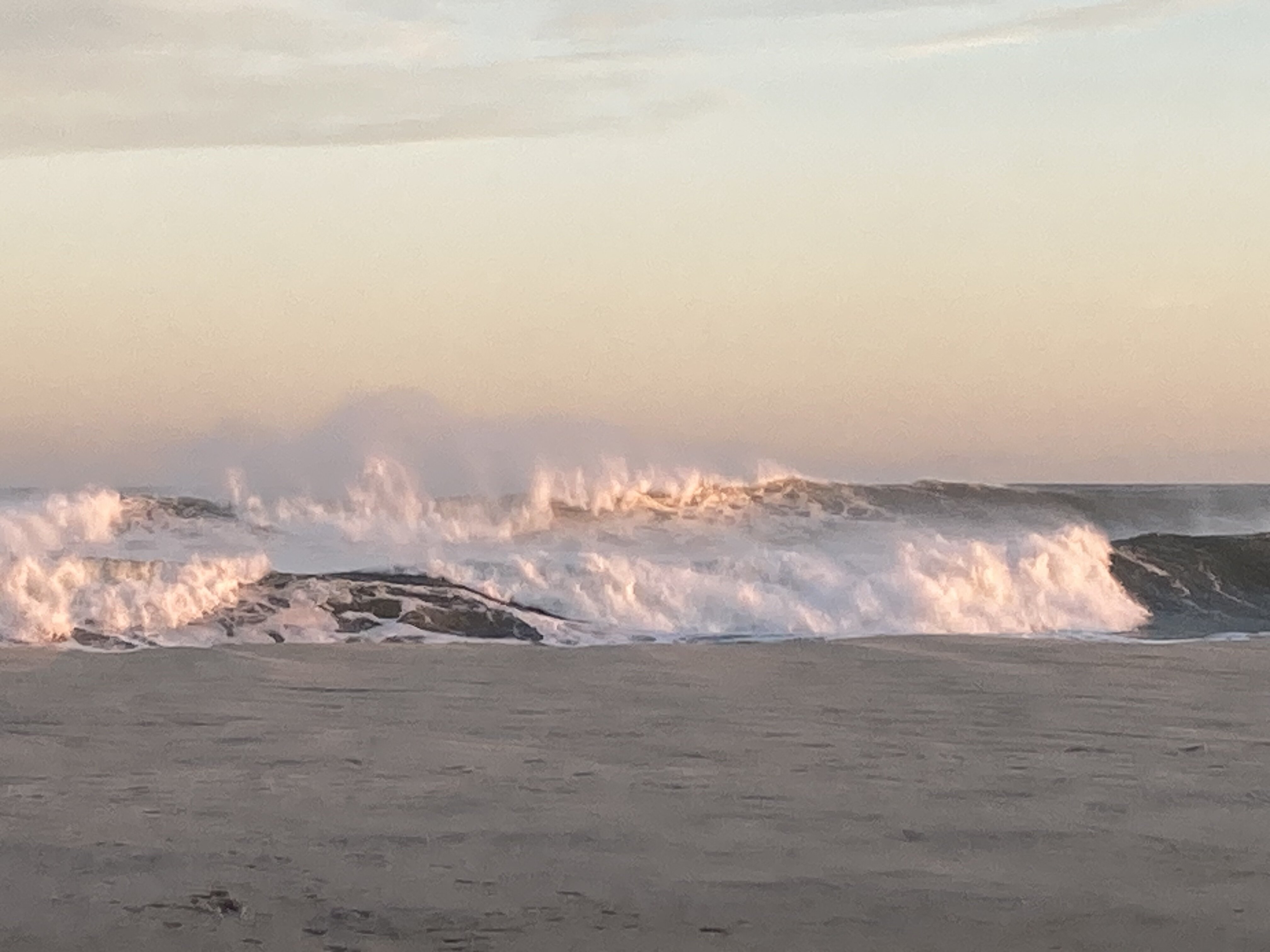
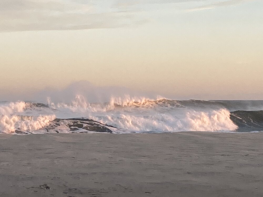
Waves were huge at Robert Moses, easily 10 ft.
-
All good lol, I think it was mostly just weenies posting on twitter to generate hype or fear or whatever since it was the only thing showing a direct landfall. It’s called PANGU or something like that
-
Picked up only 0.07” of rain today. On a side note OKX is calling for waves as high as 15 ft on the south shore beaches now by Friday, which will be pretty epic to watch
-
Has there been any info regarding the Euro AI learning models? They were consistently showing a landfall in SE New England. On a side note from what I was reading on twitter yesterday models have consistently underestimated the ridge out in the Atlantic either over this summer or maybe multiple summers, I figured AI was maybe correcting that bias but idk
-
Any reason why WPC is issuing the advisories instead of the hurricane center today?
-
I’ve picked up about 0.36” here since yesterday morning. Hoping for more but it looks like the storm over the city is completely collapsing
-
Picked up 0.03” of rain earlier today, only 0.04” for the month of September so far
-
88/70/93 here, fairly surprised considering KFRG is at 93 and usually I’m in the same range/within a degree or 2
-

Central & Eastern Pacific Thread
Intensewind002 replied to Windspeed's topic in Tropical Headquarters
-
92/73/101 Wind still from the west for now but the seabreeze front is right at my doorstep so I’m going to assume this’ll be my high for today
-
89/72/96 imby currently, this time yesterday I was only around 85
-
Walaka out in the CPAC back in 2018 was forecast 110 kts on it’s first advisory too. It eventually peaked at 140 kts, 921 mb
-
If I remember correctly I believe Sam from a couple of years ago was forecast to be a major by 120 hrs on its first advisory but I’m certain it wasn’t 120 kts. Maybe something in the East Pacific had an intensity forecast like this but I’m not entirely sure Edit: I found that Hurricane Walaka in the Central Pacific was forecast to reach 110 kts on it’s first advisory, eventually it peaked as a Cat 5. https://www.nhc.noaa.gov/archive/2018/cp01/cp012018.discus.001.shtml?
-
Roasting on a NW wind once again today to make it an official heatwave, three 90s now this month meanwhile I had zero in August