
Brian D
-
Posts
2,110 -
Joined
-
Last visited
Content Type
Profiles
Blogs
Forums
American Weather
Media Demo
Store
Gallery
Everything posted by Brian D
-
Very nice day with temps peaking in the low-mid 60's. Dandelions started opening up today. Windy off the Lake tomorrow with shwrs, stms on tap later in the day/overnight.
-
Cool, and damp wx? No debate here...light it up.
-
0.19" of rain moved through today. Sun has broken though, and now temps up a little into the low-mid 50's from upper 40's early this afternoon. Nickels n dimes on the rains, but it keeps the needle slowly heading upward.
-
0.29" of rain yesterday, and very nice today with gusty W/SW winds. Temps in the upper 60's - low 70's. Started off with dense fog along the shore, but that lifted pretty quickly this morning. Looks like the first mowing of the grass will be really soon. Almost to that point right now.
-
Another round of rain on my doorstep. Sun came out yesterday afternoon, and temps jumped from low 40's at 1 pm to around 60 by 3 pm.
-
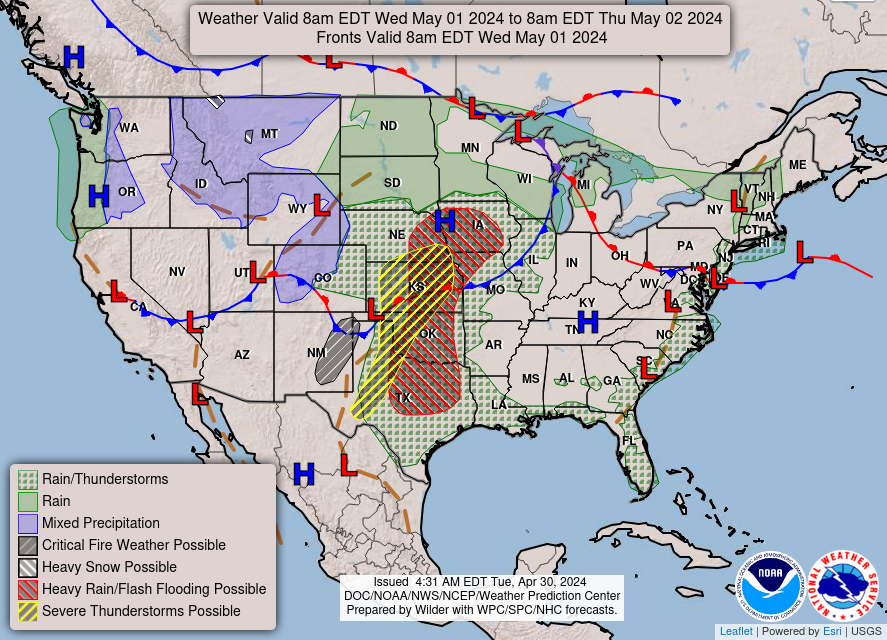
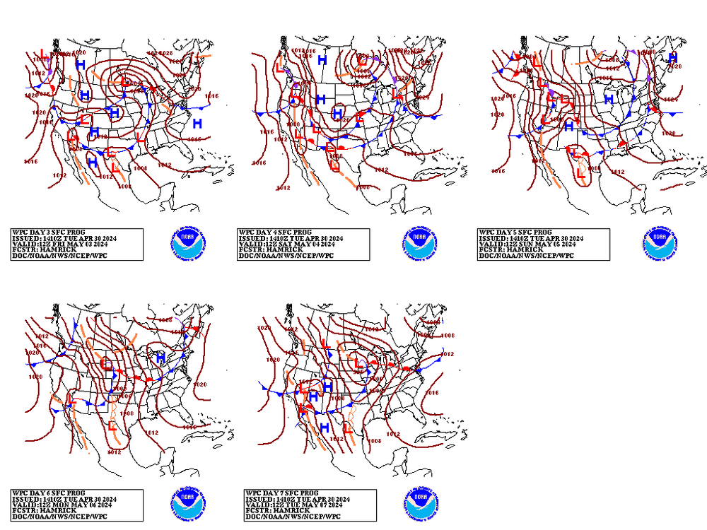
Parent's Day looking pretty decent with most of the sub under the influence of HP. Looks like a boundary may affect the southern most part of the sub. W areas could get a little on the hot side with a boundary in the Plains.

-
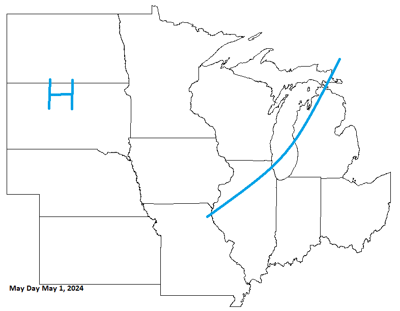
July 4th is on a Thursday this year. Looks pretty nice to me. Could get real warm in the W sub on the backside of HP moving through, ahead of next system lurking to the W.

-
0.21" of rain last night into the early morning hours. At least caught a little Sun yesterday, because there will not be much this week.
-
This could be an interesting run in the coming months with Ruang in Indonesia blowing it's top. If we are going into a neutral/La Nina phase, this could possibly have an effect combined with that. Kind of like Hunga Tonga combined with a rapid swing into El Nino. It takes a few months for things to swirl around the globe, and spread out. Good YT vid, along with ISS vid showing ash from space.
-
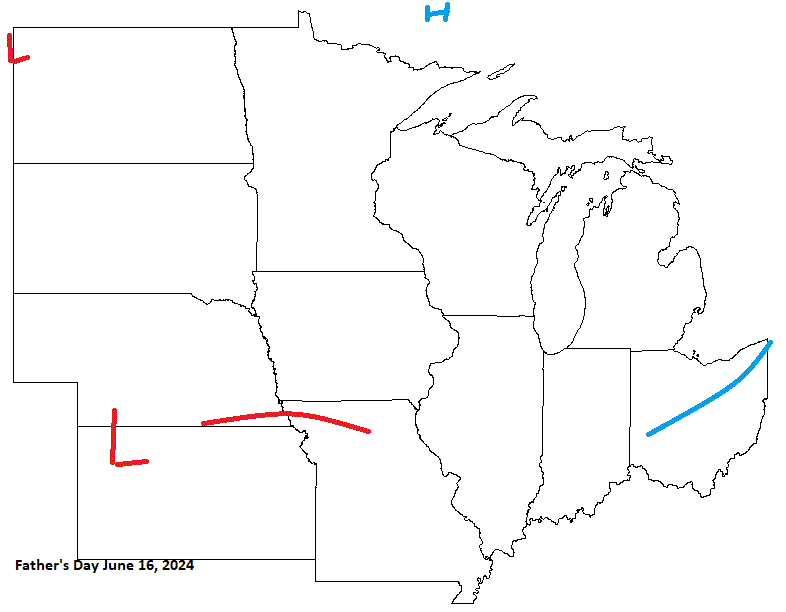
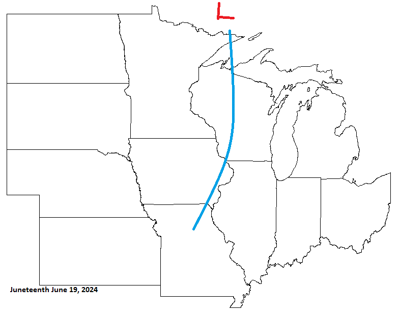
Next up is Father's Day, and I'll also include Juneteenth, as it is only 3 days after. Expecting a system moving through prior to Father's Day, with CA HP clearing things out briefly, before another system encroaches upon the sub. This will be affecting the sub around, and on Juneteenth. Mid June looks wet, and stormy as we approach the Summer Solstice.
-
Was a little too quick in bringing in HP, as more energy rides NE before HP arrives with drier, cooler wx for a couple days. Could get cold enough for frost in some areas. Then another system(s) moves in next week.
-
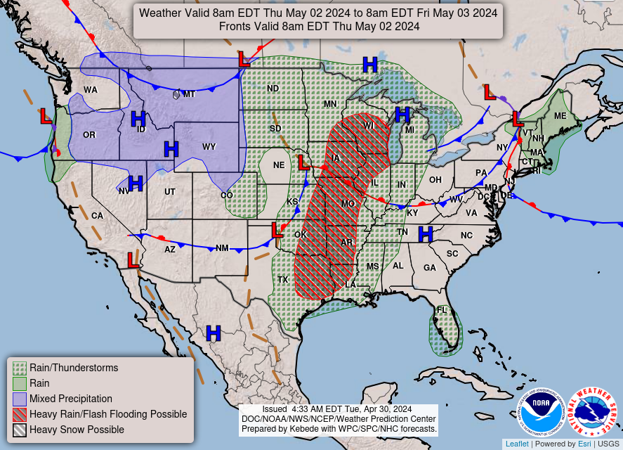
1.36" for a 2 storm total. 3.05" to end the month (2.65" avg) here in TH. Our sub actually had a rather warm April this year overall for a change.
-
About 3/4 - 1" of rain around here so far with scattered showers in the area. Next round slated for tomorrow into Monday. My deceased son's b-day tomorrow. Getting together with family. Going to be an ugly day, as winds will be running 30-40 off the Lake with the rain starting around midday.
-
-
Seems the last 2 years, April 25th has been a frosty one for you. Last year it hit 30. 28 & 30 are top 5 temps for the date. And your right about damage to fruit trees. The milder wx this month helps those buds pop a little early, so temps like this hurt. Even the 24th was top 5. April 25 1892 - 26 1919/67 - 27 1934/2024 - 28 1875/1974 - 29 1883/1941/72/2023 - 30 April 24 1874/75/83/92 - 27 1909/19/30/71/2015 - 29 1918/27/96 - 30 1888/1907/67/99/2024 - 31 1974/89/2005 - 32
-
Wet weekend on tap here with 2 rounds of rain. Might get in on some thunder Fri night.
-
Sun came out, and temps recovered to the upper 40's. Rollercoaster day.
-
Gust front moved in off the Lake. Winds picked up some from 5-15 to 15-25, and temps went from 54-55 to 39-40 in 30 min. Currently light/misty rain falling. BRRR!
-
After that, 60's will require a winter jacket when you get back here.
-
Decent call here as a CA LP moves cross the N with a trailing cold front. A piece of energy riding the S end of the front helping to kick up some stms. Back door cold front sags into the N, as HP comes S.
-
Well, they are just guidance on MAYBE. Here across N MN yesterday, NWS DLH forecast, on a storyboard, highs around 39-45, and it ended up being 35-40. Happens regularly that forecasts, even on the day, are high/low balled.
-
Snow showers moving through today. Already seen a few flakes early this morning. More convective stuff slated for the afternoon. Could see a little white on the grass, if I get hit good.
-
0.88" final tally. 1.65" for the month so far (2.65" April avg). Nice day today with seasonable temps. Green up continues.
-
0.70" so far from this system with light rn atm as LP leaves the area.. Wind gusts topped out in the low 50's yesterday. Pretty decent April storm. No thunder, tho.
-
Power outage for about 1/2 hr this aftrn. Winds really whipping this aftrn/eve. Rain is edging closer.


