
Brian D
-
Posts
3,110 -
Joined
-
Last visited
Content Type
Profiles
Blogs
Forums
American Weather
Media Demo
Store
Gallery
Everything posted by Brian D
-
Was looking at drought data. I have this chart from a tree ring proxy study of the West, and pulled this chart for the west to extend the data using D2-4. Now what tree rings would look like over the past 25 yrs compared to the index I'm not sure, but this at least gives an idea of what we are seeing now to centuries past. Too bad there isn't historical proxy tree ring data for other parts of the country.
-
April 9 1931: Severe dust storms are reported in St. Paul. For Thursday, April 9, 2026 1877 - Oregon Inlet, NC, was widened three quarters of a mile by a nor'easter. (Sandra and TI Richard Sanders - 1987) 1947 - A tornado struck Woodward, OK, during the late evening killing 95 persons and causing six million dollars damage. The tornado, one to two miles in width, and traveling at a speed of 68 mph, killed a total of 167 persons along its 221 mile path from Texas into Kansas, injured 980 others, and caused nearly ten million dollars damage. (David Ludlum) A man looking out his front door was swept by a tornado from his home near Higgins TX and carried two hundred feet over trees. The bodies of two people, thought to be together at Glazier TX, were found three miles apart. (David Ludlum) (The Weather Channel) 1977 - A storm brought 15.5 inches of rain to Jolo, WV, in thirty hours. (The Weather Channel) 1987 - International Falls, MN, reported their sixth straight record high for the date, with a reading of 77 degrees. A cold front ushering sharply colder weather into the north central U.S. produced wind gusts to 60 mph at Glasgow MT. (The National Weather Summary) 1988 - Residents of Sioux City, IA, awoke to find two inches of snow on the ground following a record high temperature of 88 degrees the previous afternoon. (The National Weather Summary) 1989 - Eighteen cities in the southwestern U.S. reported new record high temperatures for the date. The afternoon high of 80 degrees at Eureka CA established a record for the month of April. (The National Weather Summary) 1990 - Thunderstorms developing ahead of a cold front produced severe weather from the Central High Plains to Arkansas and northern Texas. Severe thunderstorms spawned five tornadoes, and there were seventy reports of large hail and damaging winds. A tornado injured four persons at Ardmore OK, and thunderstorms produced wind gusts to 70 mph at Kellyville OK, and hail three inches in diameter at Halmstead KS. (The National Weather Summary) (Storm Data) 2011 - An EF-3 tornado hits Mapleton, IA. Officials estimate more than half the town is damaged or destroyed but none of the 1200 residents were killed. 31 tornadoes were confirmed across Iowa, Kentucky, Tennessee and North Carolina on this day.
-
April 8 1805: John Sayer at the Snake River Fir Trading Post near present day Pine City mentions: 'The most tempestuous (stormy) day of the year. Pines and other trees fell near the fort.' ^Note: Would seem a line of stms with strong straight line winds, or even a weak tornado, passed through EC MN region. A bit unusual this time of year this far N.^ For Wednesday, April 8, 2026 1919 - A tornado swarm in northern Texas resulted in the deaths of 64 persons. (David Ludlum) 1926 - The lightning-set oil depot fire near San Luis Obispo CA boiled over and engulfed 900 acres. Many tornado vortices resulted from the intense heat of the fire. One such tornado traveled 1000 yards, picked up a house and carried it 150 feet, killing the two occupants inside. (The Weather Channel) 1973 - A severe storm brought high winds and heavy snow to Iowa. Belle Plain received 20 inches of snow, and 19 inches blanketed Dubuque, record totals for both locations for so late in the season. Snow drifts up to sixteen feet high closed highways. (David Ludlum) 1987 - A cold front crossing the Northern Plateau and the Northern Rocky Mountain Region produced high winds in northeastern Wyoming. Winds gusting to 69 mph at Sheridan WY downed power lines and caused some property damage. (The National Weather Summary) (Storm Data) 1988 - Strong northerly winds ushered cold air into the north central U.S. The strong winds, gusting to 60 mph at Rapid City SD and Williston ND, reduced visibilities in blowing dust over the Dakotas. (The National Weather Summary) (Storm Data) 1989 - Two dozen cities in the southwestern U.S. reported new record high temperatures for the date. Phoenix AZ equaled their record for April of 104 degrees established just the previous day. (The National Weather Summary) 1990 - Twenty-two cities reported record low temperatures for the date as readings dipped into the 20s and 30s across much of the eastern U.S. Freezing temperatures severely damaged peach and apple orchards in West Virginia, where prolonged mild weather since January had caused an early blooming of spring vegetation. State and Federal agencies estimated a 50 percent loss in production for peaches and "Delicious Red Apples". (The National Weather Summary) (Storm Data) Note: That's one serious firenado WOW!
-
Chilly mixed bag Wed.
-
My granddaughter's wedding is Sat eve, so this will start just in time after that blessed day.
-
April 7 1857: A cold snap hits the United States, with snow reported in every state. For Tuesday, April 7, 2026 1857 - A late season freeze brought snow to every state in the Union. Even as far south as Houston TX the mercury plunged to 21 degrees. (David Ludlum) 1929 - Record heat prevailed across New England. Hartford CT reported an afternoon high of 90 degrees. (David Ludlum) 1935 - Amarillo, TX, reported dust obscuring visibility for twenty hours. Blowing dust was reported twenty-seven of thirty days in the month. On several days the visibility was reduced to near zero by the dust. (The Weather Channel) 1980 - Severe thunderstorms spawned tornadoes which ripped through central Arkansas. The severe thunderstorms also produce high winds and baseball size hail. Five counties were declared disaster areas by President Carter. (The Weather Channel) 1987 - International Falls, MN, with record warm afternoon high of 71 degrees, was warmer than Miami FL, where the high was a record cool 66 degrees. (The National Weather Summary) 1988 - High winds in the Middle Atlantic Coast Region gusted to 172 mph atop Grandfather Mountain NC. Twenty-nine cities in the southwest and north central U.S. reported record high temperatures for the date, including Yankton SD with a reading of 91 degrees. (The National Weather Summary) (Storm Data) 1989 - Twenty-seven cities in the southwestern U.S. reported record high temperatures for the date. Afternoon highs of 92 degrees in Downtown San Francisco and 104 degrees at Phoenix AZ established records for April. Highs of 78 degrees at Ely NV and 93 degrees at San Jose CA equaled April records. (The National Weather Summary) 1990 - Low pressure brought strong winds to the Alaska peninsula and the Aleutian Islands. Winds gusted to 68 mph at Port Heiden two days in a row. Unseasonably warm weather prevailed across central Alaska. Yakutat reported a record high of 54 degrees. Unseasonably cold weather prevailed over central sections of the Lower Forty-eight states. A dozen cities from Kansas to Indiana and Alabama reported record low temperatures for the date. Evansville IN equaled their record for April with a morning low of 23 degrees. (The National Weather Summary) (Storm Data) 2010 - A temperature of 80 degrees is measured on Grandfather Mountain, NC, the warmest ever measured in April and three degrees short of the all-time record high for any month. Note: Looks like 1935 was setting up for the 1936 "Dust Bowl".
-
Chilly morning with +/- sd's across the area with teens along the shore. -11 at Hog Creek in Cook county. Along the BWCA it looks like. Seagull Lake N of there at -7. Top 5 cold snap looking at records. Similar cold snap back in 2023.
-
Guys in the S sub not jealous at this point. We have to wait a bit for Spring to really spring. Just life at a little higher lat, and by a big cold pond.
-
BRRR!
-
April 6 1991: The second of three consecutive record highs, all above 80 degrees, is set at MSP airport (86 on 4/6/1991). ^Note: April 5 record was eclipsed in 2021 at 85 (80 1991) but April 6 (86) & 7 (83) still stand.^ 1964: A snowstorm hits Minnesota with 9 inches at Fosston and 8.7 at Park Rapids. For Monday, April 6, 2026 1936 - A tornado outbreak in the Deep South resulted in a total of 446 deaths and eighteen million dollars damage. It was a "Tale of Two Cities". During the evening of the 5th a tornado hit Tupelo MS killing 216 persons, injuring 700 others, and causing three million dollars damage. The next morning the paths of two tornadoes met about 8:30 AM and cut a swath four blocks wide through Gainesville GA killing 203 persons, injuring 934, and causing thirteen million dollars damage. Eight to ten feet of debris filled the streets following the storm. At least 70 persons died in the Cooper Pants Factory, the greatest tornado toll of record for a single building. (David Ludlum) (The Weather Channel) 1983 - The temperature at Denver, CO, dipped to a record cold seven degrees above zero. (The Weather Channel) 1987 - Rain and melting snow caused flooding from New England to Ohio. Flooding in the Merrimack Valley of Massachusetts was the worst in fifty years, causing forty-two million dollars damage. (The National Weather Summary) (Storm Data) 1988 - A powerful storm produced wind gusts to 75 mph around Chicago, IL, and wind gusts to 92 mph at Goshen IN. The high winds created twenty-five foot waves on Lake Michigan. (Storm Data) (The National Weather Summary) 1989 - Unseasonably hot weather prevailed in California. Afternoon highs of 91 degrees in Downtown San Francisco, 93 degrees at San Jose, 98 degrees at San Diego, 103 degrees at Santa Maria, 104 degrees at Riverside, and 106 degrees in Downtown Los Angeles established records for the month of April. (The National Weather Summary) 1990 - Snow developed in the northeastern U.S. for the second time in the month. In Virginia, a heavy wet snow blanketed northern and central sections of the Shenandoah Valley, and eastern foothills, with up to 12 inches reported around Harrisonburg. Heavy snow also blanketed the high elevations of West Virginia, with 10 inches reported at Snowshoe. An inch of snow at Syracuse NY raised their total for the winter season to a record-tying 161.3 inches. (The National Weather Summary) (Storm Data) 2005 - Thunderstorms erupted and produced severe weather including 32 reports of tornadoes, most of which touched down in Mississippi and Louisiana. Between 20 and 25 homes were destroyed and 7 people were injured. Mississippi governor Haley Barbour declared a state of emergency (CNN).
-
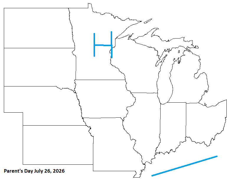
Parent's day in late July looks good. Might even be a little chilly in the morning hrs, especially in the N areas.
-
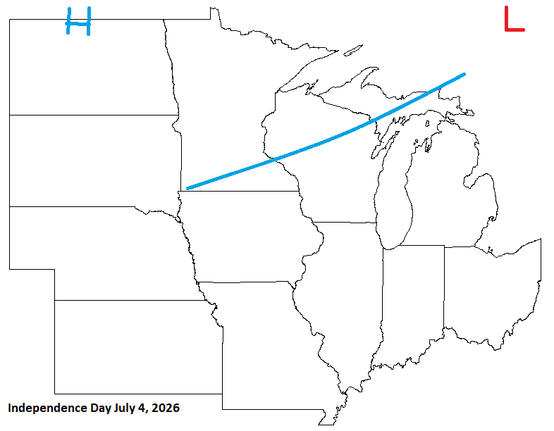
4th of July looks iffy for some with a front moving through bringing shwrs/stms.
-
^My neighborhood sentinel^ LOL
-
No they did not. Just a 7ft giant
-
April 5 1999: Heavy snow falls over the Arrowhead, with 11 inches at Two Harbors. ^Note: We just had a 2 day snow total of 7.7" imby^ 1929: A tornado cuts a path from Lake Minnetonka through North Minneapolis and leaves six dead. For Sunday, April 5, 2026 1945 - The temperature at Eagles Nest, NM, plunged to 45 degrees below zero to establish an April record for the United States. (Sandra and TI Richard Sanders - 1987) 1955 - The Northern Rockies and the Northern High Plains were in the midst of a four day storm which produced 52 inches of snow at Lead, located in the Black Hills of western South Dakota. (David Ludlum) 1972 - A tornado, 500 yards wide at times, touched down at a marina on the Oregon side of the Columbia River, and then tore through Vancouver WA killing six persons, injuring 300 others, and causing more than five million dollars damage. It was the deadliest tornado of the year, and the worst of record for Washington. (The Weather Channel) 1982 - An unprecedented April blizzard began in the northeastern U.S. One to two feet of snow fell across Massachusetts and Connecticut, and up to 26 inches was reported in Maine. New York City received a foot of snow. Winds reached 70 to 80 mph during the storm, and the storm also produced numerous thunderstorms, which contributed to the heavy snow. (Storm Data) 1987 - A storm produced unprecedented April snows in the central Appalachians. Mount Mitchell NC received 35 inches of snow, and up to 60 inches (six feet) of snow was reported in the mountains along the border of North Carolina and Tennessee. The total of 25 inches at Charleston WV easily surpassed their previous record for the entire month of April of 5.9 inches. The 20.6 inch total at Akron OH established an all-time record for that location. (Storm Data) (The National Weather Summary) 1988 - Thirty-nine cities across the eastern half of the country reported record high temperatures for the date, including Saint Louis MO with a reading of 91 degrees. Laredo TX was the hot spot in the nation with an afternoon high of 100 degrees. (The National Weather Summary) 1989 - Unseasonably hot weather prevailed in the southwestern U.S. Afternoon highs of 100 degrees at Santa Maria CA and 105 degrees in Downtown Los Angeles established records for the month of April. (The National Weather Summary) 1990 - Afternoon and evening thunderstorms developing along a cold front produced severe weather in southern Oklahoma, southern Arkansas, and north central and northeastern Texas. Thunderstorms spawned a dozen tornadoes in Texas, including one at Fort Worth which caused a million dollars damage. There were nearly one hundred reports of large hail and damaging winds. Thunderstorms in Texas produced hail three and a half inches in diameter west of Fort Worth, and produced wind gusts to 80 mph at Cross Plains. (The National Weather Summary) (Storm Data)
-
2.8" final tally. Happy Easter ev1!
-
2.5" of very wet snow. Kids in the neighborhood made a very large snowman.
-
Decent call but slow in the timing. System will be through leaving Easter Sunday pretty decent for the sub.

-
April 4 1928: Severe thunderstorms rumble through east central Minnesota. 100,000 dollars damage done at Anoka. For Saturday, April 4, 2026 1804 - A large tornado crossed six Georgia counties killing at least eleven persons near Augusta. (David Ludlum) 1933 - Pigeon River Bridge, MN, reported 28 inches of snow, which established the state 24 hour snowfall record. (4th-5th) (The Weather Channel) 1973 - Sandia Crest, NM, reported a snow depth of 95 inches, a record for the state of New Mexico. (The Weather Channel) 1983 - Colorado was in the midst of a three day winter storm. Buckhorn Mountain, located west of Fort Collins, received 64 inches of snow. (Storm Data) 1987 - Rains of five to eight inches drenched eastern New York State, and ten persons were killed in a bridge collapse over Schoharie Creek. (The National Weather Summary) (Storm Data) 1988 - Sunny and warm weather prevailed across the nation. Fort Smith AR reported a record high of 90 degrees. (The National Weather Summary) 1989 - Thunderstorms produced severe weather from the Lower Mississippi Valley to the Southern Appalachians. The thunderstorms spawned seventeen tornadoes, including one which caused two million dollars damage at Baldwin AL. Thunderstorm winds gusted to 90 mph at Bremen GA. (The National Weather Summary) (Storm Data) 1990 - A deep low pressure system in northern New York State brought heavy snow to parts of western and central New York during the day. The snowfall total of 5.8 inches at Buffalo was a record for the date, and 9.5 inches was reported at Rochester. Snowfall totals ranged up to 11 inches at Warsaw. (The National Weather Summary) (Storm Data)
-
Another snowy a.m. with some sleet mixing in. Will measure later.
-
April 3 1999: An ice storm hits Duluth and the Arrowhead. An 800 foot television tower in Duluth collapses due to the weight of the ice. ^Note: That's the second tower within a decade that falls due to ice^ 1982: A sharp cold front causes the temperature at Lamberton in Redwood County to drop from 78 to 7 degrees. This 71 degree change in 24 hours is the maximum 24-hour temperature change in Minnesota. 1837: A snowstorm rages for four days at Ft. Snelling and dumps 9 inches. For Friday, April 3, 2026 1955 - Record snows fell in north central Wyoming and south central Montana. Billings MT received a storm total of 42.3 inches, and on the 4th reported a record snow depth of 35 inches. Sheridan WY established a 24 hour snowfall record of 26.7 inches. (2nd-4th) (The Weather Channel) 1974 - A "Super-Outbreak" of tornadoes ravaged the Midwest and the eastern U.S. Severe weather erupted early in the afternoon and continued through the next day. Severe thunderstorms spawned 148 tornadoes from Alabama to Michigan, most of which occurred between 1 PM (CST) on the 3rd and 1 AM on the 4th. The tornadoes killed 315 persons, injured 5300 others, and caused 600 million dollars damage. Alabama, Kentucky and Ohio were especially hard hit in the tornado outbreak. One tornado destroyed half of the town of Xenia OH killing 34 persons. Another tornado, near the town of Stamping Ground KY, produced a path of destruction a record five miles in width. A tornado raced through Guin AL at a speed of 75 mph. Two powerful tornadoes roared across northern Alabama during the early evening hours, killing fifty persons and injuring 500 others. Some rescue vehicles responding to the first tornado were 1987 - A storm in the southeastern U.S. produced a trace of snow at Mobile, AL, one inch at Jackson MS, and two inches at Meridian MS, the latest snow of record for those three locations. Birmingham AL received seven inches of snow, and up to nine inches was reported in northeast Alabama. (Sandra and TI Richard Sanders - 1987) (The National Weather Summary) 1988 - A wind gust to 114 mph was clocked at Ann Arbor, MI, during a tornadic thunderstorm. Thunderstorms in Michigan and Indiana spawned five tornadoes that Easter Sunday, and also produced golf ball size hail. (The National Weather Summary) (Storm Data) 1989 - Thunderstorms produced severe weather from the Southern Plains to the southern and central Appalachians. The thunderstorms spawned twenty tornadoes, including one which caused eight million dollars damage at Fort Branch IN. (The National Weather Summary) (Storm Data) 1990 - Rain and snow prevailed in the northeastern U.S., with snow reported in New York State. Boston MA was soaked with 2.91 inches of rain during the day and night, and up to half a foot of snow blanketed the hills of Steuben County NY that Tuesday night. (The National Weather Summary) (Storm Data) 2008 - An EF-1 tornado knocks down numerous tress and powerlines, destroys homes in Leawood and Cammack Village and passes directly over the Little Rock National Weather Service office. Six tornados were confirmed in central Arkansas, but no fatalities were reported.
-
4.9" imby. Yesterday the wet snow mixed with small grains of sleet during the aftrn before it went all snow. Snow ended overnight sometime. Next one should hit harder to my N & W. With more mixing my way. Ice storm warning over N WI & UP MI.
-
SN with windy conditions. Mostly grass accum, with some on the rds. Temp dropped to 30 when the snow got going. Winter is back for a few days.
-
April 2 2001: Jumbo-sized snowflakes fall in east central Minnesota and west central Wisconsin. 2.5 to 2.75 inch flakes measured in Maplewood. 1920: The temperature falls to 8 degrees in Pipestone. The high the day before was 74. For Thursday, April 2, 2026 1975 - The northeastern U.S. was in the grips of a severe storm which produced hurricane force winds along the coast, and two to three feet of snow in Maine and New Hampshire. Winds atop Mount Washington NH gusted to 140 mph. (David Ludlum) 1975 - The biggest snowstorm of record for so late in the season paralyzed Chicago, IL. Up to 20 inches of snow fell in extreme northeastern Illinois, and 10.9 inches of snow closed Chicago's O'Hare Airport. (The Weather Channel) 1982 - Severe thunderstorms spawned fifty-six tornadoes in the central U.S., including seventeen in the Red River Region of Texas and Oklahoma. The tornadoes claimed thirty lives, and injured 383 other persons. A violent tornado near Messer OK left only the carpet tack strips on the slab of a house it destroyed, and carried a motel sign thirty miles. (The Weather Channel) (Storm Data) 1987 - Eleven cities in Florida reported record low temperatures for the date, including Tallahassee with a reading of 31 degrees. The low of 48 degrees at Key West smashed their previous record for the date by 13 degrees. (The National Weather Summary) 1988 - Thunderstorms produced up to nine inches of rain around New Orleans LA causing 18 million dollars damage. A tornado caused three million dollars damage at Slidell LA. (Storm Data) (The National Weather Summary) 1989 - Strong and gusty winds prevailed from California to Colorado and Wyoming. Winds gusted to 50 mph at Lancaster CA, and reached 85 mph at Berthoud Pass CO. Snow and high winds created blizzard conditions in the Colorado Rockies. (The National Weather Summary) (Storm Data) 1990 - Thunderstorms produced severe weather in North Carolina and Virginia during the afternoon and evening. Thunderstorms produced golf ball size hail, and spawned a tornado near Chester VA which caused half a million dollars damage. A storm system produced snow and gale force winds across northern Michigan, with 8.3 inches of snow reported at Marquette. Temperatures in the north central U.S. soared from morning lows in the 20s and 30s to afternoon highs in the 60s and 70s. Eight cities reported record highs for the date, including Havre MT with a reading of 77 degrees. (The National Weather Summary) (Storm Data) 2005 - Heavy rainfall in the Northeast produced flooding in parts of New York, New Jersey and Pennsylvania. Severe flooding along the Delaware River forced the evacuation of 6,000 residents in New Jersey and over 5,700 in Pennsylvania during the weekend of the 2nd-3rd. Around 3,200 homes in New Jersey were damaged, while one fatality was reported in New York (Associated Press). 2006 - Tornadoes and hail as big as softballs ripped through eight Midwestern states, killing at least 27 people, injuring scores and destroying hundreds of homes. In Tennessee, tornadoes killed 23 people, including an infant and a family of four. Severe thunderstorms, many producing tornadoes, also struck parts of Iowa, Kentucky, Arkansas, Missouri, Ohio, Illinois and Indiana. Strong wind was blamed or at least three deaths in Missouri. The weather service's Storm Prediction Center in Norman, Okla., said it had preliminary reports of 63 tornadoes. The worst damage occurred throughout the Tennessee Valley. 2015 - Late night severe storms produced 80 to 100 mph straight-line winds that caused extensive damage from Hutchinson to Newton and Wichita. An 89 mph wind gust was reported at the Kansas Aviation Museum located in southeast Wichita. (NWS, Wichita, KS)
-
Breezy, 32 n no snow yet. A trace last night. Radar showing good returns coming in, but this is going to be a slop fest.


