Brian D
-
Posts
2,150 -
Joined
-
Last visited
About Brian D

-
MRCC, and all RCC sites I think, are down as contract for funding has not been renewed as of yet. Email from MRCC to me. Hello again, We’ve had some recent developments concerning the MRCC website, including the cli-MATE self-service data portal. It is looking likely that our funding will lapse starting April 17. At that time, our website and all of our hosted products on the website will be unavailable. This is a change in what we previously communicated, and this was a very difficult decision. The base RCC contract is what funded all aspects of the website from IT server usage, data storage, and personnel support. If our funding is restored, our website and hosted products will come back online as soon as possible. Unfortunately, we do not have a timeline on this decision. We recognize that our absence will affect you. One option for obtaining climate data and services would be to inquire with NOAA’s National Centers for Environmental Information (NCEI) at https://www.ncei.noaa.gov/contact. And my response.... GRRR! $%&#$^%#@!! Well, I hope funding is restored. I use your cli-MATE nearly everyday for my wx data. Ease of use, and a treasure trove of data from active, as well as non-active stations. If you disappear permanently, I'll be pissed. Sorry for the rough language, but that's how I feel about this situation. Their response.. Brian, I share your sentiment. This is awful for all of us. Contact your representatives.
-
MRCC is down due to lack of funding. Hope it comes back soon.
-
I'm going with a C-/D+ for my area. Lack of snow, but more colder wx, especially the 2nd half. Warmer wx mixed in helped keep the heat bill at reasonable levels. I've looked ahead to next winter, and we just might have a pretty decent one with snow/bitter cold showing up quite a bit. We are due for a pretty intense winter season, and this one could be just that for 25/26. But lets enjoy our warmer months first.
-
EHH! We need variety!
-
SE trend n another chuckle out of ALEK.

-
Pretty much a fail with precip yesterday. Some came through last night giving me 0.20", and some showers around today. Hopefully will see a better round at the end of the week.
-
Showers around the area this morning. Much needed precip through tomorrow. Might see some flakes mixing in late tomorrow as system exits.
-
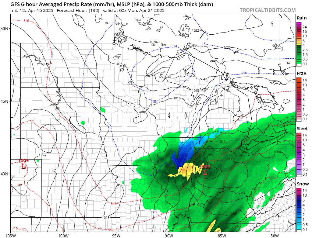
The precip trend for the 2nd half of April looks decent for MN. Hope that works out. Precip is a fickle beast.
-
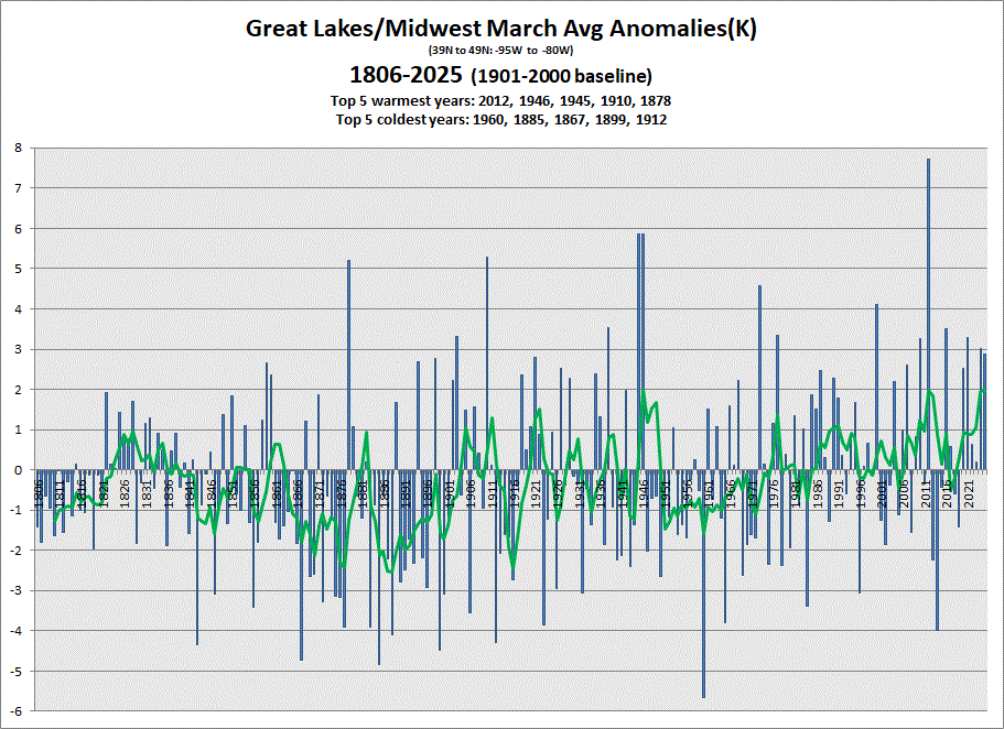
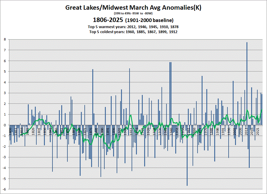
Most data in for March, and another warm one in the books similar to last year. 5 & 10 yr trend charts shown respectively.
-
A snowy aftrn yesterday, but nothing stuck. A little on the grass this morning with a mix falling. Temps hitting mid-upper 50's(60?) this weekend with some rain moving in (ending with a mix), then back into the 40's next week. Will be nice when the sustained warmer wx settles in next month.
-
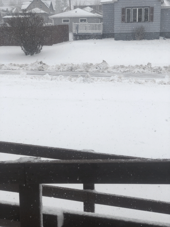
I reported a stm total of 8" here in town. Good snow. Best event total of the year for me. Should be some 12" readings inland as the am progresses. Update: Looks like 6-15" is the range being reported this morning.
-
Heavy bands finally moved through. Looks like SN/-SN for the rest of the system. +SN with the wind was very cool. Seen much worse tho.
-
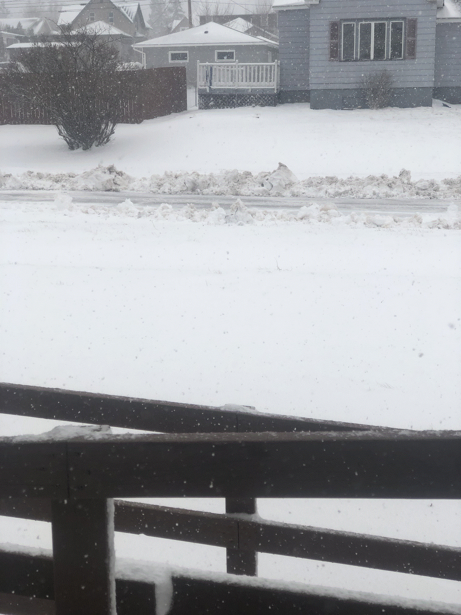
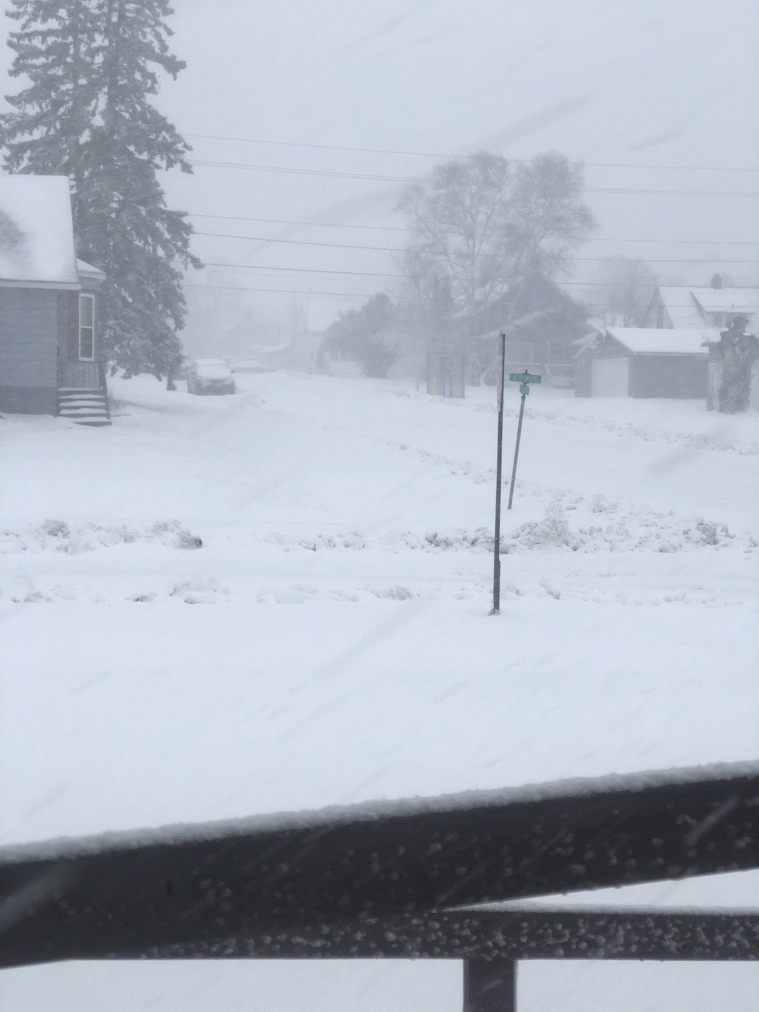
Blizzard warning issued for the North Shore. Snowing hard, and the winds have picked up some. Vis is running 1 1/2-2 blocks.
-
About 3" of very wet, compact snow. Winter wonderland, for a few days anyway.
-
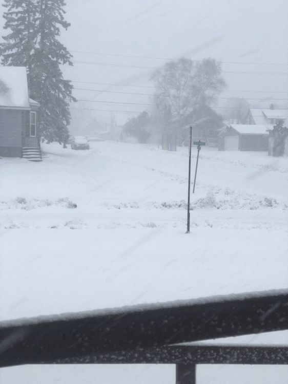
Lake banding forming, and I'm catching some of that. Snowing pretty good now. EDIT: Dark green on radar. She's snowing good now. 3 blocks vis. Liking this.