

STORMANLI
-
Posts
521 -
Joined
-
Last visited
About STORMANLI

Recent Profile Visitors
3,164 profile views


-
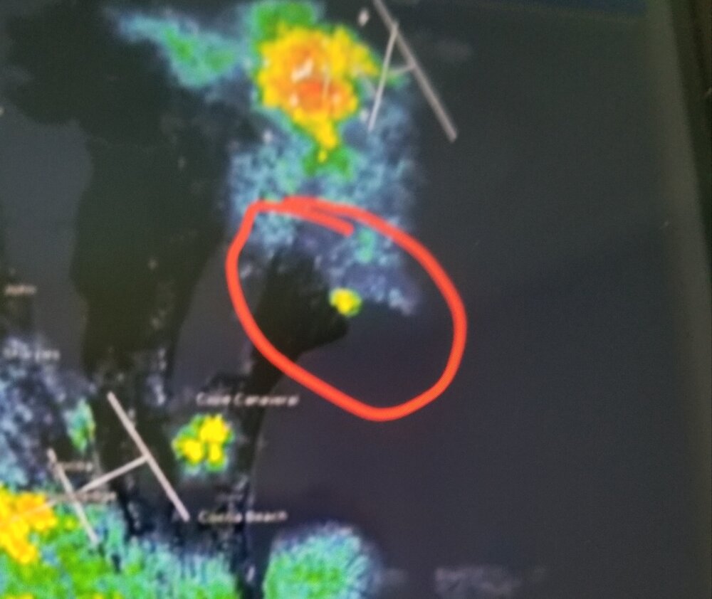
Last night's Blue Origin Rocket explosion on KMLB Radar between thunderstorm complexes to north and southwest.
-
0.50" 50°
-
Maybe Saturday; Sunday could turn out alright.
-
.28" so far
-
1.03" 41°
-
Snowflakes Northern State Parkway between exits 39 & 40
- 970 replies
-
- 2
-

-
- april showers bring may..
- rain
- (and 2 more)
-
Waiting for the rain today was like waiting for paint to dry. When it did finally get here it felt like I missed a spot as only .07" fell here.
-
My apologies if this belongs in Memory Lane. Both April 3rd and 4th of 1991 when I started my first route reached 87° without any leaves on the trees to cool off in the shade.
-
79°
-
KFOK 19°
-
Frosty 26°
-
WPC has 7-day total precipitation at < 0.10".
-
0.40" Looks quite dry next 7 days.
-
KFRG 64mph gust
-
60 mph gusts here
