MN Transplant
-
Posts
17,240 -
Joined
-
Last visited
Content Type
Profiles
Blogs
Forums
American Weather
Media Demo
Store
Gallery
Everything posted by MN Transplant
-
18z HRRR still throwing out severe-level winds on the backside as the low is passing by.
- 1,348 replies
-
- 2
-

-
- severe
- thunderstorms
- (and 2 more)
-
Clouds collapsing south more quickly now. Full sun and 68 degrees.
-
0.32”. Latest HRRR gives us about 0.30” later, but the NAM Nest is more like 0.1”-0.2”. Both develop showers tomorrow afternoon.
-
It hasn’t looked very impressive since it got into the mesos range.
-
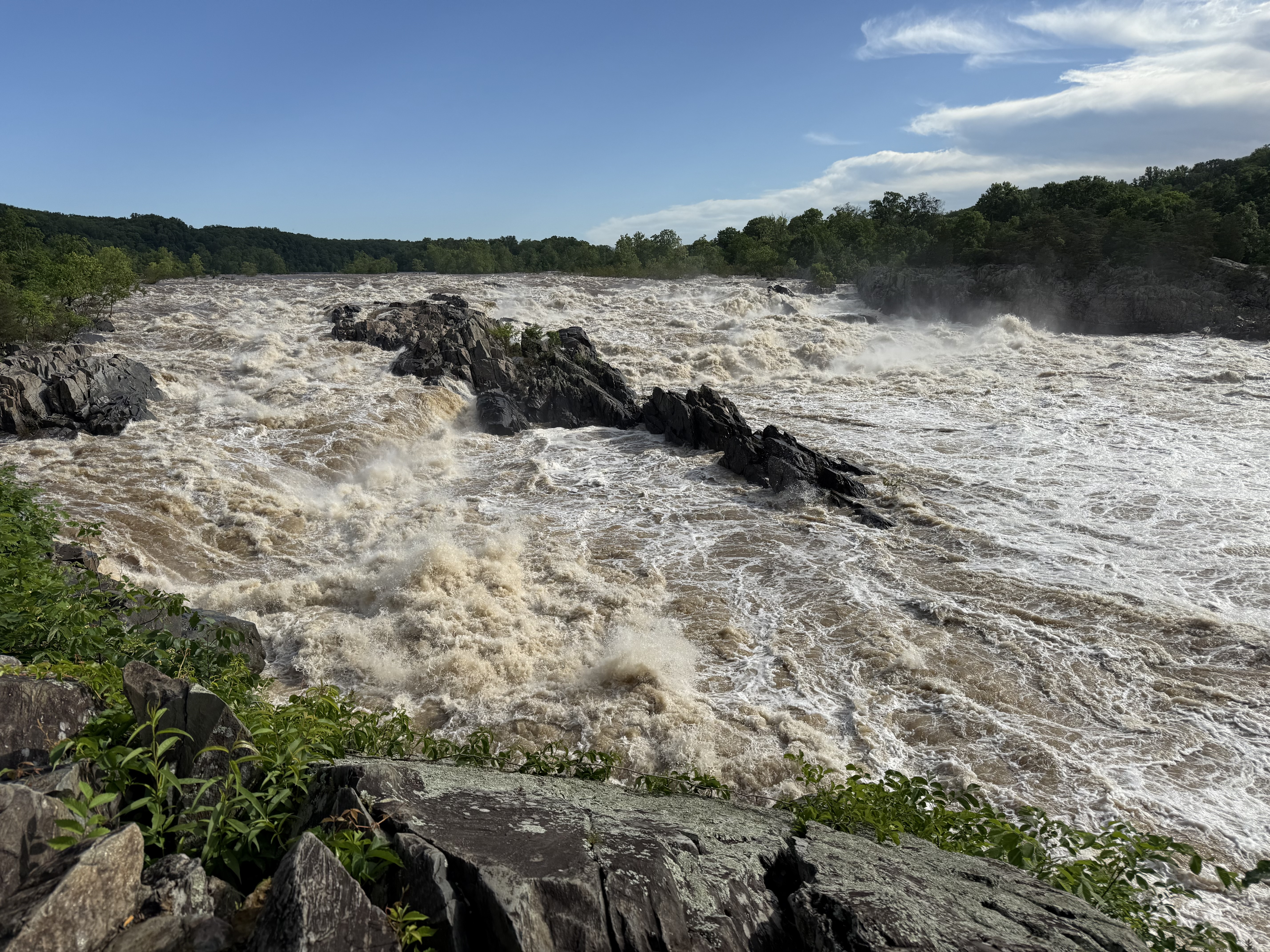
Great Falls still high, but coming down from Thursday. Beautiful morning.

- 751 replies
-
- 17
-
-
They really need to win the series against Cleveland and KC next week.
-

-
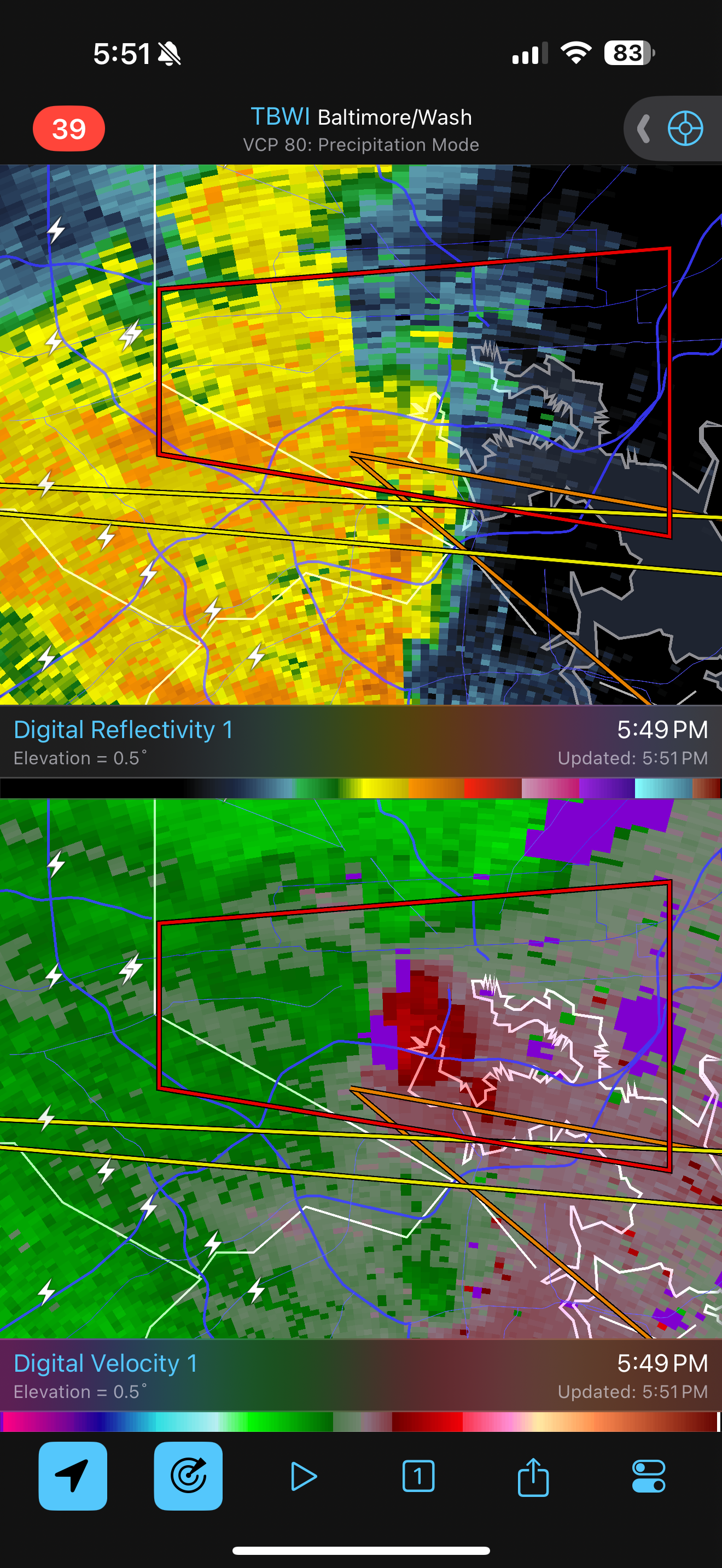
You dont see a lot of tornado warnings for downtown Baltimore
- 1,348 replies
-
- 5
-
-
- severe
- thunderstorms
- (and 2 more)
-
DCA to 69!
- 1,348 replies
-
- 7
-

-
-

-

-
- severe
- thunderstorms
- (and 2 more)
-
0.01”
-
Going to need some upscale growth soon for DC to get anything of note
-
86/70. Officially gross.
-
75mph gust for Richmond on that one, potentially a derecho with that path length and intensity. Of course, the 18z 3k wants no part of it.
- 1,348 replies
-
- 1
-
-
- severe
- thunderstorms
- (and 2 more)
-
11 in a row and the conference finals. Love it.
-
Looking at the 2-day totals on CoCoRaHS, there are a bunch of 4”+ readings, especially between Charlottesville and Winchester, Cumberland, and even one near Woodbridge/Dale City where the training set up nicely yesterday. CAMs are indicating that someone gets dumped on again today, but far less widespread.
-
2.80” Fantastic
-
I was skeptical of this, but sure enough, this is my first 2”+ calendar day since Jan 2024, which aligns with yours.
-
Yeah, this is what you needed. W to E sucks for you with the mountains but S and SE can be money.
-
Better now?
-
Over 2”
-
Around 1.5”
-
It has less than a quarter inch for DC and Baltimore from 12z to 00z. I will take the over.
-
12z HRRR really loves CHO to Winchester, with the metro areas getting virtually nothing from 2-8pm. Tough to envision that looking at the radar currently.
-
0.73” and some heavier rain moving in. True soaker.
-
Very aggressive HRRR run from this morning. NAM Nest was good too, but not as wet during the day on Tuesday.