MN Transplant
-
Posts
17,028 -
Joined
-
Last visited
Content Type
Profiles
Blogs
Forums
American Weather
Media Demo
Store
Gallery
Everything posted by MN Transplant
-
94.4. I tend to run ahead of the airports until early afternoon for whatever reason.
-
91.5 and it feels every bit of it
-
19.4, so somewhere in the middle.
-
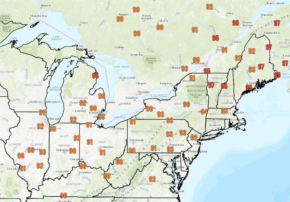
IAD/BWI 97, DCA 95
-
Copying the record high list from Sterling's AFD Saturday Jun 22nd Climate Site Record High Forecast High Washington-National (DCA) 101F (1988) 99F Washington-Dulles (IAD) 99F (1988) 99F Baltimore (BWI) 100F (1988) 99F Martinsburg (MRB) 102F (1933) 98F Charlottesville (CHO) 101F (1933) 97F Annapolis (NAK) 101F (1988) 94F Hagerstown (HGR) 100F (1988) 98F Sunday Jun 23nd Climate Site Record High Forecast High Washington-National (DCA) 98F (1988) 98F Washington-Dulles (IAD) 96F (1988) 97F Baltimore (BWI) 97F (2010) 98F Martinsburg (MRB) 100F (1934) 94F Charlottesville (CHO) 100F (1894) 96F Annapolis (NAK) 98F (1988) 94F Hagerstown (HGR) 98F (1988) 95F The 1988 drought was nasty back in the plains. I remember the river in my hometown drying up to a trickle.
-
My high looks like it will be 96.3. Impressive, and more along the lines of the warmer models.
-
It is all about rounding and conversions between C and F.
-
94.8. Torch activated.
-
90 at home. That was easy. I'm a little more bullish on heat than I might otherwise be simply because of how dry it is.
-
17.4C on the morning sounding at IAD. The models diverge by 00z this evening, with the GFS already pushing 20 and the NAM stuck in the 18 range. I can't fathom that the NAM will be correct here.
-
Yeah, I remain skeptical. Even if it is doing well with verification at 500mb, the actual weather matters more. NAM's 850s top out at 20-21C. GFS is around 22C. Euro is 22-23C.
-
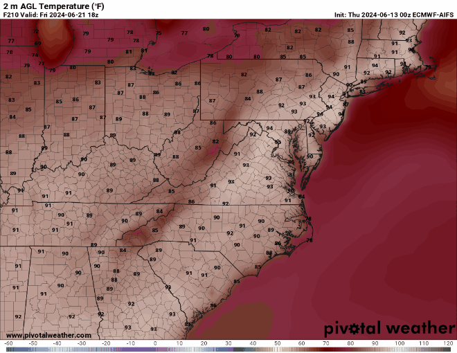
Interesting test of the AI models. ECMWF-AIFS and the GFS GraphCast both seem to top out in the 96 range per the maps on Pivotal.
-
GFS, Euro, HRDPS, and HRRR all support 100 around DC on Saturday, with the NAM being a significantly outlier. The ICON joins the other globals for Sunday.
-
The heat wave was always going to be focused north of us during the middle of the week, and then collapse down onto us for the weekend. 90/65 is hot, but not that bad. When we go to 97/98 this weekend it'll be more noticeable. But the sudden-onset dry conditions have certainly helped us out in terms of feels-like weather.
-
On cue: https://twitter.com/capitalweather/status/1803595486609256511?s=46&t=bA1Os5w_10i9PfsurY28aw
-
Even 90 at home. All the spots in the shade at the pool were full.
-
My worry is that we get a lagging El Nino summer like 2010, where the heat is continuous.
-
One of the seemingly few days so far where DCA has outperformed IAD/BWI.
-
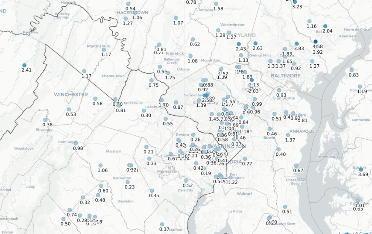
Tough June so far in northern VA. 0.23" here. Shows that it doesn't matter in the least what the precip was before summer. Once you get a couple of weeks of dry and sunny, everything without deep roots struggles.
-
The more impressive anomalies will be well north of us. Despite some of the awful Euro runs, this was always just a normal summer heat wave for us. Could grab a record high at IAD if things break right.
-
It was really the Euro, which is completely broken at this point for long-range temps.
-
0.01”. We were on a heater and it absolutely shut off once the calendar turned to June.
-
Severe warning out by Cumberland. Dews in the low 60s around the metro areas.
-
It really is broken.
-
DCA: 99 IAD: 101 BWI: 100 RIC: 99