

MN Transplant
-
Posts
17,024 -
Joined
-
Last visited
Content Type
Profiles
Blogs
Forums
American Weather
Media Demo
Store
Gallery
Everything posted by MN Transplant
-
I should add that the 12z Euro isn't all that far off from the NAM with that vort, but it swings the southern part through faster. So, yeah, unfortunately not as easy as a big bowling ball coming across the country.
-
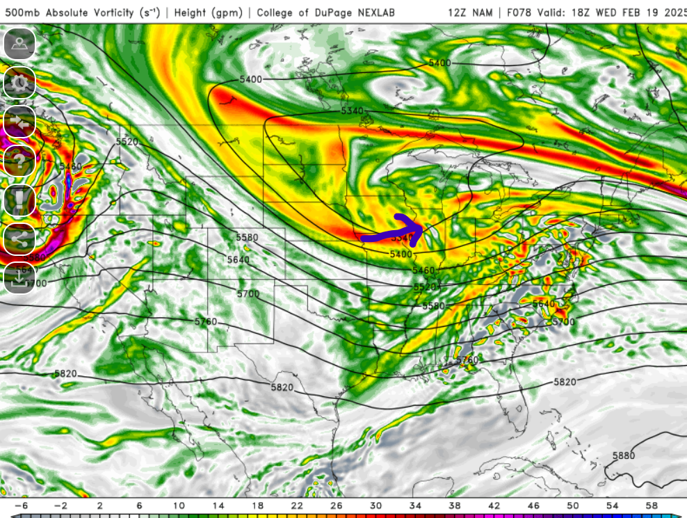
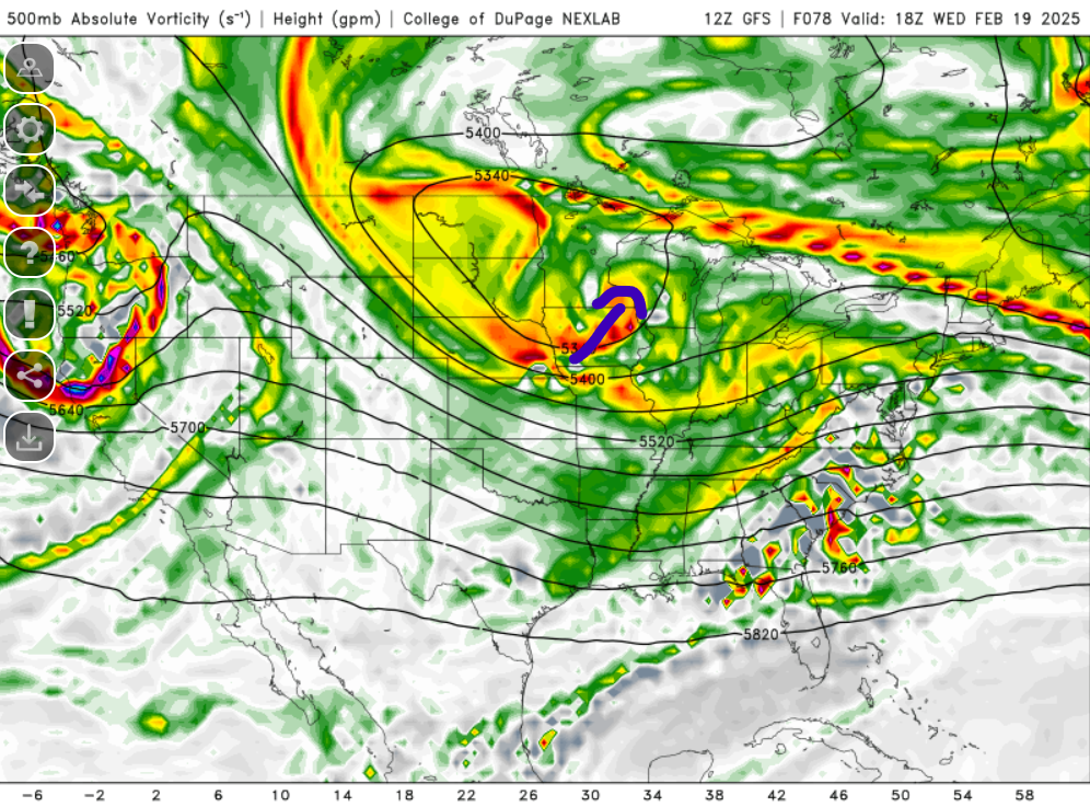
The NAM gives us the route that we want, it is just unfortunate that it is the model that we least trust. The top image is the NAM. The vort that swings through is helping to close off the 500 low near Chicago. The bottom is the GFS, where it is closing off the low over Minneapolis. We need the vort to help us bridge, not cut off.
- 385 replies
-
- 10
-

-

-

-
As I keep looping the 500 charts for both the GFS and Euro, I can’t help but think that there’s really a third party here that is helping to make a mess. These aren’t all distinct pieces, but there’s a short wave dropping down from BC that is more or less aligned with our energy that is about to hit the west coast. As these two pieces of energy rotate together in a longer wave pattern, the northern piece helps to close off the 500 low over ND/MN, while the southern piece (our storm) becomes disconnected and rotates through ahead of the 500 low. Adding to this is the completely unhelpful retrograde of the energy over Quebec which also slows the eastern movement of the northern low and enhances the disconnect.
-
It’s acting as a kicker
-
This is my take. There isn’t any useful interaction going on.
-
Temp soaring. Up to 59. Pressure 985.4
-
Yeah, tanking. 989.0, 29.21"
-
RGEM is putrid
-
Warned squall line approaching Richmond
-
Ok, summary for those waking up. Still a jackpot to the south and east. Huge difference in how big/strong the storm gets, which affects the totals to the north and west. 10:1 snow amounts for DC: GFS: 5" (06z), 4" (00z) Euro: 6.5" (06z), 9" (00z) Canadian: 0.5" (00z) ICON: 10" (06z), 5" (00z) Ukie: 2" (00z) Euro AI: 4.5" (00z)
-
No, this is a dud
-
Hadn’t been paying attention to the timing, but snow breaking out by morning Wednesday
-
Good consensus across the models of gusts at least in the 50-55mph range.
-
Kucera is rarely valid IMO. Stick with 10:1 unless there is something obvious.
-
We need a rule that if you post Kucera you have to post 10:1 too.
-
Wild map
-
Nobody is sleeping through that
-
I only got 0.2" from that, but it was still quite the event.
-
Gust to 56 at DCA and 53 at IAD. This is impressive.
-
It is loud. IAD to 51 mph.
-
12/24/24 0.1 1/3/25 0.3 1/5-1/6/25 7.7 1/11/25 1.0 1/16/25 0.1 1/19/25 0.8 2/11/25 6.3 24-25 Seasonal 16.3
-
6.3” on 0.73” precip. Not a great ratio, but a win anyway! Kudos to the NAM Nest for performing really well IMBY.
-
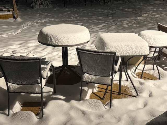
I’ll measure a bit later, but I’ll say that one oddity is that I’ve never had so much snow with absolutely no wind. The fact that there are clear patches under the table and chairs is amazing.
-
That is a depressing stat on a happy day!
-
Lightning or a transformer? Snow is sticking to the pine trees. 5 1/4” and modeling indicates about 2” more. That would be almost equivalent to last month’s event (7.7” here).


