MN Transplant
-
Posts
17,025 -
Joined
-
Last visited
Content Type
Profiles
Blogs
Forums
American Weather
Media Demo
Store
Gallery
Everything posted by MN Transplant
-
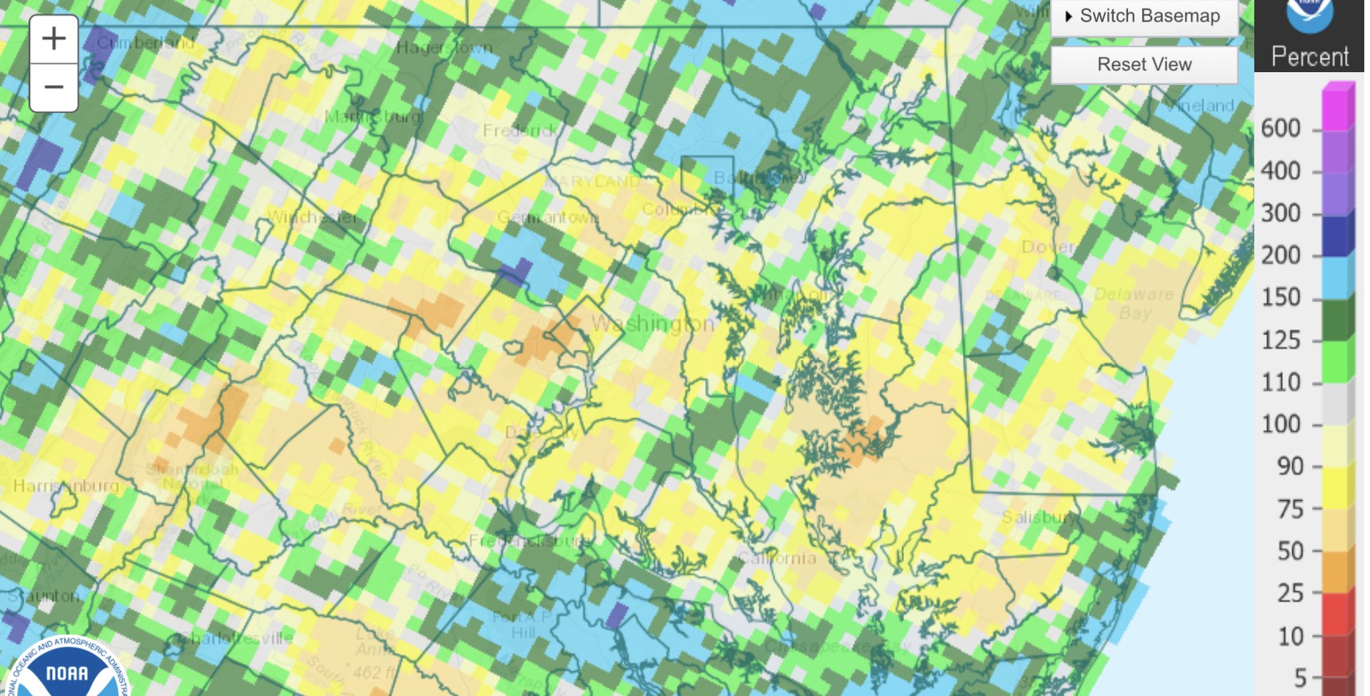
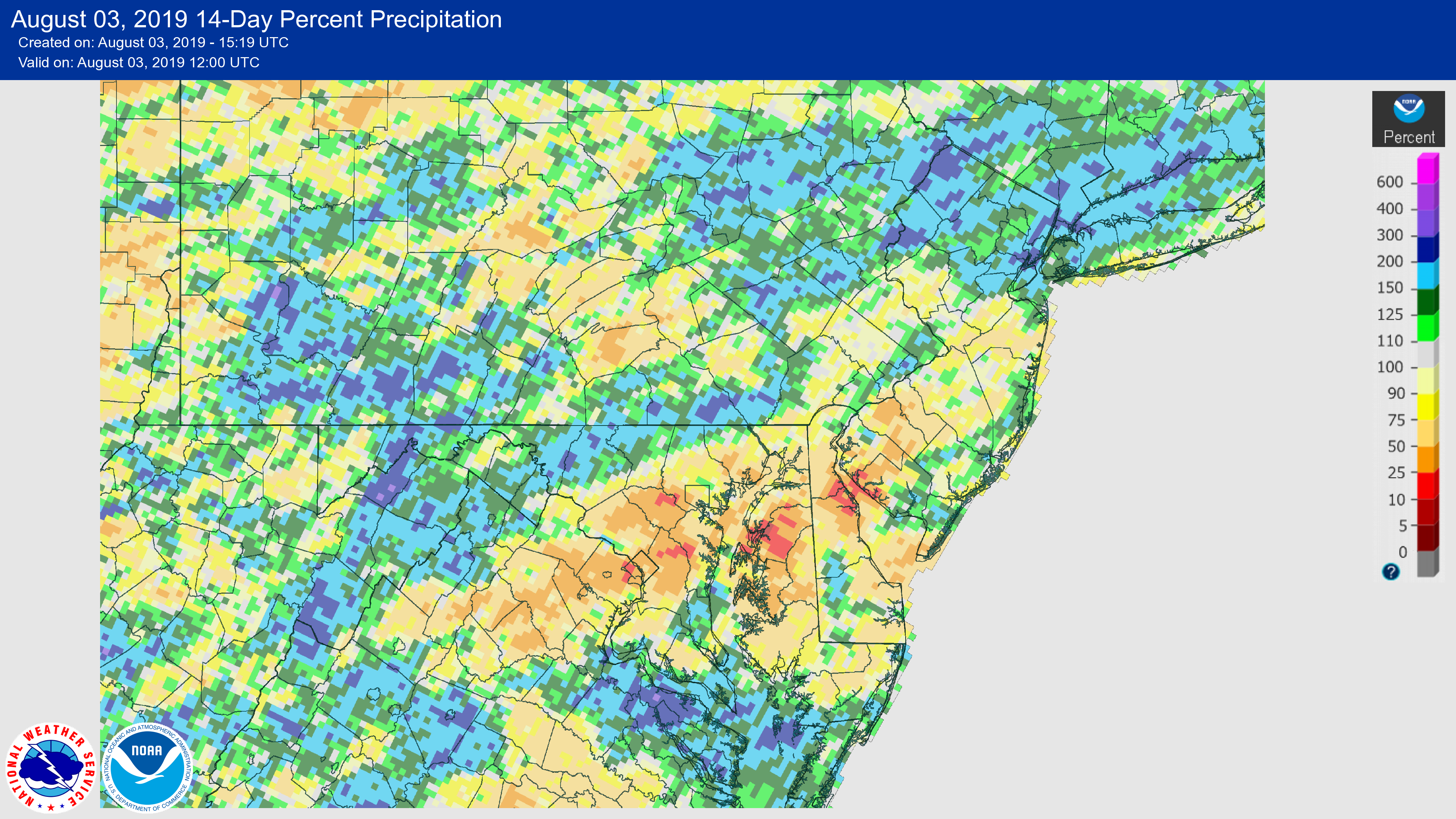
Last 30 days. Haves and have nots.

-
How exactly is NOAA going to include the university research community in their model development plans? Is there really a way forward for the NOAA labs and non-NOAA participants to work together on a system that is capable of operations and research. /I’m not Cliff Mass, I swear
-
Did ok at 0.64”. Poor Mattie.
-
That cell in Arlington is about to go boom.
-
Free water from the sky is awesome. Down about 20 degrees, too.
-
You must be borderline warned. That boundary is doing work. Didn't need much of a trigger today.
-
93 at DCA. 94 here. Waiting on a build south.
-
Had to bail from the pool because of the thunder. Didn't rain a drop.
-
1.18” since the deluge on July 8th.
-
Have a 5pm departure from DCA today. Hope they keep us in the terminal rather than have us sit on the tarmac.
-
BWI was 98 which ties the record high 3rd hottest day of the summer at BWI and IAD.
-
97. Higher than most of the days in the heat wave a week+ ago.
-
93 at home and at IAD. DCA lagging again.
-
DP in the 60s is a heck of a lot better than the mid 70s. Mid 90s is still hot, though.
-
Ob: hot 94 for a high. Looks like 96 BWI, 94 IAD, and DCA brings up the rear again with 93.
-
Great map here: https://www.forbes.com/sites/brianbrettschneider/2018/07/08/when-does-the-hottest-day-of-the-year-usually-occur/#67127324548c
-
I was going to go with 16-day FV3 model output, but yours is probably more accurate.
-
2019 Mid Atlantic Lawn, Garden, Pool, etc. Thread
MN Transplant replied to Eskimo Joe's topic in Mid Atlantic
Zoysia is fantastic in the summer, but it goes dormant (brown) in the winter and takes quite a while to green up in the Spring. If you are ok with that, it is great for full sun areas. And it is so nice and lush. -
18 didn't act like a nino, 19 is so far. That's what I get out of only the post you are quoting. The "less convection" in the Atlantic goes along with the traditional view of El Nino = less hurricanes.
-
Rained hard - for about two minutes. 0.10”.
-
I'm impressed at how well the meso models have handled this so far. The initial batch timing and location is pretty good. The rest of us should be looking out for later this afternoon into the evening.
-
It has been to 94 at DCA. Got a 95 at my house. 96/90/95/97/99/95 is a good run.
-
Quite simply, there is enough juice in the atmosphere that (as we saw yesterday) we are likely to see some wind reports. Even if this isn't a widespread severe day, I think they go with a box.
-
Honestly, anything I would have would be guesses on the CCN question. You want active updrafts and ice to ice collisions. That certainly points to the environment taking precedent. There are studies out there about increase aerosol loading leading to more lightning, but whether that effect is major or minor I think is still uncertain.