MN Transplant
-
Posts
17,028 -
Joined
-
Last visited
Content Type
Profiles
Blogs
Forums
American Weather
Media Demo
Store
Gallery
Everything posted by MN Transplant
-
I was going to come here to complain about the brine, but I see that’s been taken care of. Leading precip continues to be very light in the DC area via the 00z nest.
-
2020 Mid-Atlantic Garden, Lawn, Etc. Thread
MN Transplant replied to mattie g's topic in Mid Atlantic
Snow drops were already out last week. I’m used to seeing them more mid-to-late Jan. -
Nah. You have 3 SBs. That’s all that matters.
-
Mid Atlantic 2019/2020 season snow totals
MN Transplant replied to Midlo Snow Maker's topic in Mid Atlantic
12/11: 0.4" 1/7: 1.4" Total: 1.8" -
Went back and forth from home to the Virginia Square area this morning. Striking how much of a winter wonderland it looks like once you get west of EFC metro vs down by Ballston and the interior Arlington Orange Line.
-
1.4”. Total precip was 0.32”, so even accounting for the rain at the start the ratios weren’t great due to the non-accumulating snow.
-
1.0” on the snow board. Steady at 33.3.
-
Headed towards a garbage can topper.
-
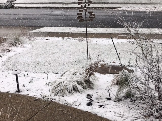
Street starting to get white. Very pretty snowfall. No 2-4”, but no HRRR either.
-
Ground is whitening. Moderate snow. Looks like the real deal out there. Down to 34.0.
-
Steady snow now. 35.3. Starting to ice up the car tops.
-
Light snow. 37.5
-
I'd be concerned about wasting precip, but I'm at 0.01" rain so far. Down to 38.8
-
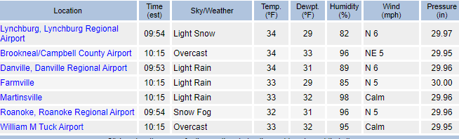
Just from poking around the DOT cameras and Wunderground, it looks like 36/37 is where we are seeing a changeover, but it is 33/34 before it starts to whiten the grass. No snow on the sides of the roads until you get pretty far west on 66 (Marshall/Markham).
-
Per the cameras, the R/S line has made it past Manassas.
-
OPM is going to be even more inclined to close now that so many people are telework capable. They expect you to hop back on once you get home, or take leave.
-
SPC has them -2 to -4 for most of us.
-
Elementary schools close at 2:05pm today in Fairfax County. Going to be a lot of kids on buses...
-
I seem to have topped off at 44. Hasn't budged in 30 minutes and solar is headed down.
-
Even better, here are the 10am obs from W/SW VA. Forget the p-type and look at the wind direction. The HRRR thinks that all of these locations should have E to SE winds right now. It just isn't handling the low correctly. So, it looks like the NAM is too cool ahead of the storm, but the HRRR isn't going to have the right track. It is better to have the track than the temps right now.
-
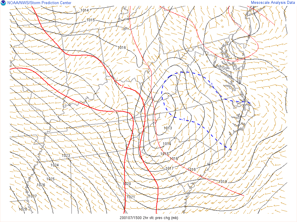
Yeah, no snow obs in grass. Here's a reason to still be positive. This is the mesoanalysis from SPC at 10am. Closed low in SW VA and NW NC with pressure falls in VA/NC and a convergence line south of Richmond. Here is the 14z HRRR at noon. Is there any world in which you can look at the current analysis and think that the low is going to be on the central WV/VA border?
-
Not for snow. I'm on a hill, so my low temps are lame in inversion situations but otherwise I'm in line with others. Hell, I pulled off 4" from March 2013 while it was raining in DC.
-
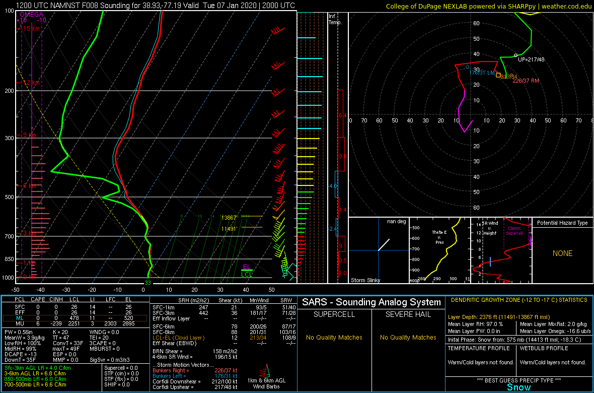
Hard to ignore that it is 10am and I'm already warmer than the 12z 3km NAM had me all day. Still hoping this sounding pans out.

-
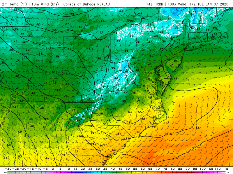
41.3. Already warmer than the HRRR 42 at DCA. The torch is on.
-
35.2 HRRR just won’t give up