MN Transplant
-
Posts
17,071 -
Joined
-
Last visited
Content Type
Profiles
Blogs
Forums
American Weather
Media Demo
Store
Gallery
Everything posted by MN Transplant
-
Nice I68 storm
-
Feels nice today, though
-
The HRRR is extremely aggressive with winds in any convection that develops this afternoon.
-
Spectacular, except this is the first day I've noticed bugs.
-
They got rain the day prior from the broader trough but not the low itself.
-
Mostly unimpressive except for two locations and two individual events. The early-season SE Colorado event and then the absurd Gulf Cost event.
-
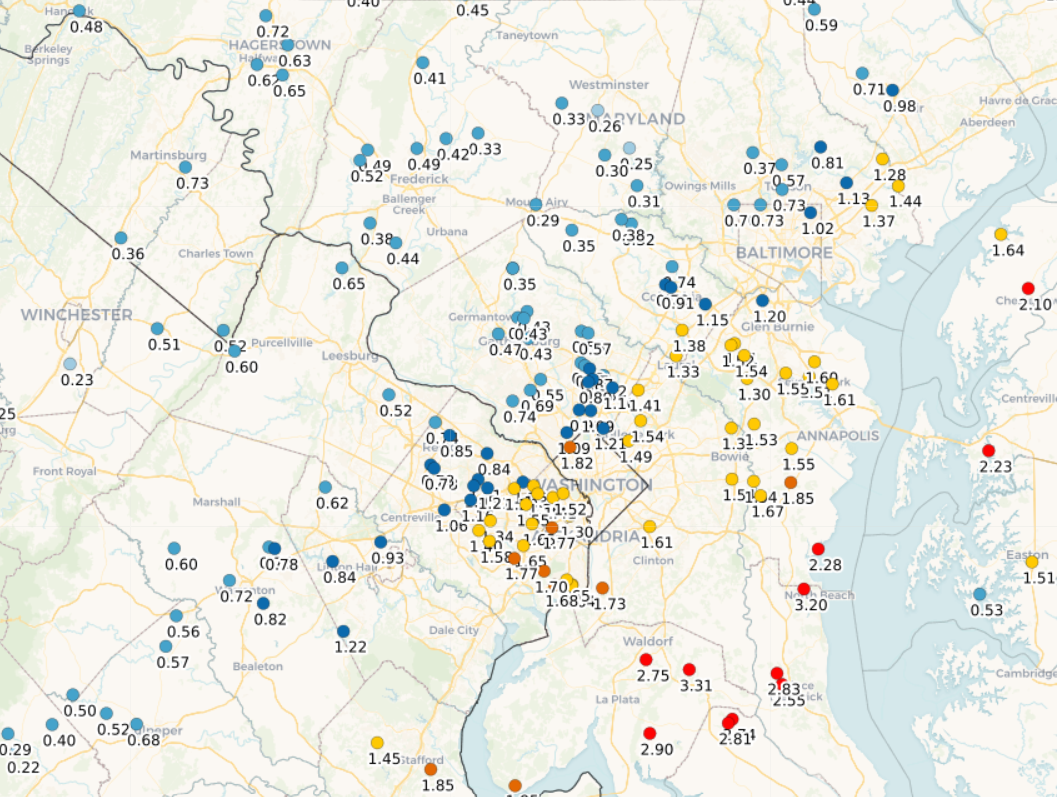
Quite the gradient (2 day totals)
-
Yeah, I’m dancing on the edge right now. 0.38”
-
12z HRRR looks great. Even throws 0.5” back to Winchester.
-
The problem is that this is a small low and the moisture availability is modest at best. PWATs don’t even get close to 1”. Part of the reason why this looked like a region-wide soaker from several days back was that the two parts (wave then low) nicely hit different areas. The wave part ended up being a dud for most of us except for up by Hagerstown. I got a trace.
-
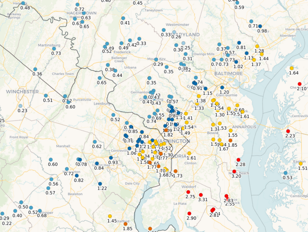
18z NAMs and HRRR look fine. Most of us over an inch, and up to 2"+ in lucky spots. The difference is that the HRRR centers the precip in the center and east of the DC/Balt region, while the NAMs favor spots W of 95.
-
Low of 30.0, which is impressive. I didn’t think my spot had another freeze in it. Downtown DC and DCA avoided freeze, as did Annapolis.
-
34 this morning. I’m skeptical of a freeze tomorrow in the warmer spots (DCA, local elevated areas), but the regular spots should get there.
-
The 4"+ on the Euro would be kind of fun.
-
The pollen puddles were unreal this morning. About 0.4”
-
Hard to tell. It looks mostly hit-and-miss showery until probably after your event when more sustained rain moves in. But, of course, if you are in the "hit" area prior to that, you'll be wet.
-
Morning mesos don't have much for later today, pretty isolated and a better chance to the NW. Most of our upcoming rain is going to happen behind the frontal boundary which comes through midday tomorrow.
-
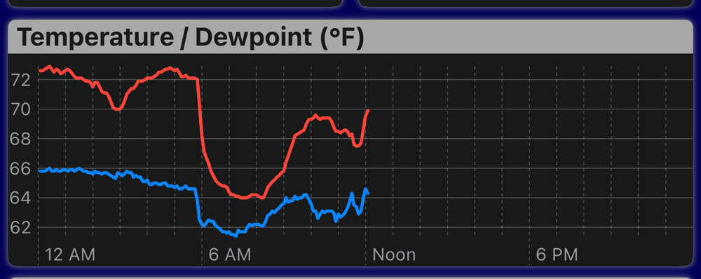
That’s a temp trace you don’t see often
-
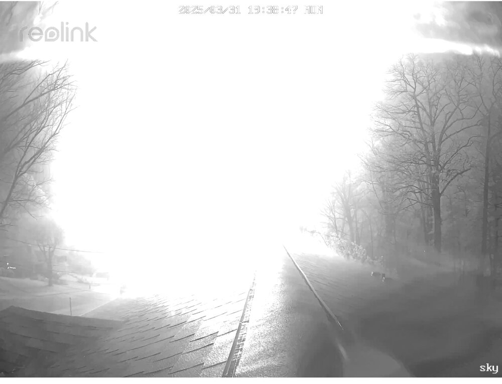
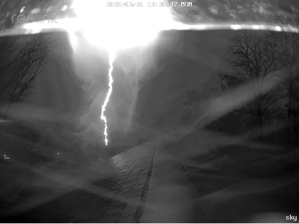
Kind of a cool effect here from my sky cam. The first pic is the over saturated frame, and then the next frame with the lightning channel.
- 691 replies
-
- 13
-

-
Debacle. Just completely lifeless. 0.50” and still coming down. This was desperately needed.
-
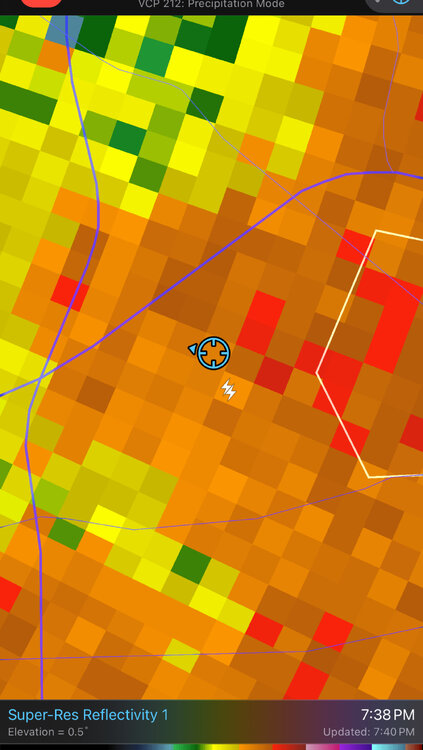
This one made me jump
-
There we go, 80 for the third consecutive day. Morch it is.
-
Another 80 and another +20 at DCA. Going to end up between +6 and +7 on the month, so despite the wind it was a torch. edit - and probably a record high minimum.
-
Making another run at 80 here. 78.3
-
First 80.