stormdragonwx
-
Posts
463 -
Joined
-
Last visited
Content Type
Profiles
Blogs
Forums
American Weather
Media Demo
Store
Gallery
Everything posted by stormdragonwx
-

Severe Weather May 26th- 28th 2021
stormdragonwx replied to weatherextreme's topic in Central/Western States
These outflow boundaries might make things interesting later on.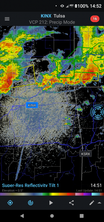
-
Severe Weather May 26th- 28th 2021
stormdragonwx replied to weatherextreme's topic in Central/Western States
Someone correct me if I'm wrong here but I don't trust the CAM's that have been showing a lot of convective overturning as I've been observing the storms out north and west on GR3 for the past few hours and they appear to be weakening and moving away from the risk area. If there's no redevelopment later tonight into the morning then this setup could be explosive tomorrow during peak daytime heating. With the atmosphere we got in place (70+ dews, plenty of shear, and 4k+ CAPE) If there's enough of a cap then I don't see how we couldn't have a couple tornadic supercells before the squall line develops.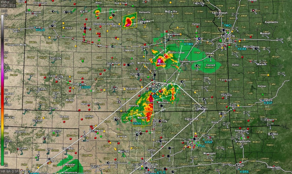
-
Severe Weather May 26th- 28th 2021
stormdragonwx replied to weatherextreme's topic in Central/Western States
A nice looking Tornadic Supercell really got its act together in the past 20-30 mins in the TX Panhandle east of AMA with nearly no chasers on it.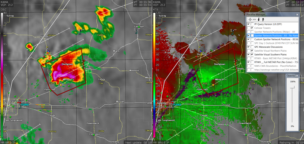
-
Severe Weather May 26th- 28th 2021
stormdragonwx replied to weatherextreme's topic in Central/Western States
Yeah I would think Mod risk with at minimum a 10% hatched for tornadoes. It is May after all. -
Devastating tornado strikes Joplin, Missouri
stormdragonwx replied to Hoosier's topic in Weather Forecasting and Discussion
Crazy to think its been 10 years. I did a video touring the damage path back then. I also made a little tribute.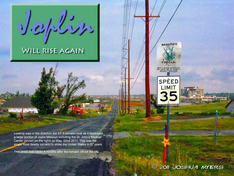
-
null (moved post)
-
^This. IIRC May 3rd, 1999 started out as a Slight Risk that morning and then went to High by that afternoon. EDIT: Here it is https://www.weather.gov/oun/events-19990503-summary
-
Agreed with the above. There's been a drought of sorts for a few years now. The two (most recent) days that I would consider a notable good plains chase day that wasn't an ugly HP mess for me were 5/24/2016 and 5/18/2017. These were more of a localized outbreak/cyclic supercell. Another clip: https://www.youtube.com/watch?v=xyUeZku1sbU
-
Severe Weather May 3rd 2021
stormdragonwx replied to weatherextreme's topic in Central/Western States
EF1 tornado rating confirmed on the AR/OK state line west of Fort Smith from last night's storms. -
Severe Weather May 3rd 2021
stormdragonwx replied to weatherextreme's topic in Central/Western States
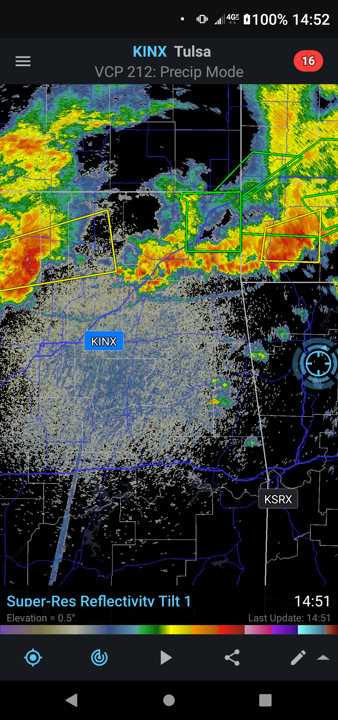
Tornado Warning just south of McAlester -
Severe Weather May 3rd 2021
stormdragonwx replied to weatherextreme's topic in Central/Western States
Pretty classic satellite view.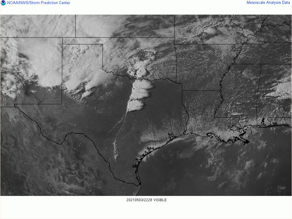
-
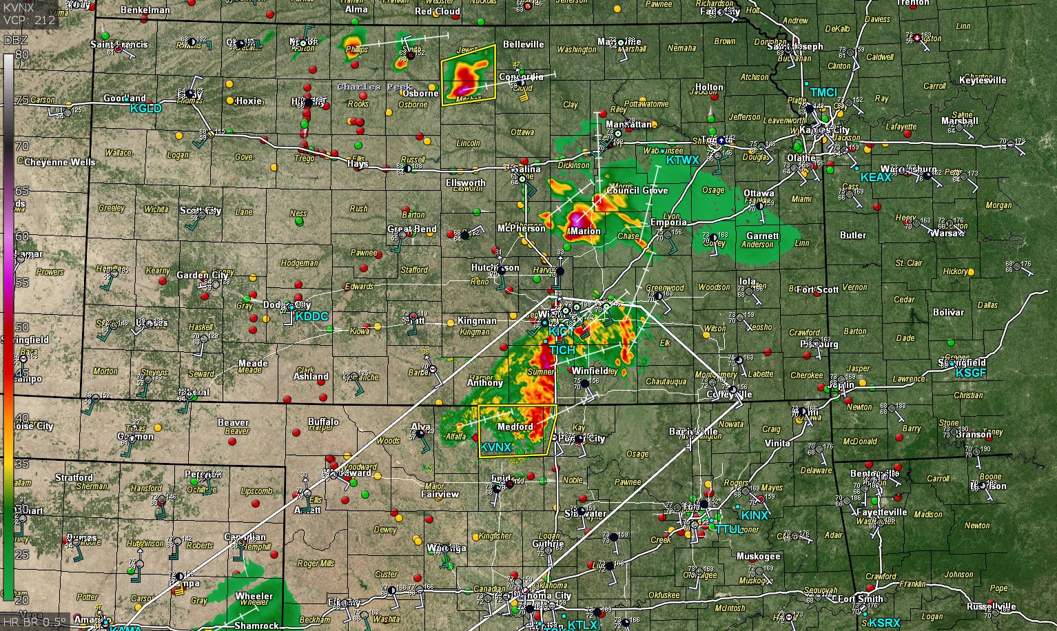
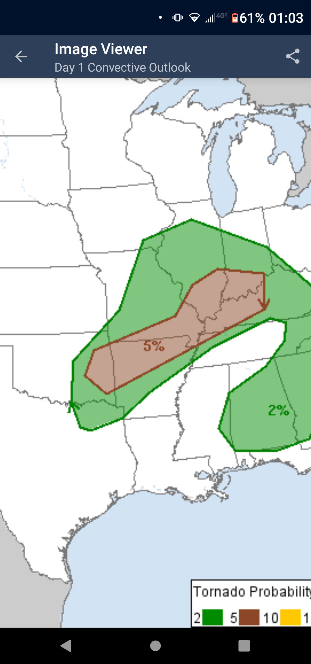
Severe Weather May 3rd 2021
stormdragonwx replied to weatherextreme's topic in Central/Western States
Enhanced Risk for today. Will the 5% Tor continue it's streak? Many noteworthy days so far this year have happened on a 5%.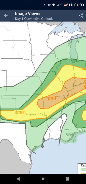

-
Who thinks our third High Risk will come this month? What day?
-
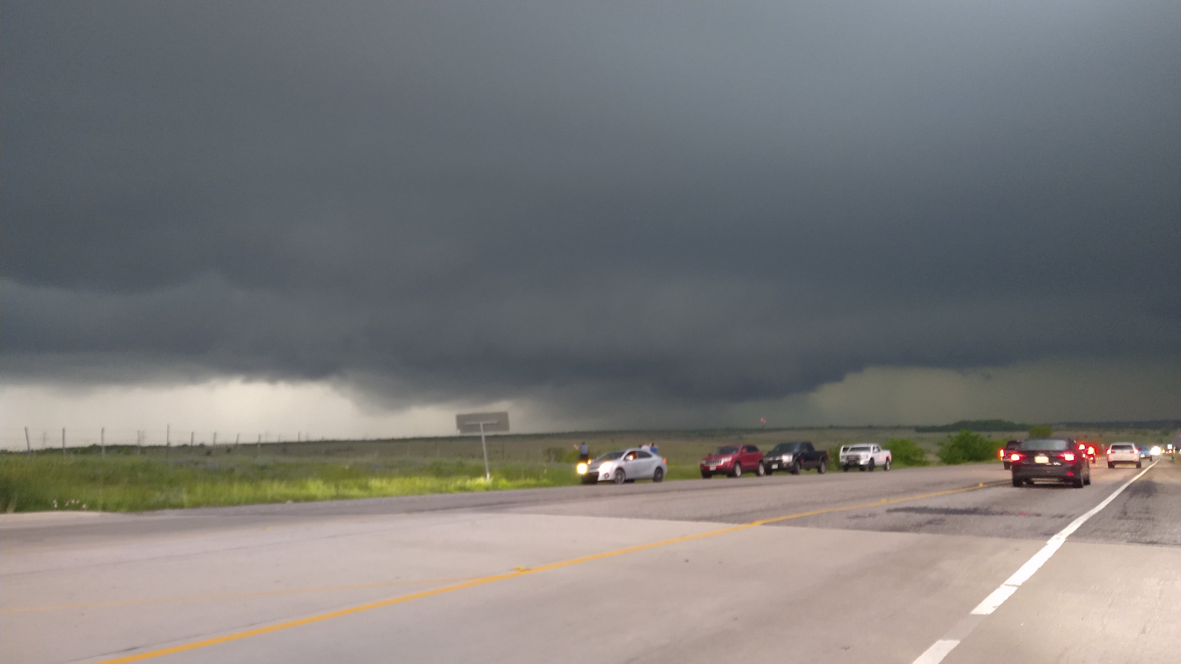
Severe Weather April 27-28th 2021
stormdragonwx replied to cheese007's topic in Central/Western States
This was my view of the DFW storm as it came in from Weatherford.
-
Severe Weather April 27-28th 2021
stormdragonwx replied to cheese007's topic in Central/Western States
Surprised this isn't Tor Warned. Storm quickly got it's act together.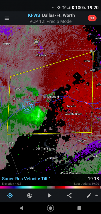
-
Severe Weather April 27-28th 2021
stormdragonwx replied to cheese007's topic in Central/Western States
Yeah I chose to sit this one out. Was actually considering NW KS last night as well. Tomorrow doesn't look much better but I might look into it. Main thing keeping me at bay these two days is excessive cloud cover and messy storm modes. -
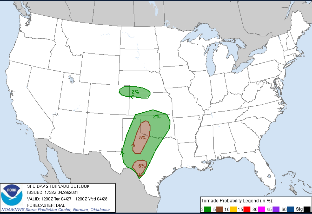
Severe Weather April 27-28th 2021
stormdragonwx replied to cheese007's topic in Central/Western States
Here's the current D2 outlook. Got a slight risk area with a 5 percent tornado. Storm chasing potential is trending more and more into the "meh" category for me. Might sit this one out but I'll have to look at the data closely tonight.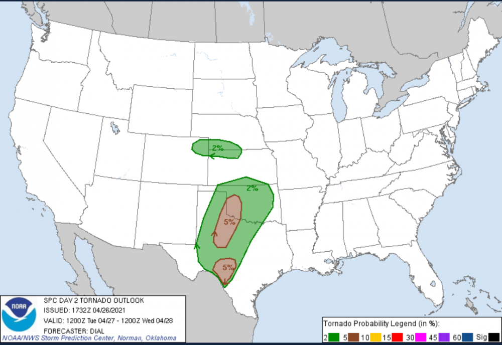
-
Severe Weather April 27-28th 2021
stormdragonwx replied to cheese007's topic in Central/Western States
Yeah its quite depressing, especially if you missed out on this past Friday. -
Central/Western Medium-Long Range Discussion
stormdragonwx replied to andyhb's topic in Central/Western States
Lol this is starting to sound like a rinse and repeat of 2020. One good photogenic storm chase event in April then it all shuts down in May. -
Severe Weather April 27-28th 2021
stormdragonwx replied to cheese007's topic in Central/Western States
Interesting. Right back in the same area as yesterday's event. Though I somehow doubt we will see a repeat performance. Either way I'd love to get redemption for having to miss yesterday.
-
Severe Weather April 23rd 2021
stormdragonwx replied to weatherextreme's topic in Central/Western States
Welp looks like my virtual target area verified. And photogenic too. Couldn't get out because of work. Congrats to those who got on the cyclic tornadic supercell in the SE TX panhandle today. -
Severe Weather April 23rd 2021
stormdragonwx replied to weatherextreme's topic in Central/Western States
Yup nailed it. -
MO/KS/AR/OK 2020-2021 "Winter" Discussion
stormdragonwx replied to JoMo's topic in Central/Western States
Had a dusting to half inch here in Fayetteville but its melting quick now that its stopped. Video: https://twitter.com/StormdragonWX/status/1384607574742364160?s=20 -
MO/KS/AR/OK 2020-2021 "Winter" Discussion
stormdragonwx replied to JoMo's topic in Central/Western States
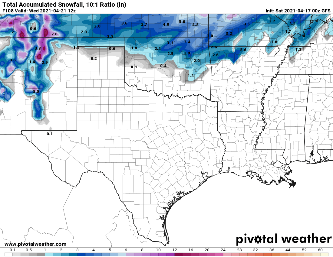
I won't spam the thread with accum maps but pretty much every model has snow for the 4 states area by this time tomorrow. -
Central/Western Medium-Long Range Discussion
stormdragonwx replied to andyhb's topic in Central/Western States
GFS has been sticking to its guns all day. GEM and Euro still seem to hint at it, but trend a bit drier. Still can't believe I'm posting snow maps this late in the season.