SUNYGRAD
-
Posts
57 -
Joined
-
Last visited
Content Type
Profiles
Blogs
Forums
American Weather
Media Demo
Store
Gallery
Everything posted by SUNYGRAD
-
February 18-19 MAJOR Ice Storm Threat
SUNYGRAD replied to NorthHillsWx's topic in Southeastern States
Sensitivity of Ice Storms in the Southeastern United States to Atlantic SST—Insights from a Case Study of the December 2002 Storm in: Monthly Weather Review Volume 134 Issue 5 (2006) (ametsoc.org). -
February 18-19 MAJOR Ice Storm Threat
SUNYGRAD replied to NorthHillsWx's topic in Southeastern States
Something to keep an eye too leading into this evening. Temperature advection at 925 (below).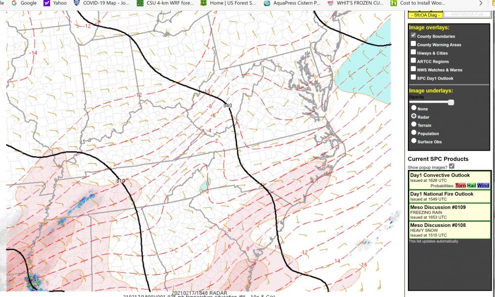
-
February 18-19 MAJOR Ice Storm Threat
SUNYGRAD replied to NorthHillsWx's topic in Southeastern States
NAM 3k running close or a little warmer with pocket of warmer temps in SW NC. It depends upon sounding location that you pick. -
February 18-19 MAJOR Ice Storm Threat
SUNYGRAD replied to NorthHillsWx's topic in Southeastern States
NAM3k is lightly cooler overall at 18z at 850 than above depiction. -
February 18-19 MAJOR Ice Storm Threat
SUNYGRAD replied to NorthHillsWx's topic in Southeastern States
-
From RAH discussion this morning. LOL The great Appalachian chain has not moved that I have noticed (even with the Sparta earthquakes and tremors this year). So, unless the high becomes centered to our NNE (arctic air air will not roll down the eastern seaboard into the Carolina`s). It will stay west of the Appalachians.
-
if interested in reading material. AMD, Cray, Nvidia Behind Massive NCAR Supercomputer Upgrade (nextplatform.com)
-
IBM GRAF has done fairly well in some the past NE storms, but I do not access to the model or any statistics. Just my observations.
-
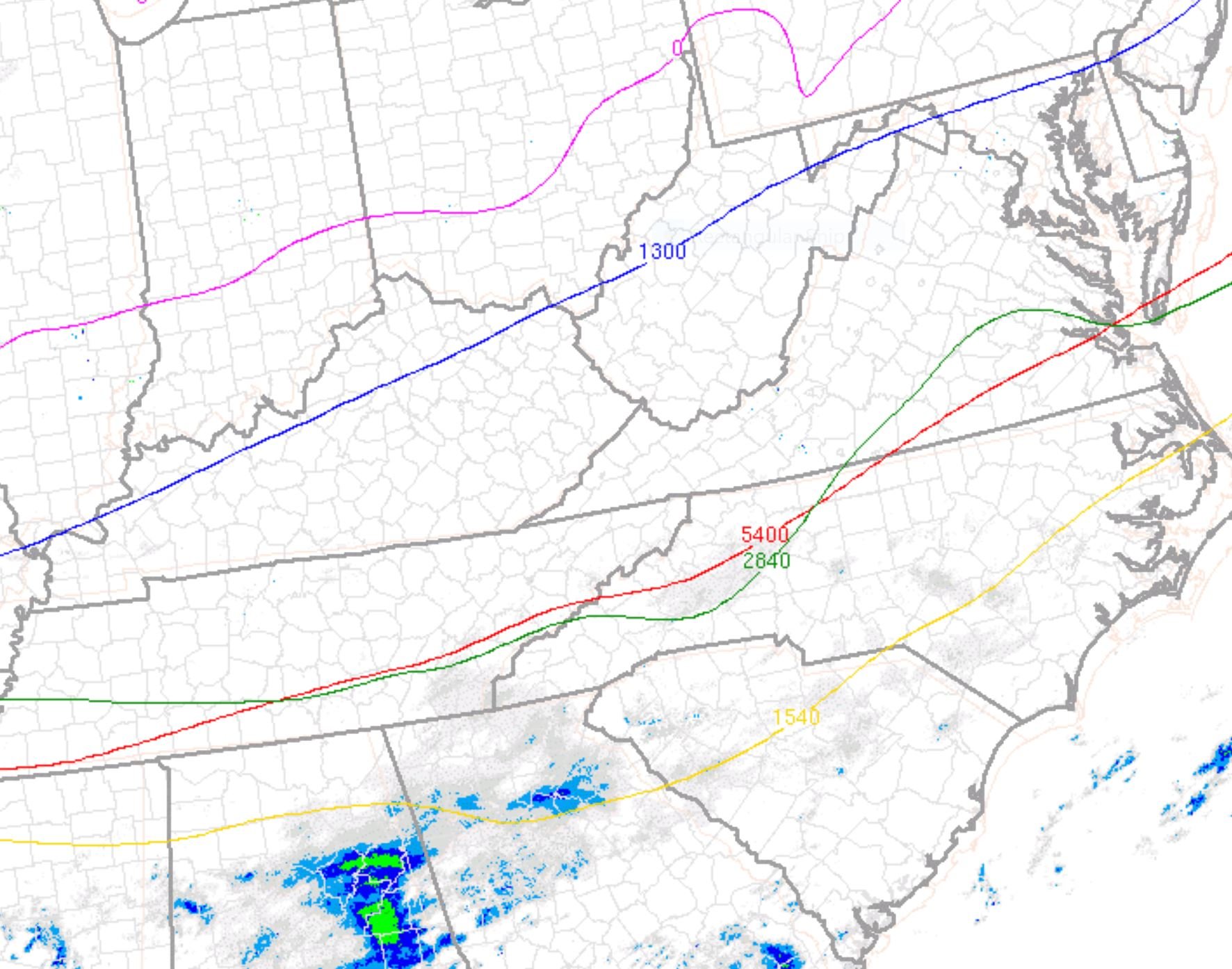
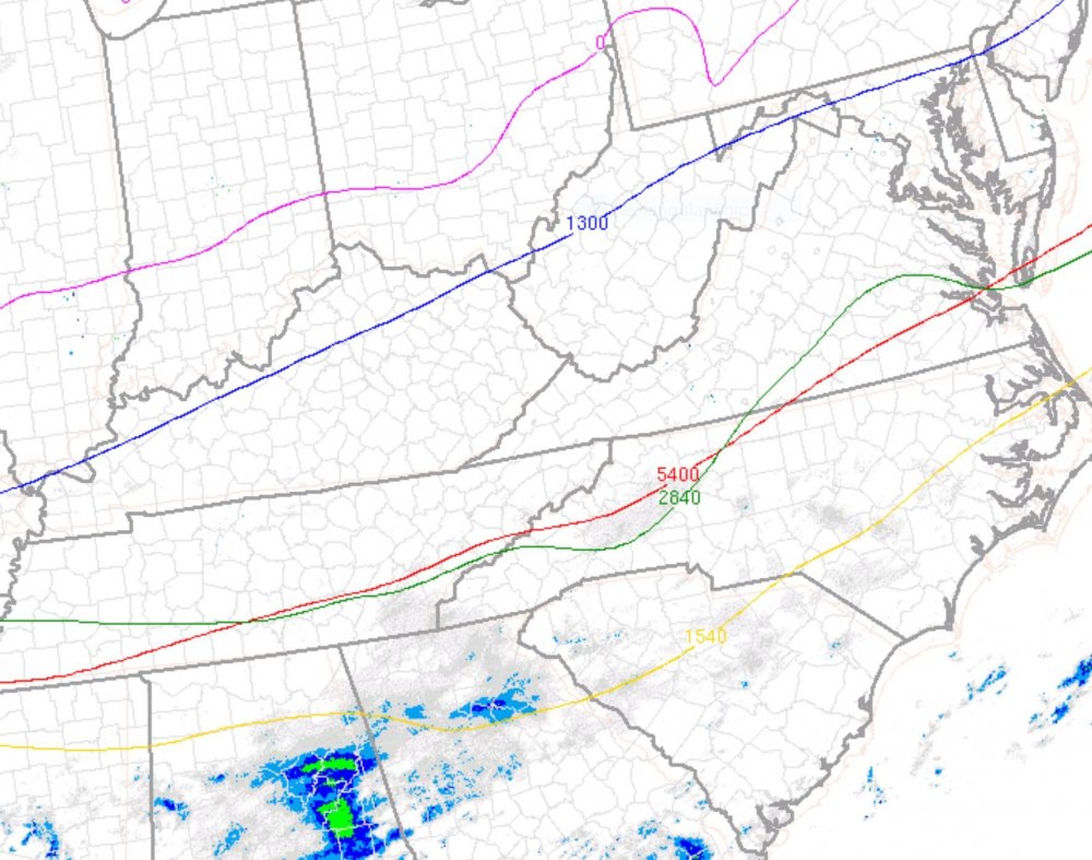
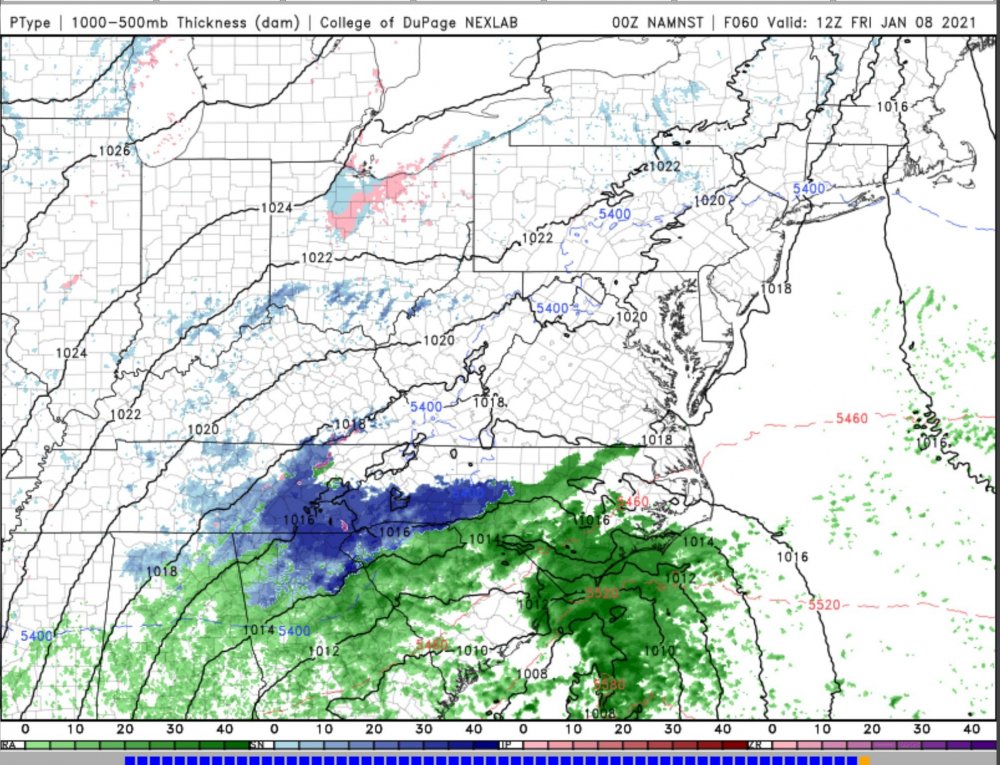
Keep any eye on this next few hours. Critical thickness. It will be interesting to see if the 1000-700 dips some-
-
They have done well in past. Tough forecast
-
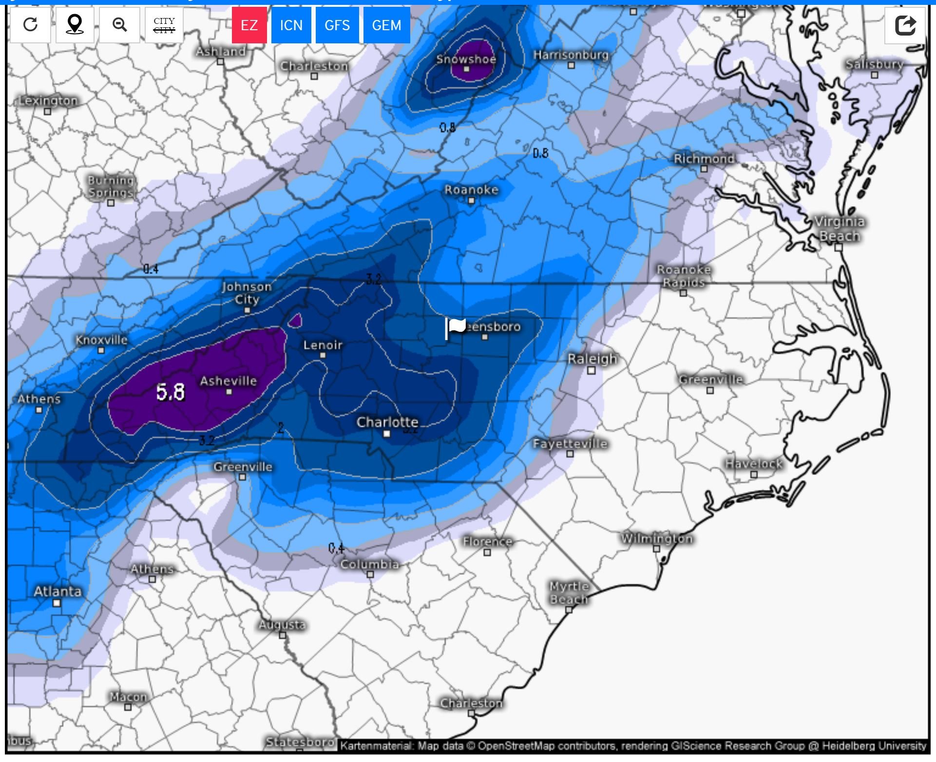
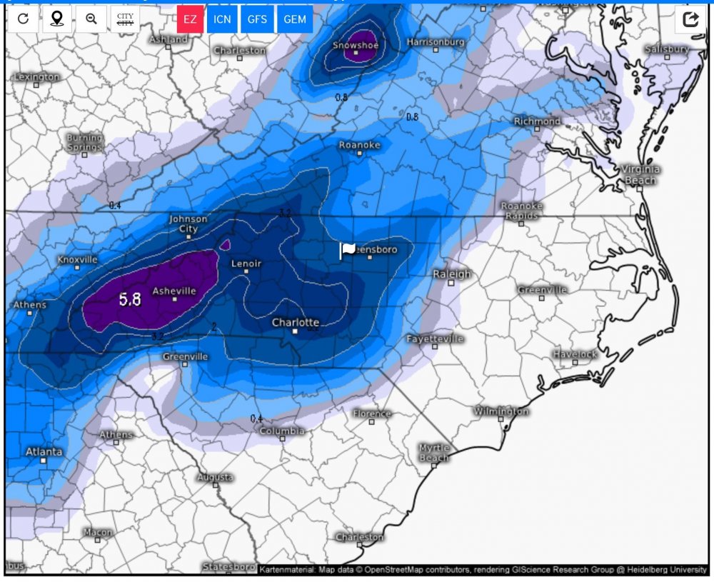
no real changes---maybe a little less in upstate into piedmont areas
-
I agree with your mention of dry slot and any transfer. It will be interesting to see how the upcoming 00Z operational Euro depicts event
-
Sharp gradient with snow and none in Piedmont areas
-
-
Not much with EURO ensembles for central NC--I hate this. We shall see this afternoon. One member (#41)---from 00Z December 20----the most I saw from the 50 members. Most of the others show very little. This #41 will skew the ensemble averages. https://weather.us/model-charts/euro/north-carolina/m50_snow-depth-in/20201227-0600z.html.
-
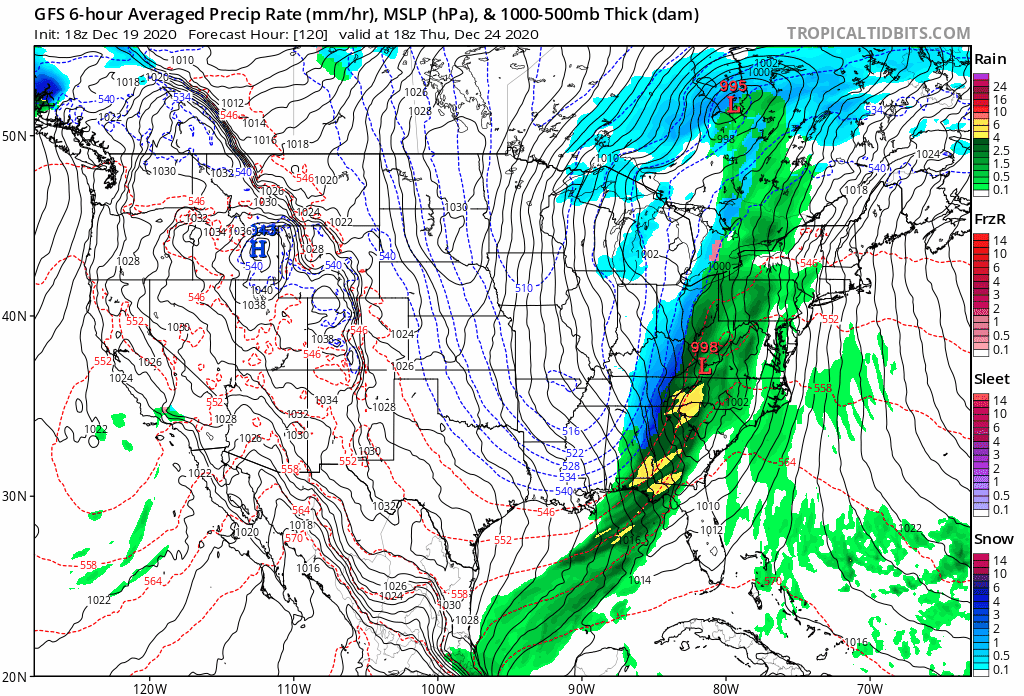
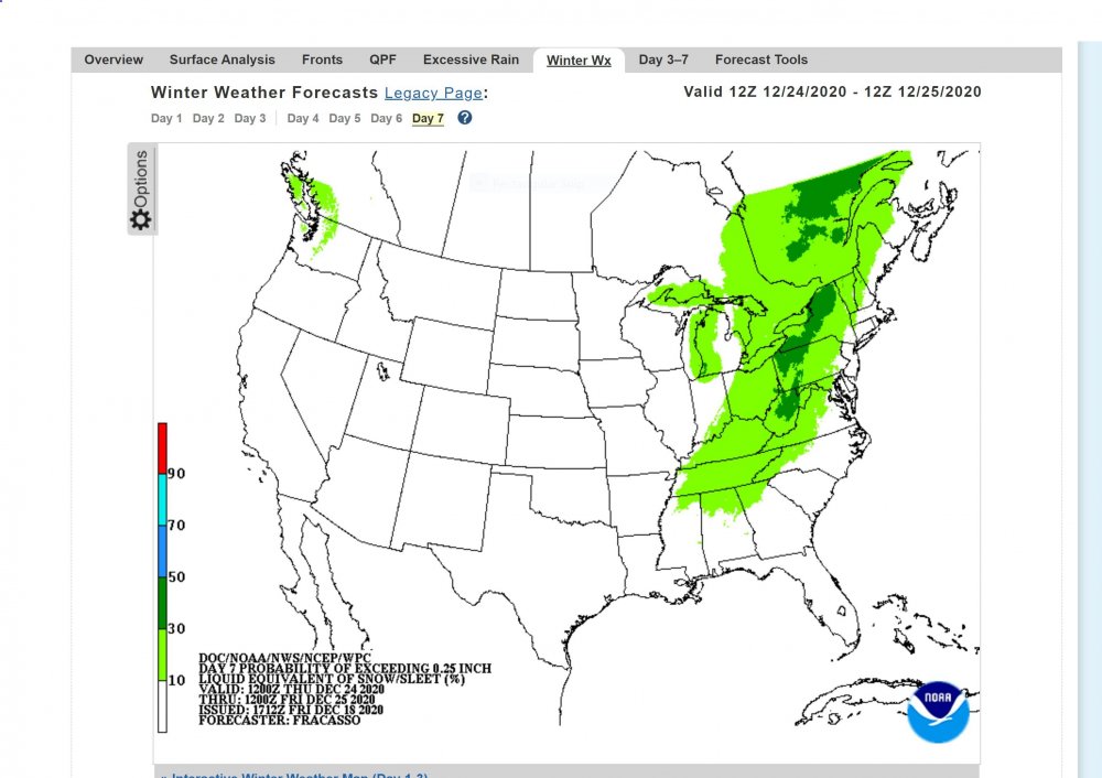
12Z GFS. A no go for snow. The front is a litter faster in pulling thru too. No apparent wave of low pressure

-
This system bears watching, as a wave of low pressure MAY ride along front.
-
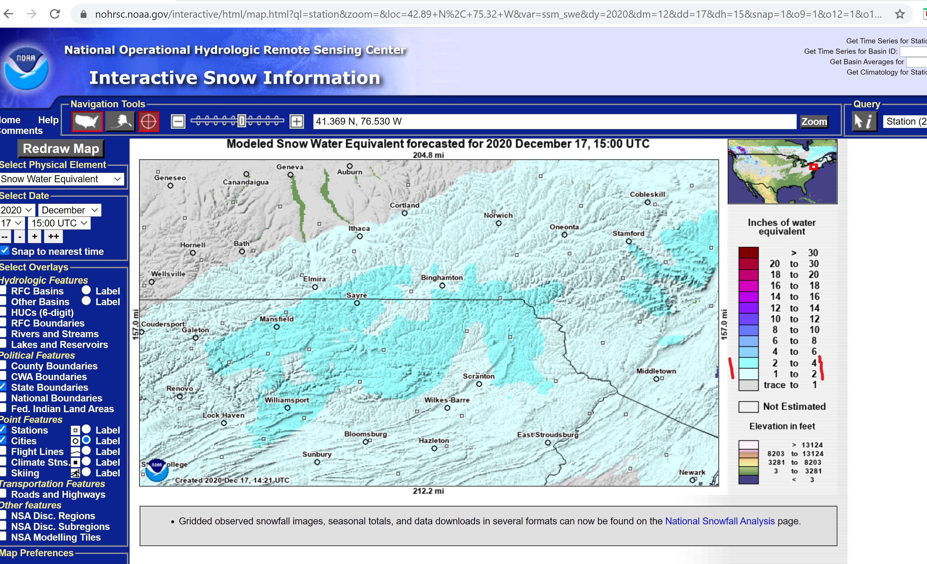
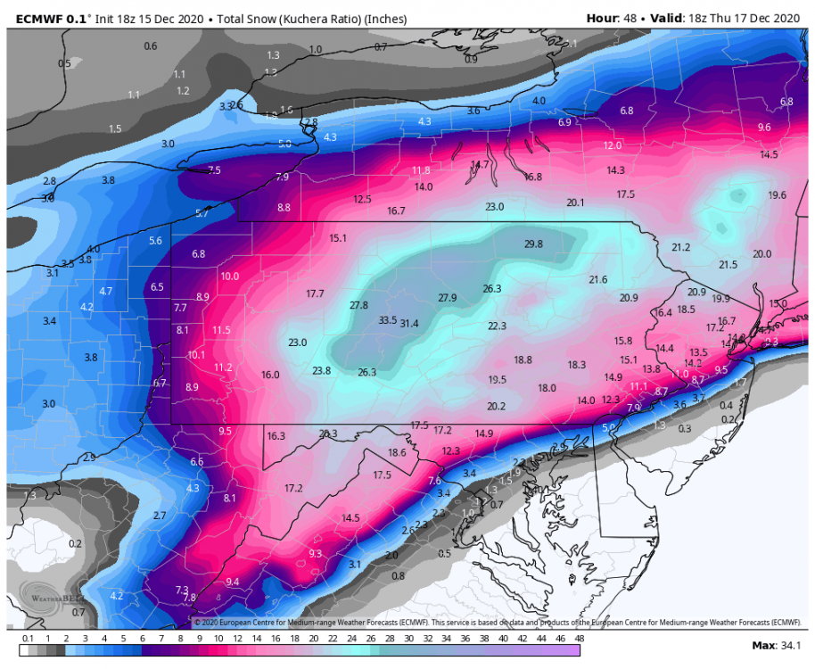
Dec 16-17 Storm OBS Thread
SUNYGRAD replied to BuffaloWeather's topic in Upstate New York/Pennsylvania
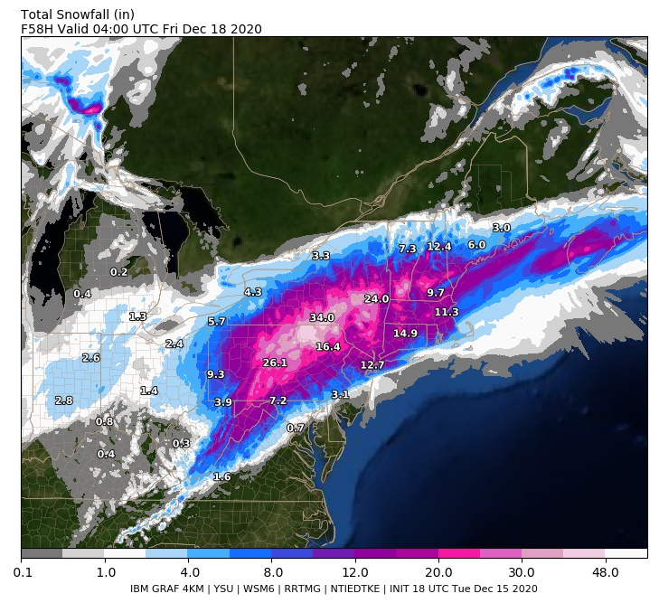
Just my observations, but this model didn't appear to perform that bad at the forecast juncture. I don't know much about it or find information, but perhaps it can and will used?.png.920be015d77d69b5e245b8914957b86c.png)
-
Dec 16-17 Storm OBS Thread
SUNYGRAD replied to BuffaloWeather's topic in Upstate New York/Pennsylvania
-
Dec 16-17 Storm OBS Thread
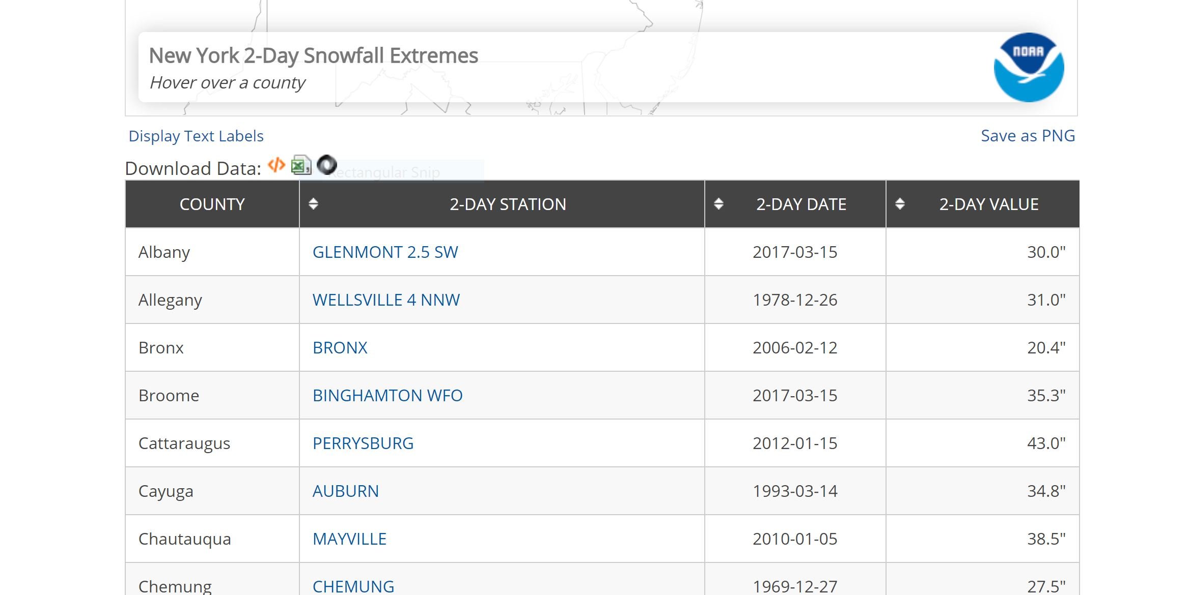
SUNYGRAD replied to BuffaloWeather's topic in Upstate New York/Pennsylvania
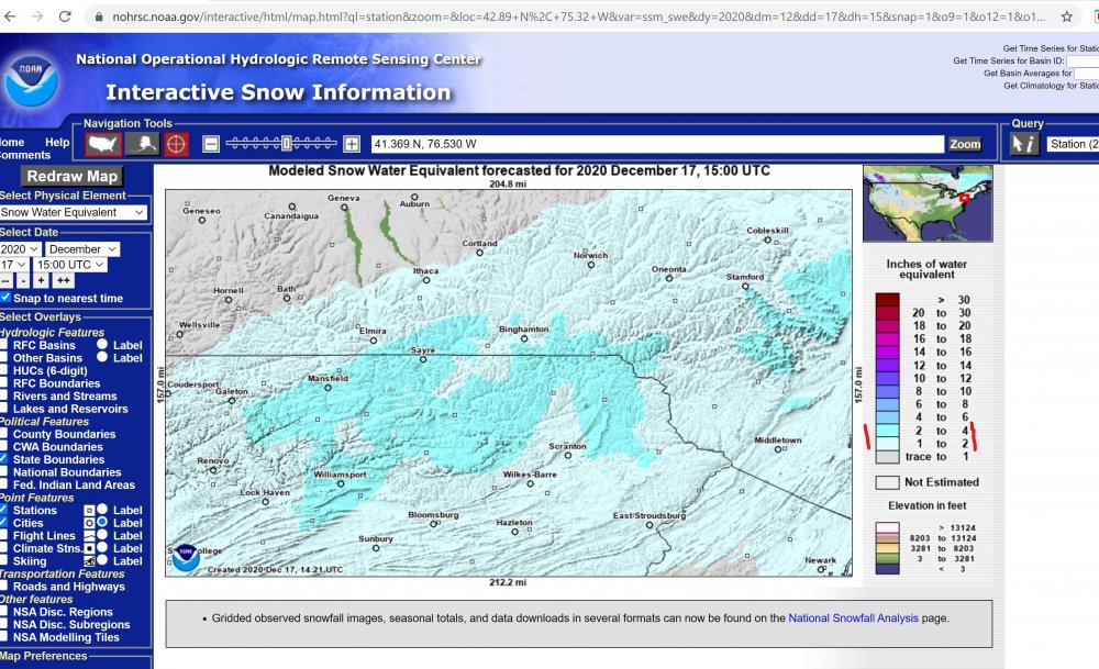
The 24 hour record was also broken. It was 31.3 inches. -
Dec 16-17 Storm OBS Thread
SUNYGRAD replied to BuffaloWeather's topic in Upstate New York/Pennsylvania
Snowfall Extremes | Snow and Ice | National Centers for Environmental Information (NCEI) (noaa.gov). for BGM or Broome county.
-
Dec 16-17 Storm OBS Thread
SUNYGRAD replied to BuffaloWeather's topic in Upstate New York/Pennsylvania
I have family in Endwell and Vestal areas. It is truly remarkable. Unofficial reports of 29-31 inches as of 4:30 am. -
Upstate/Eastern New York
SUNYGRAD replied to BuffaloWeather's topic in Upstate New York/Pennsylvania
-
For you PA folks