SUNYGRAD
-
Posts
57 -
Joined
-
Last visited
About SUNYGRAD

-
1.1 here this morning or right at 2.0 inches total----a few miles south-south-east of Winston Salem
-
Have to use high resolution at moment----look for icon at top of radar page for GSP.
-
Cool image of snow bands pulling thru Piedmont: Sector Images: Southeast - NOAA / NESDIS / STAR. 0.6 inches thus far here near Winston Salem.
-
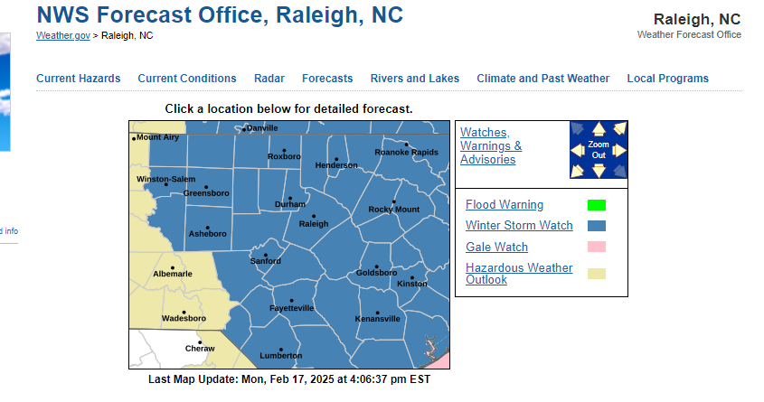
February 19-20 Major Winter Storm Threat
SUNYGRAD replied to NorthHillsWx's topic in Southeastern States

-
February 19-20 Major Winter Storm Threat
SUNYGRAD replied to NorthHillsWx's topic in Southeastern States
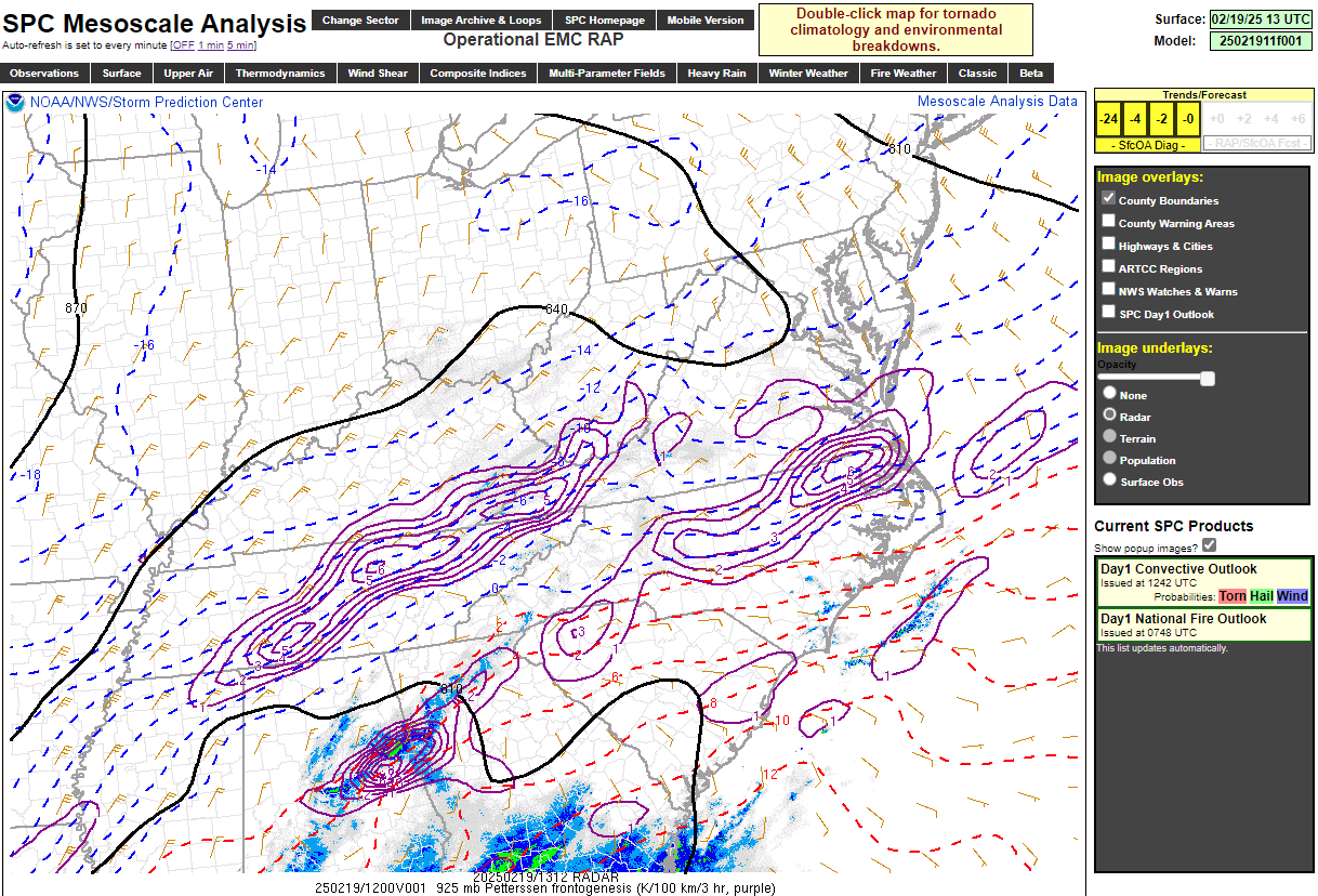
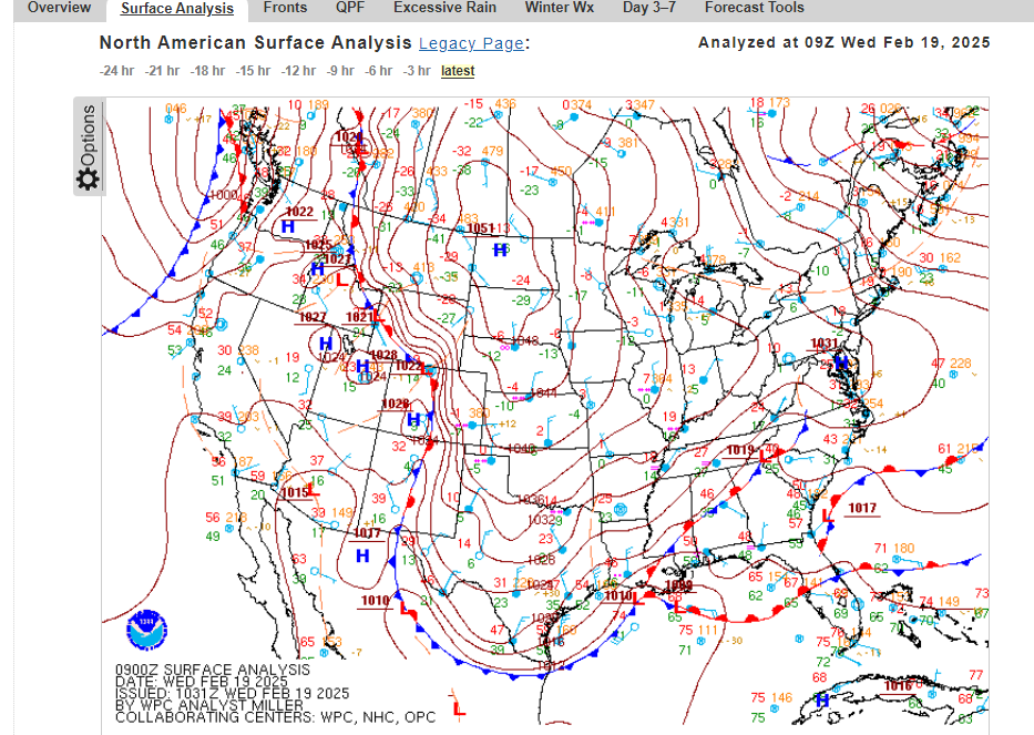
See the FGEN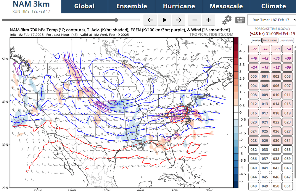
-
February 19-20 Major Winter Storm Threat
SUNYGRAD replied to NorthHillsWx's topic in Southeastern States
-
February 19-20 Major Winter Storm Threat
SUNYGRAD replied to NorthHillsWx's topic in Southeastern States
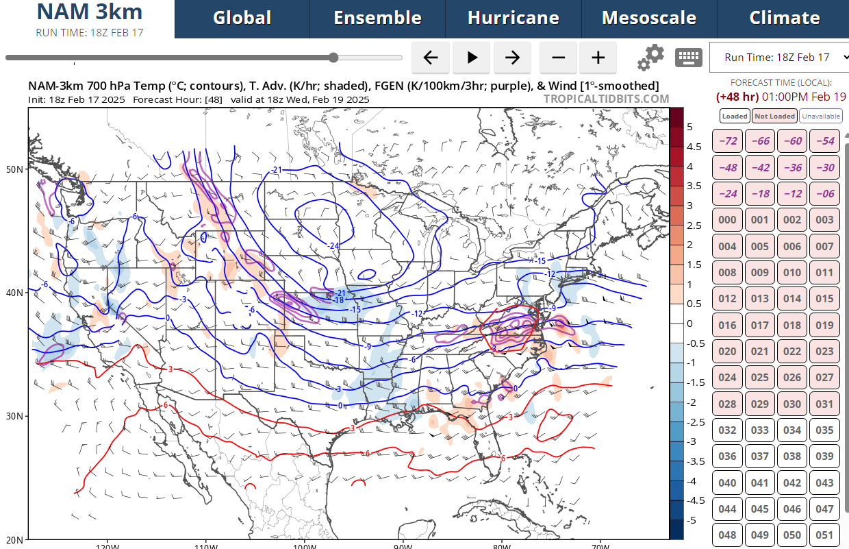
If I recall the 3K NAM did ok with storm in January in most areas, especially with thermal profiles and precip. -
February 19-20 Major Winter Storm Threat
SUNYGRAD replied to NorthHillsWx's topic in Southeastern States
Just a gut feeling that it may pull back west a bit. -
February 19-20 Major Winter Storm Threat
SUNYGRAD replied to NorthHillsWx's topic in Southeastern States
The Ledge storm is pretty amusing (named in Mid Atlantic forum). -
February 19-20 Major Winter Storm Threat
SUNYGRAD replied to NorthHillsWx's topic in Southeastern States
This should help in some confidence with EURO suite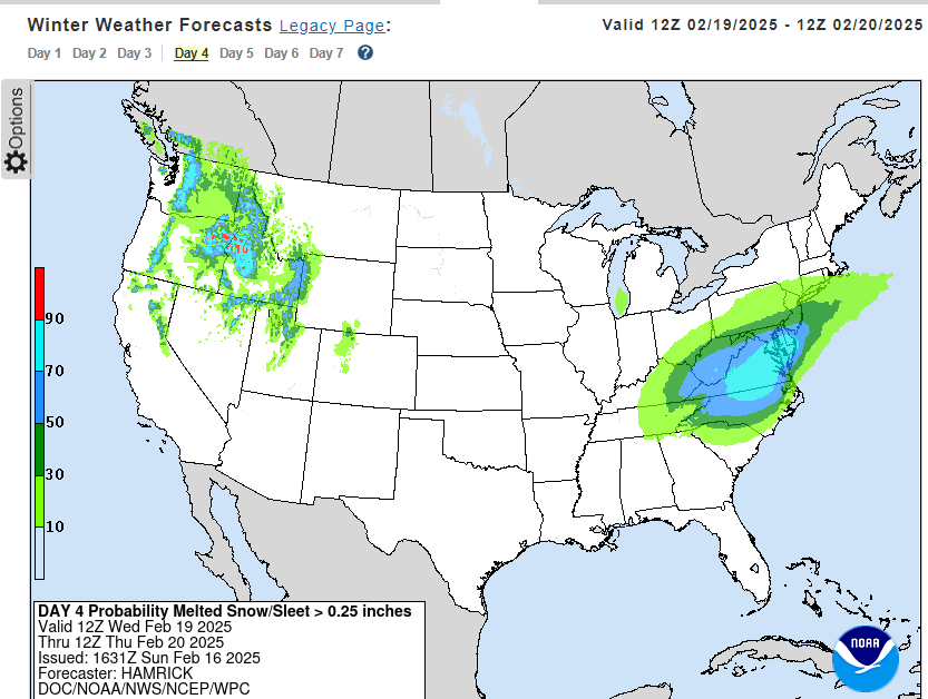
-
What does JB think of potential storm. . "So let this be said: The gauntlet has been thrown down, but the faculty have answered and answered with vigour." For the movie buffs here-
-
Make some happy ---NWS GSP Starting to get reports of snow in the Upper Savannah and Lakelands area as a mesoscale band sets up near the I-20 corridor and gradually lifts north. Heavy snow and sleet being reported within this band. Temperatures have been very cold recently, so most of any wintry precip that falls will accumulate immediately and with the recent development of the snowbank to the south, have decided to increase snowfall amounts for locations along and south of I-85. Still expect the warmnose to punch in later this afternoon into the evening hours and transition most of the precip from snow to sleet/freezing rain for the Piedmont areas. Snowfall rates will run 1"-2" within the aforementioned mesoscale band and will make travel conditions very hazardous. Even with the uptick in snowfall amounts in this area, there is the possibility that amounts could still be overdone depending on how this band of heavy snow plays out.
-
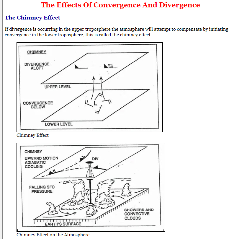
Divergence/Convergence
-
HRRR is a little too warm at surface here in GSO---about two degrees or so.