Dsty2001
-
Posts
376 -
Joined
-
Last visited
Content Type
Profiles
Blogs
Forums
American Weather
Media Demo
Store
Gallery
Everything posted by Dsty2001
-
East TN, SWVA, E KY, and Plateau NW flow obs. Feb 1 - 2
Dsty2001 replied to Holston_River_Rambler's topic in Tennessee Valley
Would anybody like to explain to me what exactly an NW event is? I've heard of them in the past and kind of understand a little, but it'd be cool to get a detailed explanation! -
East TN, SWVA, E KY, and Plateau NW flow obs. Feb 1 - 2
Dsty2001 replied to Holston_River_Rambler's topic in Tennessee Valley
Insane the mountain areas are expecting over a foot with the valley not looking like much, yeah yeah I know elevation lol -
I think that's the band that's moving through here right now, very heavy but also small flakes
-
Jan 11-12 Mississippi Mauler: Will it or won't it?
Dsty2001 replied to John1122's topic in Tennessee Valley
Future radar keeps pushing back the time to transition to rain. Earlier it was showing a transition imby around 930, it's still snowing lol -
January 7 - 8 ULL obs and nowcast
Dsty2001 replied to Holston_River_Rambler's topic in Tennessee Valley
Gotta say that was pretty wild. Watched out the door for a good five minutes and watched it go from a mix to heavy fat flakes. Still some rain mixed in but I don't believe it will be for much longer. -
January 7 - 8 ULL obs and nowcast
Dsty2001 replied to Holston_River_Rambler's topic in Tennessee Valley
Still rain snow mix in Greeneville, starting to see some fat flakes mixed in so I'm hoping it'll be soon -
January 7 - 8 ULL obs and nowcast
Dsty2001 replied to Holston_River_Rambler's topic in Tennessee Valley
Rain/Snow mix in Greeneville currently -
Anybody got some of the latest runs?
-
January 7 - 8 ULL obs and nowcast
Dsty2001 replied to Holston_River_Rambler's topic in Tennessee Valley
This really isn't supposed to start in the Eastern areas till around 12am-2am correct? -
January 7 - 8 ULL obs and nowcast
Dsty2001 replied to Holston_River_Rambler's topic in Tennessee Valley
Looks like the snow has reached the mountains but looks like it is pivoting back towards the Tri Cities -
Virga this early is a good thing though cause it will help cool the atmosphere, correct?
-
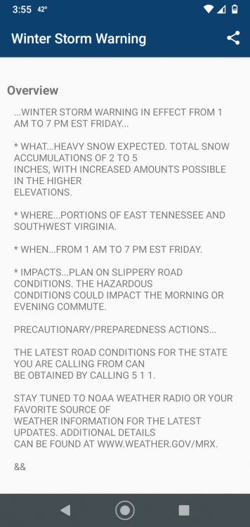
This just popped on my phone
-
MRX does their typical play it conservative thing. Not sure that is a good idea in this situation
-
Yeah, I might be wrong here but isn't the GFS sorta crappy with dynamic driven systems like this?
-
I feel like this is a reoccurring theme this winter for the temperatures to be lower than forecast.
-
Lock it in
-
MRX has a tough call on this one, while I normally give them a lot of crap I can see why they are gunshy about this one. Has the potential to bust both ways
-
God I wish they had some chains hahaha
-
I dont typically make these posts but when is the timing of this supposed to start? Wife and her sis is in Gatlinburg till Friday and don't want them getting stuck if it comes to fruition
-
Christmas Eve/Christmas 2020 Arctic Express Snow Obs.
Dsty2001 replied to John1122's topic in Tennessee Valley
We have one coming through right now that's probably dropped a half inch in just 20 minutes, very heavy band -
Christmas Eve/Christmas 2020 Arctic Express Snow Obs.
Dsty2001 replied to John1122's topic in Tennessee Valley
Friend in Morristown posted a video, it's snowing insanely hard right now -
Christmas Eve/Christmas 2020 Arctic Express Snow Obs.
Dsty2001 replied to John1122's topic in Tennessee Valley
Um wow
-
Christmas Eve/Christmas 2020 Arctic Express Snow Obs.
Dsty2001 replied to John1122's topic in Tennessee Valley
Want to say though, this is probably the best event I've witnessed since being back in Tennessee since 2018. Haven't seen snow this heavy in a while and the fact we are going to wake up to a white Christmas is a beautiful thing for a lot of people. Here's hoping the rest of the winter is as generous -
Christmas Eve/Christmas 2020 Arctic Express Snow Obs.
Dsty2001 replied to John1122's topic in Tennessee Valley
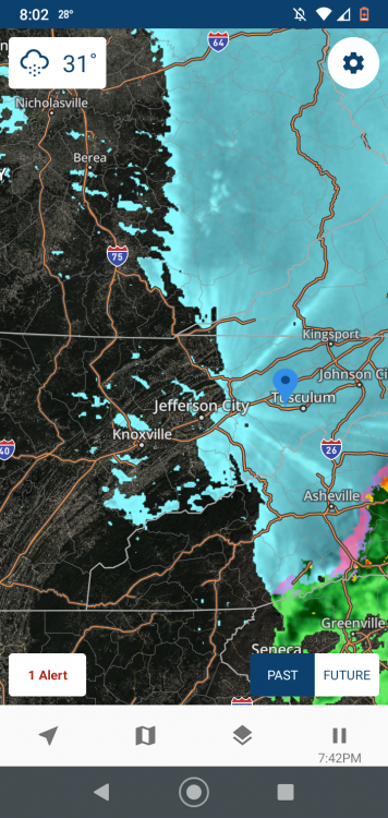
Not sure how accurate WJHL's future radar is but it's showing another band of snow moving through soon. Looking at current radar, wouldn't be surprised -
Christmas Eve/Christmas 2020 Arctic Express Snow Obs.
Dsty2001 replied to John1122's topic in Tennessee Valley
Not sure how accurate but snow showers look to be developing back towards knoxville