PaulyFromPlattsburgh
-
Posts
532 -
Joined
-
Last visited
Content Type
Profiles
Blogs
Forums
American Weather
Media Demo
Store
Gallery
Everything posted by PaulyFromPlattsburgh
-
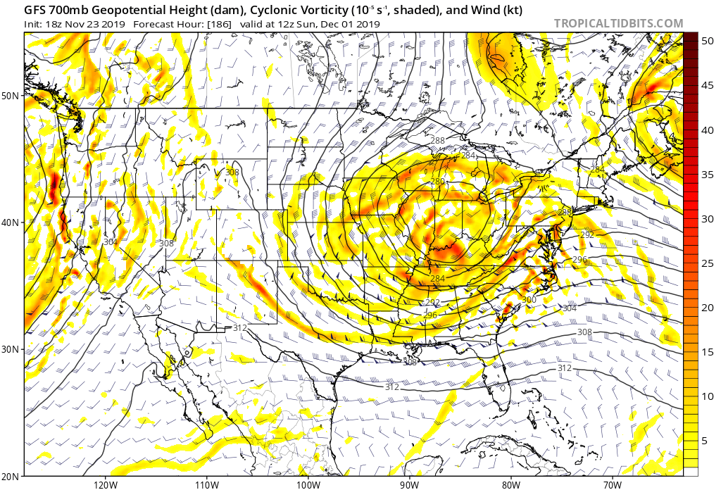
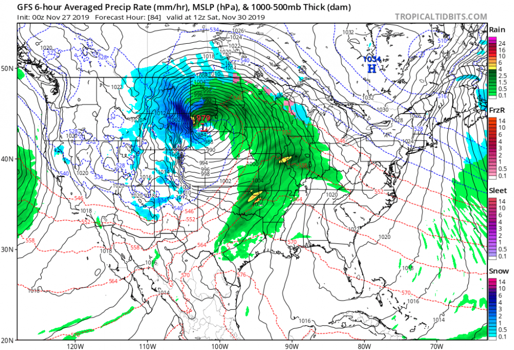
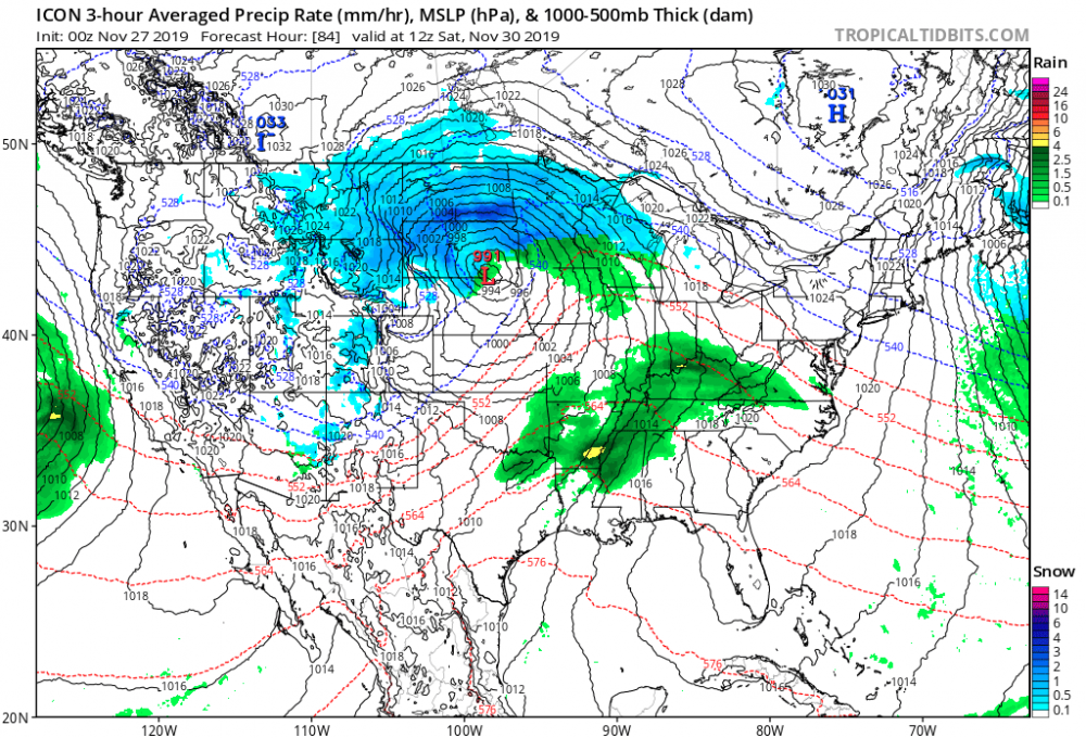
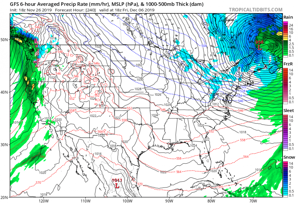
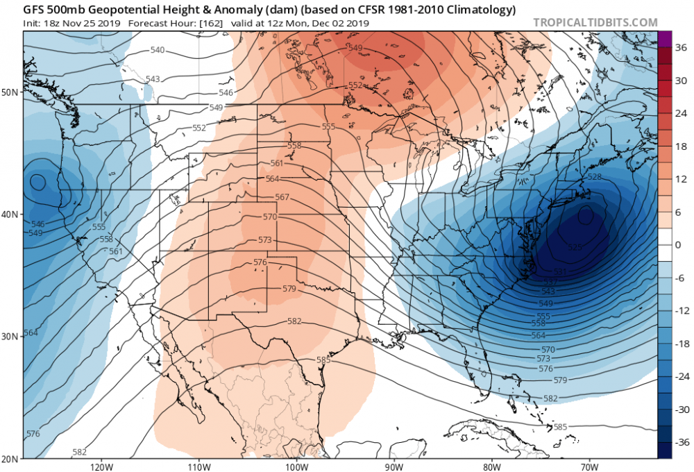
THE GFS is really amping that low wow! Then sort of occluded the low and starts the transition to the secondary real early Compared to icon same frame
-
Upstate/Eastern New York
PaulyFromPlattsburgh replied to BuffaloWeather's topic in Upstate New York/Pennsylvania
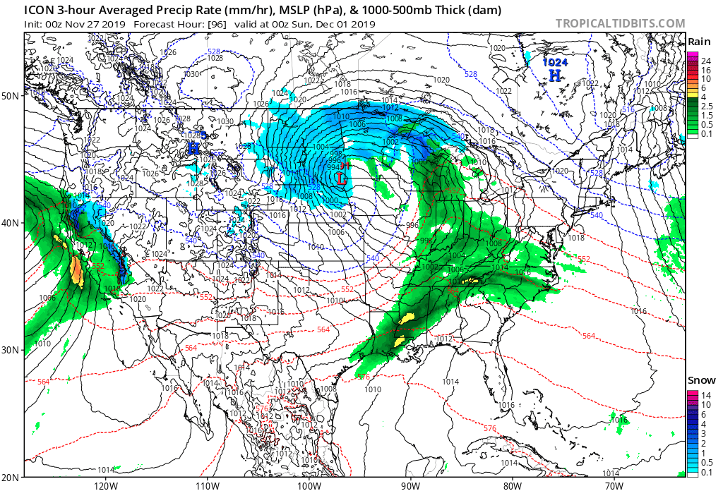
ICON a good bit north through 102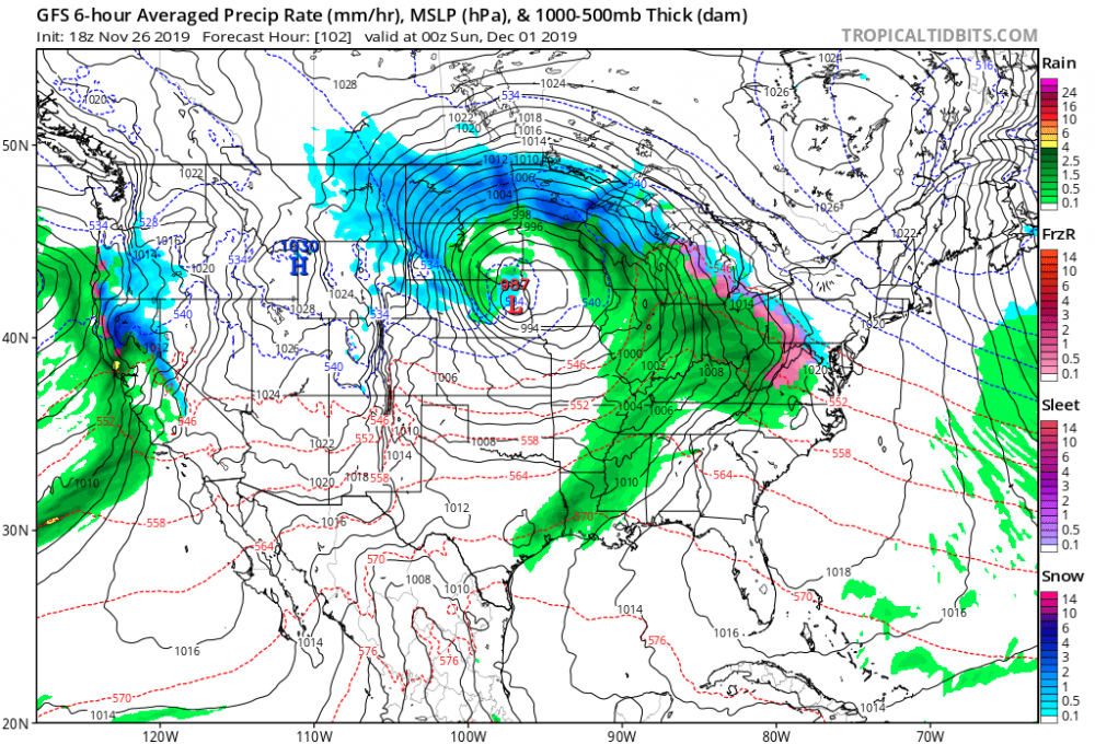

-
ICON a good bit north through 102


-
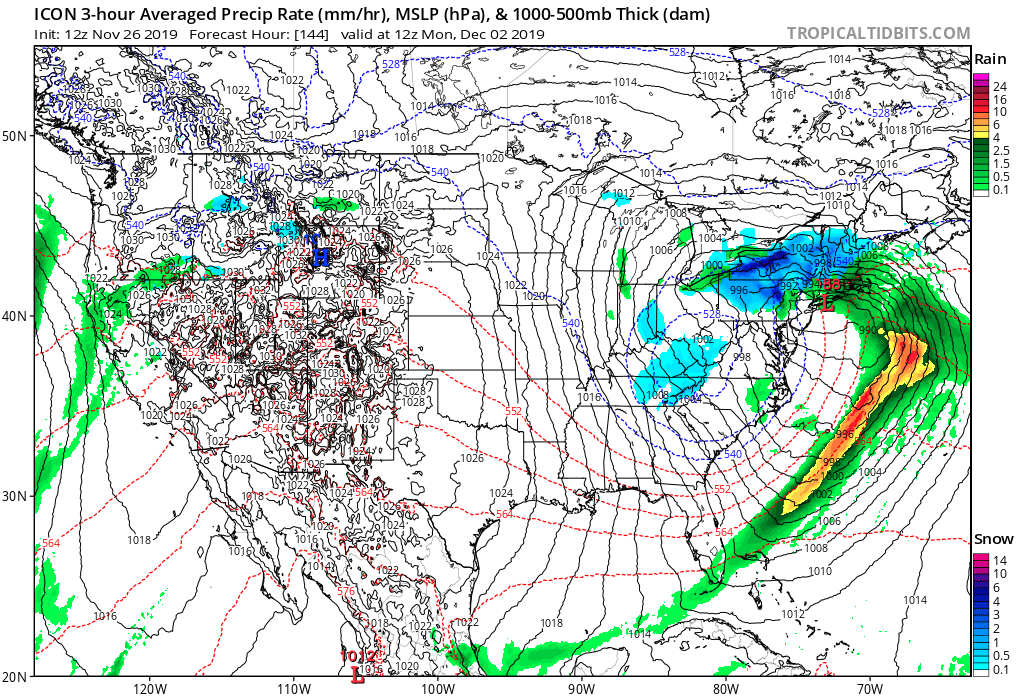
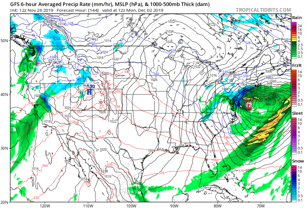
The second one behind it is a beauty also!! Um just amazing! 956 low in Maine

-
Upstate/Eastern New York
PaulyFromPlattsburgh replied to BuffaloWeather's topic in Upstate New York/Pennsylvania
It’s a block for sure. Transient or not. The definition is Meteorologists refer to a 'blocking' high when a large area of high pressure becomes stationary, resulting in the blocking or redirection of low pressure systems. -
Upstate/Eastern New York
PaulyFromPlattsburgh replied to BuffaloWeather's topic in Upstate New York/Pennsylvania
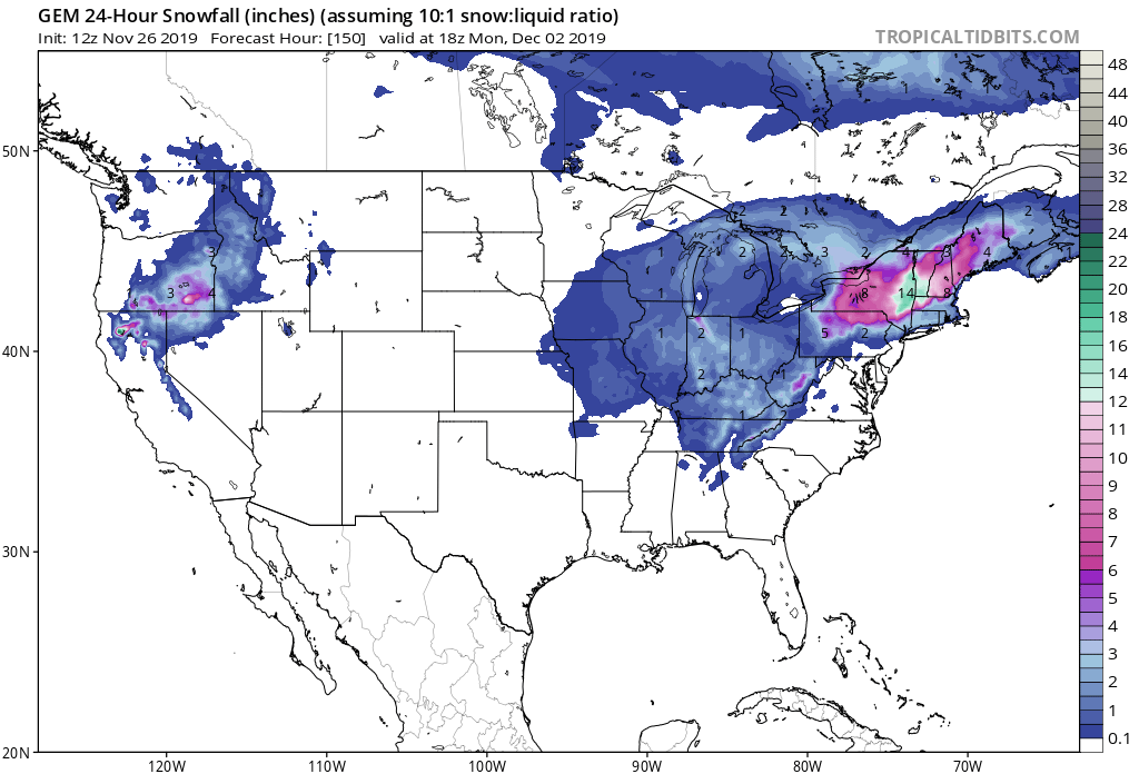
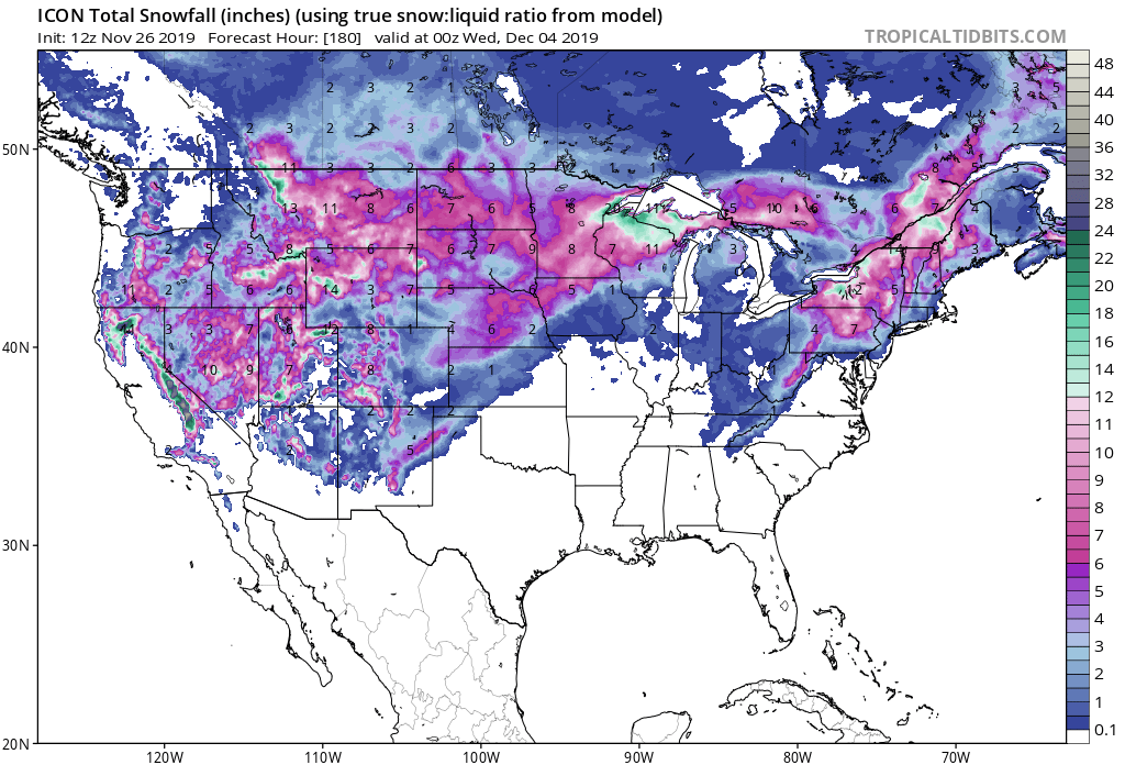
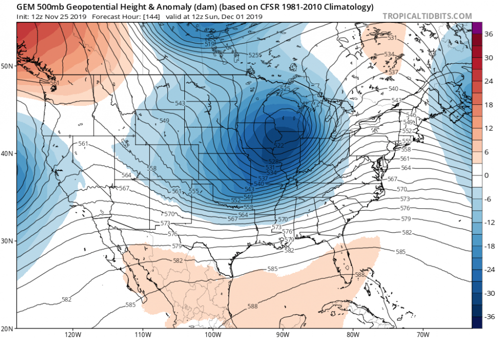
GEM crushes central NY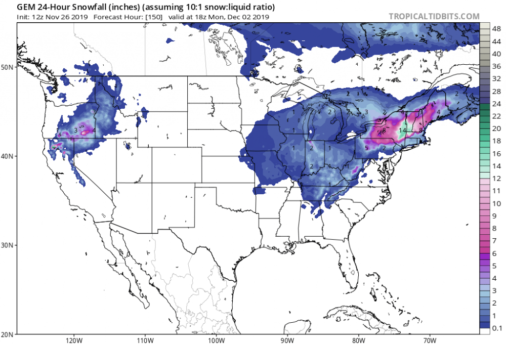
-
Weenie run
-
Upstate/Eastern New York
PaulyFromPlattsburgh replied to BuffaloWeather's topic in Upstate New York/Pennsylvania
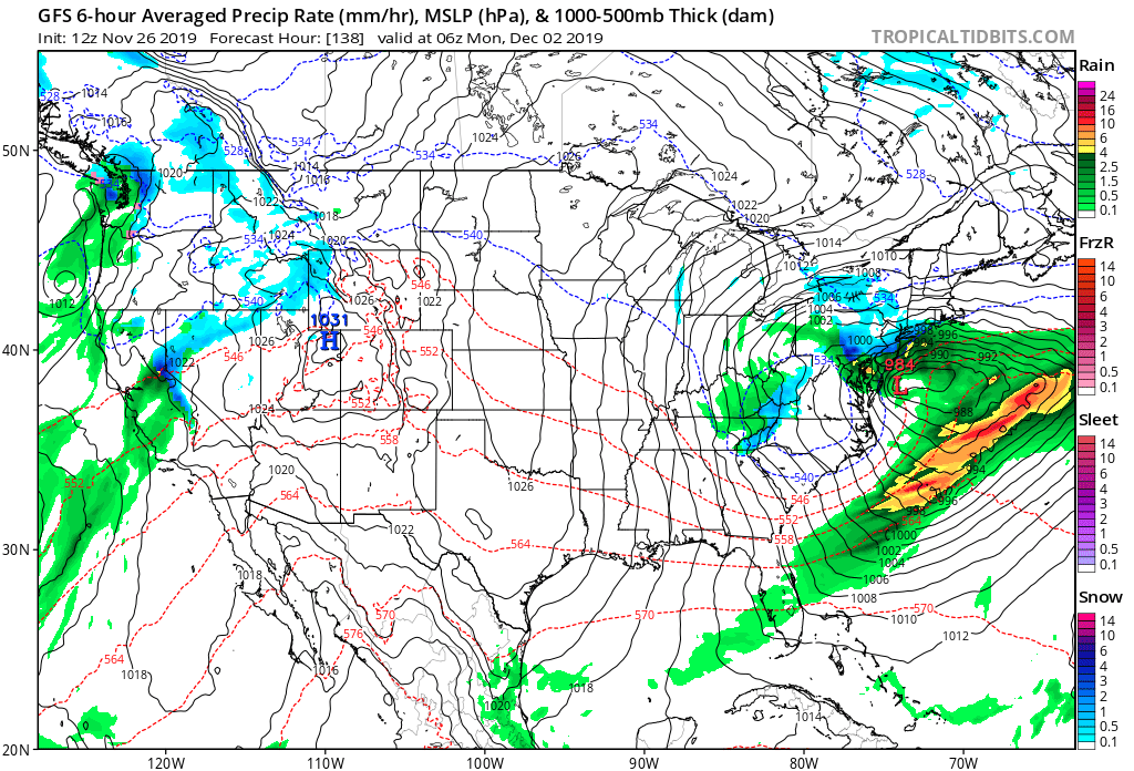
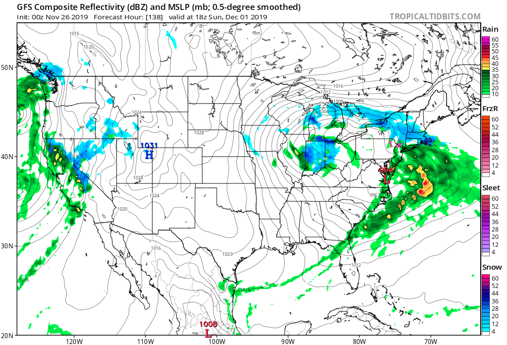
Storm is off the Delmarva on this run. That dynamic cooling is indicative of a very strong deepening system. Gonna be a crusher run for coastal areas on this run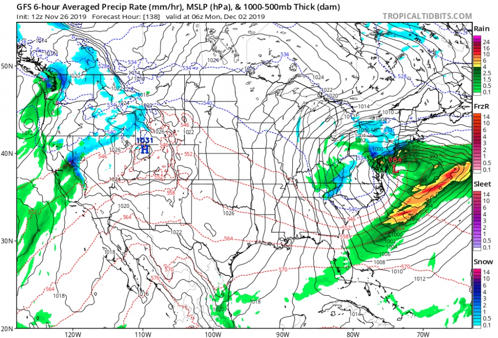
-
Upstate/Eastern New York
PaulyFromPlattsburgh replied to BuffaloWeather's topic in Upstate New York/Pennsylvania
Edit: wolfie beat me too it but regardless You western NY folks will weenie the IcOn


-
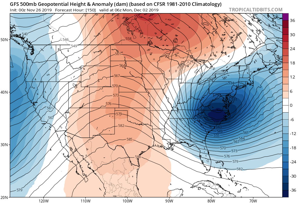
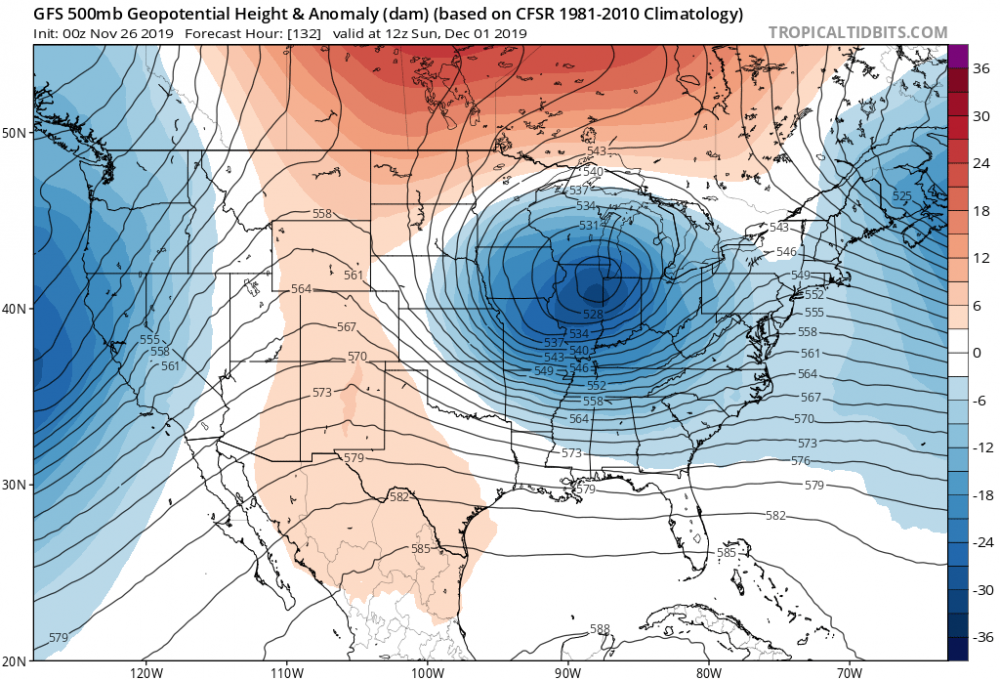
Not only weaker but major suppression. Heights crashing out ahead and baroclinic zone forcing Southeast with strong confluence and nothing to force this bad boy to go negative. The 00z goofus was for the fishies. Enjoy


-
I would have to disagree. With the heights crashing like that and the baroclonic zone pushed off to the SE. also it never goes negative. Until it’s off the coast at least
-
Upstate/Eastern New York
PaulyFromPlattsburgh replied to BuffaloWeather's topic in Upstate New York/Pennsylvania
Suppression city on new GfS
-
Suppression city on the new GFS

-
Run to run consistency on GFS is impressive

-
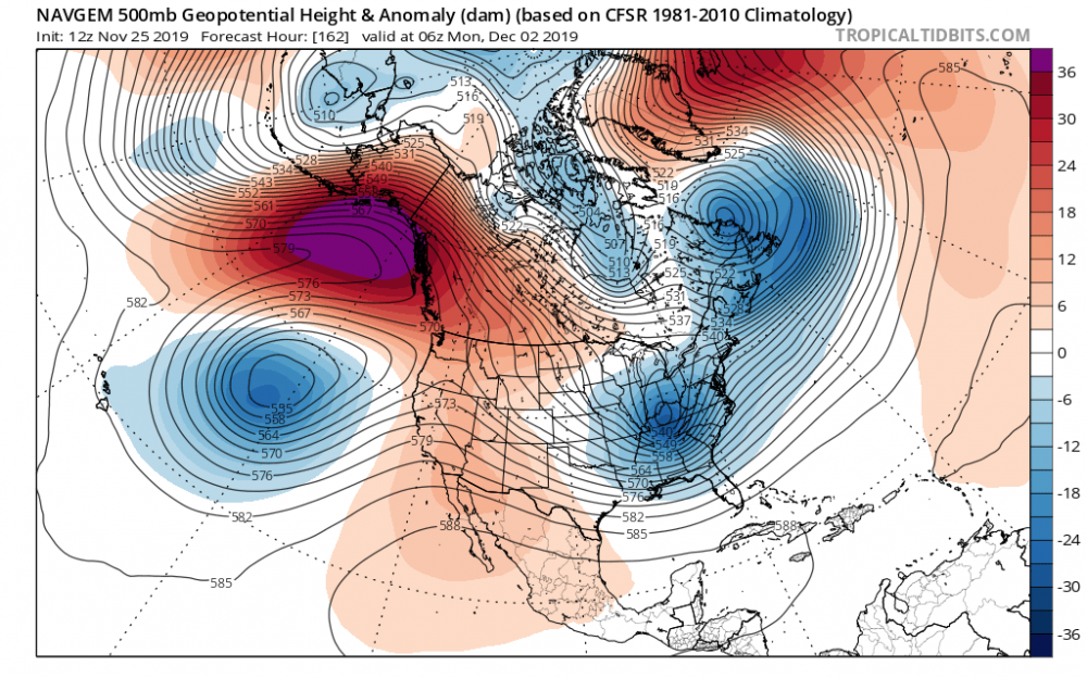
NAVGEM has a similar look. With that strong ridge in alaska
-
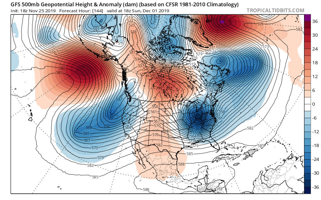
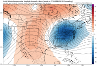
Man this omega block looks beautiful.

-
November 2019 General Discussions & Observations Thread
PaulyFromPlattsburgh replied to Rtd208's topic in New York City Metro
The differences aloft are drastic. GFS seems like the favored solution based on telleconnections. Storm has nowhere to go but south on the GFS. Cold too
-
The storm has nowhere to go but south on the GFS.

-
Upstate/Eastern New York
PaulyFromPlattsburgh replied to BuffaloWeather's topic in Upstate New York/Pennsylvania
Interesting and drastic differences in the upper air patttern. One finds a weakness and the other doesn’t. I would say GFS is favored solution based on the rapidly rising AO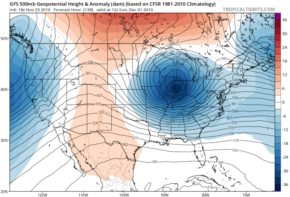
-
Drastic differences aloft between the models. One finds a weakness and the other doesn’t. Telleconnections would agree with the GfS


-
Upstate/Eastern New York
PaulyFromPlattsburgh replied to BuffaloWeather's topic in Upstate New York/Pennsylvania
Nice omega block.
-
Upstate/Eastern New York
PaulyFromPlattsburgh replied to BuffaloWeather's topic in Upstate New York/Pennsylvania
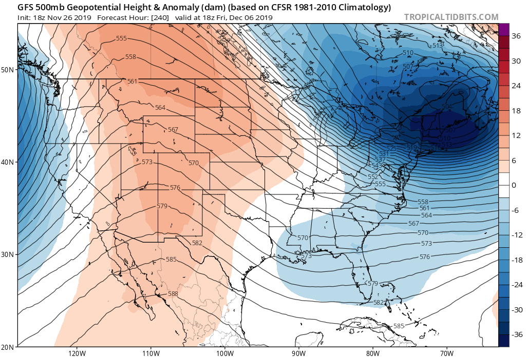
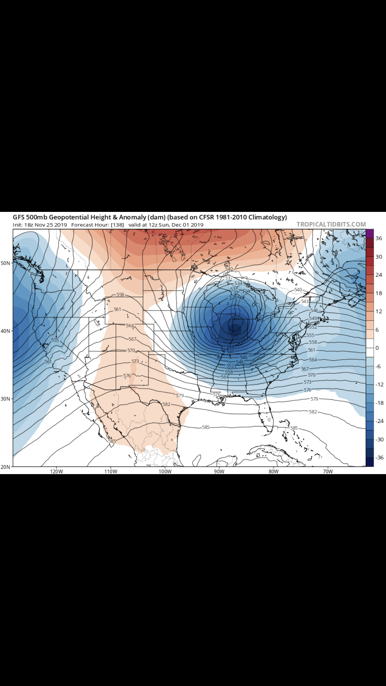
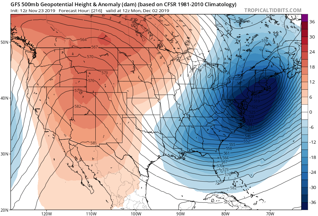
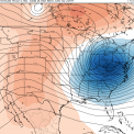
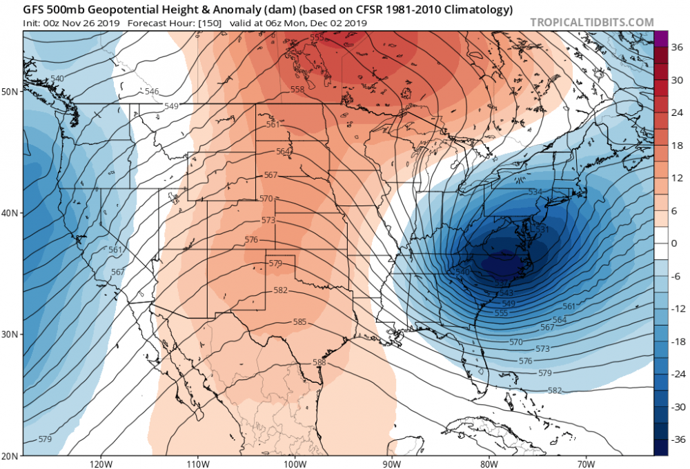
Yes these bowling ball cut off lows are notorious for causing chaotic weather from west to east throughout the country. Do you happen to know what month that was? Just look at this 500mb for the long range .This is a great look for early winter.
-
Upstate/Eastern New York
PaulyFromPlattsburgh replied to BuffaloWeather's topic in Upstate New York/Pennsylvania
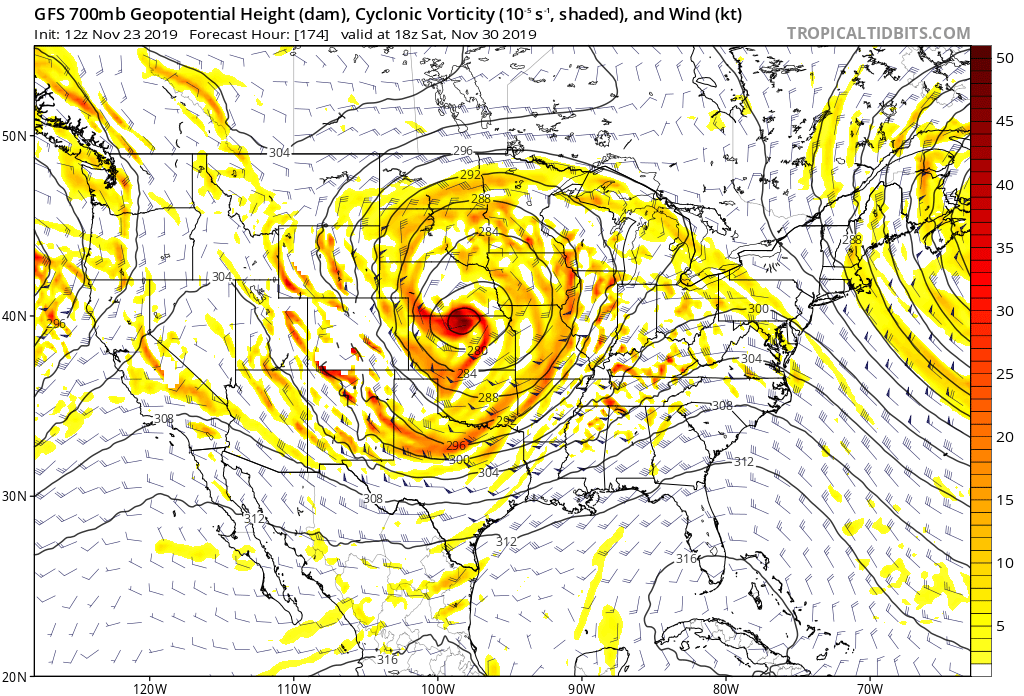
Bowling ball . Just look at the 700mb Vort. What a beauty. Quadruple closed off low barreling through middle of the country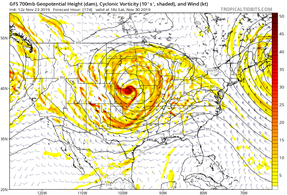
-
Upstate/Eastern New York
PaulyFromPlattsburgh replied to BuffaloWeather's topic in Upstate New York/Pennsylvania
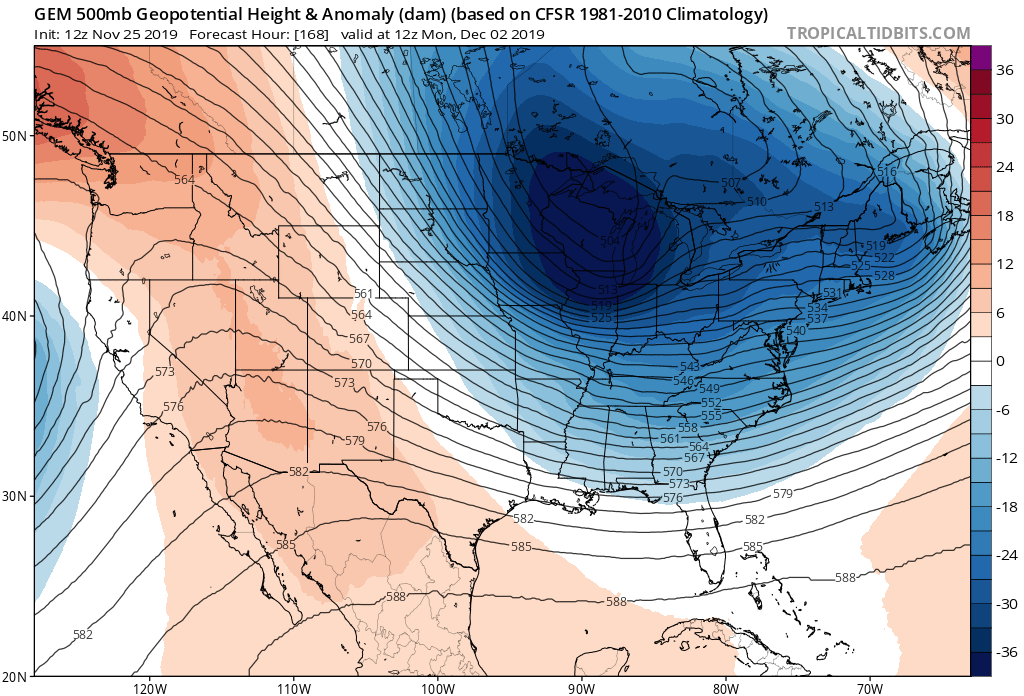
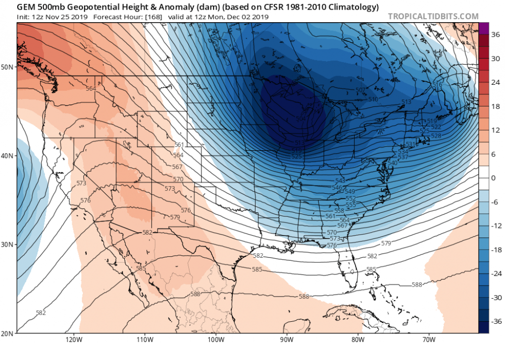
And the RGEM is even more amped. Another step
-
Upstate/Eastern New York
PaulyFromPlattsburgh replied to BuffaloWeather's topic in Upstate New York/Pennsylvania
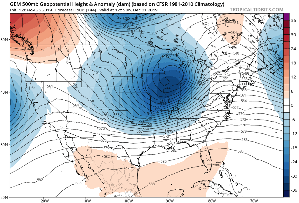
That is a strong system. I would keep eyes on this one sub 990 low in that spot would certainly produce colder air and more precipitation on the west side, especially if the primary hangs on longer. This looks like a quicker and complete transfer on this run. The 06z not so much. Better trends so far IMO