Gino27
-
Posts
550 -
Joined
-
Last visited
Content Type
Profiles
Blogs
Forums
American Weather
Media Demo
Store
Gallery
Everything posted by Gino27
-
not dead yet

-
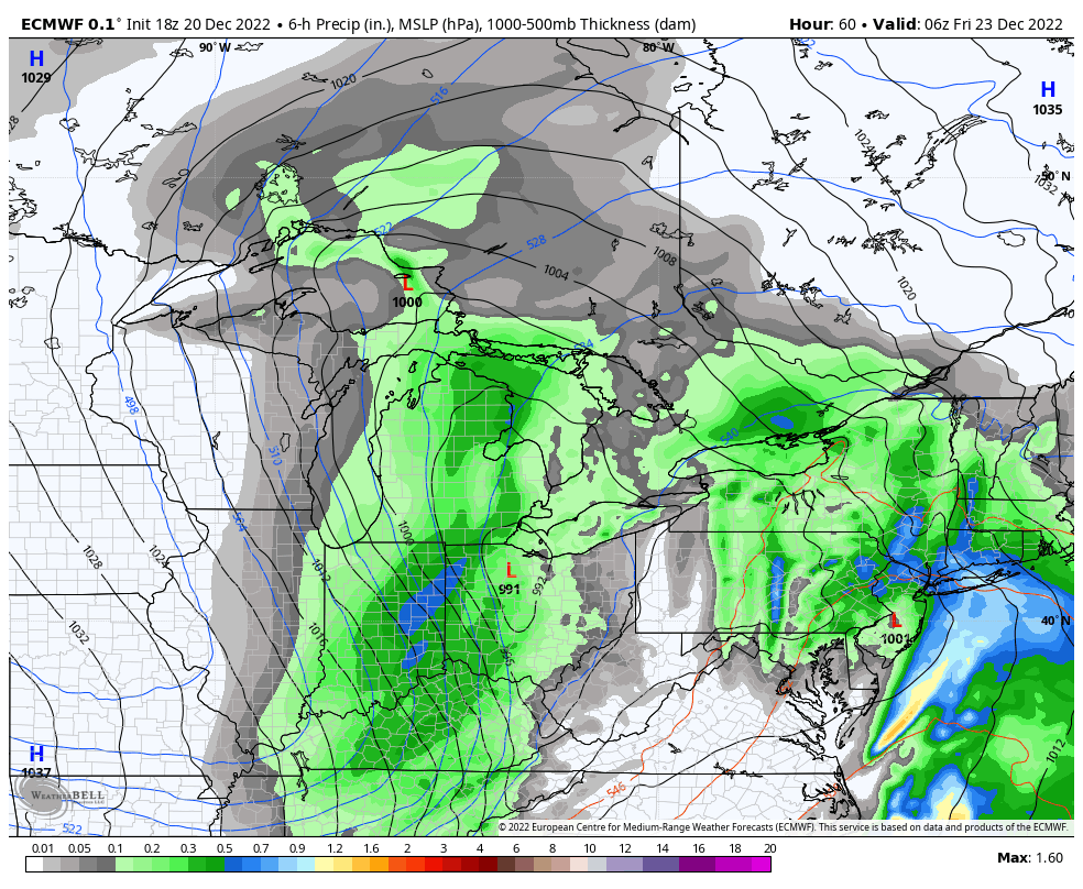
Watch for counties north and west of Columbus and Dayton. Only mentions 2" of accumulation
-
Still time to improve, but yeah not a great look
-
Pre-Christmas (Dec 21-23rd) Winter Storm
Gino27 replied to Chicago Storm's topic in Lakes/Ohio Valley
Yikes... not a good look at all for central OH -
Weaker/progressive trends continue. Not really overly impressive look anymore, but still impactful.
-
Still very much in the game. Wonder if windshield wiper effect takes this back west tomorrow.
-
Pre-Christmas (Dec 21-23rd) Winter Storm
Gino27 replied to Chicago Storm's topic in Lakes/Ohio Valley
I can guarantee I'll be in one of those pockets with significantly less than everyone else -
Pre-Christmas (Dec 21-23rd) Winter Storm
Gino27 replied to Chicago Storm's topic in Lakes/Ohio Valley
Looks like a real screw over for my area if the GFS gets it's way. Cold comes in too late for changeover, and the backside falls apart. -
GFS takes a big jump to the NE. The east trend we are probably rooting for might actually be the worst case scenario if we don't get a favorable axis on the trowel with the low too far north. Then we're limited on our backside potential.
-
Pre-Christmas (Dec 21-23rd) Winter Storm
Gino27 replied to Chicago Storm's topic in Lakes/Ohio Valley
rest in peace -
From the synopsis’ I’ve read. They mostly gave up on measuring because the drifting was so bad that there was no accurate way to measure even with averaging.
-
A lot of mets are thinking the same thing. If it trends SE and keeps the same strength...watch out
-
Pre-Christmas (Dec 21-23rd) Winter Storm
Gino27 replied to Chicago Storm's topic in Lakes/Ohio Valley
This is so close to being a huge hit for a lot of us on this board. Would be nice for Columbus to break it's streak of no storms over 6" dating back 2015. -
Well to be fair, climo does not support a storm bombing out over Indianapolis by any means so the result would likely be a bit east. Regardless a pretty good hit on euro, although likely overdone. Will be very impactful no matter the outcome.

-
GEFS is pretty much exactly what we want to see at this range. Tons of moving parts and climo tells me this can’t go too much further west than overnight euro and gfs had it.
-
Even the worst wind shear isn't going to be worse than 10:1. Still hurts our chances of seeing super efficient ratios though.
-
Pre-Christmas (Dec 21-23rd) Winter Storm
Gino27 replied to Chicago Storm's topic in Lakes/Ohio Valley
wow -
I think we could get a lot more than 2-3 inches even with the current track. Ratios will be extremely efficient and an occluded low in that position can pull from Lake Michigan.
-
I’ve got to assume GFS will keep going west and end up in line with other guidance. Question will be whether it’s windshield wiper effect over the next 3-5 days or if this thing goes west enough to be a Rainer for us.
-
Nice
-
Not sure pattern supports it, but the latest trends with PNA and NAO could bring it more west like that.
-
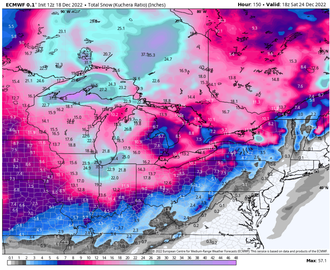
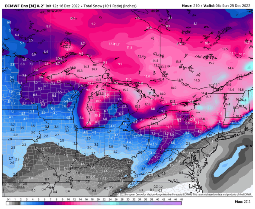
Even with the worst solutions being CMC and ICON, we would still pull a white Christmas out of those. Really hoping we're still tracking this thing under 100 hours.
-
Big difference with the GFS and Euro is that the Euro has a coastal low which doesn't let the wave dig from the NW, therefore we are warm and rainy
-
I'm not giving that threat any attention for a few days
-
There's something of a signal around the 19-20th, but suppression just rips it apart.