Gino27
-
Posts
550 -
Joined
-
Last visited
Content Type
Profiles
Blogs
Forums
American Weather
Media Demo
Store
Gallery
Everything posted by Gino27
-
I 100% agree. Twitter seems to really be down on it too. It's still a blob out on the middle of the ocean.
-
There's some nice things to like about it, mostly the very very cold air it has to work with. I worry it'll be too fast and a bit too warm. Hopefully we can get the trough to go negative a bit earlier like models had, and might be trending to.
-
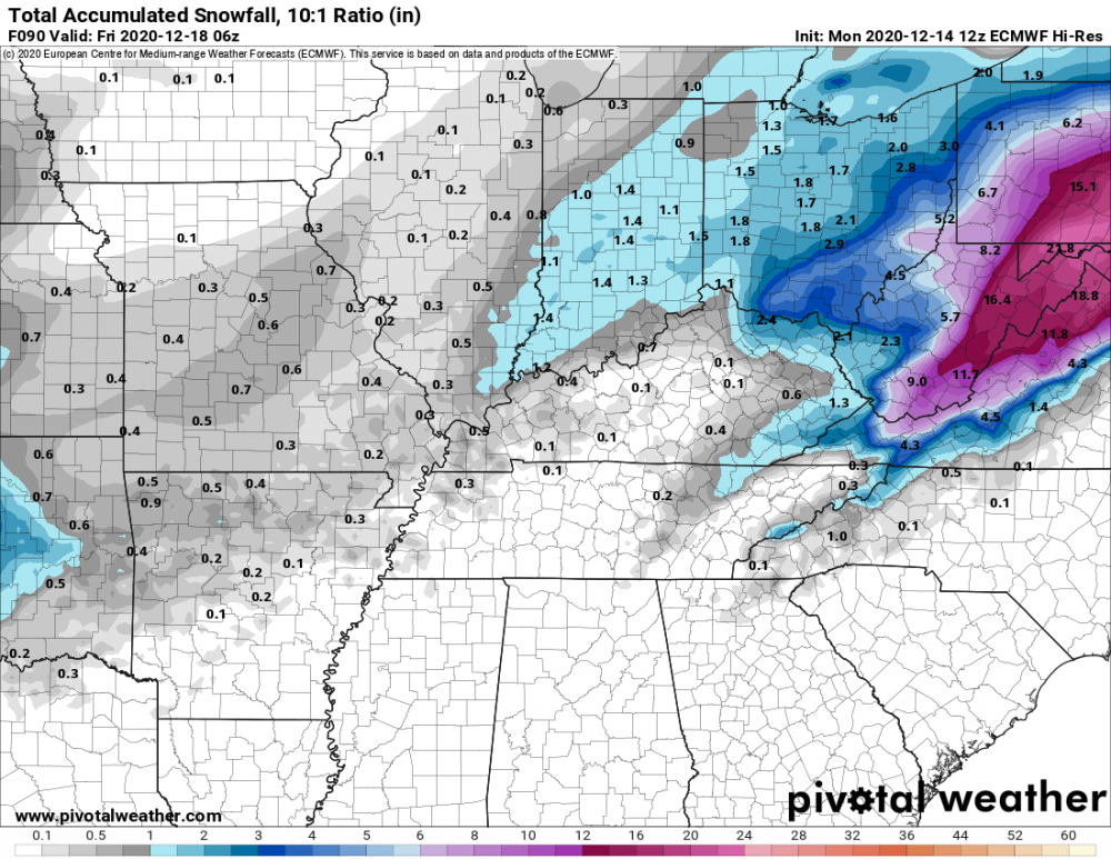
2.8" so far at CMH. New daily record. Old one was 1.8"... easy one to beat.
-
Maybe. Pockets of it seem to be intensifying too. I measured about an inch a while ago so hoping it keeps going.
-
It's ripping right now but coming to an end soon. Very quick 1/2 inch
-
Might get "saved" by the stuff coming out of the south. High res models had it picking up some moisture but it'll probably fall apart like everything else. LOL!
-
Oof. Major dry slot totally screwing me in Union county. Not even a dusting. Just drove around the north end of I-270 and it was dumping with huge flakes. Looked like more than an inch for sure.
-
Wooohooo! Looks like some of us get a big beautiful dry slot to start the morning. In all honesty It wasn't really supposed to get started this early so I have no worries.
-
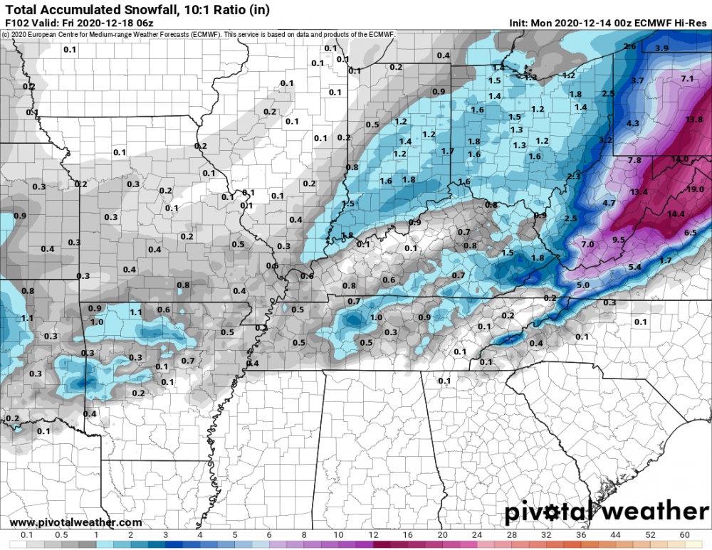
I'm thinking 1-3 across most of the Columbus area, but 3 is probably a stretch and would depend on whatever weak deformation we can squeeze out. It's nice to at least be tracking SOMETHING after last year.
-
I didn't know this was where all the Ohio folks hung out. Tomorrow looks like a nice thump for eastern OH and an inch or two for everyone else unless we get lucking with back end or something.
-
Sorry ¯\_(ツ)_/¯ ... I still don't like the way it has that gap between western and eastern ohio. Keeps looking better on vort and euro had a similar look. Might be a sneaky good system.
-
Well I'll be damned
-
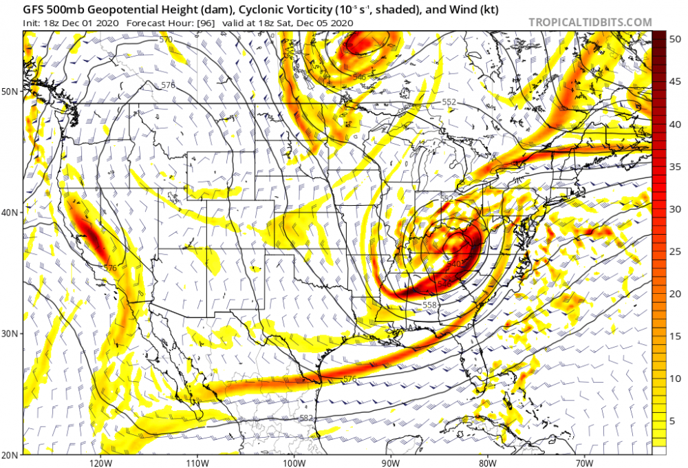
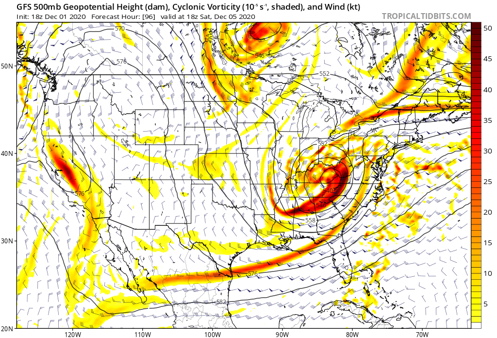
Reminds me of a surprise 4-5 inches I got ahead of a big NE storm in 2018. High res models were the only ones to pick it up and not until about 36 hours out.
-
-
Possibly yeah. Will probably depend on what radar shows the day of honestly. I will have to deal with pretty rough temps and mixing with rain unfortunately.
-
Like @StormfanaticInd said, I'll gladly take this. A a few more ticks west and this ain't bad at all.
-
Could be my climate where I get small dogs at the consistency of big dogs. Coming up on 10 years since my last 10+.
-
With something like this I'd much rather be where you are. Lots of these systems leave a dead zone from about I-71 to Pittsburgh.
-
I will likely get screwed by the transfer and only pick up a dusting. Unless of course there's a big time trend either east, or west in which I get the edge of the main event or the pre-transfer.
-
GFS ensembles continue to slowly tick west with the big NE storm next week. I might be able to sneak in a few inches.
-
Mine too. Would love to see it slow down a bit before becoming a coastal.
-
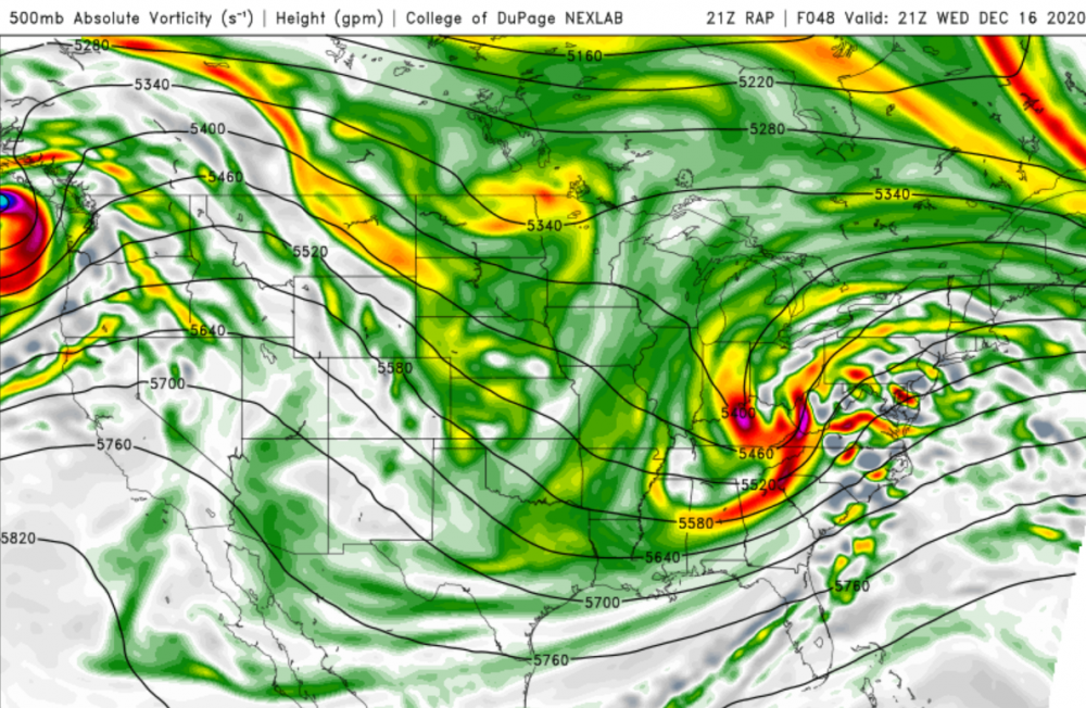
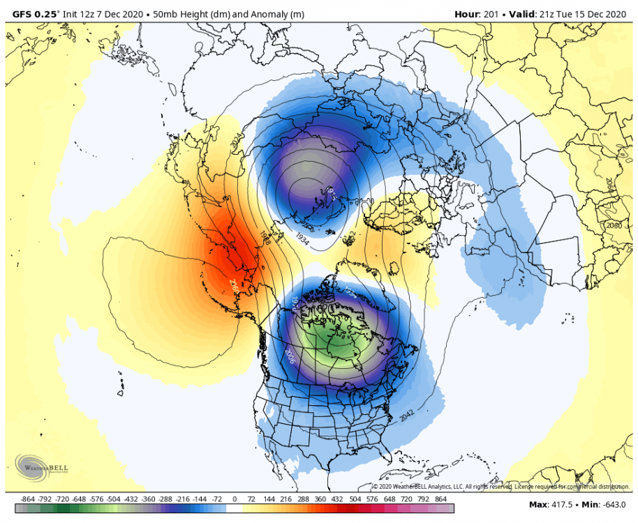
I mentioned earlier that big changes in the strat like SSW's that seem to always be pushed back by models aren't valid. GFS actually bumped this up a day. Will have to see what the euro and ensembles do. Certainly something to watch out for.
-
Big thing to watch is if the models keep moving the goal posts with them. If a SSW keeps showing up at the end of the run, it's not valid. If it gets closer as time goes on, it might be legit.
-
Far from over. Seems like most guidance is garbage outside of 5 days. Each signal has a chance.
-
Hmmm.