Gino27
-
Posts
550 -
Joined
-
Last visited
Content Type
Profiles
Blogs
Forums
American Weather
Media Demo
Store
Gallery
Everything posted by Gino27
-
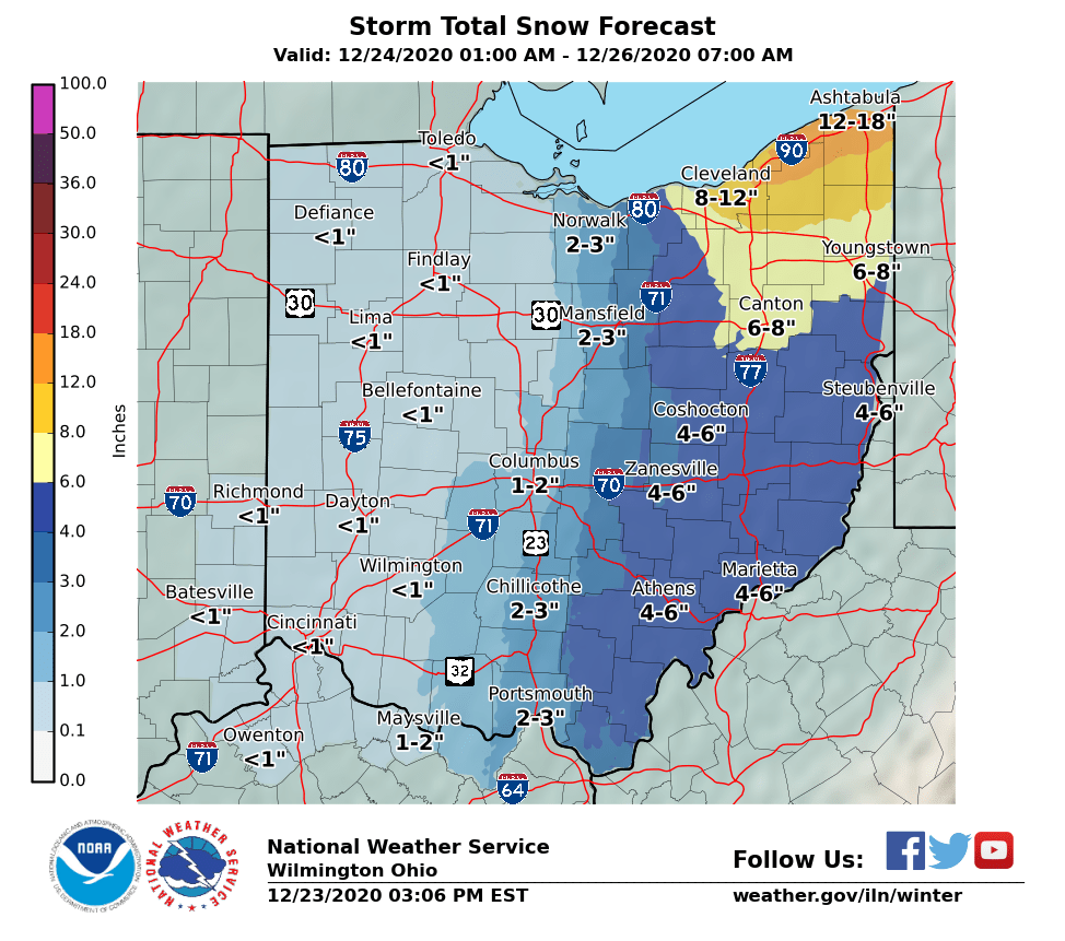
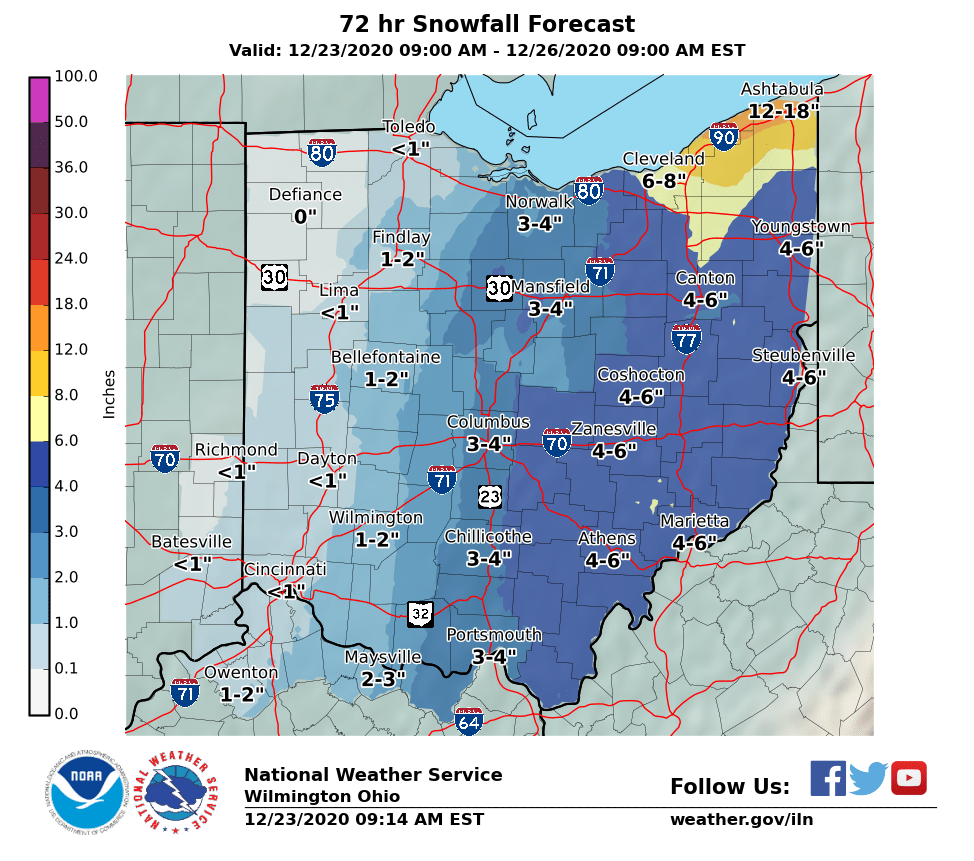
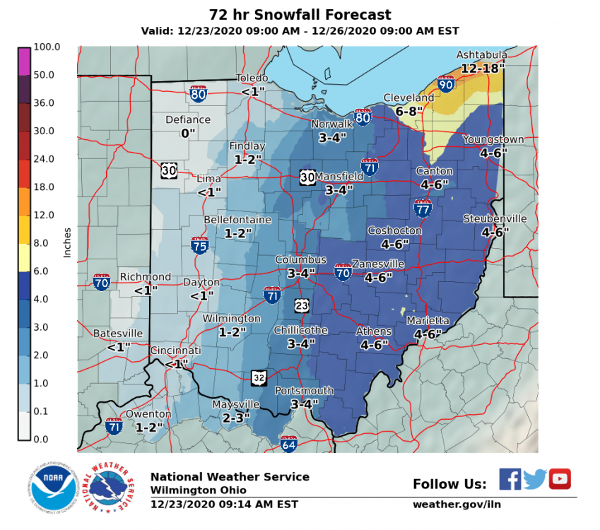
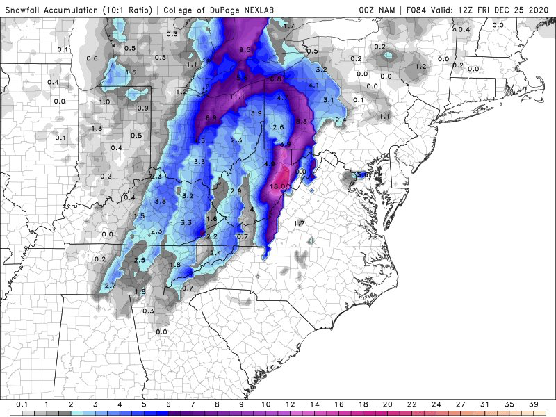
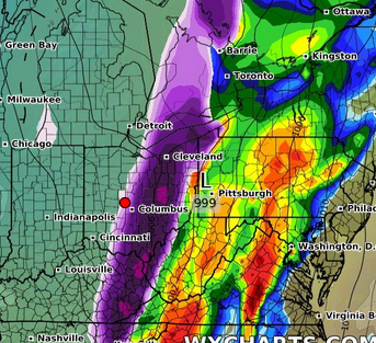
euro casually bumps west big time. Doesn't matter since the event is essentially underway but ig there's hope for Columbus.
-
It’s too bad it has to be mostly frontal. When I hear low running west of the apps I think big time snow.
-
Someone has to get screwed with every system. Shame it’s been our side of town for all three so far.
-
I spoke too soon. <1" for me now...

-
Models look like a total whiff for For the whole state of Ohio but NWS still has me near 3" I can't believe it lol.
-
Didn't expect to see this given the latest model suite, but I'd gladly take this.
-
Aaaaaand it's gone
-
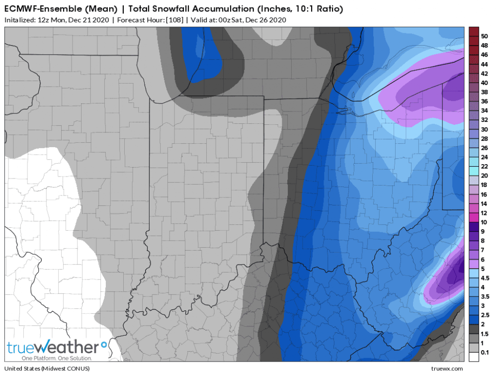
Wheels fell off on the GFS. Could be the end for the west trend.
-
CMC is absolutely insane on Kuchera. I know there will be some higher ratios after a while but holy smokes.
-
Same here. Kuchera casually drops 10" here lol
-
RGEM/RDPS with a bump west too.
-
Higher res nam still keeps the bulk of it way east, but it did boost the secondary low.
-
Needs to go a bit more. Gradient will be scary tight around Cbus.
-
Wut
-
Just chillin on the edge.
-
Right in between Dublin and Marysville. It's technically Plain City. It's gonna be a razor thin cut off I'm afraid.
-
Looks decent for you in Mt. Vernon. Painfully close for me. Euro wants to keep that snow in the general area for about 9 hours.
-
Probably going to be all east of me, maybe a coating. Just a slight tick west and I could see an inch or two. Eastern Ohio will do well again.
-
Latest euro is painfully close to a decent snow. Rest of guidance seems more to the east and hits more into PA. It's probably for the better so no one can complain about it snowing in Ohio.
-
Outside of NE Ohio it's still been relatively weak here. I've measured just north of 4" here NW of Columbus. Sure we've had more action but it's nowhere near what some of y'all are portraying it to be.

-
How exactly does one "sacrifice" a storm? Given that you all to the west get more snow than me, with the exception of the first month or two of this season, you all certainly deserve it. But whatever happens is what happens.
-
Most of the sub hasn't had much... so yes.
-
Love you too
-
Interestingly enough, IWX's AFD seems to support something frontal. I think what's tripping a lot of people is that the 500mb pattern is a more conducive to what they outlined in their tweet. Time will tell...
-
NWS offices and numerous mets don't like the idea of there being a primary low up north with a secondary maybe forming over the apps like the models have. Maybe models will sort themselves out over the next few day.