Gino27
-
Posts
550 -
Joined
-
Last visited
Content Type
Profiles
Blogs
Forums
American Weather
Media Demo
Store
Gallery
Everything posted by Gino27
-
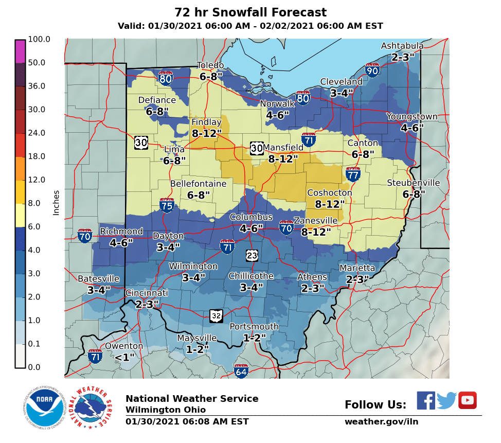
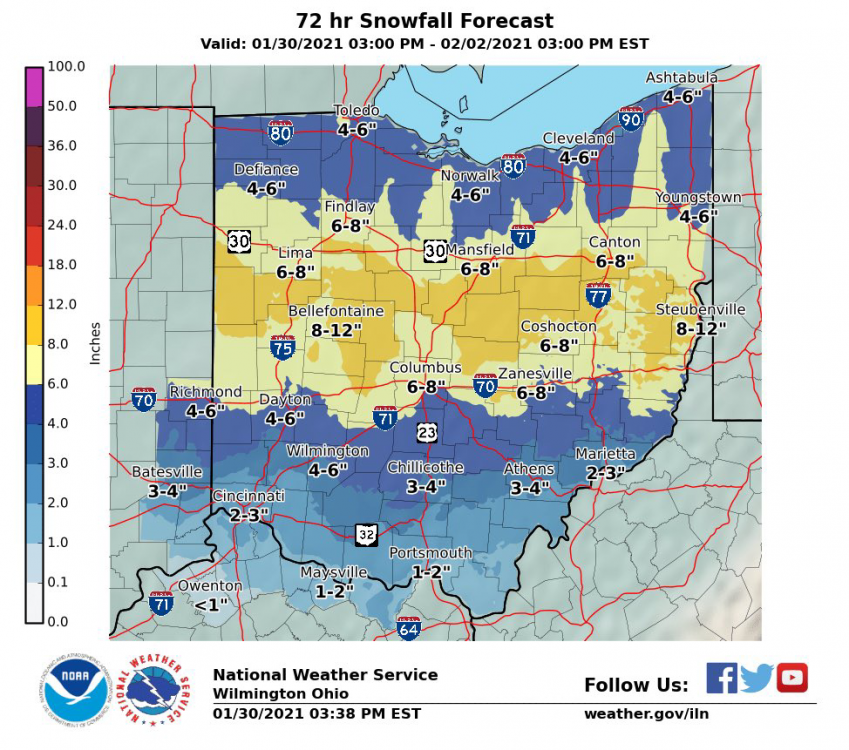
This could still evolve in a few different ways so I went with a pretty broad 5"-8" range from a bit south of I-70 and onward north in my twitter forecast.
-
I had thundersnow not that long ago during the 2/20/19 WAA event.
-
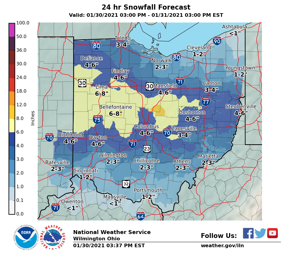
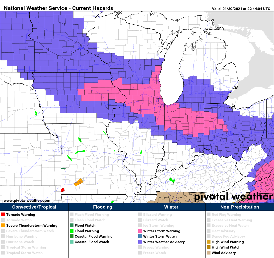
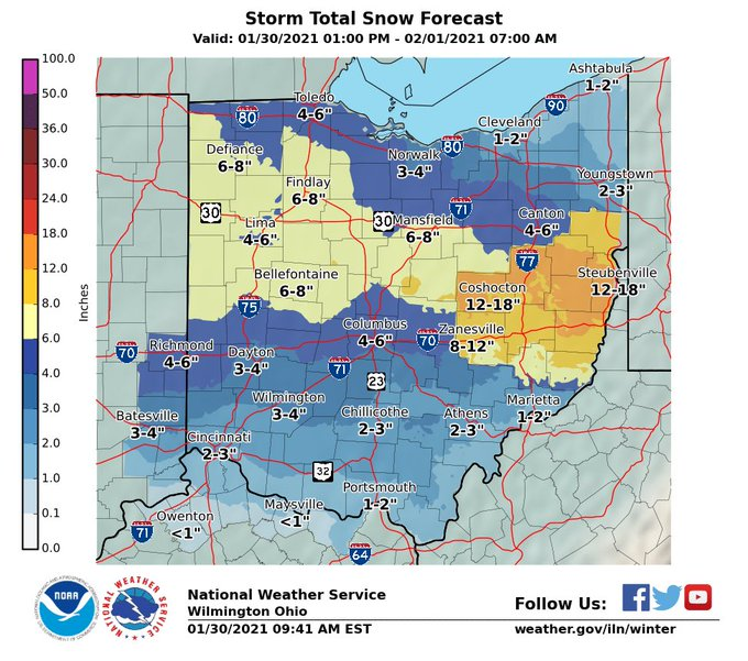
ILN must really hate Delaware county. They’ve got their 4-6 up against CLE’s 8-12 through 24 hours. I’m kinda shocked that they only have have an advisory for 3-5 outside of these counties:


-
This is 100% the reason why ILN and I are staying low. January 19th 2019 is a prime example.
-
Someone is wrong... I don't know who.
-
https://mesonet.agron.iastate.edu/plotting/auto/?q=92 Here you go! There's a lot of things to play around with so enjoy.
-
I feel like I've made out like a bandit in Union county. Clock keeps ticking for most of the state.
-
If you look reaaaaally close you can see the WFO borders lol. I'm surprised that ILN left Delaware county and that CLE left their southern counties out of their warning.

-
So much boom and bust potential here with the unpredictability of the warm tongue. I feel for the NWS.
-
Since it seems like ohio folks around I-70 will switch over to rain for a few hours after getting 3-5 inches of snow, I wonder if a decent about of that will melt before going back to snow.
-
I agree with advisories across the board. We just don't meet the criteria of 6" in 12 hours. 8" in 24 is certainly possible for the higher elevations in west-central ohio though.
-
Gfs has been consistently horrible on this storm. It’s pretty clear it’s wrong.
-
I talk with a lot of Chicago, DC, and Northeast folks on Twitter and this has to be the first time I recall all of us having chance at significant snow from the same storm.
-
Haha I just have a bad feeling about this. Warm air creeping up is always a death sentence for us.
-
Yep. Models look great at 10:1 but the snow will really struggle with warm surface temps. I bet the rain even creeps 20 miles north of I-70.
-
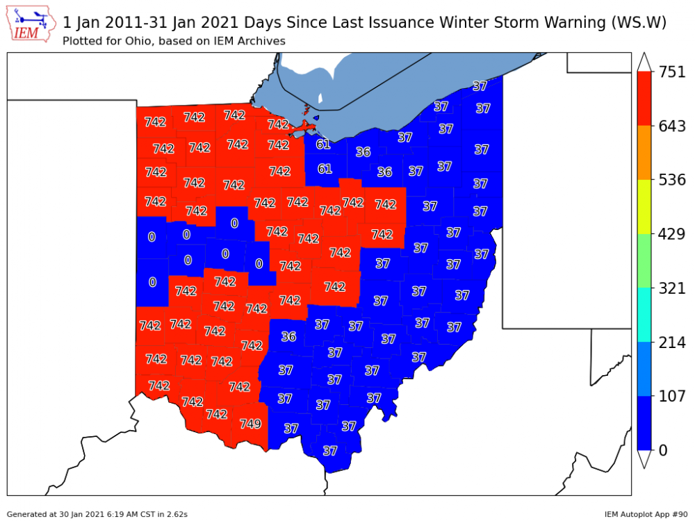
ILN backtracking with totals. Looks like my 741 day no WSW streak will survive.
-
Euro puts me at 13" NWS says 3-5" gfs at .5". I'm pretty sure there's no way to know lol.
-
Still wondering if ILN will expand watches. The news from ILX about temps being warmer is a downer for sure being I'll be right on the edge of the r/s line.
-
I'm on the very eastern fringe of the watch. Calling for 5-8. Anything over 6" would be my biggest storm in almost 6 years.
-
The typical warm tongue that usually slides right up the Scioto valley close to Columbus is pretty clear on the snowfall maps. I'm weary of a warmer solution coming to fruition.
-
If only is right. I just don't buy it. There is some dry air likely at precip onset and there will certainly be a surge of warm air. Everything is probably still on the table. It would be comforting to see the gfs come around however.
-
18z euro showing something we don't see around here often. I have my doubts per usual. These love to get swept out from under us in the last 48 hours.
-
Given how conservative ILN usually is with snow this is notable.
-
Yeah for sure. I think the thump is good regardless. Now whether or nor we are cold enough for the ULL stuff will be the difference between 2-4 inches and a major storm.
-
I'm trying to be very cautious with this. We've seen these trend north and go warm within 48 hours a million times.