Gino27
-
Posts
556 -
Joined
-
Last visited
Content Type
Profiles
Blogs
Forums
American Weather
Media Demo
Store
Gallery
Everything posted by Gino27
-
Boy this one sure blows. I'll prob be a sleet fest tomorrow. Enjoy this one Indy folks!
-
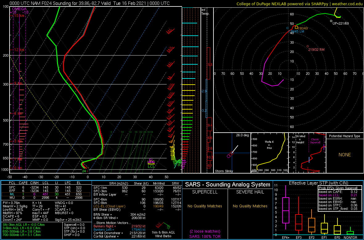
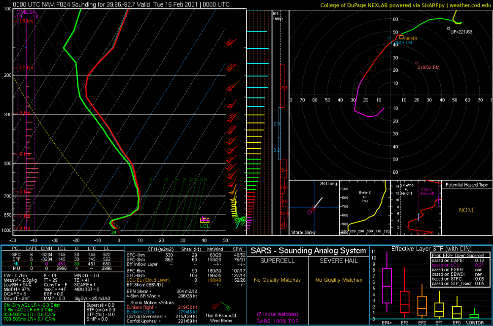
. That's after the cold air crashes in and flips you back to snow. Here's for the part that has you mixing. It's right on the edge. These soundings are in celcius so you'd want 3-4 degrees F colder to be comfortable.

-
Well hopefully the nam doesn't verify or else you're looking at 3-5 inches. In all honesty it's all model noise to me at this point. First round of snow will be on your doorstep in a few hours anyways.
-
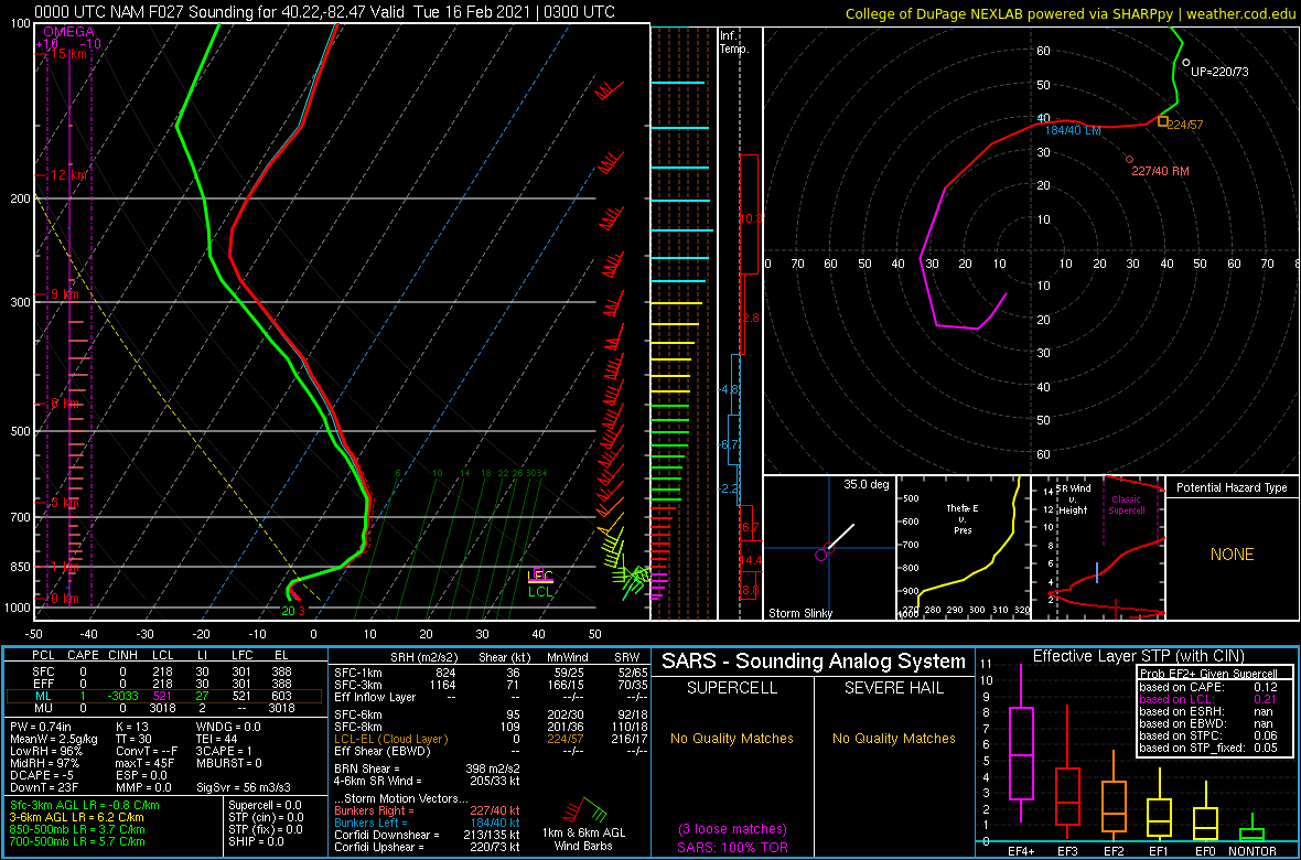
It's right here Dilly. Everything to the right of my pink line between 850 and 700 on the NAM is above freezing.
-
There's a lot of space between 850 and 700. Look at the sounding.
-
40mph gusts with sleet. that ought to sound cool.
-
-
Warm nose is at 750 mb
-
Man this run is prob gonna send most of Ohio into full panic mode. Feels like 90% of our last chances for big storms.
-
NAM has a HUGE warm tongue. Every model has warming in the mid levels but NAM is a bit extreme compared to others. It's either on crack or genius.
-

-
Yeah don't look at the nam if you enjoy your life at all
-
The nam is doing some shit
-
I'm buried. Easy toss...
-
Looks like the euro listened to Buckeye

-
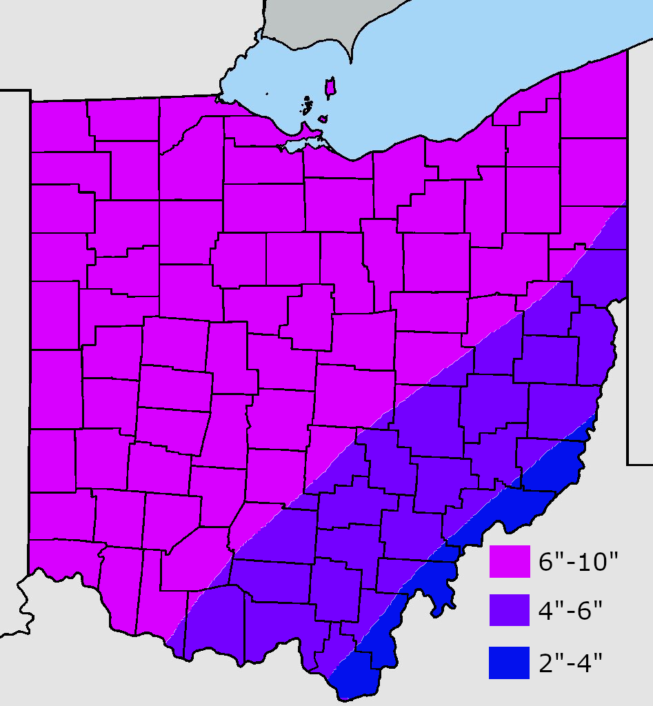
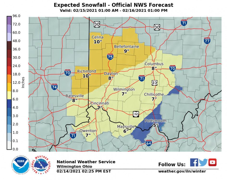
If we're playing this game... CMH: 7.4" DAY: 11.6" CVG: 9.8" TOL: 11.0" CLE: 10.5" My backyard (Plain City) 8.2"
-
Here's what I went with for my twitter forecast. The 6" line could still move east or west once we see how this shapes up.

-
I saw it was made at 3pm in the bottom right corner. Nice to see the other offices on board. DTX should be the last one to fall.
-
Nice to see all the offices agree!!
-
-
Track has changed slightly but the big difference has been it becoming a lot more amped. Also, most models definitely show a more significant push of warm air.
-
I'm a bit more optimistic than I was earlier. I'm 12 hours from snow entering my area so models don't mean as much as they did yesterday. Even if this "busts" it's still a significant snow here.
-
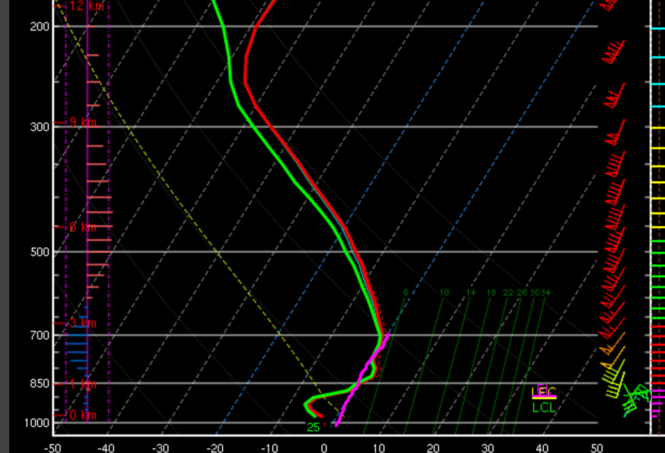
I looked into a lot of soundings of the NAm between 6z and 12z. The shift it had was honestly nuts. I'm thinking we can write it off for now.
-
As long as we stay all snow we're in for a big one. We won't get the crazy ratios of those more the west but can't compain.