binbisso
-
Posts
889 -
Joined
-
Last visited
Content Type
Profiles
Blogs
Forums
American Weather
Media Demo
Store
Gallery
Everything posted by binbisso
-
The rap would work for most of us
-
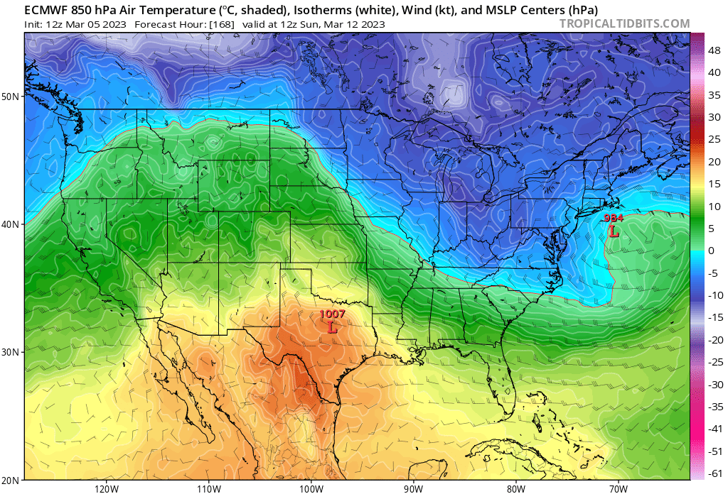
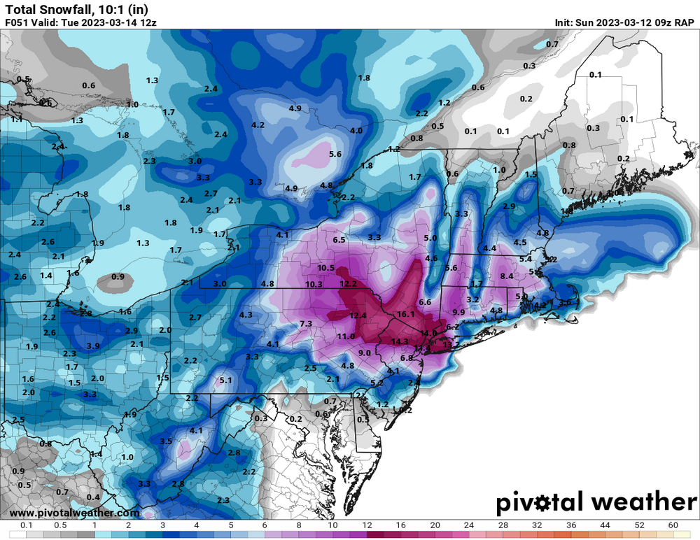
Yes. This is Such a delicate set up for us. Right now it seems like Connecticut away from the shore seems like the place to be for this system
-
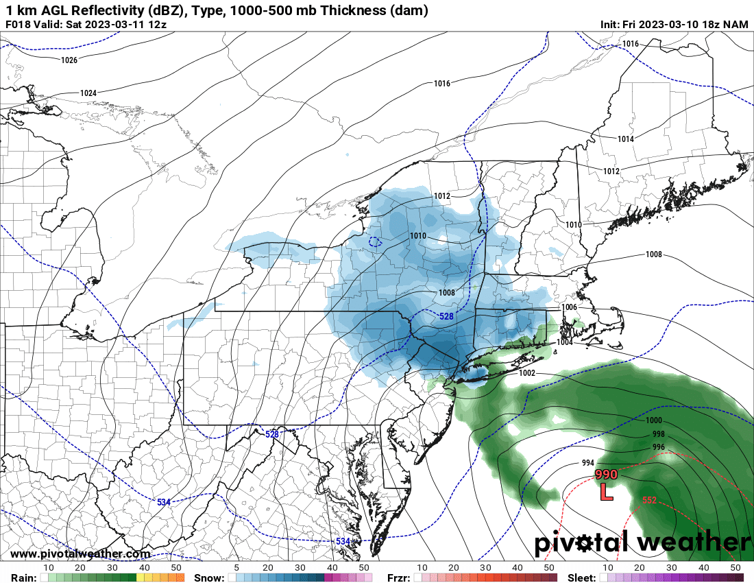
You would think a bombing low South of Long Island would have a greater precipitation field further West
-
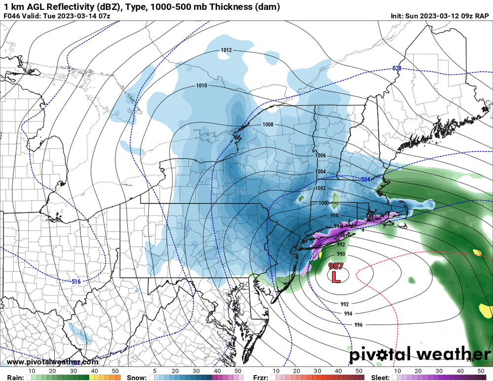
Cmc kind of weird. It's west of gfs but very little precip west of center
-
Yes so far digging northern stream further south
-
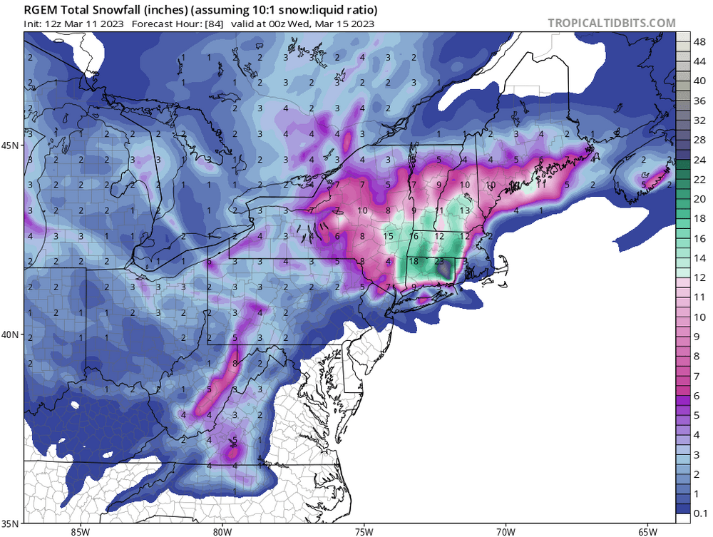
The rgem is really close to. Crosses Montauk. Just very little precip to the west. Good hit for LI
-
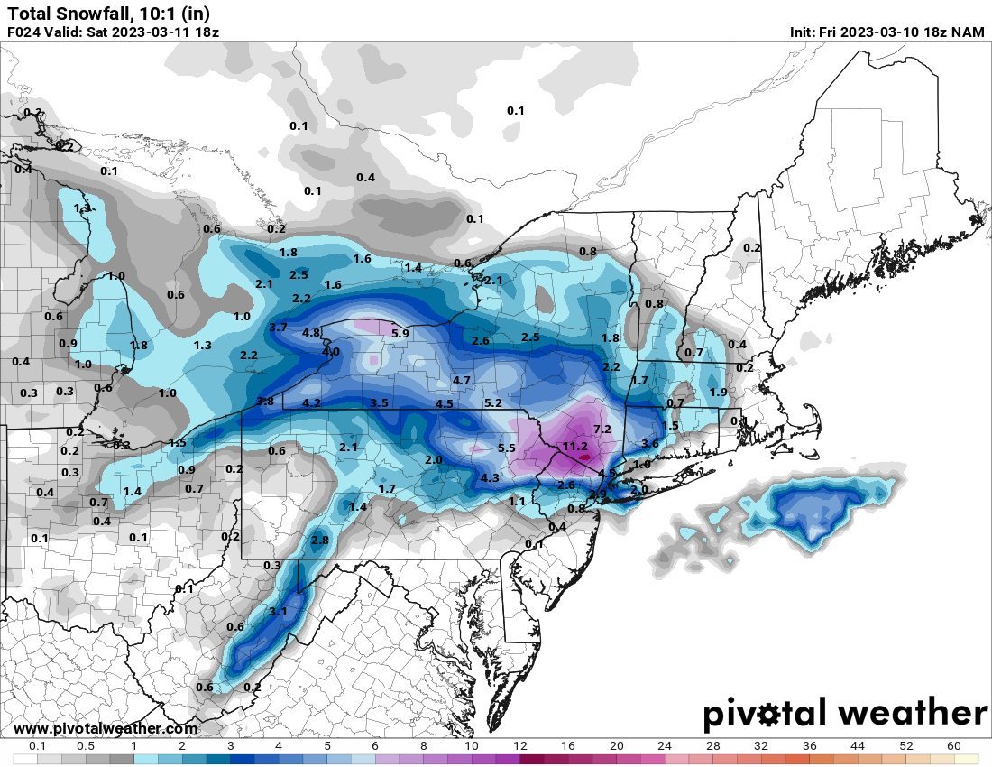
Interesting nam run at 18z. Hrrr looks similar. Looks like the gfs


-
Yup and like 5mb stronger
-
It looks north to me so far
-
Rgem and nam look good at the end of their runs. Gfs looks juiced
-
Snowing in the bronx
-

-

-
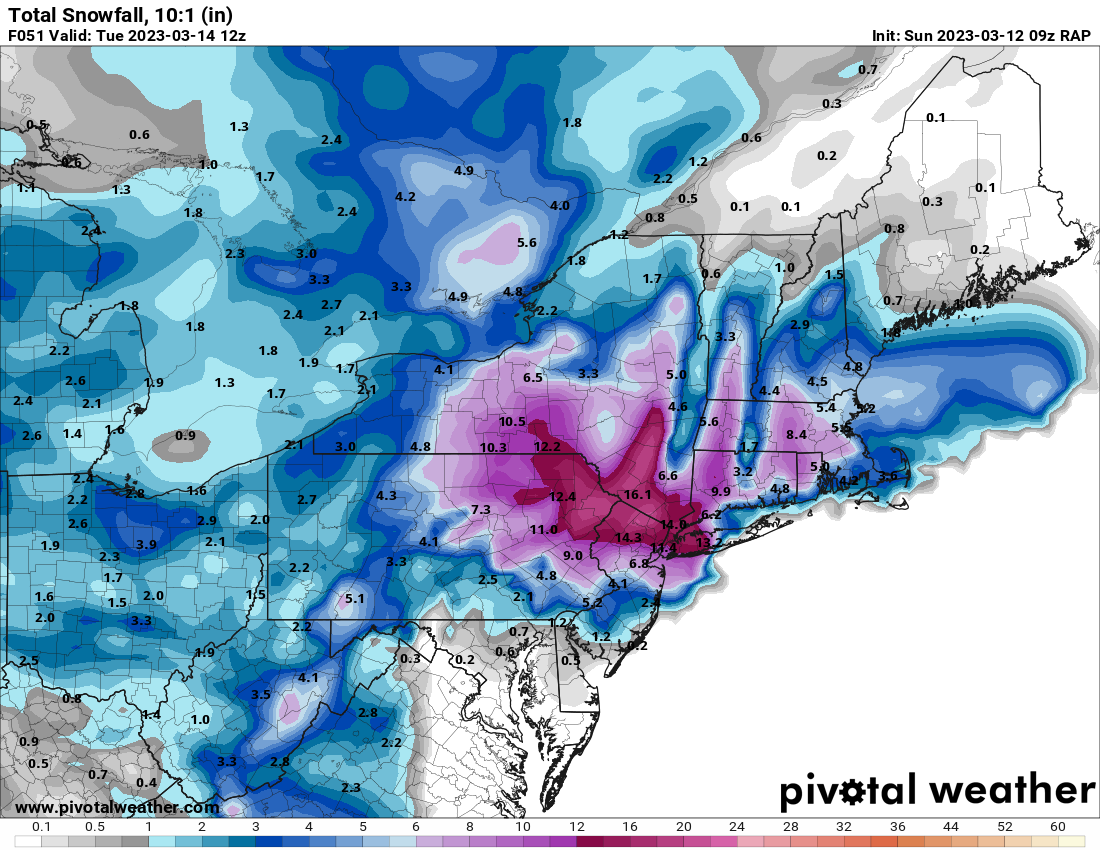
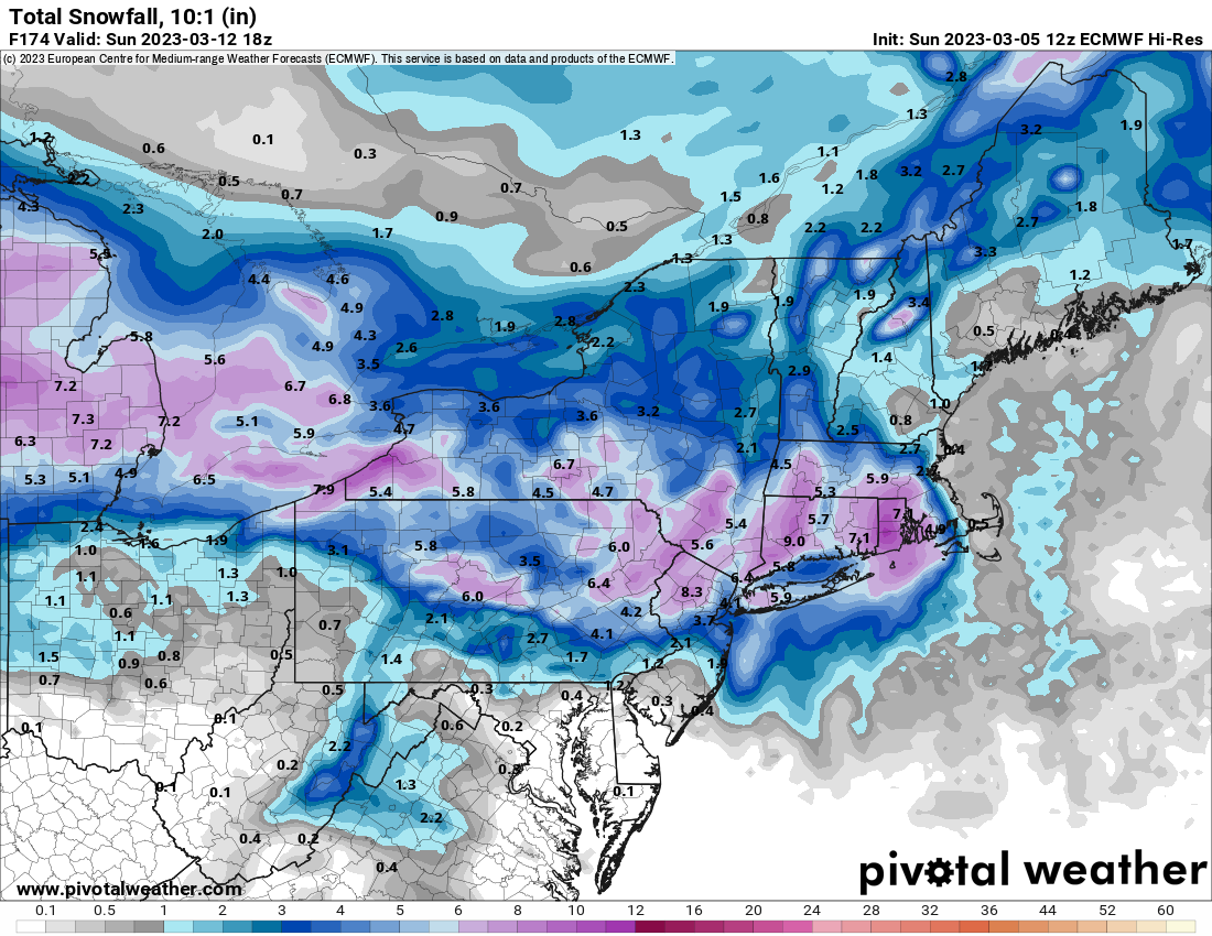
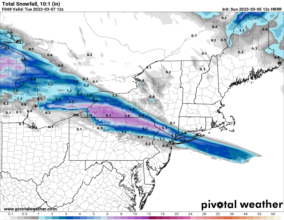
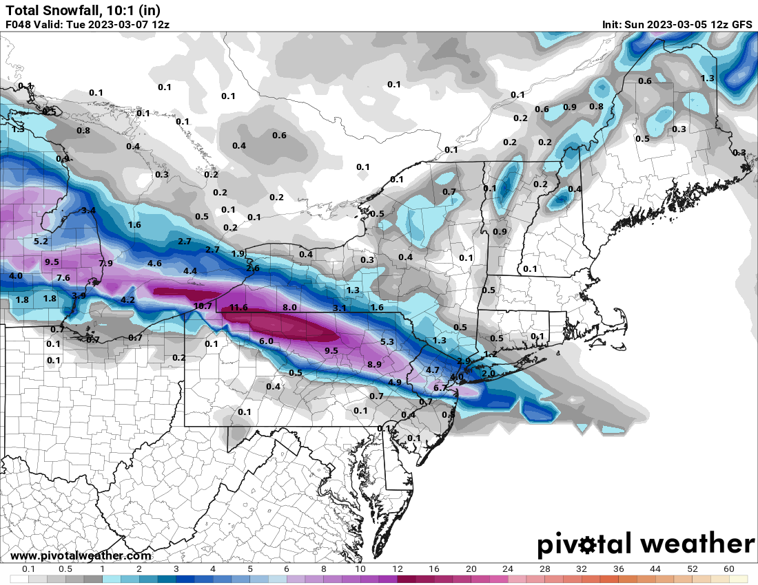
All the US models have snow for us. Nam, rap, hrrr and gfs. The euro/ukie and Canadians zippo

-
Never had any mixing issues here still snowing lightly at the moment
-
5" In Mount Vernon On the coldest surfaces
-
Isl 1.8" also a record Bdr 2"
-
Newark 1.2" Lga 1.1" Jfk 1" which is a record for date. All totals as of midnight
-
Yup eyeballing 3 to 4" In hunts point in The Bronx. Ripping snow now. Central Park measured .9" Of snow for yesterday. Had to add at least 2" since midnight.
-
2" so far here in Mount Vernon heavy snow right now big flakes 31゚
-
Snow has started here in Mt Vernon 36*
-
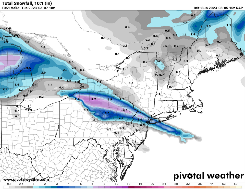
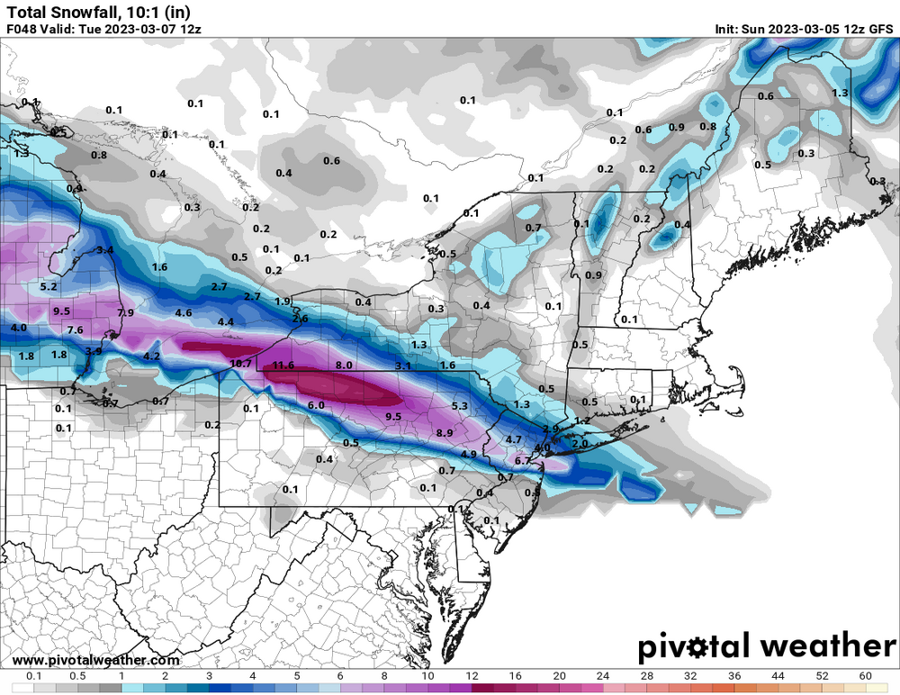
Gfs stubborn with such high totals
-
38* dp17 at home in Mt Vernon
-
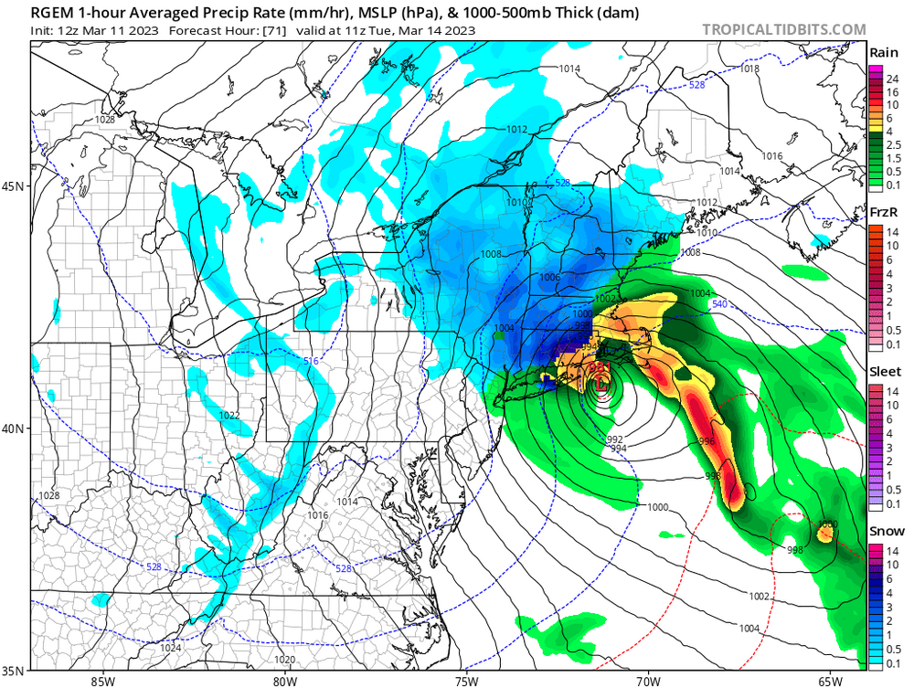
Looks like precip will get here quicker than guidance