Rhino16
-
Posts
1,703 -
Joined
-
Last visited
Content Type
Profiles
Blogs
Forums
American Weather
Media Demo
Store
Gallery
Everything posted by Rhino16
-
I enjoy Tim Vasquez’ channel! He also has some solid books.
-
I think you’ll enjoy synoptic too! It isn’t really my thing so writing posts like yours is difficult. It makes sense in my head, but getting it onto paper isn’t something I’m good at. I look forward to more of your writing!
-
What else will I do at 7am on a Saturday?
-
Despite my time on here, mostly for winters, I’m not well versed on SSWEs. Do they have any impact on the teleconnections at all? Or can they be entirely wasted with teleconnections being unfavorable? I can’t remember any ones from recent years to go look at, at least ones that have materialized.
-
It looked better 20 minutes ago. Seems to be drying out now.
-
There’s some reflectivities racing across virginia. Maybe a few flakes will make it down…
-
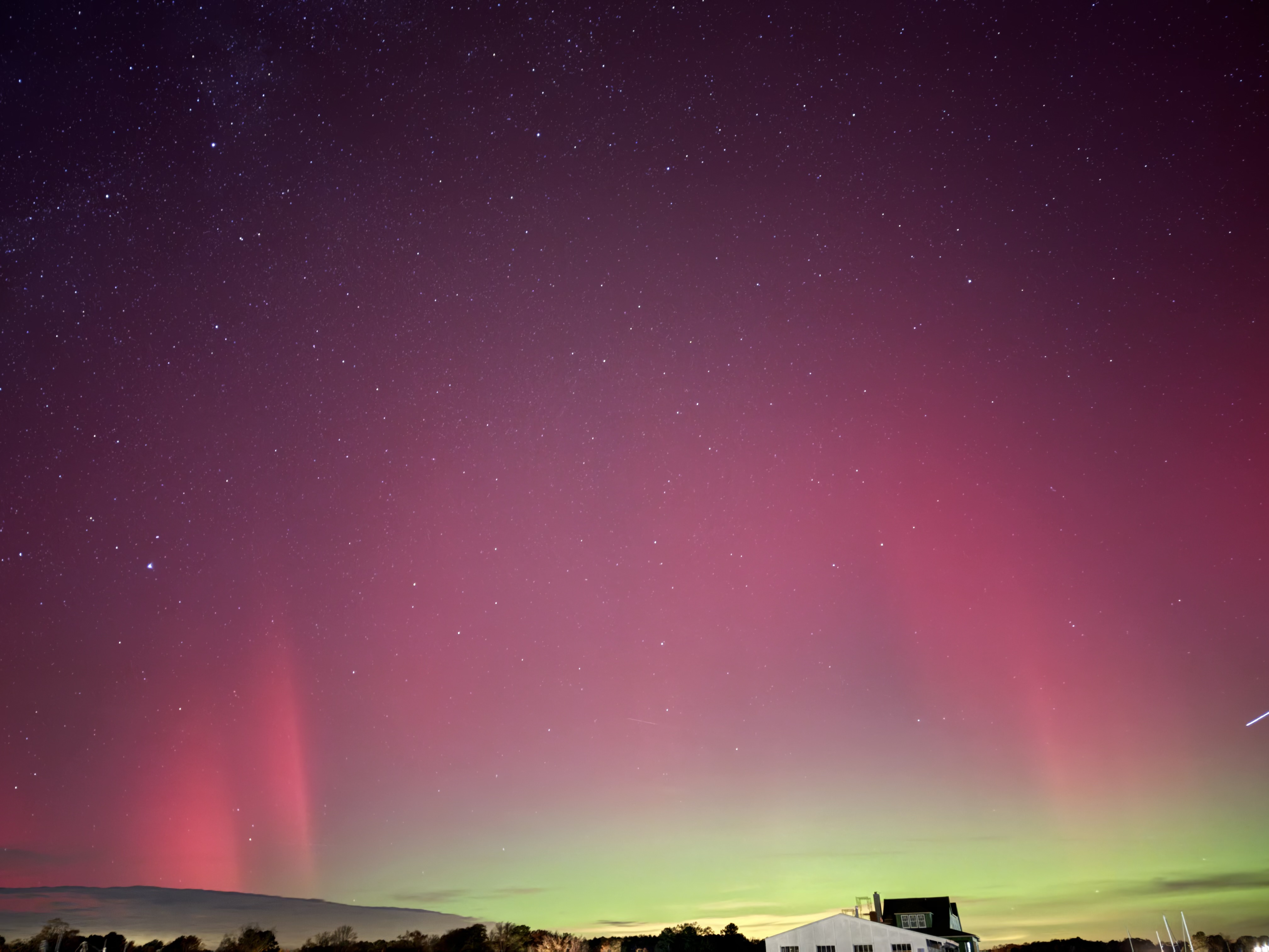
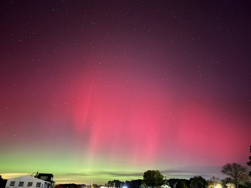
30sec exposures. Worth losing my fingers!

-
In the latest swpc post they suggest as early as late tonight to early tomorrow, but I hope it’s later so I don’t have to stay up or wake up early
-
We did have an X5 flare this morning so don’t discount anything if you can get somewhere dark. Waiting for more info on it though. Hopefully clouds won’t ruin it.
-
I got a few flakes. Wish the dewpoint depression was a bit lower but I’ll take it.
-
Yay! Now to wait out here in the NNK, but I think it would take something like the higher returns over the west end…
-
There’s definitely some stuff on radar, but I see an mping report near richmond reporting flakes. I assume it’s too warm and dry, but does anyone see anything? Even rain?
-
Starting to get stuff on radar north of richmond, but dewpoint depressions are like 25 degrees so it doesn’t matter.
-
BWI: 15.4” DCA: 11” IAD: 16.8” RIC: 7” TB LYH: 11”
-
It was pointed out that there may be possible first flakes occurring now at snowshoe wv.
-
They’re out now? I didn’t see a single one last year, and heard similar from others. Actually, maybe the only one I found was dead. That would explain a lot.
-
Drive home from work was wet! Didn’t see what happened late afternoon to now, but I think the northern neck avoided the heavier stuff.
-
We're getting there... slowly... it at least appears better than last night's you posted.
-
Did it happen to be somewhat of a squall event type thing? I have images of a snow squall chase on the 21st of November, but that’s down on a mountaintop near Blacksburg, VA.
-
Not sure, I put in a request back in May, just waiting to hear back and provide whatever proof they need.
-
Basically, we can take a set of numbers and break them into quarters. Just like we do with the months in a year. Interquartile is the set of numbers between Q1 and Q3, the numbers in the middle of the dataset. So if the models are putting out numbers that are very spread out and uncertain like in your example, the Interquartile Range will be high. If the models are all putting out similar numbers, the difference between Q3 and Q1 will be low, so making a temperature forecast might be easier.
-
I can seemingly always count on the weather to do the opposite of what I expect! As the outflow blew through it was kicking up water over the river. It almost looked like there was a gustnado in the mist. It rained a decent amount, maybe half an inch, not sure it will be enough to save some of the leaves on the trees. Also had first thunder since end of July, so that was fun.
-
It’s sooo dry, we got 0.01-0.05 on Thursday, but before that it was august 19th since the last rainfall, and that was around a quarter. Today doesn’t seem too promising in the NNK.
-
Already 32.6 at Canaan NWR. Fast! It was 37.3 this time yesterday.
-
It’s already 40.6 at Canaan NWR. 50ish at surrounding mountaintops it seems.