

NorthHillsWx
-
Posts
5,367 -
Joined
-
Last visited
Content Type
Profiles
Blogs
Forums
American Weather
Media Demo
Store
Gallery
Everything posted by NorthHillsWx
-
I don’t think so. However, the environment around this system is complex. Shear will decrease, then change vector, then really decrease, but extremely dry air will be a factor, as will land. There will be moments this system can take advantage of, but in talking about majors, you usually see less barriers. I learned a lesson with sally though: never write off a gulf system. That storm was 6 hours from being a major, amazingly. I don’t think the ceiling is high for Beta, given the above reasons. I’m not locked into that call, though, as this is an extremely challenging environment
-
Recon finding a slightly stronger system, though it does look elongated
-
I’ve seen worse looking radar presentations from June junk making landfall on the gulf coast in years past. If we name all subtropical storms, this should definitely be named.
-
Waste of a name. Good thing this is into the alphabet names.
-
LOL
-
I would be shocked if this isn’t Alpha as we speak. Looks much better on both VIS and IR. I think it was a pure lack of data and unfortunate circumstance that the plane had to turn back, as the only reasons 22 didn’t get named.
-
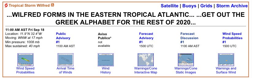
Looks like a wild race to the W storm. 22 had a lead but 98L is rounding turn 4 with momentum. Going to be down to the wire As I said that, 98L wins! Wilfred is born
-
Early fall incoming this weekend. Wow
-
This storm will require some serious patience this week. GFS and Euro have ticked up intensity and as have some of the intensity guidance. Spending this much time over untouched waters in the gulf one would expect at least a hurricane at some point. Going to be a challenging forecast on all fronts
-
Just below 2” as I go to bed. Definitely a good rain but a bit of a bust compared to the models and forecasts. May end up with 2.5” after tonight’s rain, raining good atm. Woke up to 2.74” and still lightly raining.
-
GFS now takes a hurricane into Texas. Much quicker
-
Radar is anemic here too but it’s pouring outside, as hard as it has all day. Feels more tropical
-
On cue
-
Recon showing a broad circulation but it does have west wind. SFMR 30-35 kts. FL winds slightly lower. Probably enough to classify as a depression
-
Anyone in the triangle blame me for saying this has the feel of a snowstorm we were promised moisture would not be the problem, only to have the back end show up about 12 hours before it’s supposed to and not even half the expected qpf? Haha
-
Yea, what’s strange is it turned into a large area of stratiform rain. Almost no tropical downpours, which we almost always see with these systems. My guess was the wedge overperformed (shocker) and it lost some moisture as the boundary level flow cancelled the tropical connection. That and the fact sally wasn’t able to maintain as a tropical produced an overrunning event that expanded coverage of rain but decreased rates and flooding potential. It’s also ending much earlier than expected. Per nws I was supposed to rain through tomorrow morning with 2-3” tonight on top of my “1-2” from today but I see the back edge approaching and I’m only at 1.10.” I’m seriously doubting We even hit 2”. My farm in Franklin county, however, somehow is going on 4.” Something must have moved through there overnight
-
Just over an inch here. Not expecting but maybe 2-2.5” total. Little bit of a bust on the low end for sure
-
CMC would make every surfer on the gulf coast happy.
-
Need recon for sure. Slowly getting its act together. With generally favorable conditions this thing could ramp up quicker than forecast by models to do so. It already seems ahead of the curve Hard to tell but looking at LL clouds undershooting the middle area of vorticity you outlined makes me believe that MAY be the dominant center. See a lot of north moving clouds to the east of the high convective tops, maybe some west to east moving clouds below it. Very hard to tell, last ASCAT made it seem like center would be further south but obviously fluid at this point
-
Haven’t even looked at this. Judging by that sat shot the race may already be won...
-
Though conditions are generally favorable now, some strong southerly shear looks to be present the further north the system gets in the gulf in a few days. I think that’s why we’re seeing some modeling show a sharp bend to the left, depicting a shallow system caught in low level steering flow. Too early to tell, but the long term prognosis of this disturbance does not look ideal for significant intensification over the long run
-
It also looks like a broad area of rotation in a larger trough. It would not surprise me to see center formation in the NE envelope, as some models have predicted. That blowup there this morning seems consistent and less pulse like. It may be able to induce pressure falls and eventually become the dominant center. Waiting on visible this am. Overall it’s a healthy looking system, probably will become at least a TD today
-
Still looks a little “popcorns” but making progress. This system will be in no hurry to go anywhere
-
I don't really pay the ops too much mind for intensity. Sure, it's eye-opening when they go bonkers on a particular system. You do want it to show a deep versus shallow feature, especially in the mid-levels. But generally the global ops have underperformed on intensity for systems that have not yet developed this year. Of course the TC models handle that better once a TCG has occurred however, which what they are better designed for. I only use ops before a storm forms to find potential. When systems show up consistently on the ops, as this has, it usually means there’s a good chance for development. For intensity, they are good to look at for trends, strengthening vs weakening, once a system has formed, but not for actual intensity


