

NorthHillsWx
-
Posts
5,367 -
Joined
-
Last visited
Content Type
Profiles
Blogs
Forums
American Weather
Media Demo
Store
Gallery
Everything posted by NorthHillsWx
-
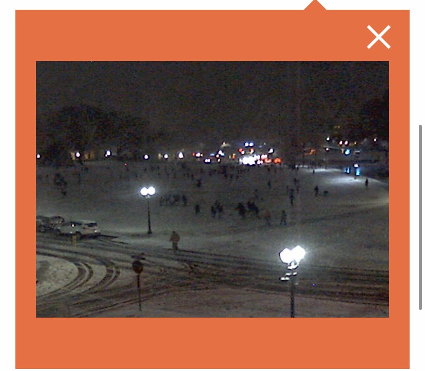
Man that looks like fun. On a weekend too. Huge snowball fight ongoing
-
Holy crap. Paste bomb per Clemson webcams. Sticking to roads.
-
Areas around and north of lake Lanier seem to be doing better than expected. Hope it translates to upstate folks soon
-
If we don’t score in next 10 days I’d have to agree. Late February/March snows are not that fun 99% of the time unless you enjoy snow that lasts 8 hours on the ground
-
12k NAM 06z run was a good one
-
Do not click on the 00z euro, just don’t do it. It’s a flaming dumpster fire run if there ever was one
-
06z GFS trended significantly colder with the late week system and also is much quicker in getting the arctic air in afterwards
-
Really hate to say it but we may have to punt till after next weekend, again. 4-5 day cool down then SE ridge reappears. Good night please give me something better to look forward to in the morning
-
Back to hour 200+ cold on gfs, what could go wrong
-
70’s in N.C. next Friday
-
Ouch. SE ridge through 186 on gfs is stout
-
I’m expecting a drought at this point. Said it last week when everything was pointing to extended cold: I was as excited for the next two weeks of winter as I could remember. Now I’m still waiting a week for cold that may never show. Sheesh!
-
With this output and we likely end up without a flake
-
I’m back!!!
-
Yep. The cold seemed like a certainty for days. We may not even get that lmao
-
After this winter the Euro has been dethroned. I never remember it being as wishy washy inside day 6 as it was between 0z and 12z today in the past. Something about this pattern throws it off
-
Rules in the south: 1) arctic air is ALWAYS over modeled 2) arctic air is ALWAYS slower to arrive than modeled
-
Hate to say it, but we now have 6 days to reel this one back in. Knew it was too good to be even 1/100th true. That SE ridge just shuns the arctic air. Obviously still a ton of time for it to change but there are now very valid reason to believe we rain several times with places west of the apps going below zero. Gut punch today. So is life in the south
-
EURO and EPS folding to GFS and it’s ensembles for the 138th time this winter
-
Never, ever, ever doubt a warm nose on the NAM. It may not be correct this time, but that model was made for sniffing them out
-
Pretty liberal use of the term “crush job”
-
Raleigh’s point forecasts until day of are about as useful as a bag of bricks in a lifeboat in terms of timing and specifics
-
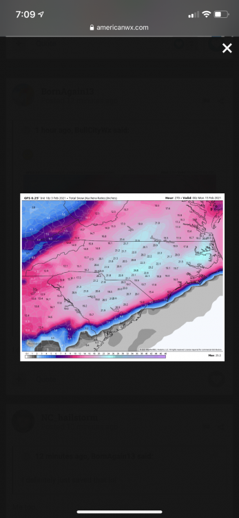
One thing about this storm is wet bulb will not help. Dew points going in are too high. It will be purely a dynamic cooling situation. Without rates, you will not approach freezing, and snow will not stick. I think the northern piedmont and triad is in the game to see snow fall but I seriously doubt if anyone gets more than a dusting in this set up. No antecedent cold air, little evaporative cooling, warm nose quickly moves in. Not being a downer but that’s just how I see it
-
Pretty much draw a line from dry fork to hickory north and west is where I’d expect accumulation. Rate driven snows that can add up but won’t be a large area of heavy accumulation. I’d say a C-2” for that area with some pockets of 3-4.” NAM sleet profiles should have everyone’s attention as well. The upstate relies on a quick hitting front end thump and those are notoriously hard to predict. BL temps are not your friend nor is frozen event duration.
-
You’re in the sweet spot. Jealous.


