

NorthHillsWx
-
Posts
3,752 -
Joined
-
Last visited
Content Type
Profiles
Blogs
Forums
American Weather
Media Demo
Store
Gallery
Posts posted by NorthHillsWx
-
-
5 minutes ago, jjwxman said:
Here is the official forecast from RAH for my point and click location 12 miles south of Greensboro... They are just not sold on this thing at all.
That’s pretty conservative, even for RAH lol
-
 1
1
-
-
The Canadian was a very good run for N.C. the Triad into SW Va would have warning level snows and the triangle would be advisory level for the most part. Gets that deform band going and goes across the whole state pretty much. Amounts not high East of Triad but widespread snow, and less splotchy. Sorry upstate, tho
-
 1
1
-
-
My thoughts are NWS Raleigh will issue a WWA from Randolph through Durham and up to Vance county tonight at some point for 1-2” of snow. East of there I doubt anything gets issued unless a deform band sets up and it will be a quick fire issuance. I’m actually feeling better about most areas in the triangle getting at least a coating of snow which is a win and some areas could have a few surprises.
-
1
-
1
-
-
16 minutes ago, CaryWx said:
Will we ever have the technology to accurately and reliably forecast this? Find me a met who can absorb and analyze the data, plus using institutional knowledge of weather-forecasting in this region finger point these areas for me on a map 72hrs in advance and we'd have ourselves a real keeper.
Of course I believed in Santa Claus probably way later into youth than most of you. But that was back in the early 70s when I'm sure longer range weather forecasting demands were quite less stressful

Haha. I doubt we will ever be able to accurately forecast where they will setup in advance, but we can nail down the most likely areas for them to do so given the placement of the ULL. Beyond that it’s all now casting and I guess that was my point that overall this system has been very much locked in for days now
-
28 minutes ago, StantonParkHoya said:
This secondary max situation is becoming real for Eastern NC. They may cash in.
Has trended better and better with the formation of that deformation band. I mentioned that the other day as being a possibility as the energy transfers to the coastal and that area of dynamic forcing moves East but it’s only now been consistently showing up on the hi-res models. Triangle-East hinges on this development
-
1
-
-
These ULL situations are modeled so much better than so many other winter storms. Details certainly have changed run to run and if you’re living and dying by snow maps you’re probably on about you last thread by this point but the storm track and most other synoptic features have been locked in for several days. Forecasting the mesoscale environment and features will be the challenge for sure and that’s ultimately what will define this storm but overall I can go back 3-4 days and models don’t look much different than they do now
-
1
-
-
3K Nam would make a lot of people happy on here
-
1 minute ago, Disc said:
A look at higher end amounts too.
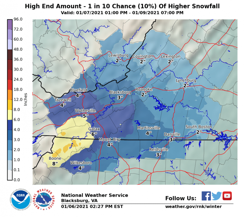
Awesome work. This all seems reasonable at this point
-
 1
1
-
-
Turned on the news... Had to head back to the storm page, quickly. Good lord.
I haven’t seen any significant changes in overall modeling and this system looks on track. It will be a foothills, eastern slopes jackpot. Outside of there will be rate dependent and pretty much anyone along from Salisbury to Raleigh could see a C-2” snow but it will be localized and difficult to pin down. Most will not have accumulation. Triad and southern VA will have 1-3” maybe a few 4” totals if banding sets up. Better timing, ULL support, and more widespread snow. It will be more patchy East
-
1
-
2
-
-
8 minutes ago, wncsnow said:
Euro clown
.thumb.png.dbc72854727ec795f5d216ba40b18c0a.png)
I don’t think this snow map is very far off from what reality will be given this setup. Northern Triad/eastern foothills seem to consistently be the areas where it wants to snow on most models and 1-4 inch amounts seem reasonable there. Given the easterly flow, some elevation bonus, the foothills and eastern slopes look to be the jackpot. As the precip works East, an increasing them has been an area where precip falls off as the energy transfer occurs. This is a very common look with ULL energy transferring to a surface low off the coast. There will definitely be a “screw zone” or cutoff area to the east of the first thump of precip. This area may not get rates to overcome the warm BL and likely sees little to no accumulation. Further East, triangle/NE NC, everything will depend on what particular bands do. The euro has this well represented with some pockets of 1”+. Given the time of day, marginal to poor airmass, and relative lack of duration, it would take the SLP to get cranking and the formation of a DZ to produce more snow than shown. The GFS actually shows this but the column is just a hair too warm several thousand feet up. The GFS solution, if a hair cooler, would produce a nice secondary band further East. I think, my first call will and relative max of 4-8” on the eastern slopes and foothills including Asheville and hickory. I think the 85 and north area of the upstate sees 1-2 inches north of Greenville to Charlotte with little to no accumulation in those cities. There will be a sharp cutoff to this snow on the southern end but I think western Oconee county will see you to 2-4 inches while eastern parts don’t have any. This will progress through the extreme western upstate and into N.C. the triad will be a north of 85 event and I can see 2-4” there. For the immediate 85 area, mooresville, high point, Greensboro, East to roxboro, it’ll depend on where the energy transfer takes place and where a relative lack of dynamic banding occurs. This will extend into SW VA. Amounts will taper off north and East with Lynchburg to Richmond the cutoff for any snowfall accumulation of a coating or more. I’m going C-2” for these areas. East of there is more of a crapshoot and more dependent of small scale factors we can’t see yet. I’m thinking the triangle to NE NC and extreme SE VA will see highly localized snowfall of a C-1.5” max UNLESS that energy transfer happens sooner and the SL slings moisture in a deformation setup where rates overcome warm BL and last long enough. The other issue in this area will be getting sustained bands. There may be some pockets of heavy snow that taper to rain between bands. It is very hard to accumulate snow if it changes to rain on n lighter returns. I think the area that has the highest potential for this would be NE NC, Ricky Mount-Williamston-Roanoke rapids. I’m not forecasting that atm and will stick with a generic 0-1.5” across the entire area east of 85 with more areas in the 0” range and only localized accumulation elsewhere. Another negative of this storm will be the tendency for it to change to rain after the snowfall has ended. Some of these accumulations will certainly be short lived and with hours until the boundary falls below freezing and warm ground temps, much of this will be gone by Saturday.
-
5
-
-
1 hour ago, magpiemaniac said:
Yes, please, and thank you.

One side of my yard has 6 inches but the other side gets 1!
-
1
-
1
-
 4
4
-
-
NAM was... not good
-
1
-
-
3 hours ago, Iceagewhereartthou said:
People here in the upstate (outside the forum) are starting to talk about getting snow. I'm not going to be the one to tell them it's not happening. Winter stinks out loud here.

It’ll be funny when we get a 60 page storm thread that devolves into observations including the terms “ripping” “fatties” then actually seeing pics of someone’s car topped and white trash cans and someone claiming they got an inch somewhere in the sub forum, ahh winter in the SE page

-
1
-
-
The splotchy appearance on the models indicates a truth with an ULL setup and limited cold air: accumulations are likely to be localized and not widespread. It may end up difficult to pin down where they will occur bc rates will need to overcome warm BL temps to get snow to the ground and even more so for accumulation to occur. I do not doubt someone sees some snow stick outside of the mountains but nothing in this setup screams a widespread storm and it may be county-wide or smaller meso scale banding features that setup that will be difficulty to pinpoint and offer very small windows for snow to fall and stick. Obviously the chance for these features to setup decreases with less dynamics and less moisture and lift as some overnight guidance has trended. Interesting system but I wouldn’t bet the house on seeing anything past token flakes outside of the mountains almost until we are now casting
-
1
-
-
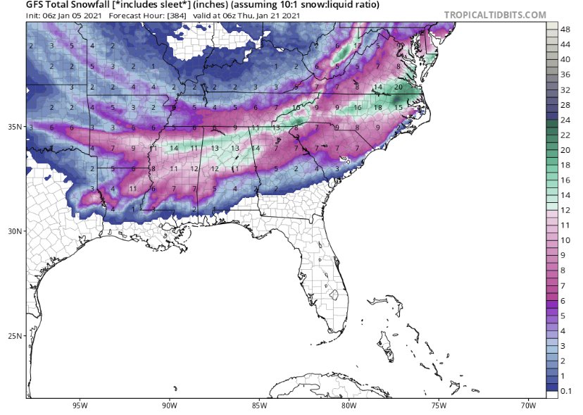
I know posting long range snow maps is a lesson in futility but this highlights the upcoming potential to have multiple storms through the period. Looks to be an exciting couple of weeks ahead
-
4
-
-
18 minutes ago, bargainmusic said:
No reason to run any more models. Let's just stick with this one and call it a day.

Any model that nails the Raleigh snow hole so perfectly has to verify 100% of the time I’d think
-
4
-
-
Love when this board comes alive. I’m still skeptical about this coming fridays system given the lack of cold air around but looks like we may have several shots down the road. I’ll let the experts continue and I love the discussion. Thanks everyone!
-
7
-
-
Another over producer in the rainfall department. Just under an inch and a half, 1.44” in the bucket
-
29 minutes ago, BornAgain13 said:
0Z Euro keeps the snow confined to the mountains, 0z GFS and 6z GFS and 0z CMC all have moderate-major snows for southern VA/Northern NC , taken verbatim
No cold air source. No threat outside of mountains for significant accumulation imo. Verbatim models showing snow only in heaviest returns. Upper levels decent but rate driven snow this far out is just something to cut out the boredom
-
Pattern better hurry up
-
1
-
-
26 degrees this morning. Pretty sure we’ve seen more 20’s this year through December than all of last winter combined
-
Yep, I’m convinced Raleigh zeroes out on snow this year
-
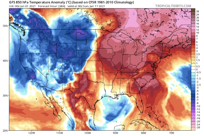
12z GFS keeps a shred of hope alive for the 3-4th storm. Euro has it too. Poor HP placement means no arctic cold source but ULL overhead provides a cool pool with decent 850’s. Storm would have to generate its own cold air, in other words. We know how that usually ends up. But the track is favorable and the upper levels aren’t bad so there is a chance... this isn’t way out in fantasy land either. At least something to watch other than cutter city in the near future. Sucks to have a favorable LP track but no cold air but alas so is life in the south
-
This thread is better than this winter
-
1
-

.png.cca1847b5c9a410bfe51476e6b14da11.png)

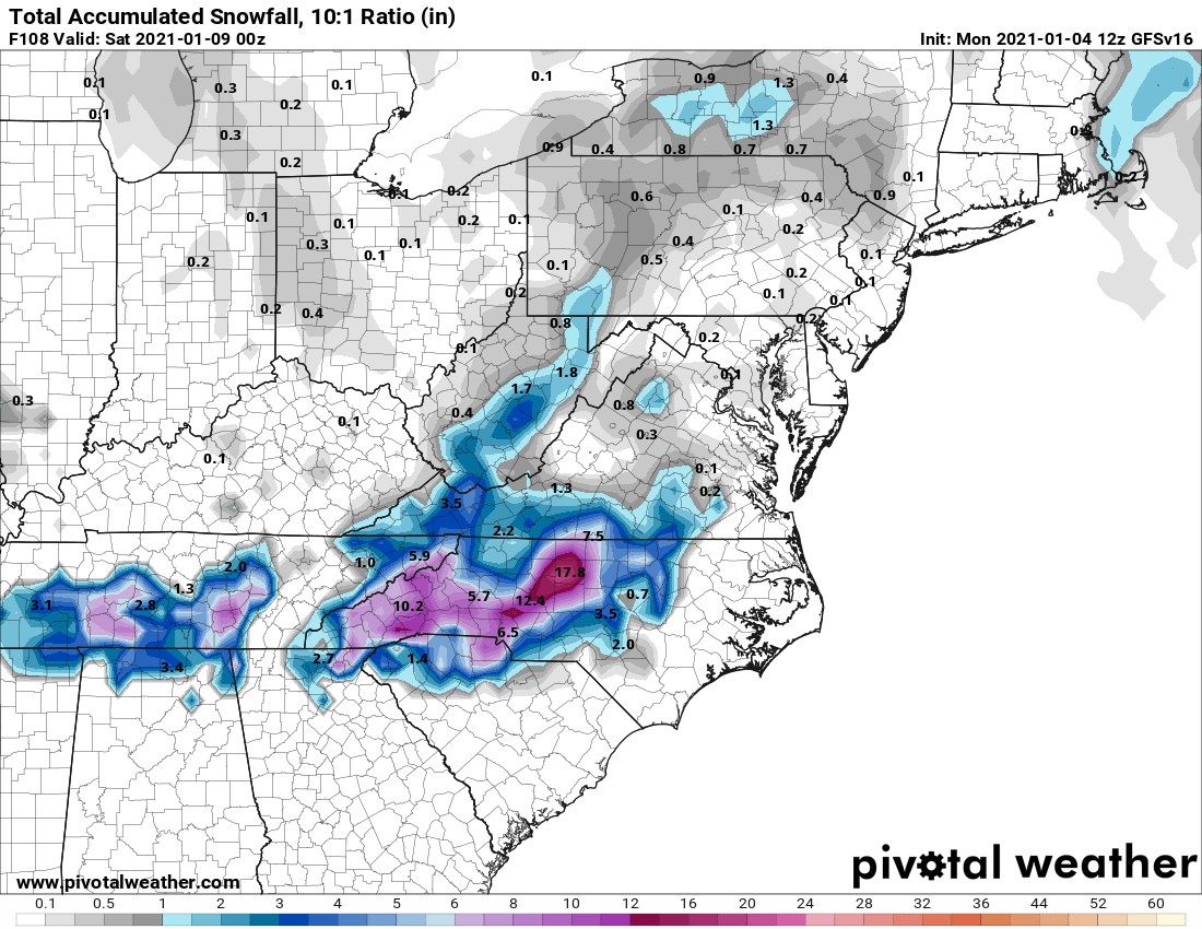
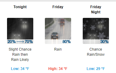
January 8th-9th threat
in Southeastern States
Posted
Always exciting to be under the first winter weather headline of the year. Liking the trends today in the Raleigh area. Think my odds of getting the grass covered are north of 50% now