

NorthHillsWx
-
Posts
3,966 -
Joined
-
Last visited
Content Type
Profiles
Blogs
Forums
American Weather
Media Demo
Store
Gallery
Everything posted by NorthHillsWx
-
Major winter storm incoming
-
Well 186 is as textbook a winter storm look as you could get. Perfect 1044 placement and developing gulf low.
-
That is, umm, a cold look for the Carolinas
-
EURO at 174 has a 1046 HP over the GL and a gulf low. Likely going to be a suppressed solution but I’ll take that look a week out
-
I remember sleeping 6 nights next to the fireplace with my family and having to shower at a friends house. No damage at our house but took weeks to clean up fallen trees at our farm in Franklin county. Also remember it snowing to begin that storm and sticking from the first flake. Must have been very cold leading up to it
-
I just want to verify a winter storm warning this winter. Be it ice or snow, bring it on! Also, if I’m getting ice in Raleigh, you’re likely getting sleet or snow in Winston Salem. Win-win
-
Well, some people on this board may have been a bit too quick to press the “cancel” button on this winter from today’s 12z suite so far. That’s all I’ll say. Many, many more runs to go but Friday through next week gives us some pretty awesome potential. Not saying we’ll get a flake or ice pellet but winter most definitely looks to be alive and well
-
Is it bad to say I kind of want an ice storm? It’s been so long since we had one in Raleigh that amounted to anything other than a nuisance event. Definitely helps I have a generator that’s been sitting unused for 3 years
-
Friday has legs imo. Won’t be a snowstorm but potentially a disruptive winter event if modeling trends continue. Most of us had written it off but it’s trended colder and colder for a couple days now.
-
GFS gives Houston consecutive hits from sleet and freezing rain. Wow
-
GFS trended much colder with the stronger weekend system as well
-
Definitely the signal for a mixed precip event Friday. These CAD storms tend to trend colder as time goes on. Definitely getting interesting
-
For the triangle (Raleigh) area we need ever mb we can get as we’re not a favored CAD location. It was more of an imby post but agreed it’s enough to work if placement is correct
-
1034 is just barely workable. Placement would have to be perfect
-
25 degrees this morning with heavy frost once again.
-
Yep. This. At least cold air is in striking distance now but that SE ridge seems to always win out when it’s established.
-
GEFS is significantly better than the op but yea, not great
-
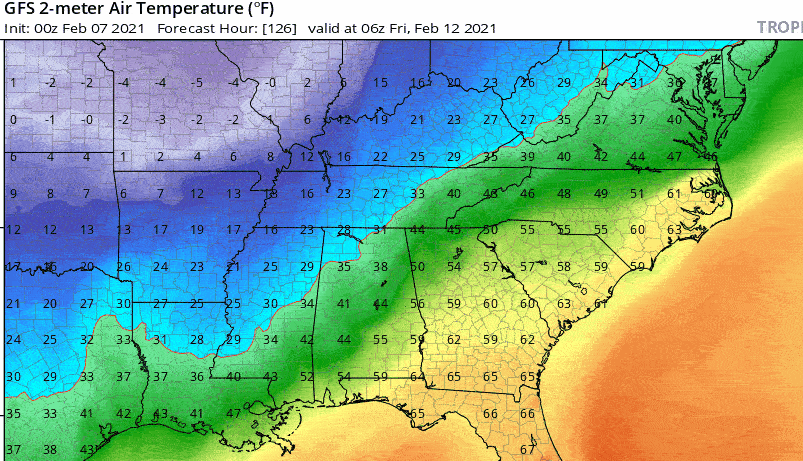
Just going to leave this here.
-
People are not going to like the snow maps or precip depictions but there’s a lot of potential showing up still. I think a CAD event, or multiple, seem probable in the coming period.
-
I would expect some wild swings with this model next couple runs given that
-
I can sense the renewed enthusiasm now that you’ve had your snowstorm this season haha
-
Model trends: GFS: positive, several winter events and close calls. Probably most consistent modeling of late EURO: Most improved player award. Gets arctic air in. Great CAD look for Thursday/Friday system then a follow up system w/potential before arctic air moves in Canadian: dumpster fire, no sugarcoating it ICON: improved. CAD signature and trended colder towards end of run
-
Man that’s a pretty HP placement at 192
-
EPS ensembles should be interesting
-
Consistency...


