

MarkO
-
Posts
3,401 -
Joined
-
Last visited
Content Type
Profiles
Blogs
Forums
American Weather
Media Demo
Store
Gallery
Everything posted by MarkO
-
Congrats, but I believe you might bust on your forecast!
-
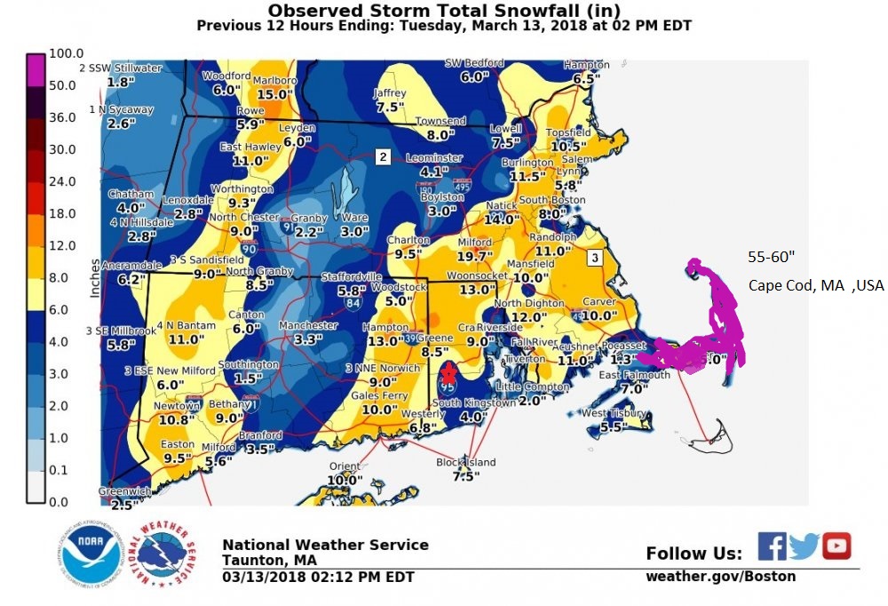
Heard another report in Lowell of 14" at 4:30. That would mean they're close to 16" by now, but I think that report was probably an actual measurement.
-
I was taking measurements this AM when I was about 2-2.5" behind Ray. Haven't taken a legit measurement since then, but I'd wager we're pretty close to Ray since the returns had been generally heavier this afternoon. He's also only 6 or 7 miles to my southeast. I'm guessing about 18". Ray, what are you at?
-
Just getting crushed in Lowell under 35dBZ returns. Starting to worry about the white pines. Boughs are nearly touching the ground, that's usually when the upper ones start to give. Wind is pretty light, 29.2/28.
-
Yeah, that band you got skipped over me, gave you a nice head start. It's been better here overall this afternoon.
-
Some of the heaviest snow of the day. About 2"/hr stuff and it's looking like a couple more hours of it.
-
Been dumping since about noon. Looks like a few more hours of this then an inch or two overnight. I think 20 burgers from 128 up through southern NH into Worcester
-
What have you gotten so far? Any core samples?
-
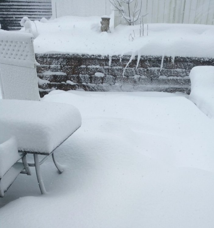
11" on the table which was cleared before it started. Not sure what that translates to, but wouldn't be surprised if it was in the 14-15" range.
-
No official measurement in Lowell, but we've got to be closing in on 15"
-
I know James was forecasting that for his neck of the woods. Around noon he was closing in on a sloppy 6"
-
yeah, was going to say about a foot here in Lowell. I think we're in for another 6"+
-
Looks like NE MA and S NH going to get in on the pivot point. Someone in that area is going to >20"
-
Yeah, I just got in on it here in eastern Lowell, but it began collapsing. :/ About 6" OTG 28.3/26
-
Ray getting crushed!!!
-
Congrats James, wind and wet snow. Do you lose power often down there? If so, get ready. That's some heavy snow!
-
Has James chimed in? Looks like he's been snow for nearly the whole event. Does he flip? 40" though.... gonna be tough.
-
At least the bands are pivoting, but there is a clear subsidence zone which appears to be 495 southwest through Worcester into C CT. Hopefully it moves west so some of us get in on the goods. Ray may have 50% more than me even though he's only 6 or 7 miles southeast.
-
I got 0.04" rain in the bucket and snow's already accumulating on pavement. Temp is only going to drop from here on out. Bigger question is where does the subsidence set up? 32.6/31
-
Lite snow, starting to accumulate on all surfaces 32.9/31 https://www.wunderground.com/personal-weather-station/dashboard?ID=KMALOWEL35
-
That low level easterly crap was rain over my backyard, but things should hopefully cool by midnight when the main event stats. 34.2/31
-
http://www.swpc.noaa.gov/communities/space-weather-enthusiasts
-
I didn't think it was too sick until I noticed the vaseline on the hotdog


