dallen7908
-
Posts
919 -
Joined
-
Last visited
Content Type
Profiles
Blogs
Forums
American Weather
Media Demo
Store
Gallery
Everything posted by dallen7908
-
Certainly a cold morning here but I wonder how much colder it would have been if the ground were white and not brown. Friday's relative warmth and Saturday's sun were enough to melt the (almost) 1" I received - at least in non-shady areas. Quite the contrast with the few of you to the north who have had full snow cover for several weeks Likely comes down to rates - an inch or two of snow is only a few tenths of precipitation - it could happen
-
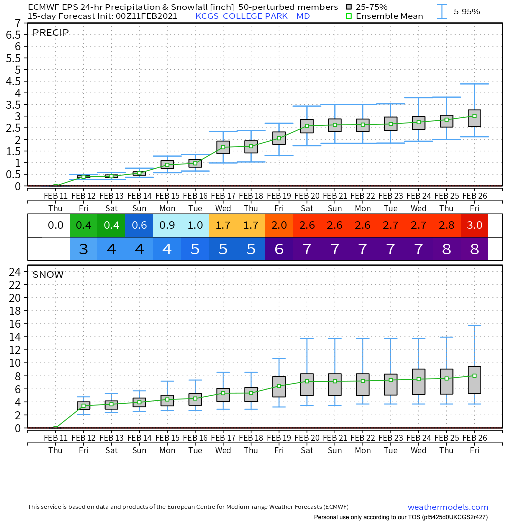
Strong support from the 00UT EPS for a minor event Monday evening - 44 of the 51 members give measurable snow/sleet in College Park. what could possibly go wrong? 90th percentile: 2" 80th percentile: 2" 70th percentile: 1" 60th percentile: 1" 50th percentile: 0.9" 40th percentile: 0.6" 30th percentile: 0.4" 20th percentile: 0.2" 10th percentile: 0.0" Keep in mind these are for College Park; your backyard could do a bit better. Also, do not apply the (EPS-3)*2/3 rule, which has worked so well this winter. It works best with a 24-hour forecast and has not been tested yet during this period of shorter wavelengths and colder climatological SSTs.
-
Sleet / snow mix in College Park
-
12/16 0.6" 1/25 0.4" 1/31 2.0" 2/1 0.25" 2/2 1.25" 2/7 0.1" 2/10-2/11 0.4" 2/18 0.8" 2/19 0.2" 6.0" for the season (College Park)
-
Sleet dancing on the bushes like popcorn in a popcorn popper. 29 degrees here. Dusting of snow very early followed by sleet/freezing rain mix
-
Feb Long Range Discussion (Day 3 and beyond) - MERGED
dallen7908 replied to WinterWxLuvr's topic in Mid Atlantic
*The storm that caused the NWS to reconsider its decision to retire the NAM or why one shouldn't look at mesoscale output until within 48 hours? *Just kidding of course, it isn't really being retired because of performance -
Feb Long Range Discussion (Day 3 and beyond) - MERGED
dallen7908 replied to WinterWxLuvr's topic in Mid Atlantic
The NAM showed an ugly warm nose near 700 hPa. Here is a time series showing 700 hPa temperature trends for several runs of the GFS-Parallel for 1 PM Thursday afternoon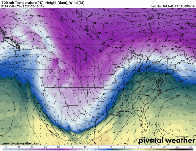
-
Feb Long Range Discussion (Day 3 and beyond) - MERGED
dallen7908 replied to WinterWxLuvr's topic in Mid Atlantic
Fun to watch the heights over the eastern U.S. get beaten down and the push of the TPV into the Dakotas. Wintry mix incoming for many of us (duh).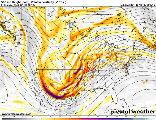
-
If 0.02" and cold surfaces/air temperatures is a high-impact event shouldn't the criterium for ice storm warning be changed; I thought 0.02" without sleet/snow is an ice storm advisory
-
12/16 0.6" 1/25 0.4" 1/31 2.0" 2/1 0.25" 2/2 1.25" 2/7 0.1" 2/10-2/11 0.4" 5.0" for the season (College Park)
-
Its maddening that (EURO_ensemble-3")*2/3 has provided a reasonable 24-hour snow fall forecast for College Park - 3 storms running. The operational has provided similar results. Guess its the Euro cold-bias at work. Of course, the ensemble mean should never be used for a forecast. At short range, use the operational forecast; at long range use the ensemble median ... and sigh adjust for your local climatology

-
For DC, the "always reliable" precip type indicator shows snow beginning just before 00 UT with mixing near DC from 7-11 UT.
-
Assuming a 17/1 ratio per Kuchera, DC-area could get close to 5". Limiting the upper bound to a more realistic 12/1 yields 3-4". Of course, temperatures may reach the mid 30s on Thursday afternoon during the lull. So we could lose a bit due to melting by the time of the 2nd wave, which is forecast to drop 0.2-0.3" of snow per hour - for several hours
-
The following is from the Capital Weather Gang's 5:31 AM bulletin. Any idea as to why their level of confidence is "low"? Is it simply the fact that the precipitation isn't expected to arrive until very early Thursday? Is it concerns about the precipitation type? Suppression? the UHI? To my untrained eye it seems like this system is more straightforward than most. It is mostly overrunning and doesn't rely on an on-time phase, dynamic cooling, or a well positioned CCB. I mean if they use "low" here what adjectives are left for most storms. Thursday should start with more snow, but some wintry mix remains possible, especially south of the District. We may see a precipitation break for a few hours in the afternoon as highs hold only in the 30s. Thursday night should see precipitation pick back up again. It’s most likely to be in the form of snow as temperatures fall into the 20s, but mixed precipitation cannot be ruled out. Confidence: Low
-
Through 12 UT on the 13th here are the EPS snow/sleet percentiles for College Park: 90%: 12 80% 11 70% 10 60% 9 50% 8 40% 7 30% 6 20% 6 10% 4
-
I should take the spotters course. No reports from P.G. county for this storm and at least one other this winter. Of course, if I take the course they'll probably tell me not to bother reporting amounts from a typical P.G. storm, i.e., 0.1 or 0.3". https://forecast.weather.gov/product.php?site=NWS&issuedby=LWX&product=PNS&format=CI&version=1&glossary=0&highlight=off
-
Feb Long Range Discussion (Day 3 and beyond) - MERGED
dallen7908 replied to WinterWxLuvr's topic in Mid Atlantic
Before "we" get too excited let's see how much of this "occurred" this morning! It's certainly been a rewarding winter for many - Hope the immediate D.C. and Baltimore areas can join the fun later this week. -
12/16 0.6" 1/25 0.4" 1/31 2.0" 2/1 0.25" 2/2 1.25" 2/7 0.1" 4.6" for the season
-
We got 1/8" of snow before changing back to rain about 15 minutes ago. Hopefully, it'll change back to snow.
-
Just changed to rain/snow mix 36 degrees (College Park)
-
If the ECMWF is truth, College Park is looking at a 4 AM start with perhaps an inch per hour from 6 am till noon; temperatures holding steady through the morning at a workable 33 before touching 40 mid-afternoon - coldest morning of the year on Monday (wouldn't take much here, I haven't seen less than 23)

-
Feb Long Range Discussion (Day 3 and beyond) - MERGED
dallen7908 replied to WinterWxLuvr's topic in Mid Atlantic
So you're saying no storm-specific thread until Friday afternoon? The northern tier folks may disagree but the GFSv16 was close to a win for all of us. -
12/16 0.6" 1/25 0.4" 1/31 2.0" 2/1 0.25" 2/2 1.25" 4.5" for the season
-
Feb Long Range Discussion (Day 3 and beyond) - MERGED
dallen7908 replied to WinterWxLuvr's topic in Mid Atlantic
My thought that our window might end for 7-10 days after this storm seems dead wrong. With respect to popping ... You'd make a fine closer in baseball. Some of us require more time to recover after being ghosted at the altar. Others live north of us. Off to the other forum, flurries (and not just a stray flurry or two) have commenced in College Park -
Jan 31st - 33rd Storm Obs and Disco like it's 1979
dallen7908 replied to Bob Chill's topic in Mid Atlantic
Perhaps this is in the small print: Realized snow = (ECMWF-3)*0.667 > 0