Stevo6899
-
Posts
2,740 -
Joined
-
Last visited
Content Type
Profiles
Blogs
Forums
American Weather
Media Demo
Store
Gallery
Everything posted by Stevo6899
-
393 days since dtw saw a wsw. Dtx gonna issue one?
-
Canadian and UK not very impressive. Id expect the models to hone in on the track of the next system hopefully by Tuesday after this current system rolls along.
-
24-30 hours until impact and crickets from dtw. I hate to rip them but they are awful. I guess one of these years I'd expect them to improve but that seems like false hope. Editt, i see they have taken down their weather story graphic they added early this am that had a map for 3-6 total.
-
If todays runs so far hold true, score one for the parallel. And maybe the euro but i dont recall if euro had the snow as far nw the past few days.
-
Curious how dtx is gonna handle this headline wise, grr too.
-
Whats your snow depth? Got the delta app fired up and really close to booking a flight home tonight and staying for the week in hopes of the late week storm producing too. Could be record snow depth. Hoosiers asleep at the ban switch!
-
What's your take on the kuchera map totals. Normally you have to at least cut those by 25% but in this setup with Arctic air in place, it's possible they could be more accurate?
-
I figured but pink and white are my fav colors, and its only fitting to start my day with a lovely map today. Happy vday to me.
-
Im sure we wouldn't mind if you generously posted the weenie kuchera for this. Thanks in advance.
-
. I hope DTX doesn't issue any headlines because when they're too conservative they always get burned and we end up with a good storm. Every winter there's a storm where they issue an advisory then upgrade to a warning an hour after 8 inches has already fallen. They've always sucked.
-
Yea been down here since nov 1st. The weathers been so nice. Its rained 3 days since then and above avg temps in the 80s everyday during this arctic intrusion the past 7 days up north. Ive been really rooting for y'all up there all winter. Hopefully this storm or the next one can deliver finally for ya. Good luck.
-
Down in florida until mid march. Tbh I dont think this will be more than 3-5 in SEMI.
-
Lol @ nam having some of the higher totals in the area in nw ohio that has no advisories currently.
-
Nornally id say you gotta cut these kuchera totals in half atleast but its been awhile since SEMI has had this kinda arctic air in place with a decent storm and moisture coming in from the south, so who knows.
-
I think gfs parallel has had over 70 inches in my backyard in the last month and we've probably got maybe 10 so I wouldn't trust it. Looks like another Detroit duster incoming. Its wild how every decent event has eluded the indy/toledo/dtw corridor.
-

Winter 2020-21 Medium/Long Range Discussion
Stevo6899 replied to Hoosier's topic in Lakes/Ohio Valley
Gfs/ggem pretty close in agreement on track for storm for next weekend. -
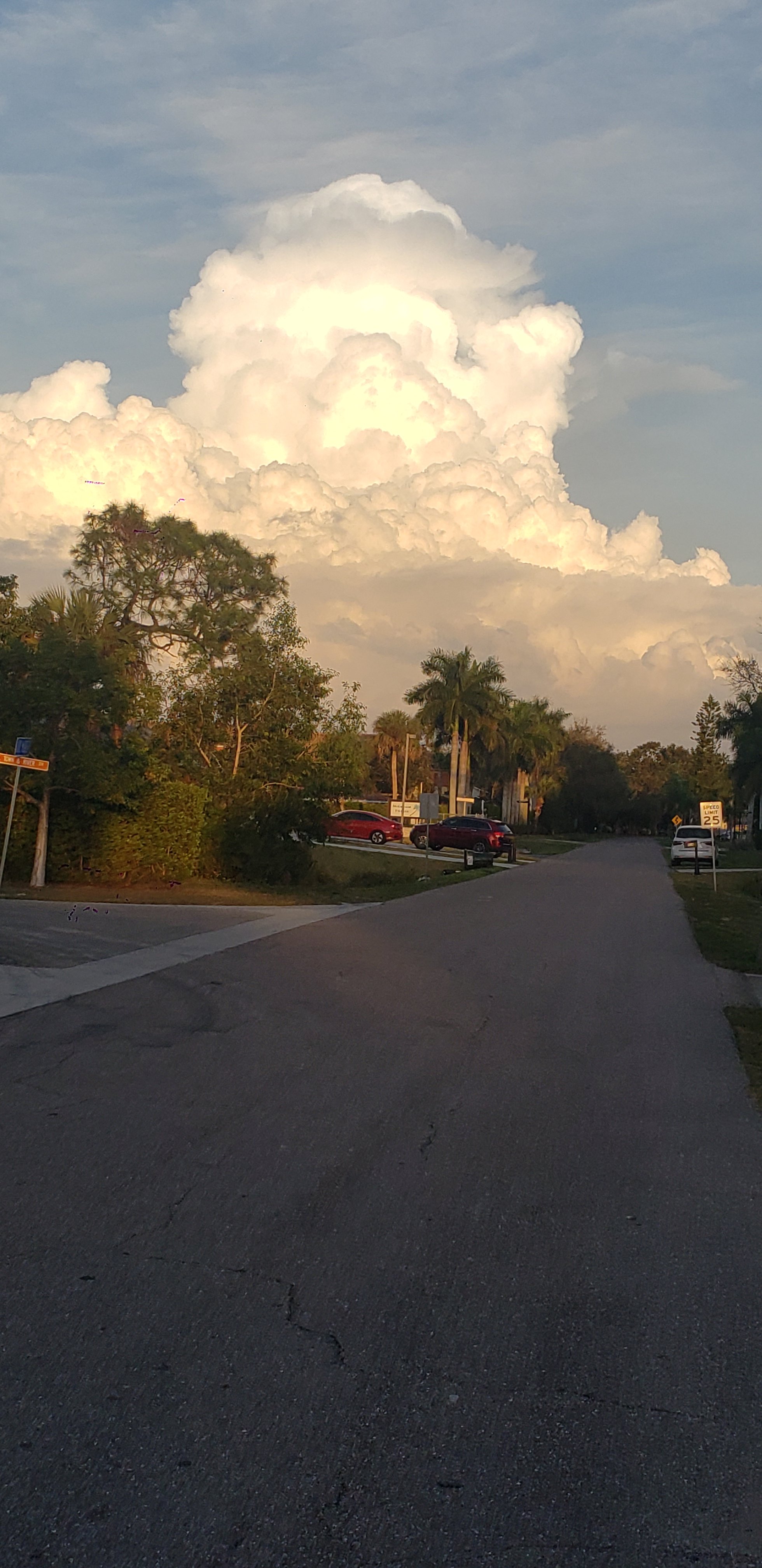
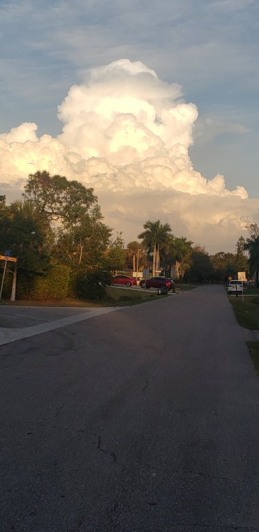
I saw this tower blossom on my bike ride tonight. Thought I'd snap a pic and upload it since its prob been 5 months since y'all seen one.
-
Pv and arctic air need to retreat a bit. Rather take my chances with precip issues. More often than not, big dogs occur with warmer temps, more moisture. Gotta smell the rain to get the big snows most of the time. This pattern isn't allowing any spacing or room for amplification. Not sure if that's more bad luck with pieces ejecting/lack of a strong shortwave or the colder air squashing the storms more SE.
-
Im assuming ratios would be atleast 20:1, so detroit could be looking at their first 6+ event, and possibly wsw and warning. Hopefully the euro is right.
-
It's funny how just a couple years can change your mindset and thinking. 2-3 years ago, those on the northwest fringe of storms thought they were sitting pretty In case of last minute NW trend/stronger low pressure systems, which we saw often. The past couple years its been the opposite for the most part. I never thought I would miss the Northwest trend days. Hoping we can get back to that the next few weeks. Ill take potential for sleet and rain over dry, cold and miss the the SE.
-
As often in this setup, the low wants to transfer its energy to a coastal vs remaining dominant and strengthening as it moves NE. This is why its so hard to get a big dog in the eastern great lakes/subforum.
-
I haven't been home since nov 1st, but via cam near my front door, I can confirm I see blades of grass peaking through the snow. The lack of big dog potential in my neck of the woods this winter is a bummer. Old crusty snowcover doesnt do anything for me but y'all enjoy your yellow/black dirty snowcover.
-
We gotta get a shortwave with some strength to come along before this cold air retreats and were back to dealing with precip issues. Early indications the euro is still gonna have a respectable storm based on the ridging and location of high pressure. Maybe a lil further east.
-
Its gonna have to be very buried to get me to leave 85 and sunny down here in estero florida. If only my family and friends knew id fly home for a snowstorm lol.
-
It seems like for the past 2 weeks the gfs has had a pretty big storm at about 160 hours and then it fades and 2 days later another storm at 160 hours lol. Definitly desperate for a decent snowstorm to even be looking past 100 hours on any model.