

Stevo6899
-
Posts
2,740 -
Joined
-
Last visited
Content Type
Profiles
Blogs
Forums
American Weather
Media Demo
Store
Gallery
Everything posted by Stevo6899
-
I feel like i saw these same maps all last year up until now and never seem to verify, atleast up this way in the eastern lakes. Either way looks like were gonna have to thread the needle to get a snowstorm for the next few weeks through christmas.
-
GFS and euro both have something around the 10th but but models have been showing a decent storm in this range for a couple weeks to only have them vanish.
-
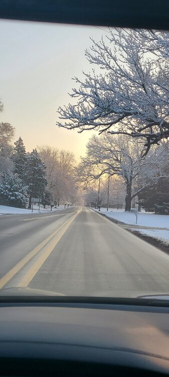
It is pretty neat to see it plastered to everything.
-
Lansing to Ann Arbor have been in the banding all day. I wouldn't be surprised if those areas see 4 to 5". Dry air has been eating away at the precip all day here on the east side. Maybe an inch has accumulated.
-
Obviously we have different criteria to what accounts for a good winter. You're okay with settling with northwest flow and garbage clippers like the current pattern, meanwhile I'd rather roll the dice and get the southern stream and gulf open for business. I'll take warm and potentially wet over dry, high ratio 2-4 inchers. Most models have something in the dec 4-6 timeframe. The key will be to have a somewhat strong clipper drop down to push the jet stream further south so the next storm in line can dig south a bit. The gfs does this, while the euro keeps the clippers weaker, making the next big storm most likely a rainer for most of the midwest.
-
Gross.
-

Winter 2021-22 Short/Medium Range Discussion
Stevo6899 replied to Chicago Storm's topic in Lakes/Ohio Valley
GFS has a decent clipper for the lower lakes late weekend. High ratio fluff. The usual weak until it blossoms along the east coast. It always amazes me when energy can look so weak around the lakes, then boom turns into a respectable storm for the coast. -
I'm remembering the mid February storm, temps were pretty cold, like in the upper teens? The ratios def saved it from being a total dud Not one model had the dry slot getting this far north, but somehow Detroit always finds a way to get into it. Either way it's been a pretty dull Winter the past 3 years so hopefully we can get things going in here soon. It's a bummer because we've had some decent colder around here lately but no storms. Hopefully yall don't mind us cluttering up this thread a bit. Not a whole lot going on really anywhere snowwise.
-
Yea that storm. Wow i thought the dry slot snuck into toledo too. Good to see toledo jackpotted for once.
-
Toledo had 14 on the ground after last yrs mid feb quick hitter?
-
I wasn't here for the feb 15 storm but i remember it as one storm that only lasted 4-6 hours and most places saw a high ratio 4-5 for the main show. Snow that happened the previous day shouldn't count towards the main show imo. Im not heading south to florida for the winter until jan 1st so here to hoping for a front loaded winter.
-
Ill take that track anyday. If you want a big snows, you got to smell the rain. That feb storm last year was a fast mover and I think only like 4-5 fell in most areas, high ratio fluffer. Models were hyping it bigger than it ended up being. I think the only event last year that dropped more than 3".
-
Northwest flow and clipper patterns don't do it for me so I guess now's a good time to be in that now and get it out of the way, and hopefully it doesnt return this winter. A decent warm up looks to be on the horizon soon. We need one powerhouse low pressure system to track north of us and push the jet stream further south so we can get some low pressure systems to come out of the 4 corners, or the gulf. I am itching and craving for a snowstorm. It's been what seems like 3 years since we've seen a decent snowstorm here in Detroit. The early november surprise storm in november 2019 is only one that comes to mind.
-
Could it be? November 13-15 Potential Snow
Stevo6899 replied to Hoosier's topic in Lakes/Ohio Valley
Decent returns over SE MI. First flakes of the season is steady snow, and not the usual mood flakes. Perhaps a sign of things to come this winter... -
Could it be? November 13-15 Potential Snow
Stevo6899 replied to Hoosier's topic in Lakes/Ohio Valley
Thus has been the theme the past few winters, "sheared out as it heads east". -
I wasn't here but I think most of the snow that was on the ground in February was High ratio/low qpf water content. Add that it all melted with no additional rain. I didn't see my 1st rain drop until 29 days after I got home March 1st, so it's not all that hard to believe that this area is in a drought. Days like today are my favorite. Mid 80's, low humidity.
-
Euro and UK schooled the GFS. GFS was way too north all along with this one. Looking outside, you wouldn't know the area was in a decent drought. Everything green and blossoming. Decent rains here the past few days. I'm ready for some 80's. This is like 3 years in a row may has been crappy.
-
I have been on a heavy lose weight campaign the past year since last year when I gained 50lbs sitting around healing from back fusion surgery. My first question after getting the first dose in March was can I exercise and do cardio right after and I was told yes and pretty much go on about your life normally. Obviously with the sore arm, lifting weights may be unpleasant. I was lethargic and arm pain almost right away after the shot, but forced myself to hop on my exercise bike. I instantly felt better.
-
Another quality potential bites the dust. Seems to be the norm the past 3 winters, trends SE, weaker as we get into 72 hour range. Score one for the ukmet, schooled the euro.
-
How many more cycles/runs until the NAM caves? 18z looks sexy for N IN up through detroit. I hope it's right but I have my doubts.
-
After last nights euro and the 6z nam this morning, along with the rgem caving SE, id say maybe the ukmet will score a coup with this one, but the 12z NAM is back a lil further NW and has a more impressive band of snow from Chicago through port huron. Not sure what to think with this one. I have a trip planned to Cali to see my bro and have a flight out tomorrow but if this one looks to drop 6+, I may stay for it and fly out wednesday lol. My brother after all these years still can't believe I would stay a few days home for a snowstorm rather than going to cali lol. Nobody understands us weenies.
-
Gfs/canadian continue to be east of the NAM and euro. 0z rgem looks juicy for eastern MI. Ukmet still well SE. Looks like its the nam/euro vs the rest.
-
Its been consistent in the band placement the past 3 runs.
-
Ukmet even further SE meanwhile 12z canadian is in the middle, 6-10 for most of SE MI. Id expect a little more waffling until the front settles SE the next day and a half. The low looks to be strengthening and maxing out in the region which is nice to see. Recently, more often than not, low pressures would be fizzling as they approach dtw, due to the darn block and other factors.
-
The gfs and ukmet went southeast clipping Detroit. The Canadian was stronger than actually throws the biggest knows West to Detroit so I would expect the euro to have a blend and keep the 6-10 totals the 12z had.


