

crossbowftw3
-
Posts
1,399 -
Joined
-
Last visited
Content Type
Profiles
Blogs
Forums
American Weather
Media Demo
Store
Gallery
Everything posted by crossbowftw3
-
73/72 here, Syracuse never fell below 80.
-
80/71 here. Sun is fully out so fixing to take off soon. Forecast high is 90 but wouldn’t be shocked if we end 3-4 degrees warmer. no reason to go outside anyway since I got a nice sunburn across my arms yesterday
-
Upstate/Eastern New York
crossbowftw3 replied to BuffaloWeather's topic in Upstate New York/Pennsylvania
Watch has finally gone up here in the Catskills, watching what comes from my west this afternoon/evening -
Watch finally went up here. 60/20 on wind and 40/30 hail, not expecting much action until post-6/7 PM by which time who knows if the storms will begin to drop off by the time they get to my doorstep.
-
Those storms blew up right over me basically. Half an hour’s worth of heavy rain has stabilized things here. Radar presentation almost looks like an MCS beginning to bubble up. 72/71
-
It's pounding out there already. 53/46 is this Memorial Day weekend or the 1st week of March?
-
Temperatures tumbling down as the main line comes through but no noteworthy storms happening. 70/64
-
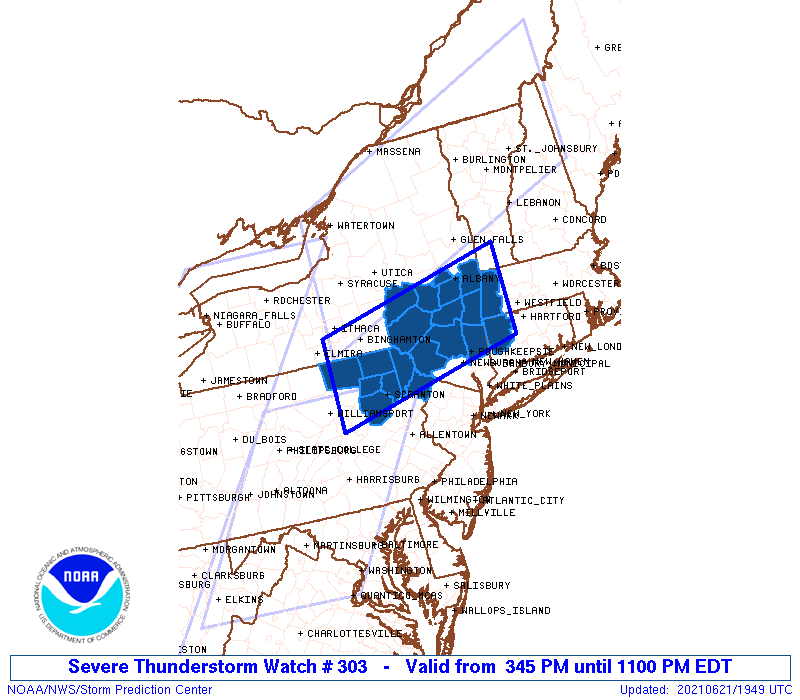
First severe watch for the season for me: https://www.spc.noaa.gov/products/watch/ww0205.html
-
rapidly becoming muggy. 78/66 for a rise of about 14 degrees in two hours
-
64/62 @ 8:23 AM. Gonna feel awful today, hope for a storm to cool things off. Window for storms here will be around 2-3 hours earlier than points SE of here, between 4-6 this afternoon.
-
Today does seem like the first real severe threat we’ll see for the summer; not everyone will see storms but I imagine areas that do could generate some reports. Meanwhile, the Midwestern states have a good chance to begin derecho season over the next two days. Very strong instability will be present both days coupled with other factors = likely evolutions both days into intense MCSs
-
cloudiness and showers around after the slug of rain Friday afternoon/evening?
-
Temperatures tumbling. 73/61
-
Front/windshift beginning to creep in, 79/64 while Binghamton has fallen to 68.
-
Mostly cloudy so far here, 72/63. Severe threat is marginal but worth watching the skies today.
-
Memorial Day plans looking at this with an unsteady glare
-
Significantly more cloudiness today. Despite this, slightly more humid at 83/60 right now.
-
First 90 of the year here @ exactly 90 degrees at 4:31. Dew points aren't awful though but just enough to make it feel like the inside of a toaster out.
-
Rain was absolutely crazy last night. Picked up about 2" here with another .3 or so today. Rivers around here look pretty angry.
-
Into full sun here now. Even if the severe threat is overall low the heavy rain threat looks like the main threat overall.
-
Downgraded to marginal risk for everyone today. Makes sense since this threat was pretty conditional overall and without much of a chance for instability the jet is the only thing that’ll generate much in the way of storms. Tomorrow’s wind threat will be the bigger issue, easy advisory gusts for everyone https://www.spc.noaa.gov/products/outlook/day1otlk.html
-
It’s looking like the Giants will land an Alabama receiver after all tonight...the question remains who.
-
feeling the toastiness already despite cloudiness dominating more than the sun. Sitting on the edge of today's marginal so we'll see what happens. Storms probably weaken on approach if anything does happen
-
Upstate/Eastern New York
crossbowftw3 replied to BuffaloWeather's topic in Upstate New York/Pennsylvania
Just barely in marginal. I’m gonna assume things will begin to fall apart on approach here -
Upstate/Eastern New York
crossbowftw3 replied to BuffaloWeather's topic in Upstate New York/Pennsylvania
Missed seeing 80 degrees here because of the timing of the front on the day NYC saw 83/84 on gusts 40-50
