Kmlwx
-
Posts
13,020 -
Joined
-
Last visited
Content Type
Profiles
Blogs
Forums
American Weather
Media Demo
Store
Gallery
Everything posted by Kmlwx
-
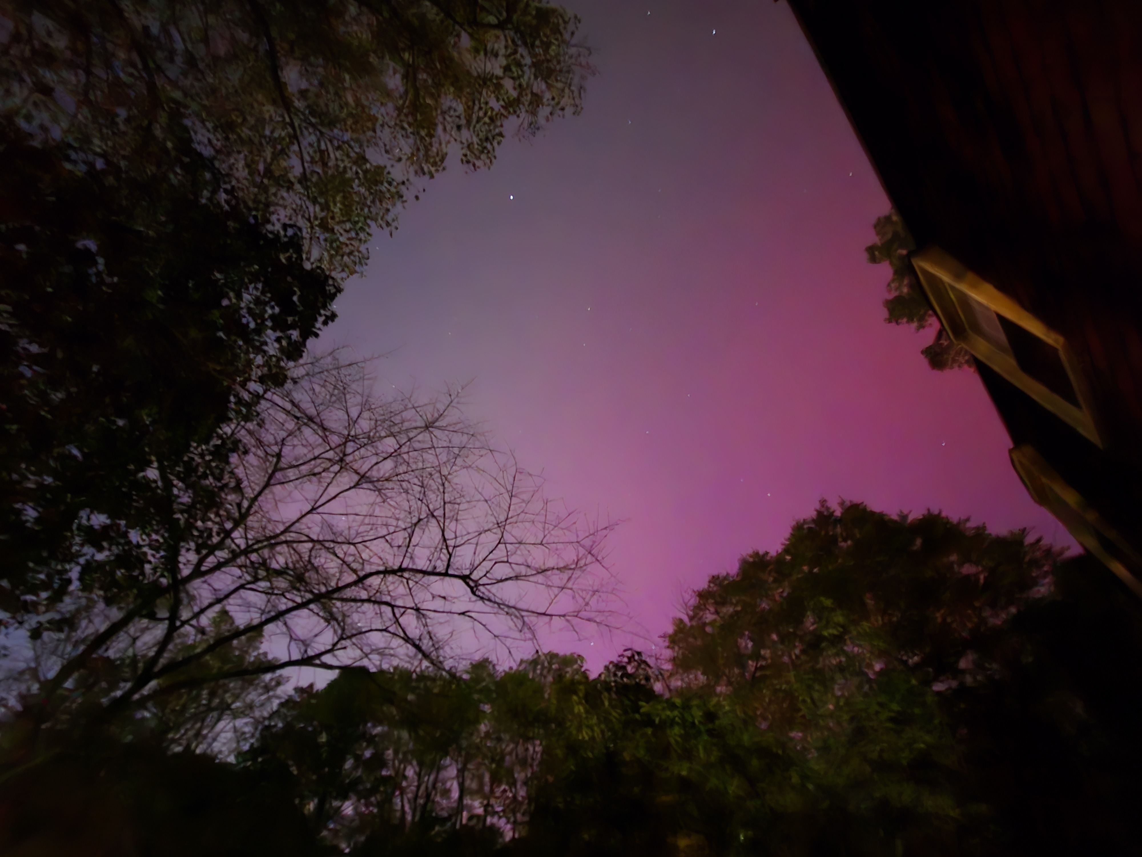
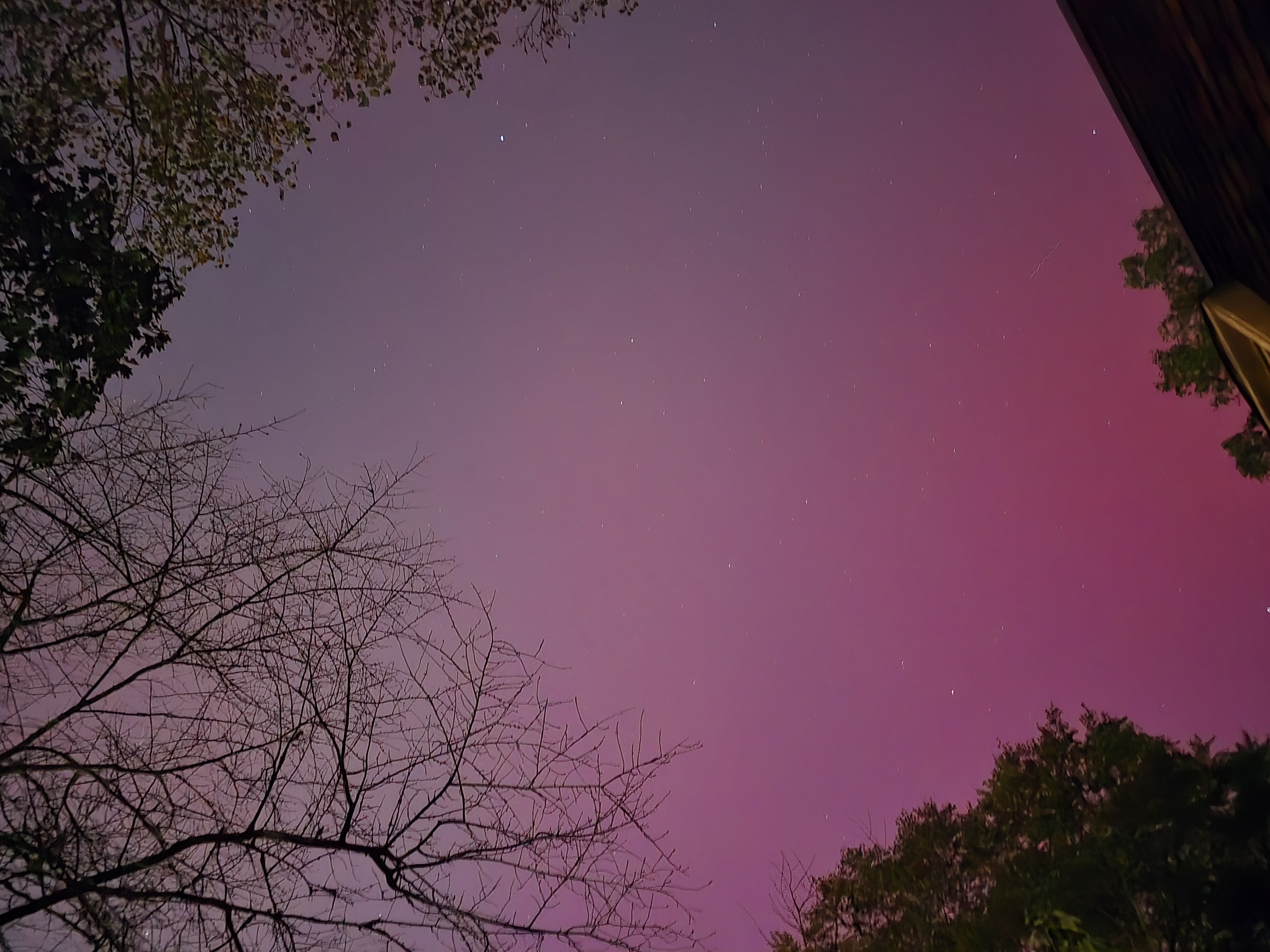
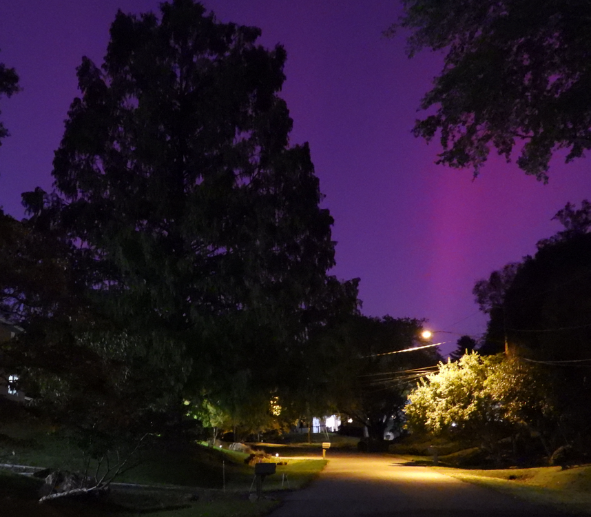
It has definitely died off a bit. It will likely ebb and flow - HUGE thanks to @WxUSAF - as soon as I saw your picture I went out. Had I been a few minutes slower I likely would have missed that first surge.
-
Every other time - save for maybe a tiny peek - I have fallen asleep or a storm has failed. This is wonderful. Savor this folks!
-
Sooo cool!
-
Another M7.7 flare it looks like. Again it looks rather impulsive rather than drawn out. We'll see.
-
Keeping an eye on imagery to see if there's any faint halo CME with the most recent impulsive flare. That sunspot bears continued watching!
-
Tomorrow night seems like the best shot. Think that by Friday night the storm will have subsided unless more activity erupts. Space weather is so fickle, though. Let's hope the storm onset and peak holds off until we are well after dark tomorrow evening. Would suck to waste daylight hours on Kp7-9 values.
-
Another X-class flare. But this one looks (at least preliminarily) to be more impulsive. Probably a lower chance of a CME with this one. But who knows. The existing CME from yesterday is still coming.
-
If this pans out - the weather looks spectacular for visibility of any geomag storm
-
They should be held criminally responsible if any of their employees are injured, killed or otherwise harmed.
-
Heck...maybe out seasons are shifting a bit. We all have mentioned that winter seems to start later and later but hang on later as well...fitting that hurricane season would follow that pattern.
-
I wonder if they are going to do rapid center fixes until the Air Force plane gets there.
-
Bearish. Why not just go with Cat 10?
-
The weather just likes making a mockery out of us amateur forecasters and such. If I tell my friends 2-4 inches of snow, it will either be nothing or 6+...if I tell them thunderstorms, they'll all miss. Always the same. We have a pretty toxic hobby
-
Name checks out.
-
Seems a little less dramatic than it looked earlier. But it was still coming down pretty hard on my morning Dunkin run.
-
Hate to say it...but the radar this morning is giving me June 2006 vibes with the linear and training look. It is POURING here right now. If there's not some dissipation or movement of the firehose - there's going to be issues this morning....
-
That first trough doesn't dig like earlier runs on that 12z GFS run - leaves it behind until another trough comes through.
-
I guess it's worth watching the Caribbean in about a week's time then. Though by tonight at 0z runs it's likely to be 1500 miles away from those runs from last night...if it even exists at all. Snoozefest weather lately (locally)
-
Wyze is cheap - some of their cameras can do timelapses too.
-
Pretty meh here so far.
- 1,696 replies
-
- 1
-

-
- severe
- thunderstorms
- (and 5 more)
-
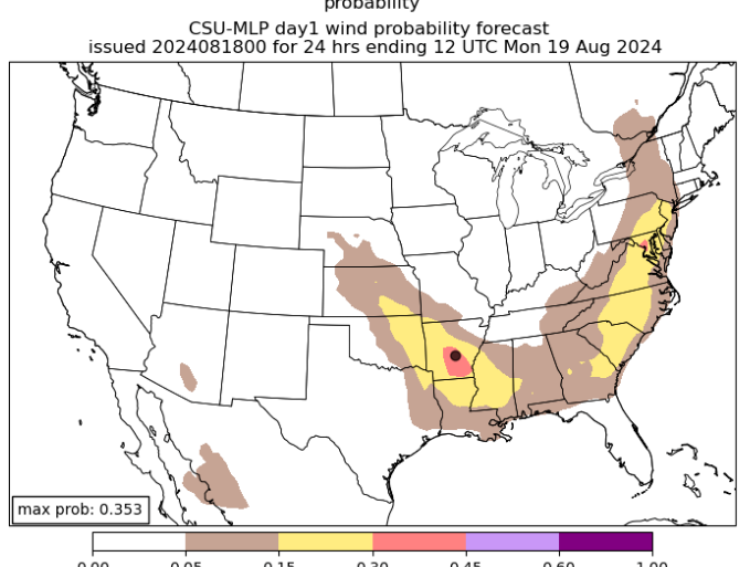
DC jackpot on the CSU MLP for today
- 1,696 replies
-
- 6
-
-
- severe
- thunderstorms
- (and 5 more)
-
About as expected. Long hurricane season remaining, though.