Kmlwx
-
Posts
13,442 -
Joined
-
Last visited
Content Type
Profiles
Blogs
Forums
American Weather
Media Demo
Store
Gallery
Everything posted by Kmlwx
-
The 18z GFS hasn't run yet...
-
Poor Wes
-
Omg...it gets earlier every year. I'll see how things look on Wed/Thursday lol.
- 1,378 replies
-
- 3
-

-
- severe
- thunderstorms
- (and 2 more)
-
Lots of folks on here seemingly are in need of other hobbies. Pick something! It will help you fill the time. I'll be the first to admit that having snow chances fade is really disappointing. In the past 2 months I've gone down the espresso/coffee rabbit hole. Trying a new latte/coffee drink recipe most mornings is a fun experience. Many of the folks on here are craft beer enthusiasts - indulge in that! I also plane spot where I get the chance, spend time with your pets/family/etc - do a big puzzle, grab a new video game. There are countless ways you can get lost in something new to pass the time until a snow threat becomes apparent. Or,...the less desirable option....if you work...lose yourself in the ho hum of the 9-5... It doesn't make the sting of missed snow chances any less...but it helps pass the time until a new threat emerges.
-
Ok
-
Eh - we all do it! Blame superstitious weenie-minds!
-
I get what you are saying but models have no impact on each other. The GFS is not "getting other ops to move towards it" - they don't talk and aren't interconnected. The only "trend" would be from id they are all in time figuring out the solution.
-
Gusty shower line to close out 2025? Friday AM?
-
The product is "Lightning flash density" and thus with lightning would come thunder!
-
Warning for ice would be 1/4 inch or more
-
Are you sure you aren't thinking about the 1" "during commute" for advisories. I do not recall something like you are mentioning in my 34 years living here.
-
Inverted trough?
-
I remember I was in Downtown Silver Spring having dinner and saw it start to snow. Only had to go from there to roughly MD-650 and Randolph Rd (back to the house) and it was extremely dangerous. Within about 30 minutes of getting home, the roads were all snow covered and by morning everything was SUPER icy. A winter containing an event like that (or two), a few few nice cold shots, and a moderate snow event or two (and if we are lucky a major one too) would be a perfect winter. But even without a MECS/BECS - a winter containing a good blend of the above (minus the major one) can be memorable....even if it isn't a 2013-2014 style wall-to-wall. And those types of arctic snow squalls are NOT something that the long rangers here are going to be able to spot with accuracy at range. That kind of crap is going to make itself known only once in range of things like the NAM nest etc.
-
Maybe of these arctic fronts can give us something like that dynamic snow squall setup from Valentine's Day 2015. That was a heck of an evening! I know we all want to chase legit snowstorms - but those mini dynamic ones can be 1) Very impactful and 2) Fun to nowcast in real time.
-
Bold of you to assume there will be a "next storm"
-
I hope so....it's also our holiday party today so at least by later I'd expect a surge of people coming in - including people we don't normally see...and thus "my monitor isn't turning on" calls.... We don't do IT "tiers" here so even as one of the managers....I take even the stupidest of calls right up there with my lower level employees.
-
I got to the office early before things started to go downhill on the roads. Guessing the office will be a ghost town this AM...We should have delayed...
-
Reiterates in my mind that if I want snow....I pretty much have to travel for it.
-
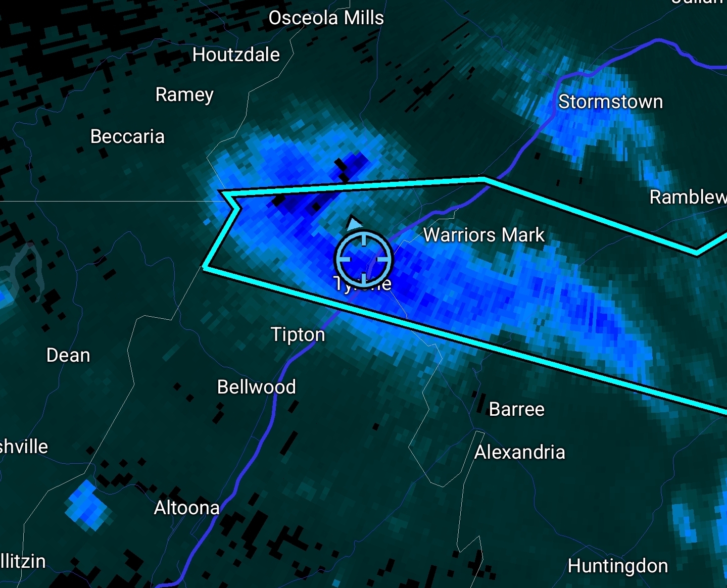
Crazy snow squall up here in Tyrone, PA. Quick quarter to half inch.

-
I use spaceweather.com and solarham.com I also get the Space Weather Alerts via text message.
-
Something LOUD just flew over Colesville area. ADS-B has something but it's not identified. Probably fighter jet(s) - only getting it periodically on MLAT tracking. 340+ knots if the MLAT is accurate.
-
yeah the shorter days could definitely help us! Fingers crossed (about all we can do with space weather - or ANY weather to be honest)
-
I would say potentially yes - the prior two may have "cleared the way" for this one. However, if it arrives too early it might not be well-timed with daylight/night.
-
BWI: 9.7" DCA: 5.0" IAD: 14.1" RIC: 2.2" (Tiebreaker) SBY: 0.6"
-
Well s**t...