-
Posts
13,434 -
Joined
-
Last visited
Content Type
Profiles
Blogs
Forums
American Weather
Media Demo
Store
Gallery
Everything posted by Kmlwx
-
If that track verifies - the conditional TOR threat would certainly be present.
-
Lord GooFus
-
Disgusting out there with a 78 dewpoint....heat index over 100 here already.
-
It's far enough west that it bring a tornado threat into play.
-
If only we were in S PA. CSU MLP and SPC seem decently enthusiastic about their odds for severe t'storms today.
- 1,696 replies
-
- 3
-

-
- severe
- thunderstorms
- (and 5 more)
-
Lately it seems like the first REALLY refreshing air masses don't show up until well into October lol
-
Latest HRRR sucks horribly.
- 1,696 replies
-
- severe
- thunderstorms
- (and 5 more)
-
NAM nest rolling in now is weaker and HRRR seems less enthusiastic as well.
- 1,696 replies
-
- severe
- thunderstorms
- (and 5 more)
-
The usually stingy HRRR is actually semi-decent - maybe not for severe but storms across a decent chunk of the area. Of course there will be deadzones and jackpots. CAMs vary in coverage and intensity.
- 1,696 replies
-
- 1
-

-
- severe
- thunderstorms
- (and 5 more)
-
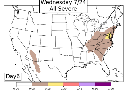
Little signal at Day 8 for CSU-MLP
- 1,696 replies
-
- severe
- thunderstorms
- (and 5 more)
-
1999! https://en.wikipedia.org/wiki/Hurricane_Floyd
- 1,696 replies
-
- 1
-

-
- severe
- thunderstorms
- (and 5 more)
-
It will be interesting to see what the tropics do once they wake up in mid-August and beyond. Of course it's always low odds, but if it's as busy as the experts expect - would think something either gives us remnants from a Gulf strike or maybe this is the year an Isabel or similar returns.
- 1,696 replies
-
- 4
-

-
- severe
- thunderstorms
- (and 5 more)
-
I feel like it's going to take a tropical system or strong remnants to get us out of this "funk" - other than the big tornado day this has been an exceedingly calm season IMO. I'm a big proponent of the "rubber band effect" though. Whenever we break the boredom it will be significant in nature.
- 1,696 replies
-
- 2
-

-
- severe
- thunderstorms
- (and 5 more)
-
There's a westward moving outflow boundary that might trigger more activity as it heads west.
-
Low of 70.5 and that's where I'm sitting right now. Dew in the mid 60s feels worlds better than 75+
-
- 1,696 replies
-
- 2
-

-
- severe
- thunderstorms
- (and 5 more)
-
Classic lol
- 1,696 replies
-
- severe
- thunderstorms
- (and 5 more)
-
Me too. I mean mid-level lapse rates of course sucked - but my dewpoint hasn't dropped below 70 all day. Just one of those days, I guess. I don't even think I got rain that could classify as "heavy" Seems we'll have a boring stretch now.
- 1,696 replies
-
- severe
- thunderstorms
- (and 5 more)
-
Guarantee you it's going to blow up east of the metros for like Southern Maryland etc.
- 1,696 replies
-
- 2
-

-
- severe
- thunderstorms
- (and 5 more)
-
Looks pretty tame and lame.
- 1,696 replies
-
- severe
- thunderstorms
- (and 5 more)
-
Interesting warning from LWX for MoCo and vicinity. The warning itself tilts slightly south of east (SLIGHTLY) but the warning storm motion is north of east..which leads the storm motion markers to leave the warning box to the north.
- 1,696 replies
-
- severe
- thunderstorms
- (and 5 more)
-
The MoCo section might be gusting out...hoping for reenergizing of the line.
- 1,696 replies
-
- severe
- thunderstorms
- (and 5 more)
-
Lightning on this stuff hasn't been particularly prolific based on the GOES lightning mapper and ENTLN data. Additionally, I haven't seen any really nice velocity scans - best velocity seems to be in the northern warning so far - but mostly subsevere if anything. I don't see any pronounced outflow outrunning the line yet on the LWX radar - that's one failure mode that can cause storms to "skip" over some locales.
- 1,696 replies
-
- 1
-

-
- severe
- thunderstorms
- (and 5 more)
-
Echo tops have been gradually increasing along the line. Assuming the 20z WoFS will hold serve given the line is developing nicely now. Doesn't look like any jaw dropping wind on the line yet - but will be interested to see how it comes off the higher terrain.
- 1,696 replies
-
- 1
-

-
- severe
- thunderstorms
- (and 5 more)
-
You can see on radar various areas where the storms may be trying to bow a bit. QLCS/LEWP-esque in nature.
- 1,696 replies
-
- 1
-

-
- severe
- thunderstorms
- (and 5 more)


