

Kmlwx
-
Posts
13,021 -
Joined
-
Last visited
Content Type
Profiles
Blogs
Forums
American Weather
Media Demo
Store
Gallery
Everything posted by Kmlwx
-
I feel like it's going to take a tropical system or strong remnants to get us out of this "funk" - other than the big tornado day this has been an exceedingly calm season IMO. I'm a big proponent of the "rubber band effect" though. Whenever we break the boredom it will be significant in nature.
- 1,696 replies
-
- 2
-

-
- severe
- thunderstorms
- (and 5 more)
-
There's a westward moving outflow boundary that might trigger more activity as it heads west.
-
Low of 70.5 and that's where I'm sitting right now. Dew in the mid 60s feels worlds better than 75+
-
DC special slight on Wednesday? LOL
- 1,696 replies
-
- 2
-
-
- severe
- thunderstorms
- (and 5 more)
-
Classic lol
-
Me too. I mean mid-level lapse rates of course sucked - but my dewpoint hasn't dropped below 70 all day. Just one of those days, I guess. I don't even think I got rain that could classify as "heavy" Seems we'll have a boring stretch now.
-
Guarantee you it's going to blow up east of the metros for like Southern Maryland etc.
- 1,696 replies
-
- 2
-
-
- severe
- thunderstorms
- (and 5 more)
-
Looks pretty tame and lame.
-
Interesting warning from LWX for MoCo and vicinity. The warning itself tilts slightly south of east (SLIGHTLY) but the warning storm motion is north of east..which leads the storm motion markers to leave the warning box to the north.
-
The MoCo section might be gusting out...hoping for reenergizing of the line.
-
Lightning on this stuff hasn't been particularly prolific based on the GOES lightning mapper and ENTLN data. Additionally, I haven't seen any really nice velocity scans - best velocity seems to be in the northern warning so far - but mostly subsevere if anything. I don't see any pronounced outflow outrunning the line yet on the LWX radar - that's one failure mode that can cause storms to "skip" over some locales.
- 1,696 replies
-
- 1
-
-
- severe
- thunderstorms
- (and 5 more)
-
Echo tops have been gradually increasing along the line. Assuming the 20z WoFS will hold serve given the line is developing nicely now. Doesn't look like any jaw dropping wind on the line yet - but will be interested to see how it comes off the higher terrain.
- 1,696 replies
-
- 1
-
-
- severe
- thunderstorms
- (and 5 more)
-
You can see on radar various areas where the storms may be trying to bow a bit. QLCS/LEWP-esque in nature.
- 1,696 replies
-
- 1
-
-
- severe
- thunderstorms
- (and 5 more)
-
19:30z WoFS looks great for a big chunk of the area.
- 1,696 replies
-
- 4
-
-
- severe
- thunderstorms
- (and 5 more)
-
19z WoFS ensemble members are all very consistent with bringing that line east. Many of them kind of screw parts of Northern Maryland, however.
-
92.7 here (the high so far and currently)
-
MESOSCALE DISCUSSION 1666 NWS STORM PREDICTION CENTER NORMAN OK 1127 AM CDT WED JUL 17 2024 AREAS AFFECTED...EASTERN PA/NORTHERN NJ INTO WESTERN NEW ENGLAND CONCERNING...SEVERE POTENTIAL...WATCH LIKELY VALID 171627Z - 171830Z PROBABILITY OF WATCH ISSUANCE...80 PERCENT SUMMARY...THE DAMAGING-WIND THREAT WILL INCREASE THIS AFTERNOON. ONE OR MORE WATCHES WILL LIKELY BE NEEDED. DISCUSSION...RELATIVELY STRONG HEATING IS UNDERWAY FROM PARTS OF THE MID ATLANTIC INTO WESTERN NEW ENGLAND, TO THE EAST OF AN EXTENSIVE CLOUD SHIELD THAT IS MOVING EASTWARD ACROSS WESTERN/CENTRAL NY/PA AND WV. A SEASONABLY DEEP UPPER-LEVEL TROUGH WILL MOVE EASTWARD ACROSS THE LOWER GREAT LAKES AND NORTHEAST THROUGH THE DAY, WHILE AN MCV EMBEDDED IN THE LARGER-SCALE TROUGH WILL MOVE FROM WV TOWARD THE MID ATLANTIC. CUMULUS IS GRADUALLY BUILDING FROM EAST-CENTRAL PA INTO SOUTHEAST NY, AND A GENERAL INCREASING IN STORM DEVELOPMENT AND COVERAGE IS EXPECTED WITH TIME THIS AFTERNOON. MIDLEVEL LAPSE RATES ARE WEAK (AS NOTED ON REGIONAL 12Z SOUNDINGS), BUT CONTINUED HEATING WILL SUPPORT MLCAPE INCREASING ABOVE 1000 J/KG WITH TIME. MODESTLY ENHANCED MIDLEVEL FLOW WILL SUPPORT 30-40 KT OF EFFECTIVE SHEAR, SUFFICIENT FOR SOME STORM ORGANIZATION. MULTIPLE STORM CLUSTERS AND POSSIBLY A COUPLE OF SUPERCELLS MAY EVOLVE WITH TIME, WITH STEEPENING LOW-LEVEL LAPSE RATES SUPPORTING A PRIMARY THREAT OF DAMAGING WIND. SOME THREAT FOR ISOLATED HAIL AND/OR A BRIEF TORNADO IS ALSO POSSIBLE IF ANY SUPERCELLS CAN BE SUSTAINED. ONE OR MORE WATCHES WILL LIKELY BE NEEDED THIS AFTERNOON TO COVER THE DAMAGING-WIND THREAT. ..DEAN/HART.. 07/17/2024 ..PLEASE SEE WWW.SPC.NOAA.GOV FOR GRAPHIC PRODUCT ATTN...WFO...GYX...BOX...BTV...OKX...ALY...PHI...BGM...CTP... LWX...
- 1,696 replies
-
- 1
-
-
- severe
- thunderstorms
- (and 5 more)
-
No appreciable changes to the latest SPC outlook.
-
MCVs are notoriously sneaky for amping up severe chances. They just have to be timed correctly and take a good path for us. But they can add a little "boost" to our odds in an otherwise less favorable environment.
-
Many of the CAMs this morning seem to wait until E of 95 to get things going. Also, almost every model skunks decent swaths of the area...should be expected with convection - but seems there will be some bad shaftings.
- 1,696 replies
-
- 2
-

-

-
- severe
- thunderstorms
- (and 5 more)
-
The NAM nest is pretty good too. We'll see....
- 1,696 replies
-
- 3
-
-
- severe
- thunderstorms
- (and 5 more)
-
Amateur/gut answer is that it's simply more humid in the summer versus the winter - thus more humidity to overmix out. We might not notice it as much (or at all) when the dewpoints are in the teens versus the 70s. But I could be totally wrong.
-
And also it's a WATCH not a WARNING. The literal purpose of a watch is to indicate that the criteria are possible, not occurring or imminent. Urban flooding is definitely an ever-growing problem in the cities and urban corridor.
-
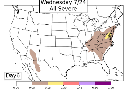
45%+ showing on the the CSU MLP for today. SPC holds us at slight but does mention a bowing structure possible - too many uncertainties.
- 1,696 replies
-
- 5
-
-
- severe
- thunderstorms
- (and 5 more)
-
Storming - all sub severe IMBY but has cooled the temp down to 80 now and still dropping. Dewpoint in the mid 70s so very soupy still. Let's see what the threat tomorrow ends up being.

