ORH_wxman
-
Posts
93,099 -
Joined
-
Last visited
Content Type
Profiles
Blogs
Forums
American Weather
Media Demo
Store
Gallery
Everything posted by ORH_wxman
-
What storm would’ve given over 6” here? Had exactly 6” in the 1/19-1/20 event. Clipper in Dec gave 6”+ to ORH but not where I am. I was a bit too far east.
-
It’s already a glacier. Add 3-6” with sleet on top, a little ZR, some cold rain and a quick refreeze…piles could become pretty impressive despite the fact we haven’t had an event over 6” all season.
-
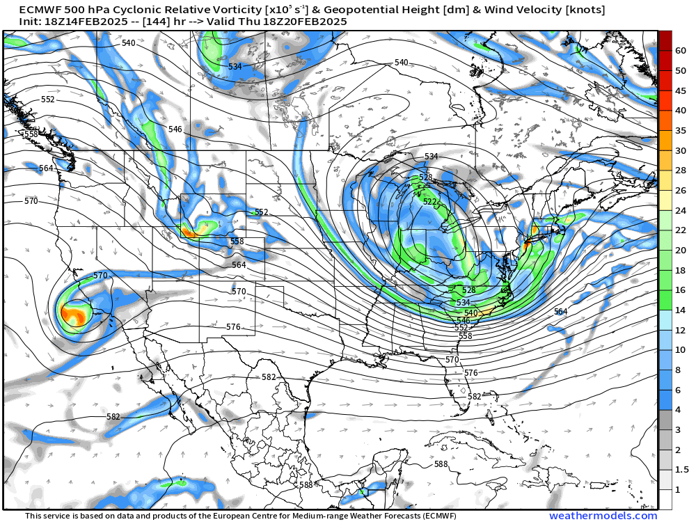
Look at h5 at 144. That would probably be going on for a while
-
Heavy rain at 33 is still going to run off. If you can’t freeze it or absorb it, it’s gonna produce some localized flooding. Hell, even during the historic ice storm in 2008, the street was like a river running down it on winter hill when I was outside around midnight while trees were starting to snap. It’s because it was coming down so hard that the accretion rate wasn’t super efficient and we were losing a ton of QPF to runoff. We had like 3” of QPF in that storm but it didn’t all accrete as ice…and that was at 30-31F…when it’s 33-34 you aren’t accreting anything.
-
That looks pretty aggressive in S NH.
-
You don't get much ZR at all on Reggie....mostly a sleet bomb there.
-
Mesolow doesn't form quick enough for all frozen there...you're going to get in-situ icing that brings you to 33-34F....you won't really lose any pack, but it's gonna be cold rain for a time. Need a much quick transfer....still possible, but pretty much no guidance keeps you all frozen now except maybe skynet.
-
3k is coming in flatter too. Nice thump on that model.
-
It’s actually quite amazing that I’m sitting at sub-30” for the season and have had almost continuous snow cover since 1/11 save maybe 2 days. We haven’t even had big time cold either…it’s just been a lack of torches and a lot of continuous “seasonable cold” temps. Hopefully this is the system to get this winter into respectable potential. If we scored double digits from this system, then respectable is within striking distance.
-
NAM def flatter than 12z…but not shocking considering it was most amped.
-
Prob like a solid 12-18 is the realistic high end scenario for us when you look at the pattern aloft. Yeah, there’s a few plausible exotic evolutions that might give us 2 feet but they are at the tail end of the distribution of outcomes. I think I’d want to see H5 stall this thing a little better for the 20”+ threat to increase…and I don’t mean like stall for 36 hours or anything…more like capture it in just the right spot and enhance the goods for 4-6 hours which is usually what turns our 12-16 inchers into 20-24 inchers. We all know most of the snow falls inside a 12-18 hour window, but having 8-9 hours of super intense rates versus 12-15 hours makes the difference.
-
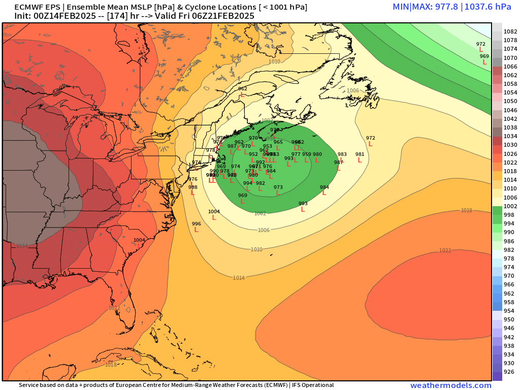
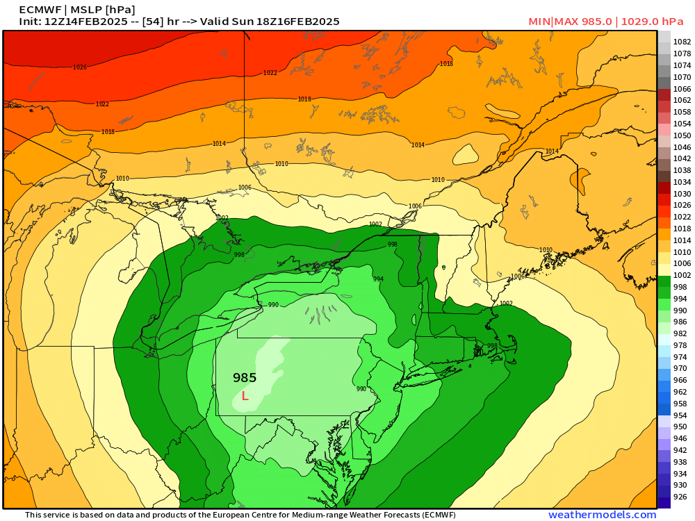
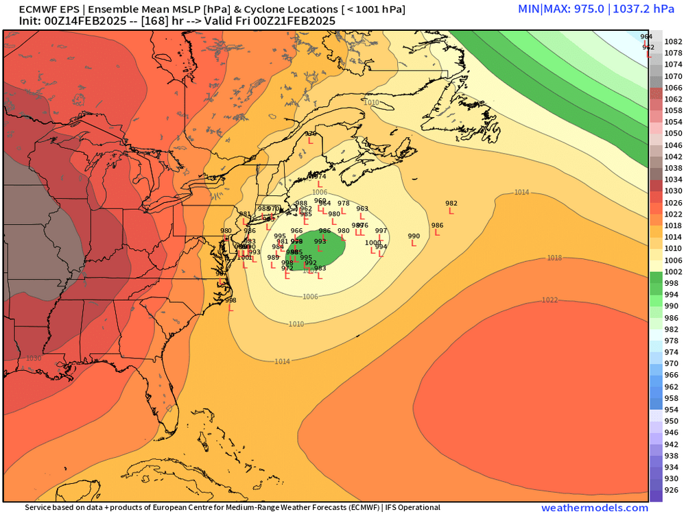
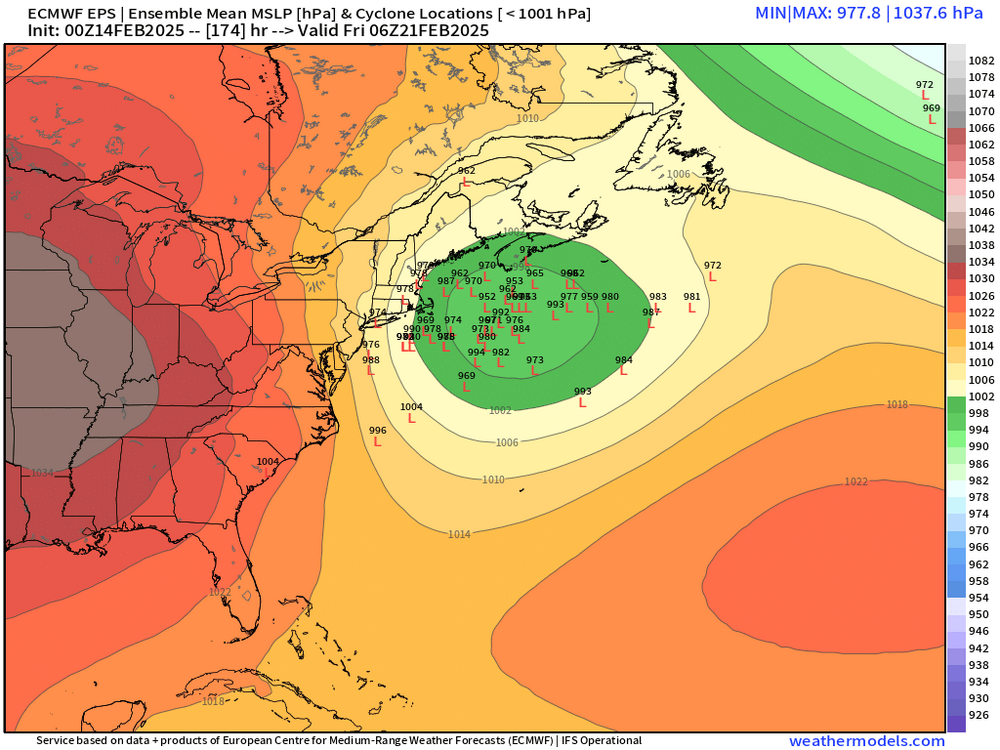
My guess is there’s a bunch of members that aren’t even “registering” as lows. Basically your failed phases/whiffs way off southeast and it skews the mean.
-
This looks a bit suspect to me given the climo of SE NH on CFs and CAD
-
I think we’ll see the sfc reflection do some small messenger shuffles in the final 24 hours as the models “see” the syrupy airmass. Doesn’t mean we won’t torch aloft up to MWN but we often see the sfc getting shoved a bit SE as it tries to run into that arctic brick wall. I also noticed the 3k NAM was really struggling to bring sfc front north even when the 12k was trying to.
-
I’m not even looking at OP runs other than pure entertainment at this stage. Show me ensemble mean and spread until we get to tomorrow night or sunday.
-
Yeah euro is def colder than GFS and has been for a couple of runs.
-
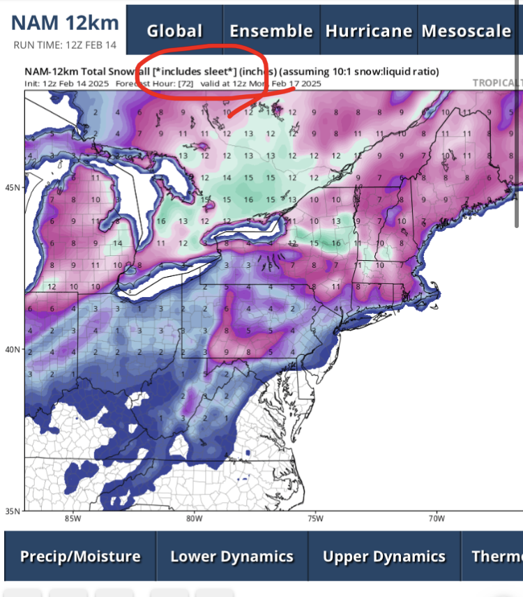
Tropical tidbits maps usually tell you if it including sleet. You can toss the map if it’s an event with lots of sleet like this one

-
Positive snow depth change I’ve found to be almost universally too conservative if you’re forecasting actual snowfall but it’s semi-useful to use as a floor scenario.
-
Yes the 06z skynet was really cold. You’d never crack freezing if it verified. Not sure I buy a solution that cold but we’ll see what the real models do in a bit.
-
I remember the Feb 28, 1995 ice storm stayed on the trees for like 4 days afterward and that was the first few days of March. It did stay below freezing though but there was some sun too…luckily not much wind behind that one. I think the icing will be significantly less in this one versus 1995 though…this is going to be a lot of snow/sleet and then prob intermittent showery ZR and if the mesolow isn’t well-defined (ala NAM solutions), it will just morph into an in-situ icing event where it creeps to 32.1F after maybe a quarter inch of ice (if that).
-
1979-80 analog again
-
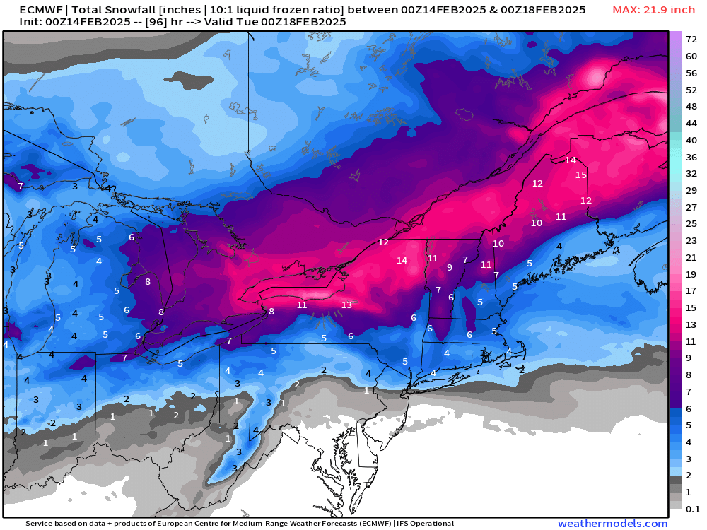
Map you saw above from TheMainer was only the snow after 12z Sunday. So it didn’t include all the snow that fell late Saturday and overnight prior to 12z Sunday. Euro has been pretty consistent with 3-4” in CT and 5-6” pike region.
-
Pretty solid for a week out
-
Looks more like the Euro suite
-
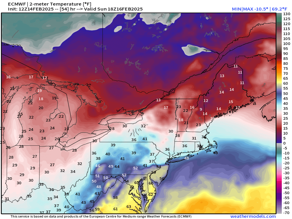
Def a bit colder than 18z. Easily a net-gainer for a large part of SNE. I’d prob take and run. But I’m hopeful we get a little easing SE as guidance feels the sludge to the north…but maybe they already have it correct, not sure. But one can hope for the messenger shuffles as we close in.