ORH_wxman
-
Posts
90,892 -
Joined
-
Last visited
Content Type
Profiles
Blogs
Forums
American Weather
Media Demo
Store
Gallery
Everything posted by ORH_wxman
-
Yeah it was my first winter back up here after living in Texas from age 2 to 7 and I remember seeing ads for Watatic that fall even as an elementary school kid who didn’t ski yet…the dude actually put ads out he was so confident and then got the shaft, lol. I wonder why they never let him reopen. It probably would have been good for the area to have another ski area. I always wondered if Wa-Wa did some “influencing” to keep them closed.
-
I was living in Holden in 1988 when they almost reopened. Some dude bought the place and was ready to open it but he never got the permits and it just slowly got engulfed by the wilderness since then.
-
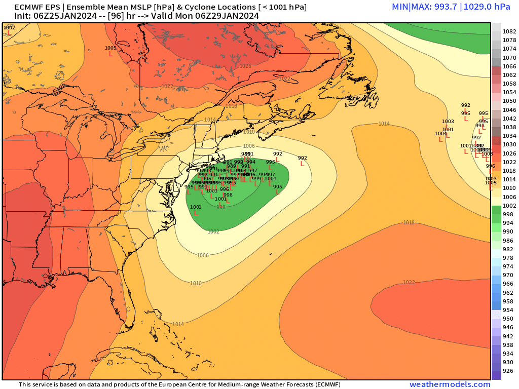
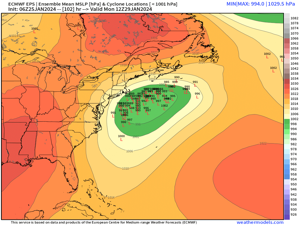
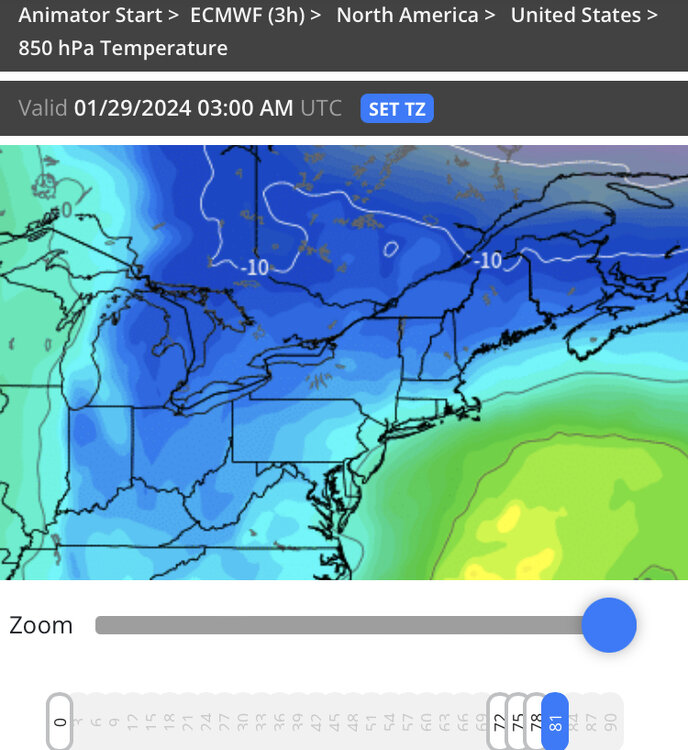
Yeah it briefly kisses there…here’s 75-78-81 hours. You can see how it wobbles over C/N CT before collapsing by 81 hours.
-
Decent event for interior on 18z euro though the midlevels are very marginal early on in CT before they crash. It would still be nice to actually link the WCB and CCB stuff…the fact they they are separated like that on all these runs today is partially responsible for the lower jackpot totals now…instead of 12-16 it’s like 6-9”
-
It was a Flop... February 2024 Disco. Thread
ORH_wxman replied to Prismshine Productions's topic in New England
A lot of guidance is trending that way. It’s pretty interesting because you don’t normally see that type of pattern in early February. Like you said, usually March or April….but in early February, there’s enough cold around that you could really score big from one of those bowlers. Who knows, maybe something breaks our way. -
Woodshed Scooter….we beast. His area is paying for being like 200% of climo between 2003-2019.
-
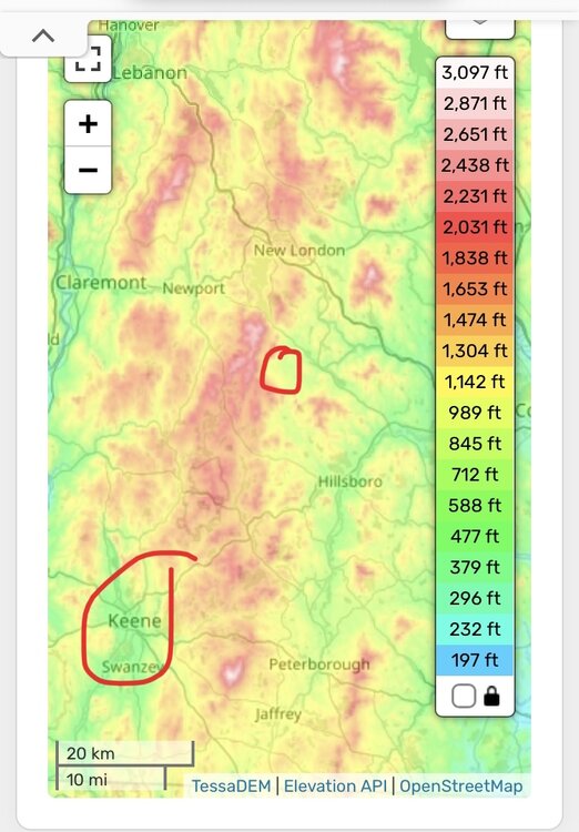
Keene is pretty far west almost in the valley. Even the parts of Keene that are above 1000 feet still feel the effect of the mountains to the east. Where he is in Bradford is to the east of the highest terrain so he will do well in most events. You can see on the topo map below where he is to the east of the highest terrain and then look down southwest where Keene is to the west of it.
-
Lol i don’t think it matters either way. Lost pack in any areas less than 4-5” AWT. Hopefully replenish Sunday/Monday.
-
Yeah i mentioned it earlier….it actually had nice midlevel track with H7 going over ACK area…I think it was a little faster which hurts its ability to really draw in more moisture off Atlantic but I also wouldn’t be surprised to see a replica of that track produce a bit more on future runs.
-
We got to 52 here though it’s fallen back to 48 now and that’s all she wrote. Today was the day to try and sneak it in…the euro and others touting 60+ for tomorrow were always a pipe dream with that setup to our northeast.
-
It was a Flop... February 2024 Disco. Thread
ORH_wxman replied to Prismshine Productions's topic in New England
EPS looks like GEFS too
-
EPS are not very exciting either. The mean is fairly close to the OP except less for the Cape and SE areas.
-
Synoptically it really wasn’t that bad of a solution. It’s not going to drop 12”+ on that look but a 5-8” type event would be pretty consistent with how it looked. Id look for stronger vort going forward which may help in strengthening the storm more rapidly once south of us.
-
Disorganized mess on the QPF. Midlevel tracks are really nice though…so I don’t hate that part. Wish the vort was a bit stronger in the upper air which I think would help get that “curl” we want to really get it to go to town
-
Euro looks more robust with shortwave at 60h compared to 06z but the confluence is a little stronger as well.
-
Yeah most of them were. 1990-91 wasn’t that dry, but it still sucked. It was slightly AN for temps.
-
Yeah I’m not overly confident yet. Kevin has definitely bought in…I do think he’s in a decent spot right now but I’d really like to see some more agreement on guidance. 12z so far (sans clown range NAM) is actually all pretty close, which is something we haven’t really seen so far in this system.
-
There was a storm over a foot on January 8-9, 1988 at ORH and then we didn’t get another double digit storm until December 1992. Almost 5 years. If it can happen at 1000 feet over interior MA over 3 decades ago, it can happen a lot longer elsewhere.
-
Yeah sure, if the CCB is tracking over NNE then it’s a moot point. But I’m talking if this is mostly as depicted on the synoptics….it would quickly be a paste storm over the interior after brief rain to start.
-
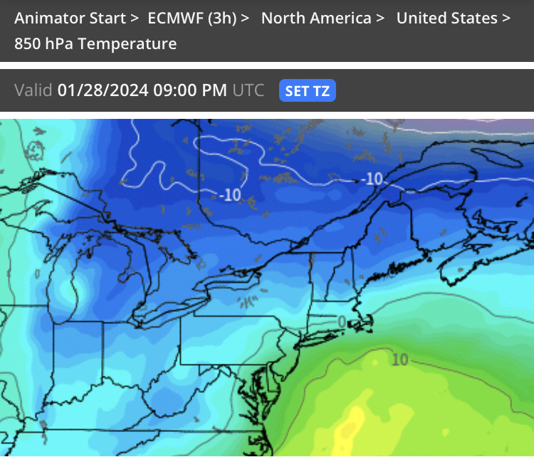
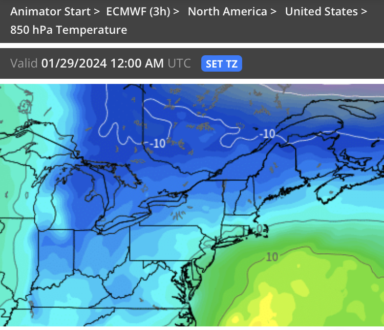
It looks plenty cold over the interior once it gets going. Might start as a little rain but 925s are like -2 to -3….no chance of rain for him when it wetbulbs to that profile.
-
Kevin this might be the paster you’ve been waiting for.
-
Def morphing into an interior SNE/CNE deal. You don’t get that second round of deepening that was crushing SE areas on some of the runs yesterday.
-
It was a Flop... February 2024 Disco. Thread
ORH_wxman replied to Prismshine Productions's topic in New England
1958 stayed great almost to the end. The big dog HECS was around the equinox. -
Someone who is not on a phone can prob toggle EPS to see if they moved…but they look really close to 00z just eyeballing…maybe the smallest tick SE


-
Up to 47 here. Might be able to sneak in a warm day today at least in this area though that frontal boundary is lurking not too far north of the pike and it’s going to sink back south at some point.