ORH_wxman
-
Posts
90,892 -
Joined
-
Last visited
Content Type
Profiles
Blogs
Forums
American Weather
Media Demo
Store
Gallery
Everything posted by ORH_wxman
-
It was a Flop... February 2024 Disco. Thread
ORH_wxman replied to Prismshine Productions's topic in New England
Yeah but the sample size on that is exceedingly small, isn't it? I don't see how that would be predictive unless someone can illustrate a physical attribtution. -
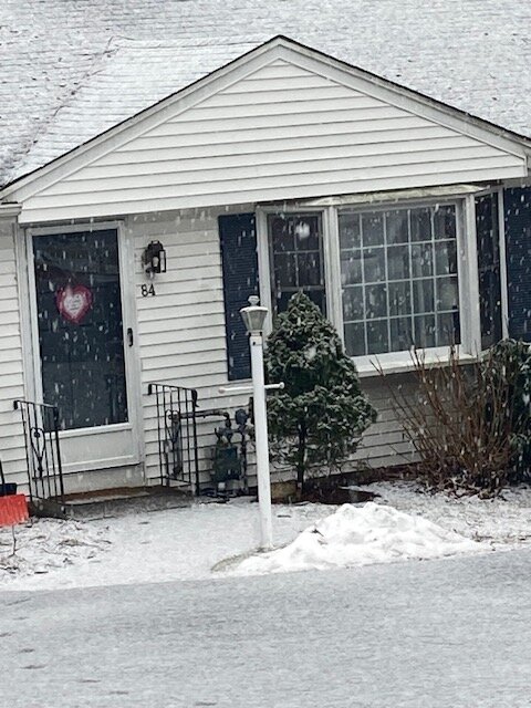
Picked up another inch and a half overnight. Total starting from yesterday morning a bit shy of 3” but that first round compacted before last night. Looks like we got at least double that amount on the piles though because of how dense it is
-
It was a Flop... February 2024 Disco. Thread
ORH_wxman replied to Prismshine Productions's topic in New England
Yeah threat is a really vague term. -
Been getting sleet bombed here off and on.
-
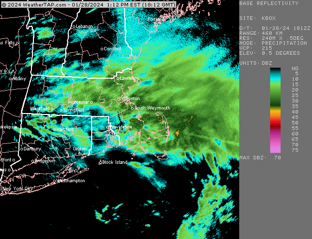
I’m watching that area just north of the ML center in NE PA…I think if we’ve got a positive bust up our sleeve tonight, it’s going to happen just north of that…Berks to N ORH county and near MA/NH border looks best but some of the goods may be as far south as pike region or S MA border near dryslot. We’ll see. Expectations fairly low, but we watch.
-
It was a Flop... February 2024 Disco. Thread
ORH_wxman replied to Prismshine Productions's topic in New England
It’s not a classic clipper because those come out of NW or at least central Canada…this is dropping from almost up near Baffin Island. It’s an exotic pattern…I am not counting on anything right now, but it is within the envelope of possibilities to see at least a few inches. -
Short term guidance has been looking better for later. Euro was kind of bullish to the pike/495/rt 2 tonight. Had additional advisory snows. There’s some midlevel goodies further north too for S NH into dendrite land, but near the ML dryslot, there’s almost come convective bands that we should watch.
-
Been sleety when precip is light but it flips to aggregates when these heavier echoes happen
-
It was a Flop... February 2024 Disco. Thread
ORH_wxman replied to Prismshine Productions's topic in New England
I mean if this drops further west then it would be a pretty decent storm. Unlikely at this time but it’s been pretty volatile on guidance. But even some steady light stuff with that temp profile, it could add up to several fluffy inches. -
It was a Flop... February 2024 Disco. Thread
ORH_wxman replied to Prismshine Productions's topic in New England
Euro is kind of interesting for eastern areas next friday night/Saturday. Drops that ULL straight south and it’s really cold/unstable profile. -
Yeah there’s prob some spots above 1000 feet that got close to 2”…esp a little further south near ORH and Paxton…wonder if Pickles ever went to Paxton.
-
Yeah maybe a few tenths more if you’re not on a dark surface. It was about an inch on the walk but prob 1.2-1.4 on the deck. Honestly was better than I expected on the thump before it started this morning…once it flipped I was hoping to get past 2” but the heavy stuff didn’t last long enough.
-
Doesn’t look like a big deal. Maybe another 1-3”…though if the NAM is more correct, some places in ORH county over to Ray’s area could see more than that.
-
Yeah I told most people the snow will shut off for a while this afternoon and into early evening and then prob resume late evening once the commahead of saturation collapses back SE. The WCB and CCB never linking up cleanly in this event definitely put a cap on the totals…even with marginal temps it would have been more prolific if you linked the two
-
Looks like about an inch of paste here so far. Still above freezing at 32.7
-
Yeah the road goes all the way to the top and there’s houses on it. Not a lot but there are at least a handful above the 1300 foot line.
-
Top of Asnebumskit hill in Paxton is over 1400 feet.
-
Go up 31 to Paxton. You could go up to Princeton too but you’d prob need to go to WaWa lodge to find food in that town.
-
You’re forgetting Theo’s and Paxton house of pizza.
-
Paxton is around 1200 feet downtown near 31/56/122 intersection. Prob one of the best spot for this storm. Paxton house of pizza used to have decent pizza and subs but haven’t tried it in eons.
-
Sticking to all surfaces. Hopefully can grab 2-3” with the thump, but we’ll see
-
Massive quarters falling here now. Temp slowly ticking down to 33F even now.
-
Yep. Not much thermal packing on this. Prob would wring out even more QPF.