ORH_wxman
-
Posts
93,099 -
Joined
-
Last visited
Content Type
Profiles
Blogs
Forums
American Weather
Media Demo
Store
Gallery
Everything posted by ORH_wxman
-
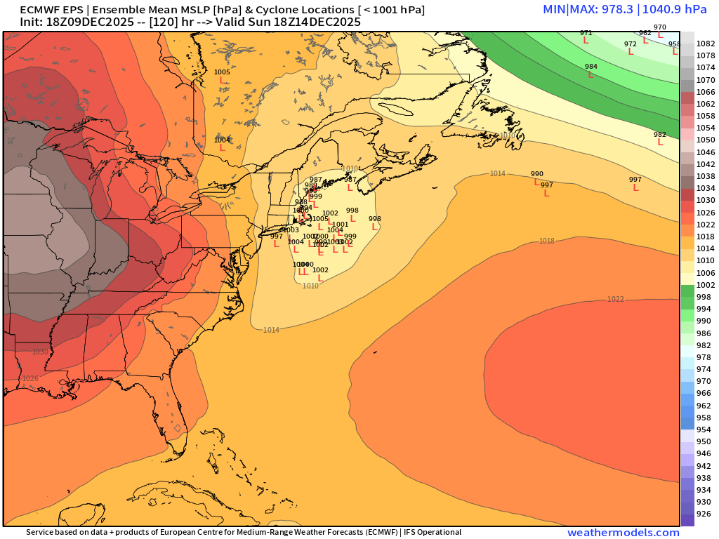
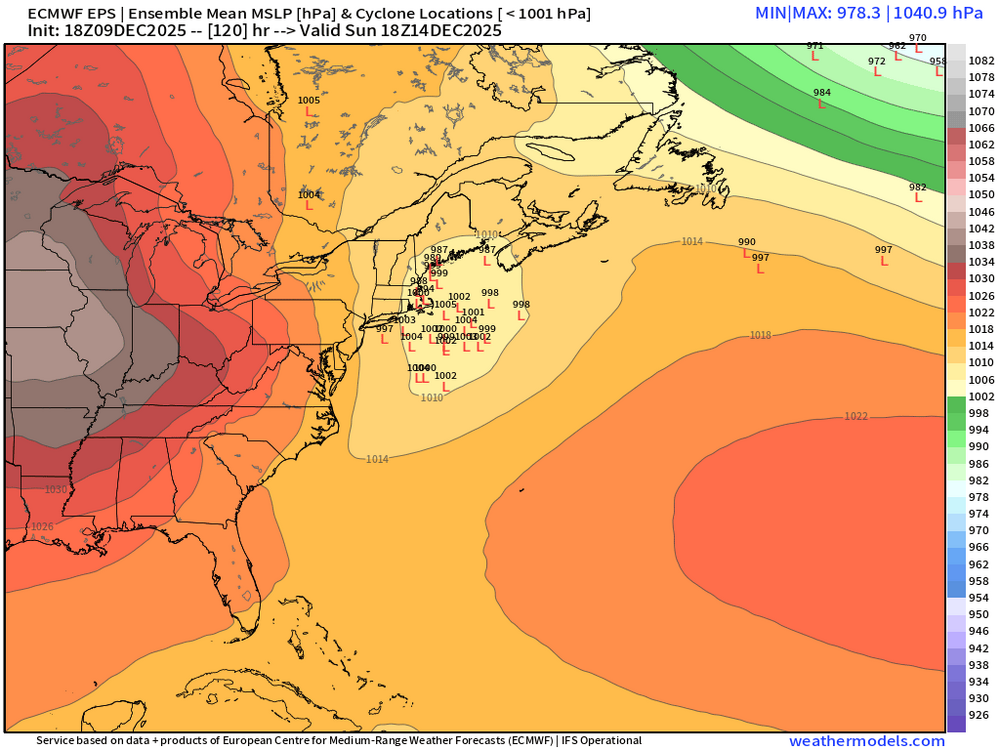
Pretty good trends today too on EPS for the Xmas period....notice how much lower the heights are in SE Canada....this is kind of what we saw in clown range on the OP run where there was a lot of ridging over CONUS but we were staying colder due to the lower heights in SE Canada. That's a trend you'll want to see keep up as we get closer if you are looking to avoid macaw parrots for Xmas.
-
It's very cold on the backside of the system so there def could be some ocean enhancement on N or NNW winds.
-
EPS might actually be more bullish than the OP by a touch for Sunday.
-
Not doing anything yet on 12z Xmas morning (on the doorstep)…but if it went another panel or two I think it would prob be a front ender for snow (at least N of HFD) then flipping/mixing.
-
At least we Houdini a White Xmas on the OP Euro.
-
Yeah we literally need like 75-100 miles on the PV placement to turn this into a likely low end warning event.
-
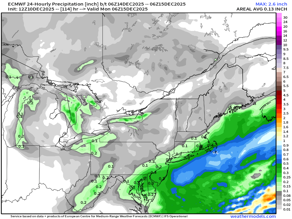
Euro QPF….youre prob bumping that a bit NW on these types of setups. You get good fronto on NW side of that thermal gradient.
-
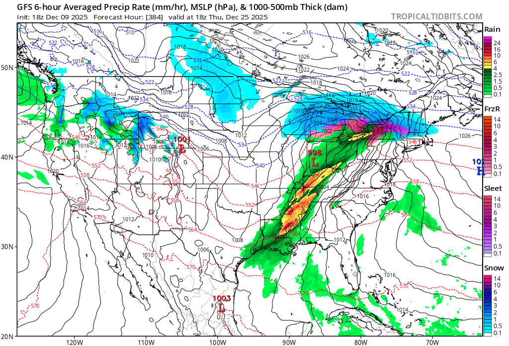
Looks like the post-Xmas 1984 warm shot. ORH hit 70F in that. Latest 70F on record.
-
If the solution ends up verifying pretty close to the AI models, that would definitely be a big win for them. They’ve been way steadier than the regular OP runs.
-
06z euro def brought it back…esp for SE areas. I’d want to see the 12z suite as a whole look better though before believing it.
-
Def quite a good change on the 18z eps
-
Fwiw, the energy responsible for the Sunday system is over Siberia and crosses over north of AK tomorrow night and finally into Canada by Thursday during the day. So we could still see some decent changes.
-
Yeah SE Canada does make a difference too. Ridge axis is a little west on that 18z run too…so even though it isn’t taller, it’s better oriented.
-
That’s a pretty decent sized event for recent standards over SE areas. But I think decent banding would prob get back into interior too.
-
That’s CAD-city on that setup.
-
Dang we lost our 70F Xmas day

-
Both AI models have been relatively bullish on the Sunday threat.
-
18z GFS still a whiff on Sunday. Icon was pretty decent though. Always good to have that model on your side.
-
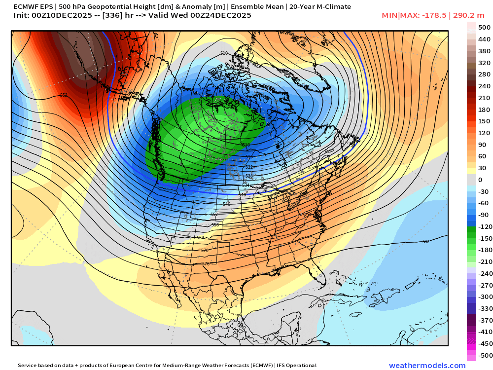
Thankfully basically zero similarities between those two years at the moment. We’ve had a different Pacific regime compared to recent years so far…that very strong WPO block is not something that’s been there. In recent years, we’ve seen a generally strong positive WPO which will tend to mute the cold…the negative phase has the opposite effect which is probably why our cold has been overperforming in the medium range.
-
When you have summer heat ridge heights near the winter solstice, I'm guessing it's hard to wash that out even with other ensemble members.
-
Even the Euro aloft might argue for more QPF being wrung out a bit further inland...not an uncommon model bias for all guidance in keeping thew QPF too close to the low-level thermal gradient. It's why I think that run was pretty good for SE MA despite most QPF being centered over Cape/Islands. But yeah, that could get juicy pretty quickly if you displaced the PV lobe even 75-100 miles west.
-
This will be verification
-
Actually a nice look for SE MA.
-

-
Might be able to go 70F if we pump that ridge enough